Filters: Tags: drainage (X) > Extensions: ArcGIS REST Service (X)
4 results (28ms)|
Filters
Date Range
Types Contacts Categories Tag Types Tag Schemes |

The Watershed Boundary Dataset (WBD) from The National Map (TNM) defines the perimeter of drainage areas formed by the terrain and other landscape characteristics. The drainage areas are nested within each other so that a large drainage area, such as the Upper Mississippi River, will be composed of multiple smaller drainage areas, such as the Wisconsin River. Each of these smaller areas can further be subdivided into smaller and smaller drainage areas. The WBD uses six different levels in this hierarchy, with the smallest averaging about 30,000 acres. The WBD is made up of polygons nested into six levels of data respectively defined by Regions, Subregions, Basins, Subbasins, Watersheds, and Subwatersheds. For additional...
This map service is an information surface representing the dominant class within the soil map unit polygon for soil drainage class. Each component (and therefore soil map unit polygon) falls into one of the following classes according to NRCS: Very Poorly Drained, Poorly Drained, Somewhat Poorly Drained, Moderately Well Drained, Well Drained, Somewhat Excessively Drained and Excessively Drained. Of soil components which make up greater than or equal to 15% of the soil map unit, the wettest component is reported by the map service. Another service exists for drainage class which reports the dominant class in the soil map unit. The concept is similar but for some purposes knowing the dominant component may be...
Categories: Data;
Types: ArcGIS REST Map Service,
Map Service;
Tags: SSURGO,
drainage,
infiltration,
percolate,
permeability,
This map service is an information surface representing the dominant class within the soil map unit polygon for soil drainage class. Each component (and therefore soil map unit polygon) falls into one of the following classes according to NRCS: Very Poorly Drained, Poorly Drained, Somewhat Poorly Drained, Moderately Well Drained, Well Drained, Somewhat Excessively Drained and Excessively Drained. The class belonging to the component that makes up the highest percentage of the map unit is reported by the map service. Another service exists for drainage class which reports the wettest class in the soil map unit. The concept is similar but for some purposes knowing the wettest component may be the most useful piece...
Categories: Data;
Types: ArcGIS REST Map Service,
Map Service;
Tags: SSURGO,
drainage,
infiltration,
permeability,
porosity,

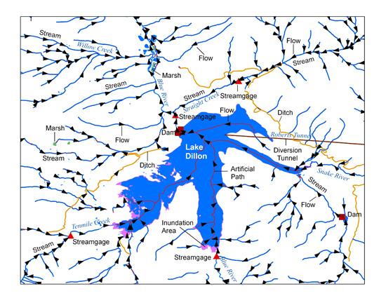
The USGS National Hydrography Dataset (NHD) service from The National Map (TNM) is a comprehensive set of digital spatial data that encodes information about naturally occurring and constructed bodies of surface water (lakes, ponds, and reservoirs), paths through which water flows (canals, ditches, streams, and rivers), and related entities such as point features (springs, wells, stream gages, and dams). The information encoded about these features includes classification and other characteristics, delineation, geographic name, position and related measures, a "reach code" through which other information can be related to the NHD, and the direction of water flow. The network of reach codes delineating water and...
Categories: Data;
Types: ArcGIS REST Map Service,
Map Service;
Tags: HU,
Hydrography,
NGP-TNM,
NHD,
Overlay Map Service,
|

|