Filters: Tags: ecosystem (X)
341 results (13ms)|
Filters
Date Range
Extensions Types Contacts
Categories Tag Types Tag Schemes |
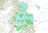
This dataset represents the location and class density of potential invasive Forbs risk within the Central Great Basin and Mojave Basin Ecoregion for the 2010 time period. This model represent an inductive (Maximum Entropy) models of the noxois forbs, other than Halogeton glomeratus, using non-spectral landscape variables. Input Variables: elevation, aspect, distance to fire, geology, distance to hydric soils, distance to intermitant streams, landform, ombrotype, distance to perrenial streams, soil pH, density of primary roads, density of secondary/local roads, percent sandy soil, slope, thermotype. SciName Cnt_SciName Acroptilon repens 6 Cardaria draba 10 Centaurea 1 Centaurea diffusa 1 Chorispora tenella 19 Cirsium...
Types: Downloadable;
Tags: BLM,
Biology,
Bureau of Land Management,
CBR 2010,
Central Basin and Range,
This part of DS 781 presents bathymetric contours for several seafloor maps of the Offshore of Monterey map area, California. This metadata file refers to the data included in "Contours_OffshoreMonterey.zip," which is accessible from https://doi.org/10.5066/F70Z71C8. These data accompany the pamphlet and map sheets of Johnson, S.Y., Dartnell, P., Hartwell, S.R., Cochrane, G.R., Golden, N.E., Watt, J.T., Davenport, C.W., Kvitek, R.G., Erdey, M.D., Krigsman, L.M., Sliter, R.W., and Maier, K.L. (S.Y. Johnson and S.A. Cochran, eds.), 2016, California State Waters Map Series—Offshore of Monterey, California: U.S. Geological Survey Open-File Report 2016–1110, pamphlet 44 p., 10 sheets, scale 1:24,000, https://doi.org/10.3133/ofr20161110....
Categories: Data;
Types: Citation,
Downloadable,
Map Service,
OGC WFS Layer,
OGC WMS Layer,
Shapefile;
Tags: Backscatter,
Bathymetry,
Bathymetry,
CMHRP,
Coastal and Marine Hazards and Resources Program,
The Great Plains Landscape Conservation Cooperative (GPLCC, https://www.fws.gov/science/catalog) is a partnership that provides applied science and decision support tools to assist natural resource managers conserve plants, fish and wildlife in the mid- and short-grass prairie of the southern Great Plains. It is part of a national network of public-private partnerships — known as Landscape Conservation Cooperatives (LCCs, http://www.fws.gov/science/shc/lcc.html) — that work collaboratively across jurisdictions and political boundaries to leverage resources and share science capacity. The Great Plains LCC identifies science priorities for the region and helps foster science that addresses these priorities to support...
Categories: Data;
Types: Downloadable,
GeoTIFF,
Map Service,
Raster;
Tags: GPLCC,
Great Plains Landscape Conservation Cooperative,
bioclimate,
biogeography,
biophysical stratification,
A combination of remote sensing and ecosystem modeling is used to examine the trends in NEP and net ecosystem carbon balance (NECB) in this region over the 1985 - 2007 period, with particular attention to land ownership since management now differs widely between public and private forestland. In the late 1980s, forestland in both ownership classes was subject to high rates of harvesting, and consequently the land was a carbon source (i.e. had a negative NECB). After the policy driven reduction in the harvest level, public forestland became a large carbon sink driven in part by increasing NEP whereas private forestland was close to carbon neutral.
Fire in the western U.S. poses one of the greatest threats to human and ecological communities alike. In fact, fire management is the largest single expenditure of land management funds on federal lands. Now, climate change is altering wildfire patterns. Climate change in the West is creating warmer and drier conditions, resulting in an increase in the amount of dead vegetation available to fuel fires. This project sought to assess the vulnerability of forests in the southwestern U.S. to climate change and wildfire, in order to understand how these ecosystems might become altered as a result. Researchers (a) examined how climate change impacts wildfires in the region, to better understand fire risk; (b) identified...
Categories: Project;
Types: Map Service,
OGC WFS Layer,
OGC WMS Layer,
OGC WMS Service;
Tags: 2012,
CA,
CASC,
CO,
Completed,
Heart of the West wildlands network This dataset represents the lowlands wildlands network of core areas, linkages and compatible use areas recommended to define land management and land use based on a biological basis consistent with sustaining the health of this region's ecosystems.

A combination of remote sensing and ecosystem modeling is used to examine the trends in NEP and net ecosystem carbon balance (NECB) in this region over the 1985–2007 period, with particular attention to land ownership since management now differs widely between public and private forestland. In the late 1980s, forestland in both ownership classes was subject to high rates of harvesting, and consequently the land was a carbon source (i.e. had a negative NECB). After the policy driven reduction in the harvest level, public forestland became a large carbon sink driven in part by increasing NEP whereas private forestland was close to carbon neutral.
This U.S. Geological Survey (USGS) data release presents the geospatial data used to assess the hydrologic resources and the potential effects from oil and gas development in the Bureau of Land Management Tri-County Planning Area, Sierra, Doña Ana, and Otero Counties, New Mexico. Publicly available data were used to assess these resources and effects and to identify data gaps in the Tri-County planning area. These data support the following publication: Blake, J.M., Miltenberger, K.E., Stewart, A.M., Ritchie, A.B., Montoya, J., Durr, C., McHugh, A.R., and Charles, E.G., in press, Assessment of Water Resources and the Potential Effects from Oil and Gas Development in the Bureau of Land Management Tri-County Planning...

This data layer was constructed to allow researchers access to a standard map of meso-scale marine eco-regions for the waters surrounding Alaska. To better understand of how and why marine ecosystems vary, we developed a map of "Large Marine Ecosystems" (LME) for the area surrounding Alaska. These LMEs were constructed using the best information available on bathymetry, currents, temperature, primary productivity, and the distribution of marine organisms such as plankton, fish, seabirds and marine mammals.
Final aquatic coarse filter for Headwater Streams. These data are provided by Bureau of Land Management (BLM) "as is" and may contain errors or omissions. The User assumes the entire risk associated with its use of these data and bears all responsibility in determining whether these data are fit for the User's intended use. These data may not have the accuracy, resolution, completeness, timeliness, or other characteristics appropriate for applications that potential users of the data may contemplate. The User is encouraged to carefully consider the content of the metadata file associated with these data. The BLM should be cited as the data source in any products derived from these data.
Final aquatic coarse filter for Estuaries. These data are provided by Bureau of Land Management (BLM) "as is" and may contain errors or omissions. The User assumes the entire risk associated with its use of these data and bears all responsibility in determining whether these data are fit for the User's intended use. These data may not have the accuracy, resolution, completeness, timeliness, or other characteristics appropriate for applications that potential users of the data may contemplate. The User is encouraged to carefully consider the content of the metadata file associated with these data. The BLM should be cited as the data source in any products derived from these data.
This map shows the status of aquatic ecosystems, in addition to the input datasets used for the analysis and distribution modeling that were involved in producing these status datasets. These data are provided by Bureau of Land Management (BLM) "as is" and may contain errors or omissions. The User assumes the entire risk associated with its use of these data and bears all responsibility in determining whether these data are fit for the User's intended use. These data may not have the accuracy, resolution, completeness, timeliness, or other characteristics appropriate for applications that potential users of the data may contemplate. The User is encouraged to carefully consider the content of the metadata file associated...
The dataset represents the work of multiple states and Federal agencies as part of the US Gap Analysis and LandFire programs. Multi-season satellite imagery (Landsat ETM+) from 1999-2001 were used in conjunction with digital elevation model (DEM) derived datasets (e.g. elevation, landform) to model natural and semi-natural vegetation. The minimum mapping unit for this dataset is approximately 1 acre. Landcover classes are drawn from NatureServe's Ecological System concept. Five-hundred and fourty-four land cover classes composed of 12 cultural and 532 Natural/Semi-natural types are described. Land cover classes were mapped with a variety of techniques including decision tree classifiers, terrian modeling, inductive...
This dataset was derived from 'NatureServe L48 ESLF V2.7'. See process steps for additional information. The dataset represents the work of multiple states and Federal agencies as part of the US Gap Analysis and LandFire programs. Multi-season satellite imagery (Landsat ETM+) from 1999-2001 were used in conjunction with digital elevation model (DEM) derived datasets (e.g. elevation, landform) to model natural and semi-natural vegetation. The minimum mapping unit for this dataset is approximately 1 acre. Landcover classes are drawn from NatureServe's Ecological System concept. Five-hundred and fourty-four land cover classes composed of 12 cultural and 532 Natural/Semi-natural types are described. Land cover classes...
This dataset was derived from 'NatureServe L48 ESLF V2.7'. See process steps for additional information. The dataset represents the work of multiple states and Federal agencies as part of the US Gap Analysis and LandFire programs. Multi-season satellite imagery (Landsat ETM+) from 1999-2001 were used in conjunction with digital elevation model (DEM) derived datasets (e.g. elevation, landform) to model natural and semi-natural vegetation. The minimum mapping unit for this dataset is approximately 1 acre. Landcover classes are drawn from NatureServe's Ecological System concept. Five-hundred and fourty-four land cover classes composed of 12 cultural and 532 Natural/Semi-natural types are described. Land cover classes...
Both tabular and spatial models were used to predict fire regime departure at the sub-watershed scale (i.e., HUC 10 units). Integrating the fire regime models with predicted changes in climate envelopes provides a clearer understanding of how these ecological systems are likely to respond to multiple stresses. The natural range of variability for each CE was initially derived from LANDFIRE Vegetation Dynamics Development Tool (VDDT) models. The VDDT allows for the development of probabilistic quantitative model of CEs consisting of multiple ecological states with both deterministic and probabilistic drivers. For any defined suite of drivers, the models predict the relative abundance of each state within a defined...
Types: Downloadable;
Tags: BLM,
Bureau of Land Management,
CBR 2010,
Central Basin and Range,
Climate,
Both tabular and spatial models were used to predict fire regime departure at the sub-watershed scale (i.e., HUC 10 units). Integrating the fire regime models with predicted changes in climate envelopes provides a clearer understanding of how these ecological systems are likely to respond to multiple stresses. The natural range of variability for each CE was initially derived from LANDFIRE Vegetation Dynamics Development Tool (VDDT) models. The VDDT allows for the development of probabilistic quantitative model of CEs consisting of multiple ecological states with both deterministic and probabilistic drivers. For any defined suite of drivers, the models predict the relative abundance of each state within a defined...
This dataset represents the location and class density of potential invasive Forbs risk within the Mojave Basin Ecoregion for the 2010 time period. This model represent an inductive (Maximum Entropy) models of the noxois forbs, other than Halogeton glomeratus, using non-spectral landscape variables. Input Variables: elevation, aspect, distance to fire, geology, distance to hydric soils, distance to intermitant streams, landform, ombrotype, distance to perrenial streams, soil pH, density of primary roads, density of secondary/local roads, percent sandy soil, slope, thermotype. SciName Cnt_SciName Acroptilon repens 6 Cardaria draba 10 Centaurea 1 Centaurea diffusa 1 Chorispora tenella 19 Cirsium arvense 27 Conium...
|

|
