Filters: Tags: forest cover (X)
37 results (94ms)|
Filters
Date Range
Extensions (Less) Types (Less)
Contacts (Less)
Categories (Less) Tag Types
|
Nest site and perch locations were derived from the NLCD (all forested cover types) were analyzed to determine the distance from Bald eagle potential suitable habitat. The quality of a HUC in relation to distance to nest site and perch locations was defined as good (3), fair (2), or poor (1). The score indicates the threat level for each attribute. A low score indicates a low threat, a medium score indicates a medium threat, and a high score indicates a high threat to the species. The values for each score were characterized in relation to distance from nest site and perch locations by 2km = poor.
Conclusions:Study found statistically significant relationships among source water quality, percent land cover, and drinking water treatment cost. Increased percent agriculture and urban cover were significantly related to decreased water quality, while decreased forest land cover was significantly related to decreased water quality. High percent land cover by non-forest vegetation was significantly related to low treatment cost.Thresholds/Learnings:
Categories: Publication;
Types: Citation;
Tags: Land use configuration,
Natural cover amount,
New England/Mid Atlantic,
forest cover,
regional,
Conclusions:Report synthesizes scientific, planning, and policy-related aspects on the importance of land conservation in areas producing water for potable uses, including watersheds and aquifers. One critical finding indicated that if there is more forest cover in a watershed, water treatment costs are lower.Thresholds/Learnings:For every 10% increase in forest cover in the source area, treatment and chemical costs decreased by about 20%, up to about 60% forest cover. Treatment costs level off when forest cover is between 70-100%.
Categories: Publication;
Types: Citation;
Tags: Land use configuration,
Natural cover amount,
United States,
forest cover,
multiple,
Synopsis: Using multi-scale seasonal models, this study explored how broad scale landscape context and local resource heterogeneity influenced local resource selection among threatened forest-dwelling woodland caribou in southern Quebec. Caribou consistently avoided roads, however researchers identified thresholds in road proximity effects. The threshold distance at which caribou avoid roads is 1.25 km for active roads and 0.75 km from derelict roads. Open lichen woodlands were an important cover type for caribou during winter and spring, whereas deciduous forests, wetlands, and even young disturbed stands became important during calving and summer. Landscape cover type and amount explained more variation in habitat...
Categories: Publication;
Types: Citation,
Map Service,
OGC WFS Layer,
OGC WMS Layer,
OGC WMS Service;
Tags: Caribou,
Forest-dwelling woodland cairbou,
Land use configuration,
Landscape context,
Landscape fragmentation,
Synopsis: This study analyzed the effects of vegetation change on hydrological fluctuations in the Columbia River basin over the last century using two land cover scenarios. The first scenario was a reconstruction of historical land cover vegetation, c. 1900. The second scenario was more recent land cover as estimated from remote sensing data for 1990. The results show that, hydrologically, the most important vegetation-related change has been a general tendency towards decreased vegetation maturity in the forested areas of the basin. This general trend represents a balance between the effects of logging and fire suppression. In those areas where forest maturity has been reduced as a result of logging, wintertime...
Categories: Publication;
Types: Citation,
Map Service,
OGC WFS Layer,
OGC WMS Layer,
OGC WMS Service;
Tags: British Columbia,
Idaho,
Land use configuration,
Montana,
Natural cover amount,

Abstract: This dataset portrays 28 forest type groups across the contiguous United States. These data were derived from MODIS composite images from the 2002 and 2003 growing seasons in combination with nearly 100 other geospatial data layers, including elevation, slope, aspect, ecoregions, and PRISM climate data. The dataset was developed as a collaborative effort between the USFS Forest Inventory and Analysis and Forest Health Monitoring programs and the USFS Remote Sensing Applications Center. Â Purpose: The purpose of this dataset is to portray broad distribution patterns of forest cover in the United States and provide input to national scale modeling projects. The data should not be displayed at scales smaller...
Synopsis: Remotely sensed data and GIS were used to compare the effects of clear-cutting and road-building on the landscape pattern of the Bighorn National Forest, Wyoming. Landscape patterns were quantified for each of 12 watersheds on a series of four maps that differed only in the degree of clear-cutting and road density. Researchers analyzed several landscape pattern metrics for the landscape as a whole and for the lodgepole pine and spruce/fir cover classes across the four maps to determine the relative effects of clear-cutting and road building on the pattern of each watershed. At both the landscape and cover class scales, clear-cutting and road building resulted in increased fragmentation as represented...
Categories: Publication;
Types: Citation,
Map Service,
OGC WFS Layer,
OGC WMS Layer,
OGC WMS Service;
Tags: Land use configuration,
Landscape fragmentation,
Natural cover amount,
Wyoming,
configuration,
This dataset portrays 28 forest type groups across the contiguous United States. These data were derived from MODIS composite images from the 2002 and 2003 growing seasons in combination with nearly 100 other geospatial data layers, including elevation, slope, aspect, ecoregions, and PRISM climate data. The dataset was developed as a collaborative effort between the USFS Forest Inventory and Analysis and Forest Health Monitoring programs and the USFS Remote Sensing Applications Center.
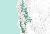
This dataset depicts forest cover on privately owned lands. Forest cover was determined using Landsat 7 ETM+ imagery from mainly summer 2000 and some from 1999. The remote imagery analysis was conducted by Hong Jiang and Jim Strittholt at Conservation Biology Institute. Cell resolution is 30 m. In 1999, the Conservation Biology Institute (CBI) concluded a conservation science assessment of the Klamath-Siskiyou ecoregion culminating in the report “A Science-based Conservation Assessment for the Klamath-Siskiyou Ecoregion.” Numerous ecological assessments were conducted and a conservation plan was proposed based on the results for special elements, ecosystem representation, and focal species. That study focused...

This dataset portrays 28 forest type groups across the contiguous United States. These data were derived from MODIS composite images from the 2002 and 2003 growing seasons in combination with nearly 100 other geospatial data layers, including elevation, slope, aspect, ecoregions, and PRISM climate data. The dataset was developed as a collaborative effort between the USFS Forest Inventory and Analysis and Forest Health Monitoring programs and the USFS Remote Sensing Applications Center.

This dataset portrays 61 forest group types across the southeastern United States. These data were derived from a product created by the USFS Forest Inventory and Analysis (FIA) program and the Remote Sensing Applications Center (RSAC). Â The original dataset (accessible from the US Forest Service Website) consists of 141 forest types across the contiguous United States. The original dataset was downloaded on 12/13/2013, clipped to the southeastern states, Â and used in a generalization procedure which involved the application of a majority filter (8 neighbors, half replacement threshold) followed by a sieving process which removed pixels in groups of four or less by reassigning them to their nearest neighbor value....

This dataset portrays 141 forest types across Alaska. These data were derived from MODIS composite images from the 2002 and 2003 growing seasons in combination with nearly 100 other geospatial data layers, including elevation, slope, aspect, and ecoregions. The dataset was developed as a collaborative effort between the USFS Forest Inventory and Analysis and Forest Health Monitoring programs and the USFS Remote Sensing Applications Center.

Abstract: This dataset portrays 141 forest types across the contiguous United States. These data were derived from MODIS composite images from the 2002 and 2003 growing seasons in combination with nearly 100 other geospatial data layers, including elevation, slope, aspect, ecoregions, and PRISM climate data. The dataset was developed as a collaborative effort between the USFS Forest Inventory and Analysis and Forest Health Monitoring programs and the USFS Remote Sensing Applications Center. Purpose: The purpose of this dataset is to portray broad distribution patterns of forest cover in the United States and provide input to national scale modeling projects. The data should not be displayed at scales smaller than...
Conclusions:Forest clearcutting differentialy affects birds of different ages. There is a threshold distance between reserves below which birds do not mind crossing clear cuts, making corridors more important as clearcut area and distance between forest reserves expandsThresholds/Learnings:
Categories: Publication;
Types: Citation;
Tags: Alberta,
Land use configuration,
Landscape fragmentation,
Natural cover amount,
birds,
Conclusions:Results indicated that system and species-specific considerations are important when assessing the potential outcome of habitat loss and fragmentation on regional biotaThresholds/Learnings:
Categories: Publication;
Types: Citation;
Tags: Canada and Finland,
Land use configuration,
Landscape fragmentation,
Natural cover amount,
birds,
Synopsis: Classical demographic methods applied to life history data on the northern spotted owl yield an estimate of the annual geometric rate of increase for the population of λ = 0.96 ± 0.03, which is not significantly different from that for a stable population (λ = 1.00). Sensitivity analysis indicates that adult annual survivorship has by far the largest influence on λ, followed by the probability that juveniles survive dispersal, and the adult annual fecundity. Substantial temporal fluctuations in demographic parameters have little effect on the long-run growth rate of the population because of the long adult life expectancy. A model of dispersal and territory occupancy that assumes demographic equilibrium...
Categories: Publication;
Types: Citation,
Map Service,
OGC WFS Layer,
OGC WMS Layer,
OGC WMS Service;
Tags: Landscape fragmentation,
Natural cover amount,
Oregon,
Western Washington,
birds,
This dataset portrays 28 forest type groups across the contiguous United States. These data were derived from MODIS composite images from the 2002 and 2003 growing seasons in combination with nearly 100 other geospatial data layers, including elevation, slope, aspect, ecoregions, and PRISM climate data. The dataset was developed as a collaborative effort between the USFS Forest Inventory and Analysis and Forest Health Monitoring programs and the USFS Remote Sensing Applications Center.

This dataset portrays 11 forest group types across the southeastern United States. These data were derived from a product created by the USFS Forest Inventory and Analysis (FIA) program and the Remote Sensing Applications Center (RSAC). Â The original dataset (accessible from the US Forest Service Website) consists of 28 forest type groups across the contiguous United States. The original dataset was downloaded on 12/13/2013, clipped to the southeastern states, Â and used in a generalization procedure which involved the application of a majority filter (8 neighbors, half replacement threshold) followed by a sieving process which removed pixels in groups of four or less by reassigning them to their nearest neighbor...

Forest resources in Washington and Oregon were surveyed in the early 1930s by employees of the Pacific Northwest Experimental Station (the original name of the current Pacific Northwest Research Station). This was the first of many periodic forest surveys conducted nationwide by the USDA Forest Service. Many publications and maps were produced from the Washington and Oregon 1930s survey data. Forest cover maps created from that data (at an original scale of 1:253, 440) have recently become available in digital formats, but little documentation was provided with the electronic files, and the older publications are not readily available to most users. The 27 forest cover types defined are the result of the combination...

This dataset portrays 28 forest type groups across the contiguous United States. These data were derived from MODIS composite images from the 2002 and 2003 growing seasons in combination with nearly 100 other geospatial data layers, including elevation, slope, aspect, ecoregions, and PRISM climate data. The dataset was developed as a collaborative effort between the USFS Forest Inventory and Analysis and Forest Health Monitoring programs and the USFS Remote Sensing Applications Center.
|

|
