Filters: Tags: land cover (X) > partyWithName: World Resources Institute (X)
21 results (7ms)|
Filters
Date Range
Extensions Types Contacts Categories Tag Types Tag Schemes |

This dataset depicts relative erosion rate derived for all land draining above the Mesoamerican reef. It is a function of slope, land cover type, precipitation and soil type. The indicators developed by the Reefs at Risk in the Caribbean project enable detailed comparative analyses of threats on many scales. The Reefs at Risk indicators are a simplification of human activities and complex natural processes. This data set was derived at the World Resources Institute for input to the sedimentation and pollution from watershed based sources threat analysis. Agriculture, though important to economic development and food security, is a source of increased sediment, nutrient, and pesticide runoff. Threats from sedimentation...

Using basins derived from a hydrologically-corrected 30m resolution DEM as a unit for summary statistics, we provide a series of indicators focused on land-based sources of threat within the US Virgin Islands and Puerto Rico. This includes indicators of a) the relative vulnerability of the land to erosion (based on slope, precipitation and soil erodibility); b) the relative erosion potential (REP) of the land, based on the relative vulnerability of the land, coupled with the current land cover type; c) the sediment delivery rate for each basin (percentage of eroded which reaches the river mouth); d) estimated sediment delivery for the basin, given current land use;

Used in the national level analysis of the Mining and Critical Ecosystems project for the country of Papua New Guinea.

This dataset shows summary statistics for relative erosion rate (REP), river flow, and sediment delivery estimated for each of over 150 watersheds draining along the Mesoamerican Reef.

Using basins derived from a hydrologically-corrected 30m resolution DEM as a unit for summary statistics, we provide a series of indicators focused on land-based sources fo threat within the US Virgin Islands. This includes indicators of a) the relative vulnerability of the land to erosion (based on slope, precipitation and soil erodibility); b) the relative erosion potential (REP) of the land, based on the relative vulnerability of the land, coupled with the current land cover type; c) the sediment delivery rate for each basin (percentage of eroded which reaches the river mouth); d) estimated sediment delivery for the basin, given current land use; e) the road density within the basin, and f) indicators of how...

Used in the national level analysis of the Mining and Critical Ecosystems project for the country of Papua New Guinea.

This dataset depicts land cover classes for the Ban Lung Village in Cambodia in 1953, from the Pilot Analysis of Global Ecosystems of Forest Ecosystems (PAGE) by World Resources Institute. This study examines forest ecosystems of the world using a large collection of spatial and temporal data. This study analyzes datasets at the global, national, and subnational levels, and draws on published and unpublished scientific studies. It develops selected indicators that describe the condition of the world's forests, where condition is defined as the current and future capacity of forests to provide the full range of goods and services that humans need and consume.

Using mapped watersheds as a unit for summary statistics, we provide a series of indicators focused on land-based sources of threat within the US Virgin Islands. This includes indicators of a) the relative vulnerability of the land to erosion (based on slope, precipitation and soil erodibility); b) the relative erosion potential (REP) of the land, based on the relative vulnerability of the land, coupled with the current land cover type; c) the sediment delivery rate for each basin (percentage of eroded which reaches the river mouth); d) estimated sediment delivery for the basin, given current land use; e) the road density within the basin, and f) indictors of how erosion prone areas with roads might be (average...

This dataset depicts relative sediment delivery at the river mouth for each of over 3,000 watersheds draining into the Caribbean Sea and Gulf of Mexico.
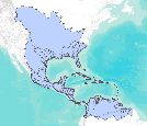
This dataset depicts watershed boundaries with a minimum size of 35 square kilometers for the Caribbean region.

Using watersheds derived from a hydrologically-corrected 30m resolution DEM as a unit for summary statistics, we provide a series of indicators focused on land-based sources of threat within the US Virgin Islands and Puerto Rico. This includes indicators of a) the relative vulnerability of the land to erosion (based on slope, precipitation and soil erodibility); b) the relative erosion potential (REP) of the land, based on the relative vulnerability of the land, coupled with the current land cover type; c) the sediment delivery rate for each basin (percentage of eroded which reaches the river mouth); d) estimated sediment delivery for the basin, given current land use;

This dataset depicts land cover classes for the Ban Lung Village in Cambodia in 1996, from the Pilot Analysis of Global Ecosystems of Forest Ecosystems (PAGE) by World Resources Institute. This study examines forest ecosystems of the world using a large collection of spatial and temporal data. This study analyzes datasets at the global, national, and subnational levels, and draws on published and unpublished scientific studies. It develops selected indicators that describe the condition of the world's forests, where condition is defined as the current and future capacity of forests to provide the full range of goods and services that humans need and consume.

This dataset depicts relative erosion rate by land cover type derived for all land draining above the Mesoamerican Reef. The indicators developed by the Reefs at Risk in the Caribbean project enable detailed comparative analyses of threats on many scales. The Reefs at Risk indicators are a simplification of human activities and complex natural processes. This data set was derived at the World Resources Institute for input to the sedimentation and pollution from watershed based sources threat analysis. Agriculture, though important to economic development and food security, is a source of increased sediment, nutrient, and pesticide runoff. Threats from sedimentation and pollution from inland sources were modeled...
An indicator of relative sediment delivery at the river mouth for each of over 3,000 watersheds draining into the Caribbean Sea and Gulf of Mexico.
Categories: Data;
Types: ArcGIS REST Map Service,
ArcGIS Service Definition,
Downloadable,
Map Service;
Tags: Alabama (AL),
Caribbean,
Florida (FL),
Gulf of Mexico,
Gulf of Mexico,

For areas with roads, we have developed a simple indicator of the erosivity of the land based on physical factors of the location (slope, precipitation, and a soil characteristic called K-factor, which reflects the erodibility of the given soil type.) This indicator provides a rough indication of the relative erosion that might result from road construction and runoff from roads in the range of locations on the US Virgin Islands. It identifies the roads likely to be contributing the most erosion to the watershed.

An indicator of relative sediment delivery at the river mouth for each of over 3,000 watersheds draining into the Caribbean Sea and Gulf of Mexico.

Summary statistics for relative erosion rate (REP), river flow, and sediment delivery estimated for each of over 3,000 watersheds draining into the Caribbean Sea and Gulf of Mexico. This dataset is a combination of the region wide 1 km analysis and the higher resolution 270 m analysis for the islands of the eastern caribbean.

Using basins derived from a hydrologically-corrected 30m resolution DEM as a unit for summary statistics, we provide a series of indicators focused on land-based sources of threat within the USVI. This includes indicators of a) the relative vulnerability of the land to erosion (based on slope, precipitation and soil erodibility); b) the relative erosion potential (REP) of the land, based on the relative vulnerability of the land, coupled with the current land cover type; c) the sediment delivery rate for each basin (percentage of eroded which reaches the river mouth); d) estimated sediment delivery for the basin, given current land use; e) the road density within the basin, and f) indicators of how erosion prone...

Using mapped watersheds as a unit for summary statistics, we provide a series of indicators focused on land-based sources of threat within the US Virgin Islands. This includes indicators of a) the relative vulnerability of the land to erosion (based on slope, precipitation and soil erodibility); b) the relative erosion potential (REP) of the land, based on the relative vulnerability of the land, coupled with the current land cover type; c) the sediment delivery rate for each basin (percentage of eroded which reaches the river mouth); d) estimated sediment delivery for the basin, given current land use; e) the road density within the basin, and f) indicators of how erosion prone areas with roads might be (average...

For areas with roads, we have developed a simple indicator of the erosivity of the land based on physical factors of the location (slope, precipitation, and a soil characteristic called K-factor, which reflects the erodibility of the given soil type.) This indicator provides a rough indication of the relative erosion that might be resulting from road construction and runoff from roads in the range of locations on the US Virgin Islands. It identifies the roads likely to be contributing the most erosion to the watershed.
|

|
