Filters: Tags: land use (X)
471 results (28ms)|
Filters
Date Range
Extensions Types Contacts
Categories Tag Types
|
A table summarizing the inventoried acreage by crop type and irrigation system was compiled for Franklin County, Florida. The irrigated acreage totals were derived from analyses of satellite and aerial imagery. Crop types and irrigation system types were verified during field trips that started in May 2021 and concluded in August 2021. In addition, the table provides acreage totals by crop type reported by the U.S. Department of Commerce for 1982, the U.S. Department of Agriculture from 1987 through 2017, and Florida Statewide Agricultural Irrigation Demand for 2018-19.
Categories: Data;
Tags: Crop type,
Florida,
Florida Department of Agriculture and Consumer Services,
Franklin County,
Groundwater,
A table summarizing the inventoried acreage by crop type and irrigation system was compiled for Bradford County, Florida. The irrigated acreage totals were derived from analyses of satellite and aerial imagery. Crop types and irrigation system types were verified during field trips that started in January 2020 and concluded in December 2020. In addition, the table provides acreage totals by crop type reported by the U.S. Department of Commerce for 1982, the U.S. Department of Agriculture from 1987 through 2017, and Florida Statewide Agricultural Irrigation Demand for 2016-18.
Categories: Data;
Tags: Bradford County,
Crop type,
Florida,
Florida Department of Agriculture and Consumer Services,
Groundwater,
A table summarizing the irrigated acreage by crop type and irrigation system was compiled for January to December 2019 for Pasco County, Florida. The irrigated acreage totals were derived from analyses of aerial imagery and data were field verified in 2019. In addition, the table provides acreage totals by crop type published by the U.S. Department of Commerce for 1982 and the U.S. Department of Agriculture for years between 1987 and 2017.
Categories: Data;
Tags: Crop type,
Florida,
Florida Department of Agriculture and Consumer Service,
Groundwater,
Irrigation type,
Phase 1 & 2 (2010, 2012): This project developed a sampling design and monitoring protocol for wintering shorebirds in the Central Valley and in the San Francisco Bay Estuary and develop an LCC-specific online shorebird monitoring portal publicly available at the California Avian Data Center. The three objectives in Phase II of this project are: 1) Complete the shorebird monitoring plan for the CA LCC by developing a sampling design and monitoring protocol for wintering shorebirds in coastal southern California and northern Mexico. 2) Develop models to evaluate the influence of habitat factors from multiple spatial scales on shorebird use of San Francisco Bay and managed wetlands in the Sacramento Valley, as a model...
Categories: Data,
Project;
Types: Map Service,
OGC WFS Layer,
OGC WMS Layer,
OGC WMS Service;
Tags: 2010,
2011,
2013,
Academics & scientific researchers,
Academics & scientific researchers,
This dataset is the third (circa 2013) in a series of three 1-kilometer land use land cover (LULC) time-periods datasets (1975, 2000, and 2013) aids in monitoring change in West Africa’s land resources. To monitor and map these changes, a 26 general LULC class system was used. The classification system that was developed was primarily inspired by the “Yangambi Classification” (Trochain, 1957). This fairly broad class system for LULC was used because the classes can be readily identified on Landsat satellite imagery. A visual photo-interpretation approach was used to identify and map the LULC classes represented on Landsat images. The Rapid Land Cover Mapper (RLCM) was used to facilitate the photo-interpretation...
Categories: Data;
Types: Downloadable,
GeoTIFF,
Map Service,
Raster;
Tags: Gambia,
Land Cover,
Land Use,
biota,
land cover,
The National Park Service (NPS), in conjunction with the Biological Resources Division (BRD) of the U.S. Geological Survey (USGS), has implemented a program to "develop a uniform hierarchical vegetation methodology" at a national level. The program will also create a geographic information system (GIS) database for the parks under its management. The purpose of the data is to document the state of vegetation within the NPS service area during the 1990's, thereby providing a baseline study for further analysis at the Regional or Service-wide level. The vegetation at Devils Tower National Monument was mapped using 1:16,000 scale U.S. Forest Service Color Aerial Photography acquired July 29, 1993. The mapping classification...
The vegetation spatial database coverage (vegetation map) is a product of the Effigy Mounds National Monument Vegetation Mapping Project, USGS-NPS Vegetation Mapping Program (VMP). The U.S. Geological Survey (USGS) Upper Midwest Environmental Sciences Center (UMESC) in La Crosse, Wisconsin, and the Minneapolis Office of NatureServe in Minneapolis, Minnesota, have completed mapping and classification of existing plant communities of Effigy Mounds National Monument (EFMO) and extended surroundings. Photointerpreters, ecologists, and botanists collaborated to describe National Vegetation Classification System (NVCS) plant communities (associations) and determine how best to map them using aerial photographs. --- Two...

Soil organic carbon is a general term for the total of all the different non-living organic compounds in the soil, it also excludes dead plants and animals. The organic carbon in the soil is used by plants for nourishment as they grow, and the plants themselves replenish the resource when they decay after they die. Although it would seem that high densities of soil carbon would correspond to areas where vegetation thrives, this is not necessarily the case. For example, the regions of the world categorized as tropical rainforest typically have very low quality soils - not because the soils are bad, rather because the highly active vegetation on the surface has already extracted most of the nutrient from the soil....
An approach is presented in this study to aid water-resource managers in characterizing streamflow alteration at ungauged rivers. Such approaches can be used to take advantage of the substantial amounts of biological data collected at ungauged rivers to evaluate the potential ecological consequences of altered streamflows. National-scale random forest statistical models are developed to predict the likelihood that ungauged rivers have altered streamflows (relative to expected natural condition) for five hydrologic metrics (HMs) representing different aspects of the streamflow regime. The models use human disturbance variables, such as number of dams and road density, to predict the likelihood of streamflow alteration....
Categories: Publication;
Types: Citation;
Tags: altered flows,
dams,
human alterations,
land use,
urba
This geospatial database covers vegetation land cover and land use for Wind Cave National Park and surrounding areas and is authorized as part of the USGS/NPS Vegetation Mapping Program http://www.usgs.gov/core_science_systems/csas/vip/index.html. The program is administered by the Biological Resources Division (BRD) of the United States Geological Survey (USGS). This mapping effort was performed by the US Bureau of Reclamation's (USBR) Remote Sensing and GIS Group, Technical Service Center, Denver, CO. The vegetation mapping program is part of a larger Inventory and Monitoring (I&M) program started by the National Park Service (NPS) http://science.nature.nps.gov/im/. I&M goals are, among others, to map the vegetation...

This dataset portrays land cover for NLCD mapping superzone thirteen, which covers all of Maine, Vermont, New Hampshire, Massachusetts, Rhode Island, Connecticut, New York, New Jersey, Delaware, and Maryland, and parts of Pennsylvania, Virginia, West Virginia, and North Carolina. Refer to http://www.mrlc.gov/nlcd_multizone_map.php for a map of the superzones. From NLCD: The National Land Cover Database 2001 was produced through a cooperative project conducted by the Multi-Resolution Land Characteristics (MRLC) Consortium. The MRLC Consortium is a partnership of federal agencies (www.mrlc.gov), consisting of the U.S. Geological Survey (USGS), the National Oceanic and Atmospheric Administration (NOAA), the U.S....

This dataset represents Bureau of Land Management (BLM) grazing allotments in California. The GIS dataset obtained from the US BLM was attributed with several additional attributes derived from information publicly available on BLM web pages, in order to make information easily accessible to users. These attributes were joined to the dataset automatically, and errors of omission or commission may be present. The additional attribution was not performed under the supervision of the US BLM, and neither BLM nor CBI shall be held liable for any use or misuse of this dataset. While efforts were undertaken to ensure that features were correctly attributed using the latest publicly-available information from the BLM, users...

This dataset contains generalized landcover data for the Prairie Farm Rehabilitation Administration (PFRA) agricultural extent of Alberta and British Columbia. This dataset was subset into two shapefiles. The other half of this dataset covers PFRA agricultural areas of Manitoba and Saskatchewan. The Landcover Generalization process was undertaken to solve rendering problems of the original vectorized landcover data due to its unwieldy/overwhelming size. LANDSAT 7 imagery used in the process was collected during the WGTPP. This landcover imagery has a 30 meter resolution and is stored in over 1,100 vectorized 1:50,000 map sheet tiles. The data requires over seven gigabytes of disc space. If the user wishes to view...
Farmland Mapping and Monitoring Program data product for 2010 with all counties in the San Joaquin Valley, and available bordering counties.

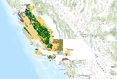
Description and data downloaded from DRECP Website: http://www.drecp.org/meetings/2012-07-25-26_workshop/background/Department_of_Defense_Materials/This information and data is provided in support of the Desert Renewable Energy Conservation Plan. Attachment 1 provides a Department of Defense (DoD) comprehensive matrix detailing potential military operational constraints by Development Focus Area. Attachment 2 provides associated conflict maps by renewable energy technology. Regarding the color coding:·        The red areas represent locations where there is a high likelihood of unacceptable risk to national security, and then technology identified might impact military operations, testing and training.Â...

This dataset portrays land cover for southwestern Alaska, part of NLCD superzone 15. To reduce file size, Alaska was divided into ten zones, which can be found in the NLCD 2001 gallery . For more infomation on NLCD superzones, including a map, refer to http://www.mrlc.gov/nlcd_multizone_map.php . From NLCD: The National Land Cover Database 2001 was produced through a cooperative project conducted by the Multi-Resolution Land Characteristics (MRLC) Consortium. The MRLC Consortium is a partnership of federal agencies (www.mrlc.gov), consisting of the U.S. Geological Survey (USGS), the National Oceanic and Atmospheric Administration (NOAA), the U.S. Environmental Protection Agency (EPA), the U.S. Department of Agriculture...

The Last of the Wild represents the least influenced (most wild) areas of major terrestrial biomes. Most wild in each biome are defined as areas with Human Footprint Index values less than or equal to 10. The map shows the distribution of what remains the least influenced areas in each biome. The Last of the Wild Dataset of the Last of the Wild Project, Version 2, 2005 (LWP-2) is derived from the LWP-2 Human Footprint Dataset. The gridded data are classified according to their raster value (wild = 0-10; not wild >10). The ten largest polygons of more than 5 square kilometers within each biome by realm are selected and identified. The dataset is produced by the Wildlife Conservation Society (WCS) and the Columbia...
Projected increases in aridity throughout the southwestern United States due to anthropogenic climate change will likely cause reductions in perennial vegetation cover, which leaves soil surfaces exposed to erosion. Accelerated rates of dust emission from wind erosion have large implications for ecosystems and human well-being, yet there is poor understanding of the sources and magnitude of dust emission in a hotter and drier climate. Here we use a two-stage approach to compare the susceptibility of grasslands and three different shrublands to wind erosion on the Colorado Plateau and demonstrate how climate can indirectly moderate the magnitude of aeolian sediment flux through different responses of dominant plants...
Categories: Publication;
Types: Citation,
Journal Citation;
Tags: arid,
horizontal flux,
land use,
national park,
threshold shear velocity
This raster file represents classification and mapping results for priority area 1 of the Cody Region and Yellowstone National Park land cover remote sensing project. Extensive field collected reference data describing the range of plant communities and habitat types comprising the Bighorn Basin have been analyzed to produce a classification of land cover types based on the Wyoming Game and Fish Department (WGFD) Wildlife Observation System (WOS). Corresponding land cover classes were subsequently spatially modeled using a non-parametric Classification and Regression Tree (CART) algorithm that integrated both spectral data from Landsat Thematic Mapper satellite imagery and a variety of ancillary environmental data...
Categories: Data;
Types: Downloadable;
Tags: Absaroka,
Bighorn Basin,
Land Cover,
Land Use,
Landcover,
This study uses an integrative approach to study the water-quality impacts of future global climate and land-use changes. In this study, changing land-use types was used as a mitigation strategy to reduce the adverse impacts of global climate change on water resources. The climate scenarios were based on projections made by the Intergovernmental Panel on Climate Change (IPCC) and the United Kingdom Hadley Centre's climate model (HadCM2). The Thornthwaite water-balance model was coupled with a land-use model (L-THIA) to investigate the hydrologic effects of future climate and land-use changes in the Ohio River Basin. The land-use model is based on the Soil Conservation Service's curve-number method. It uses the curve...
Categories: Publication;
Types: Citation;
Tags: ASFA 3: Aquatic Pollution & Environmental Quality,
Climatic changes,
Data Visualization & Tools,
Environment management,
Freshwater,
|

|
