Filters: Tags: lynx (X)
29 results (13ms)|
Filters
Date Range
Extensions (Less) Types (Less) Contacts (Less)
Categories (Less) Tag Types Tag Schemes
|

Potential Lynx Habitat in Umatilla National Forest, originally published in 2002, last updated 6/24/2010.

This dataset depicts the spatial distribution of lynx habitat as developed for the 2002 revised land and resource management plan on the White River National Forest in Colorado. No additional information was available from the White River National Forest on how this dataset was created. For the revised land and resource management plan and ammendments, please see: http://www.fs.fed.us/r2/whiteriver/projects/forest_plan/index.shtml
Tags: lynx

This dataset depicts Lynx (Lynx canadensis) habitat in the Northern Appalachians predicted using the spatially explicit population model PATCH under the population cycling across the region plus trapping plus climate change scenario (FC2; Carrol 2007). This dataset represents one of several scenarios testing the interacting effects of population cycling, trapping, territory size, and climate change on lynx populations. Static habitat suitability models for lynx were fed through PATCH to predict source and sink habitat areas across the landscape. The static models for lynx were created based on a logistic regression model of reported lynx locations against the proportion of the landscape in deciduous forest cover...
USGS Historical Quadrangle in GeoPDF.

Canada Lynx modeled corridors in Colorado by the Southern Rockies Ecosystem Project (now Center for Native Ecosystems) encompassing the most important expert and model identified corridors from the Linking Colorado's Landscapes project that cross highways. The modeled corridors represent the corridors that were modeled using the Corridor Design tool http://corridordesign.org

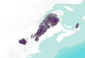
This dataset represents the predicted distribution for Canada Lynx (Lynx canadensis) based on the average climatic conditions of the past 50 years (1950-2000), based on the agreement (spatial average) of 5 niche modeling techniques (BIOCLIM, Climate Space Model, Envelope Score, Environmental Distance, SMV). Localities used to produce the model were resampled from the core area (highest probability) of the predicted distribution based on 48 Worldclim 1.4 climatic variables and BIOCLIM.
Tags: distribution,
lynx

This dataset depicts Lynx (Lynx canadensis) habitat in the Northern Appalachians predicted using the spatially explicit population model PATCH under the population cycling only in Gaspe (core area) plus trapping scenario (B2; Carroll 2007). This dataset represents one of several scenarios testing the interacting effects of population cycling, trapping, territory size, and climate change on lynx populations. Static habitat suitability models for lynx were fed through PATCH to predict source and sink habitat areas across the landscape. The static models for lynx were created based on a logistic regression model of reported lynx locations against the proportion of the landscape in deciduous forest cover and annual...
This data set contains imagery from the National Agriculture Imagery Program (NAIP). The NAIP program is administered by USDA FSA and has been established to support two main FSA strategic goals centered on agricultural production. These are, increase stewardship of America's natural resources while enhancing the environment, and to ensure commodities are procured and distributed effectively and efficiently to increase food security. The NAIP program supports these goals by acquiring and providing ortho imagery that has been collected during the agricultural growing season in the U.S. The NAIP ortho imagery is tailored to meet FSA requirements and is a fundamental tool used to support FSA farm and conservation programs....
This data set contains imagery from the National Agriculture Imagery Program (NAIP). The NAIP program is administered by USDA FSA and has been established to support two main FSA strategic goals centered on agricultural production. These are, increase stewardship of America's natural resources while enhancing the environment, and to ensure commodities are procured and distributed effectively and efficiently to increase food security. The NAIP program supports these goals by acquiring and providing ortho imagery that has been collected during the agricultural growing season in the U.S. The NAIP ortho imagery is tailored to meet FSA requirements and is a fundamental tool used to support FSA farm and conservation programs....

This dataset depicts Lynx (Lynx canadensis) habitat in the Northern Appalachians predicted using the spatially explicit population model PATCH under the population cycling only in Gaspe (core area) plus 36 square kilometer territory size (compared to 90 square kilometer territory) scenario (B136; Carroll 2007). This dataset represents one of several scenarios testing the interacting effects of population cycling, trapping, territory size, and climate change on lynx populations. Static habitat suitability models for lynx were fed through PATCH to predict source and sink habitat areas across the landscape. The static models for lynx were created based on a logistic regression model of reported lynx locations against...

This dataset depicts Lynx (Lynx canadensis) habitat in the Northern Appalachians predicted using the spatially explicit population model PATCH under the no population cycling scenario (A1; Carrol 2007). This dataset represents one of several scenarios testing the interacting effects of population cycling, trapping, territory size, and climate change on lynx populations. Static habitat suitability models for lynx were fed through PATCH to predict source and sink habitat areas across the landscape. The static models for lynx were created based on a logistic regression model of reported lynx locations against the proportion of the landscape in deciduous forest cover and annual snowfall. Demographic parameters were...
This dataset depicts Lynx (Lynx canadensis) habitat in the Northern Appalachians predicted using the spatially explicit population model PATCH under the no population cycling plus trapping plus 36 square kilometer territory size (compared to 90 square kilometer territory) scenario (A236; Carroll 2007). This dataset represents one of several scenarios testing the interacting effects of population cycling, trapping, territory size, and climate change on lynx populations. Static habitat suitability models for lynx were fed through PATCH to predict source and sink habitat areas across the landscape. The static models for lynx were created based on a logistic regression model of reported lynx locations against the proportion...
This data set contains imagery from the National Agriculture Imagery Program (NAIP). The NAIP program is administered by USDA FSA and has been established to support two main FSA strategic goals centered on agricultural production. These are, increase stewardship of America's natural resources while enhancing the environment, and to ensure commodities are procured and distributed effectively and efficiently to increase food security. The NAIP program supports these goals by acquiring and providing ortho imagery that has been collected during the agricultural growing season in the U.S. The NAIP ortho imagery is tailored to meet FSA requirements and is a fundamental tool used to support FSA farm and conservation programs....

This dataset depicts Lynx (Lynx canadensis) habitat in the Northern Appalachians predicted using the spatially explicit population model PATCH under the population cycling only in Gaspe (core area) scenario (B1; Carroll 2007). This dataset represents one of several scenarios testing the interacting effects of population cycling, trapping, territory size, and climate change on lynx populations. Static habitat suitability models for lynx were fed through PATCH to predict source and sink habitat areas across the landscape. The static models for lynx were created based on a logistic regression model of reported lynx locations against the proportion of the landscape in deciduous forest cover and annual snowfall. Demographic...

This dataset depicts Lynx (Lynx canadensis) habitat in the Northern Appalachians predicted using the spatially explicit population model PATCH under the population cycling only in Gaspe (core area) plus climate change scenario (FB1; Carroll 2007). This dataset represents one of several scenarios testing the interacting effects of population cycling, trapping, territory size, and climate change on lynx populations. Static habitat suitability models for lynx were fed through PATCH to predict source and sink habitat areas across the landscape. The static models for lynx were created based on a logistic regression model of reported lynx locations against the proportion of the landscape in deciduous forest cover and...

This dataset depicts Lynx (Lynx canadensis) habitat in the Northern Appalachians predicted using the spatially explicit population model PATCH under the population cycling across the region plus trapping scenario (C2; Carrol 2007). This dataset represents one of several scenarios testing the interacting effects of population cycling, trapping, territory size, and climate change on lynx populations. Static habitat suitability models for lynx were fed through PATCH to predict source and sink habitat areas across the landscape. The static models for lynx were created based on a logistic regression model of reported lynx locations against the proportion of the landscape in deciduous forest cover and annual snowfall....

This dataset depicts Lynx (Lynx canadensis) habitat in the Northern Appalachians predicted using the spatially explicit population model PATCH under the no population cycling plus trapping scenario (A2; Carrol 2007). This dataset represents one of several scenarios testing the interacting effects of population cycling, trapping, territory size, and climate change on lynx populations. Static habitat suitability models for lynx were fed through PATCH to predict source and sink habitat areas across the landscape. The static models for lynx were created based on a logistic regression model of reported lynx locations against the proportion of the landscape in deciduous forest cover and annual snowfall. Demographic parameters...
This data set contains imagery from the National Agriculture Imagery Program (NAIP). The NAIP program is administered by USDA FSA and has been established to support two main FSA strategic goals centered on agricultural production. These are, increase stewardship of America's natural resources while enhancing the environment, and to ensure commodities are procured and distributed effectively and efficiently to increase food security. The NAIP program supports these goals by acquiring and providing ortho imagery that has been collected during the agricultural growing season in the U.S. The NAIP ortho imagery is tailored to meet FSA requirements and is a fundamental tool used to support FSA farm and conservation programs....

This dataset depicts Lynx (Lynx canadensis) habitat in the Northern Appalachians predicted using the spatially explicit population model PATCH under the population cycling across the region scenario (C1; Carrol 2007). This dataset represents one of several scenarios testing the interacting effects of population cycling, trapping, territory size, and climate change on lynx populations. Static habitat suitability models for lynx were fed through PATCH to predict source and sink habitat areas across the landscape. The static models for lynx were created based on a logistic regression model of reported lynx locations against the proportion of the landscape in deciduous forest cover and annual snowfall. Demographic parameters...

This dataset depicts the spatial distribution of lynx habitat on the San Juan National Forest in Colorado, USA. No additional information was available from the San Juan National Forest on how this dataset was created. This dataset was modified by the Conservation Biology Institute (CBI) from the original dataset obtained from the San Juan National Forest. Due to the lack of appropriate metadata, CBI dropped all attributes except those that identify lynx habitat type. These attributes are represented as codes, and their interpretations were deduced by CBI; these interpretations may be incorrect and users are therefore cautioned to use this dataset at their own risk. Areas that lacked a habitat code were dropped...
Tags: lynx,
san juan national forest
|

|
