Filters: Tags: macroinvertebrates (X)
58 results (35ms)|
Filters
|
Article Citation: T. R. Maret, D. J. Cain, D. E. MacCoy, and T. M. Short (2003) Response of benthic invertebrate assemblages to metal exposure and bioaccumulation associated with hard-rock mining in northwestern streams, USA. Journal of the North American Benthological Society: December 2003, Vol. 22, No. 4, pp. 598-620.
Categories: Publication;
Types: Citation;
Tags: Bioaccumulation,
macroinvertebrates,
metal exposure,
mining,
structural response
This data release links benthic macroinvertebrate sites to both the NHDPlus Version 2 and NHDPlus High Resolution Region 02 networks, hereafter referred to as V2 and HR, using the hydrolink methodology. Linked benthic macroinvertebrate sites are those included in the Chesapeake Bay Basin-wide Index of Biotic Integrity (Chessie BIBI) developed by the Interstate Commission on the Potomac River Basin (ICPRB) and available from the Chesapeake Bay Program (https://datahub.chesapeakebay.net/LivingResources). The data set contains a unique sample identifier created by ICPRB, survey program, coordinates of sample, linked V2 COMID and HR Permanent Identifier, and information regarding uncertainty in the attribution. We strongly...
Categories: Data;
Tags: Aquatic Biology,
District of Columbia (national district),
Ecology,
Hydrology,
Maryland (state),
The Stream Conditions of Chester County Biological Monitoring Network was established by the U.S. Geological Survey and the Chester County Water Resources Authority in 1969. Benthic-macroinvertebrate, habitat, and stream chemistry data were collected annually from 1998-2021 at 18 fixed location sites. Additionally, nine flexible location sites were selected and sampled annually from 1998-2021. Some of the flexible location sites were sampled more than once over the study period. All data were collected in the fall months (October-November) during baseflow conditions. The benthic-macroinvertebrate data collected was used to calculate six metrics and to establish an index of biotic integrity for each sample, while...
This dataset contains taxonomic information, counts, and lengths of macroinvertebrates collected from rivers in northwest Alaska using drift and kick nets during summer and fall 2015-2019.
Dam removal is often proposed as way to restore ecological integrity to rivers and streams, but ecological responses to dam removals are poorly understood, especially for downstream benthic communities. We examined the responses of benthic macroinvertebrate and algal assemblages in downstream reaches to the removal of a small, run-of-river dam on Manatawny Creek, Pennsylvania. Benthic macroinvertebrates, algae, and habitat characteristics were monitored upstream and downstream of the dam for 4 mo before removal, 3 mo after partial removal (i.e., when the impoundment was largely eliminated but sediment remained trapped behind the remaining structure), and 12 mo after complete dam removal. Macroinvertebrate density,...
Categories: Publication;
Types: Citation;
Tags: algae,
baci,
dam removal,
macroinvertebrates,
restoration
Macroinvertebrate samples were collected from streams tributary to Honnedaga Lake and from the Middle Branch of the Black River during 2012-2016 and analyzed for methylmercury concentrations and for stable isotope ratios of nitrogen and carbon. Macroinvertebrates were identified in the field, and the level of taxonomic resolution varied from order to species; most taxa were identified to the family level. Specimens were field-processed into composite samples, field-frozen, and submitted to the mercury laboratory for freeze-drying and analysis. Subsamples were then submitted to the stable isotope laboratory for analysis of nitrogen and carbon isotope ratios. This database contains the resulting data and associated...
Categories: Data;
Types: Map Service,
OGC WFS Layer,
OGC WMS Layer,
OGC WMS Service;
Tags: Ambient Monitoring,
Aquatic Biology,
Aquatic Community Health,
Ecosystem Health,
Environmental Health,
OBIS-USA brings together marine biological occurrence data – recorded observations of identifiable marine species at a known time and place, collected primarily from U.S. Waters or with U.S. funding. Coordinated by the Science Analytics and Synthesis (SAS) Program of the United States Geological Survey (USGS), OBIS-USA, strives to meet national data integration and dissemination needs for marine data about organisms and ecosystems. OBIS-USA is part of an international data sharing network (Ocean Biodiversity Information System, OBIS) coordinated by the Intergovernmental Oceanographic Commission, of UNESCO (United Nations Educational, Science and Cultural Organization) International Oceanographic Data and Information...
Griffith, Michael B., F. Bernard Daniel, Matthew A. Morrison, Michael E. Troyer, James M. Lazorchak, and Joseph P. Schubauer-Berigan, 2009. Linking Excess Nutrients, Light, and Fine Bedded Sediments to Impacts on Faunal Assemblages in Headwater Agricultural Streams. Journal of the American Water Resources Association (JAWRA) 45(6):1475-1492. Abstract: Biological impairments in streams are typically defined by regulatory agencies in terms of altered invertebrate or fish assemblages. While nutrients, canopy cover, and sediment fines contribute to these impairments, these stressors are often defined, at least in part, by their impacts on periphyton. Path analysis can extend these assessments to impacts on invertebrates...
Categories: Publication;
Types: Citation;
Tags: Data Visualization & Tools,
Landscapes,
Northeast CASC,
Other Landscapes,
Science Tools For Managers,
This study deployed acoustic telemetry into a red swamp crayfish-infested water retention pond (1.0 ac) near Novi, Michigan to document the movements and behavior of telemetered red swamp crayfish (Procambarus clarkii). Telemetry was setup in the pond for approximately 3 months. Spreadsheets include telemetry data with position estimates for individual crayfish.
Categories: Data;
Tags: Acoustic telemetry,
Aquatic Biology,
Aquatic biology,
Invasive crayfish,
Invasive species,
A major challenge in the biological monitoring of stream ecosystems in protected wilderness areas is discerning whether temporal changes in community structure are significantly outside of a reference condition that represents natural or acceptable annual variation in population cycles. Otherwise sites could erroneously be classified as impaired. Long-term datasets are essential for understanding these trends, to ascertain whether any changes in community structure significantly beyond the reference condition are permanent shifts or with time move back to within previous limits. To this end, we searched for long-term (>8 years) quantitative data sets of macroinvertebrate communities in wadeable rivers collected...
Categories: Publication;
Types: Citation;
Tags: Biomonitoring,
Impairment,
Macroinvertebrates,
Management,
Rivers,
The removal of the numerous ageing dams in the United States has become an important stream restoration technique. The extent to which the ecological damage done to streams by dams is reversed upon removal is unknown, especially on decadal time scales. The objectives of this study were to determine if macroinvertebrate assemblages within rivers recover following the removal of a dam and to estimate the time needed for recovery. A space‐for‐time substitution approach was used on eight rivers in various stages of recovery following a dam removal, ranging from <1 to 40 years post‐removal. Within each river, macroinvertebrates were sampled in a zone unaffected by the dam removal (reference zone) and two zones impacted...
Categories: Publication;
Types: Citation;
Tags: Michigan,
Wisconsin,
dam removal,
long‐term,
macroinvertebrates
This data release supports the manuscript: Walker, R.H. and A.W. Walters. 2019. A mechanistic understanding of ecological responses to anthropogenic surface disturbance in headwater streams. Ecosphere 10(10):e02907. 10.1002/ecs2.2907. It includes one data set with physicochemical and biological data from 40 stream sites (100 m length) in the Wyoming Range for summer 2016.
Categories: Data;
Tags: Aquatic Biology,
Ecology,
USGS Science Data Catalog (SDC),
Upper Green River basin,
Water Resources,
The rrbasin_inverts shapefile (polygons) contains ranks that represent the habitat integrity of the watershed (HUC6) based on aquatic macroinvertebrate bioassessment scores calculated by Aquatic Biology Associates (ABA).This is Figure 15 from the report titled "Assessment of Aquatic Habitat Monitoring Data in the Rogue River Basin and Southern Oregon Coastal Streams" (January 2003) by Conservation Biology Institute.For more information, please review the full report.
The USGS and Virginia Tech are determining if and how the implementation of conservation practices, such as best management practices (BMPs), in watersheds have improved the health of Chesapeake nontidal streams. Our goal is to identify the effects of BMPs and land-use on stream ecosystems by linking upstream landscape change to stream physical habitat, water quality, flow and temperature, and macroinvertebrate and fish responses. We are also determining the specific sources of stress to streams and fish populations to help identify which management practices are most likely to improve stream health. Each year from 2021 to 2024 we study a different Chesapeake landscape setting that is a focus area for stakeholders...
This dataset contains macroinvertebrate sampling data (weights) for wetlands in the Cottonwood Lake Study Area, Stutsman County, North Dakota.
Categories: Data;
Tags: Aquatic Biology,
Biota,
Community composition,
Cottonwood Lake Study Area,
Ecology,
Benthic macroinvertebrate samples to evaluate before- and after-culvert construction phases were collected at seven study sites. Samples were collected in two reaches at each site, one upstream and one downstream of the culvert installation. Biological data for all seven sites (14 sample reaches) are included in this data release. In the summer of 2011, samples were collected from upstream and downstream reaches at six stream sites. Samples from Oakmulgee Creek, Northington Branch, Lye Branch, Mill Creek, and Kanetuche Creek represented conditions before culvert construction. The samples from the Tributary to Cahaba River represented conditions during construction since the culvert was already constructed and active...
Categories: Data;
Types: Map Service,
OGC WFS Layer,
OGC WMS Layer,
OGC WMS Service;
Tags: Alabama,
Gulf Coastal Plain,
aquatic biology,
macroinvertebrates
These data consists of three related tables describing in-situ field conditions including pesticide concentration, water quality, and post-treatment survival of crayfish associated with the application of a pesticide to a stormwater retention pond and burrows to suppress or eradicate an invasive crayfish species, Procambarus clarkii, in support of high-priority research developing control methods to mitigate impacts of invasive crayfish within the Great Lakes Basin. Effectiveness of the treatment was accessed using an in-situ bioassay and by measuring pesticide concentrations in water, sediment, and caged crayfish. Water quality data, including temperature, pH, specific conductance, dissolved oxygen, alkalinity,...
This data release includes sampling location data; field-collected stream attribute data; laboratory-analyzed chemistry concentrations (total mercury, methyl mercury) and isotopic composition (total mercury, carbon, and nitrogen) for stream biota (seston, periphyton, benthic insects, emerging adult insects, riparian spiders, and fish); density, body length, and taxonomic information for benthic insects; and density, biomass, and taxonomic information for emerging adult aquatic insects for biota sampled from stream reaches up and downstream of an historical mercury mine site. Sampling took place during summer low-flow conditions in 2015 and 2016. Stream reaches were located on USFS land near the Cinnabar Mine Site...
These data are comprised of measurements of elements (e.g., uranium, cobalt, nickel, copper, zinc, cadmium, lead, etc.), major anions (chloride, nitrite+nitrate as nitrogen, sulfate, etc.), dissolved organic carbon, and general water quality characteristics in Canyon Mine containment pond water, sediment, vegetaiton and invertebrate samples collected in calendar year 2017.
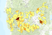
These data show the data from 2018 for Stream Condition Index (SCI) for Florida. River/Stream SCI is an ecological indicator for the Landscape Conservation Project for Florida. The project entails a large-scale assessment of and planning for the health of important natural resources, known as Conservation Assets (CAs), in Florida. Conservation planning at the landscape scale provides a framework for safeguarding functional ecosystems, and their interconnected processes necessary to achieve true preservation of healthy resources. Spatially explicit data from the project informs coordination and prioritization for making conservation decisions. And suite of ecological indicators was carefully selected for each CA...
Categories: Data;
Types: ArcGIS REST Map Service,
ArcGIS Service Definition,
Downloadable,
Map Service;
Tags: Conservation Asset,
Florida,
Indicator,
Landscape Conservation,
Macroinvertebrates,
|

|
