Filters: Tags: partnerships (X)
37 results (111ms)|
Filters
Contacts
(Less)
|

This layer was created from the U.S. Fish and Wildlife Service Landscape Conservation Cooperatives data for the purpose of serving as a mask to show only land areas covered by the South Atlantic LCC geographic area. Landscape conservation cooperatives (LCCs) are conservation-science partnerships between the U.S. Fish and Wildlife Service, U.S. Geological Survey (USGS), and other federal agencies, states, tribes, NGOs, universities and stakeholders within a geographically defined area. They inform resource management decisions to address national-scale stressors-including habitat fragmentation, genetic isolation, spread of invasive species, and water scarcity-all of which are accelerated by climate change.
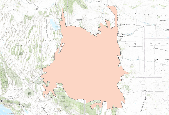
Landscape conservation cooperatives (LCCs) are conservation-science partnerships between the U.S. Fish and Wildlife Service, U.S. Geological Survey (USGS), and other federal agencies, states, tribes, NGOs, universities and stakeholders within a geographically defined area. They inform resource management decisions to address national-scale stressors-including habitat fragmentation, genetic isolation, spread of invasive species, and water scarcity-all of which are accelerated by climate change.

This dataset represents the North Atlantic LCC's ecoregion boundary. Landscape conservation cooperatives (LCCs) are conservation-science partnerships between the U.S. Fish and Wildlife Service, U.S. Geological Survey (USGS), and other federal agencies, states, tribes, NGOs, universities and stakeholders within a geographically defined area. They inform resource management decisions to address national-scale stressors-including habitat fragmentation, genetic isolation, spread of invasive species, and water scarcity-all of which are accelerated by climate change.

Landscape conservation cooperatives (LCCs) are conservation-science partnerships between the U.S. Fish and Wildlife Service, U.S. Geological Survey (USGS), and other federal agencies, states, tribes, NGOs, universities and stakeholders within a geographically defined area. They inform resource management decisions to address national-scale stressors-including habitat fragmentation, genetic isolation, spread of invasive species, and water scarcity-all of which are accelerated by climate change.
This section of the data release includes core images in the format of photos (JPG) that have been compressed into a zipped file (2018LakePowellCoring_CorePhotos.zip). It is Part 4 (of four) in this data release and contains images of the cleaned archival half from split cores as they appeared immediately after splitting (late March and early April 2019). Each photo includes a ruler (in centimeters) and X-Rite ColorChecker Classic color correction card that may be used for corrections. Drillhole information, such as location and total recovery, are outlined in “Part 1 – Drillhole information from the 2018 coring project in Lake Powell, Utah” (2018LakePowellCoring_DrillholeInfo.csv) of this data release. Each drillhole...
The boundary of the Southern Rockies LCC. From metadata: Landscape conservation cooperatives (LCCs) are conservation-science partnerships between the U.S. Fish and Wildlife Service, U.S. Geological Survey (USGS), and other federal agencies, states, tribes, NGOs, universities and stakeholders within a geographically defined area. They inform resource management decisions to address national-scale stressors-including habitat fragmentation, genetic isolation, spread of invasive species, and water scarcity-all of which are accelerated by climate change.
Categories: Data;
Types: Downloadable,
Map Service,
OGC WFS Layer,
OGC WMS Layer,
Shapefile;
Tags: Conservation,
Landscape Conservation Cooperatives,
Partnerships,
U.S. Fish and Wildlife Service

Landscape conservation cooperatives (LCCs) are conservation-science partnerships between the U.S. Fish and Wildlife Service, U.S. Geological Survey (USGS), and other federal agencies, states, tribes, NGOs, universities and stakeholders within a geographically defined area. They inform resource management decisions to address national-scale stressors-including habitat fragmentation, genetic isolation, spread of invasive species, and water scarcity-all of which are accelerated by climate change.
These four tables document the data used to draw the findings in the manuscript “Measuring sustainability of seed-funded Earth science informatics projects,” by Hsu et al. Table 1, “ListProjects-data” lists the projects funded by the Community for Data Integration from 2010-2016. Table 2, “Outputs-data” lists the deliverables that were proposed and delivered to the Community for Data Integration from 2010-2016, and notes if they were still accessible or sustained at the time of this study (December 2018). Table 3, “Influences-and-Sustainabiltiy-data” lists the projects and the sustainability influences examined in this study, as well as if the project achieved individual-level or organizational-level sustainability....
The U.S. Geological Survey South Atlantic Water Science Center, in cooperation with the South Carolina Department of Transportation, implemented a South Carolina StreamStats application in 2018. This shapefile dataset contains vector lines representing streams, rivers, and ditches that were used in preparing the underlying data for the South Carolina StreamStats application. Data were compiled from multiple sources, but principally represent lidar-derived linework from the South Carolina Department of Natural Resources and the South Carolina Lidar Consortium.The South Carolina hydrography lines were created from elevation rasters that ranged from 4 to 10 ft resolution, to produce a product of approximately 1:6,000-scale....
Categories: Data;
Types: Downloadable,
Map Service,
OGC WFS Layer,
OGC WMS Layer,
Shapefile;
Tags: Abbeville County,
Aiken County,
Allendale County,
Anderson County,
Bamberg County,
This section of the data release includes drillhole information in the format of a comma-separated value (CSV) file (2018LakePowellCoring_DrillholeInfo.csv). It is Part 1 (of four) in this data release and represents the broadest hierarchical information on the dataset including the drillhole name, location, water depth, sediments top and bottom, drillhole depth, and recovery for each coring location. Each drillhole comprises multiple cores which are outlined in “Part 2 – Core and core section information from the 2018 coring project in Lake Powell, Utah” (2018LakePowellCoring_CoreSectionInfo.csv) of this data release. Core logs and spectrophotometry data are available in “Part 3 – Multi-Sensor Core Logger and spectrophotometry...
Categories: Data;
Types: Map Service,
OGC WFS Layer,
OGC WMS Layer,
OGC WMS Service;
Tags: Animas River,
Antelope Canyon,
Bears Ears National Monument,
Bullfrog,
Bullfrog Bay,
Landscape conservation cooperatives (LCCs) are conservation-science partnerships between the U.S. Fish and Wildlife Service, U.S. Geological Survey (USGS), and other federal agencies, states, tribes, NGOs, universities and stakeholders within a geographically defined area. They inform resource management decisions to address national-scale stressors-including habitat fragmentation, genetic isolation, spread of invasive species, and water scarcity-all of which are accelerated by climate change. LCCs provide scientific and technical support for conservation at "landscape" scales-the entire range of an identified priority species or groups of species. They support biological planning, conservation design,...
Categories: Data;
Types: Downloadable,
Map Service,
OGC WFS Layer,
OGC WMS Layer,
Shapefile;
Tags: Landscape Conservation Cooperatives,
conservation,
fish and wildlife service,
partnerships
The boundaries of the LCCs. The shapefile can be downloaded and opened in ArcMAP. For web services, select an option from the grey bar above the inset map. Link to metadata. From metadata: Landscape conservation cooperatives (LCCs) are conservation-science partnerships between the U.S. Fish and Wildlife Service, U.S. Geological Survey (USGS), and other federal agencies, states, tribes, NGOs, universities and stakeholders within a geographically defined area. They inform resource management decisions to address national-scale stressors-including habitat fragmentation, genetic isolation, spread of invasive species, and water scarcity-all of which are accelerated by climate change.
Categories: Data;
Types: ArcGIS REST Map Service,
Downloadable,
Map Service,
OGC WFS Layer,
OGC WMS Layer,
Shapefile;
Tags: Conservation,
Landscape Conservation Cooperatives,
Partnerships,
U.S. Fish and Wildlife Service

Landscape conservation cooperatives (LCCs) are conservation-science partnerships between the U.S. Fish and Wildlife Service, U.S. Geological Survey (USGS), and other federal agencies, states, tribes, NGOs, universities and stakeholders within a geographically defined area. They inform resource management decisions to address national-scale stressors-including habitat fragmentation, genetic isolation, spread of invasive species, and water scarcity-all of which are accelerated by climate change.

Landscape conservation cooperatives (LCCs) are conservation-science partnerships between the U.S. Fish and Wildlife Service, U.S. Geological Survey (USGS), and other federal agencies, states, tribes, NGOs, universities and stakeholders within a geographically defined area. They inform resource management decisions to address national-scale stressors-including habitat fragmentation, genetic isolation, spread of invasive species, and water scarcity-all of which are accelerated by climate change.
The Lake Powell Coring Project was a USGS research effort, in cooperation with the Utah Department of Environmental Quality, U.S. Bureau of Reclamation, and U.S. National Park Service. In the fall of 2018, hydraulic piston cores targeted sediment that had been deposited in Lake Powell. This large reservoir on the Colorado River in Utah and Arizona was created after the completion of Glen Canyon Dam in 1963. Retrieval and analysis of cores was undertaken in response to the Gold King mine release from the Bonita Peak Mining District in Colorado on August 5, 2015. This event resulted in the containment loss of three-million gallons of mine-impacted waters which flowed from the Animas River into the San Juan River,...

Landscape conservation cooperatives (LCCs) are conservation-science partnerships between the U.S. Fish and Wildlife Service, U.S. Geological Survey (USGS), and other federal agencies, states, tribes, NGOs, universities and stakeholders within a geographically defined area. They inform resource management decisions to address national-scale stressors-including habitat fragmentation, genetic isolation, spread of invasive species, and water scarcity-all of which are accelerated by climate change.
Landscape Conservation Cooperatives (LCCs) are public-private partnerships composed of states, tribes, federal agencies, non-governmental organizations, universities, international jurisdictions, and others working together to address landscape and seascape scale conservation issues. LCCs inform resource management decisions to address broad-scale stressors-including habitat fragmentation, genetic isolation, spread of invasive species, and water scarcity-all of which are magnified by a rapidly changing climate. For further information go to https://www.fws.gov/science/catalog. The previous 2011 LCC Network Areas data is available at https://www.sciencebase.gov/catalog/item/52f2735ee4b0a6f0bd498c2f
Categories: Data,
Publication;
Types: ArcGIS Map Package,
ArcGIS REST Map Service,
ArcGIS Service Definition,
Citation,
Downloadable,
Map Service;
Tags: Aleutian and Bering Sea Islands,
Appalachian,
Arctic,
California,
Caribbean,
Landscape Conservation Cooperatives (LCCs) are public-private partnerships composed of states, tribes, federal agencies, non-governmental organizations, universities, international jurisdictions, and others working together to address landscape and seascape scale conservation issues. LCCs inform resource management decisions to address broad-scale stressors-including habitat fragmentation, genetic isolation, spread of invasive species, and water scarcity-all of which are magnified by a rapidly changing climate. For further information go to https://www.fws.gov/science/catalog. The previous 2011 LCC Network Areas data is available at https://www.sciencebase.gov/catalog/item/52f2735ee4b0a6f0bd498c2f
Categories: Data,
Publication;
Types: Citation,
Downloadable,
Map Service,
OGC WFS Layer,
OGC WMS Layer,
Shapefile;
Tags: Aleutian and Bering Sea Islands,
Appalachian,
Arctic,
California,
Caribbean,

Landscape conservation cooperatives (LCCs) are conservation-science partnerships between the U.S. Fish and Wildlife Service, U.S. Geological Survey (USGS), and other federal agencies, states, tribes, NGOs, universities and stakeholders within a geographically defined area. They inform resource management decisions to address national-scale stressors-including habitat fragmentation, genetic isolation, spread of invasive species, and water scarcity-all of which are accelerated by climate change.

In 2013 the California LCC designated these ecoregions as subregions of the LCC.
|

|
