|
|

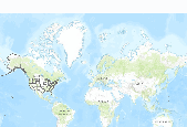
U.S. and Canada Lakes represents the major lakes within the United States and Canada.This data set provides five feature classes for displaying the data at different scales. Everything about the feature classes is the same but the level of generalization and its name. The base feature class is called and isn't generalized. The least generalized feature class is called _1, the next more generalized feature class is called _2, and so on. For best performance, use the most appropriate feature class when displaying or printing.

U.S. States (Generalized) represents the 50 states and the District of Columbia of the United States.

A map service on the www depicting the location and boundaries of the United States, the District of Columbia and the US territories. It includes common identifiers for these entities so this data set can be used in conjunction with other data sets describing states. This map service uses a generalized states layer for display at small scales. The data are an extract of the Census codes and boundaries from the following Census FTP site: ftp://ftp2.census.gov/geo/tiger. Since the Census data do not include the coastline detail, the coastal boundaries have been spatially clipped to the Health Resources and Services Administration (HRSA) coastline detail. This coastline detail was derived from the Census water blocks...

World Urban Areas represents the world's major urban areas with populations greater than 10,000. Source: DeLorme Publishing Company, Inc.
|
|