|
|

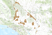
Bureau of Land management shape file depicting Oil and Gas lease Areas in Utah, USA This data set contains Oil and Gas Leases, derived from Legal Land Descriptions (LLD) contained in the US Bureau of Land Management's LR2000 Database, and geocoded (mapped) using the Public Land Survey System (PLSS)/Geographic Coordinate Data Base (GCDB) derived from the most accurate survey data available through BLM Cadastral Survey workforce, and the Premier Data Services CarteView Software.
Tags: active leases,
gas,
land grid,
lease,
oil, All tags...
permit,
petroleum,
plss,
public land survey system,
range,
section,
township, Fewer tags

This metadata references the polygonal ARC/INFO GIS cover showing the current and historic distribution of potential habitat, or range, of the Greater Sage-grouse (Centrocercus urophasianus) and Gunnison Sage-grouse (Centrocercus minimus) in Western North America. This data was initially researched and compiled by Dr. Michael A. Schroeder, research biologist for the Washington State Department of Fish and Wildlife. The initial draft of current and historic range data was mapped and submitted to state, federal, or provincial natural resource agencies and other experts for review, comment, and editing. The final product represents the best available science and expert review available at the time of compilation. ...
Tags: biology and ecology,
bird conservation,
centrocercus,
current,
distribution, All tags...
ecosystems,
environment and conservation,
greater sage-grouse,
gunnison sage-grouse,
habitat,
historic,
historical features,
minimus,
natural resources,
potential,
pre-settlement,
present-day,
range,
sage-grouse,
urophasianus, Fewer tags

The RMU_UNIT feature class depicts the boundaries of the range allotments, general resource areas, and wild horse and burro territories on the Prescott National Forest and is part of the USFS Southwestern Region Core Data Project. This project is designed to generate and maintain 15 vertically integrated resource data layers which are standardized across the Southwestern Region. These 15 layers are derived from a Master Arc coverage which maintains vertical integration.The RMU_UNIT feature class depicts the boundaries of the range allotments, general resource areas, and wild horse and burro territories on the Prescott National Forest and is part of the USFS Southwestern Region Core Data Project. This project is...

This metadata references the polygonal ARC/INFO GIS cover showing the current and historic distribution of potential habitat, or range, of the Greater Sage-grouse (Centrocercus urophasianus) and Gunnison Sage-grouse (Centrocercus minimus) in Western North America. This data was initially researched and compiled by Dr. Michael A. Schroeder, research biologist for the Washington State Department of Fish and Wildlife. The initial draft of current and historic range data was mapped and submitted to state, federal, or provincial natural resource agencies and other experts for review, comment, and editing. The final product represents the best available science and expert review available at the time of compilation. ...
Tags: biology and ecology,
bird conservation,
centrocercus,
current,
distribution, All tags...
ecosystems,
environment and conservation,
greater sage-grouse,
gunnison sage-grouse,
habitat,
historic,
minimus,
natural resources,
potential,
pre-settlement,
present-day,
range,
sage-grouse,
urophasianus, Fewer tags

This is an aggregate dataset for the DRECP 12 km buffer region, depicting the geographic boundaries of Grazing Allotments within BLM managed public lands. An allotment is an area of land designated and managed for grazing of livestock (43 CFR 4100.0-5). An allotment may include private, state, and public lands under the jurisdiction of the Bureau of Land Management and/or other federal agencies. An allotment may be subdivided into pastures. Range improvement projects are not depicted within this dataset.
Tags: allotment,
blm,
drecp,
farming,
gra, All tags...
grazing,
lands,
livestock,
pasture,
range,
rangeland management, Fewer tags

This digital range map represents the range of Colorado pinyon pine (Pinus edulis) in western North America. Data from multiple sources, including existing digitized maps, tabular data, personal communications, USDA Forest Service Inventory and Analysis data, and figures from other publications, were synthesized to create a single digital distribution. The distribution was peer reviewed and iteratively revised based on personal observations of regional authorities.

This dataset depicts the boundaries of therange allotments, General Resource Areas, and Wild Horse and Burro territorieson the Coronado National Forests. Eachallotment is a designated area of land available for livestock grazing,and may be subdivided into pastures necessary for grazing management.General resource areas are boundaries outside of an established allotment.It is part of the USFS Southwestern Region Core Data Project. Thisproject is designed to generate and maintain 15 vertically integratedresource data layers which are standardized across the Southwestern Region.Associated National Application: Infrastructure (INFRA) RangeINFRA Web Page: http://infra.wo.fs.fed.us/infra/ This dataset was obtained...

This dataset depicts livestock grazing range allotments for the Tiller and Diamond Lake districts on the Umpqua National Forest in Oregon.

This data set represent the digital range map of Creosote Bush (Larrea tridentata) in western North America. Data from multiple sources, including existing digitized maps, tabular data, personal communication, and figures from other publications, were synthesized to create a single digital distribution. The distribution was peer reviewed and iteratively revised based on personal observations of regional authorities.

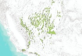
This data set represent the digital range map of Joshua Tree (Yucca brevifolia) in western North America. Data from multiple sources, including existing digitized maps, tabular data, personal communication, and figures from other publications, were synthesized to create a single digital distribution. The distribution was peer reviewed and iteratively revised based on personal observations of regional authorities.

The source of this coverage data set is the fish biodiversity maps created for The Nature Conservancy (TNC) as part of their Hexagon Project. Professor Peter Moyle and his graduate student, Paul Randall, of the Department of Wildlife and Fisheries Conservation Biology at the University of California, Davis were hired to produce range maps for all known fish species that presently occur in California. Each coverage denotes a separate fish species (refer to the species coverage key below).

This map service provides display, identification, and analysis tools for determining current boundary information for Forest Service managers, GIS Specialists, and others. Best available source with a target scale of 1:24000 for Continental U.S., Puerto Rico, and Hawaii and 1:63360 for Alaska.

The RMU_UNIT feature class depicts the boundaries of the range allotments, general resource areas, and wild horse and burro territories on the Tonto National Forest and is part of the USFS Southwestern Region Core Data Project. This project is designed to generate and maintain 15 vertically integrated resource data layers which are standardized across the Southwestern Region. These 15 layers are derived from a Master Arc coverage which maintains vertical integration.The RMU_UNIT feature class depicts the boundaries of the range allotments, general resource areas, and wild horse and burro territories on the Prescott National Forest and is part of the USFS Southwestern Region Core Data Project. This project is designed...

The source of this coverage data set is the fish biodiversity maps created for The Nature Conservancy (TNC) as part of their Hexagon Project. Professor Peter Moyle and his graduate student, Paul Randall, of the Department of Wildlife and Fisheries Conservation Biology at the University of California, Davis were hired to produce range maps for all known fish species that presently occur in California. Each coverage denotes a separate fish species (refer to the species coverage key below).

The source of this coverage data set is the fish biodiversity maps created for The Nature Conservancy (TNC) as part of their Hexagon Project. Professor Peter Moyle and his graduate student, Paul Randall, of the Department of Wildlife and Fisheries Conservation Biology at the University of California, Davis were hired to produce range maps for all known fish species that presently occur in California. Each coverage denotes a separate fish species (refer to the species coverage key below).

This data set represent the digital range map of Single-Needle Pinyon Pine (Pinus monophylla) in western North America. Data from multiple sources, including existing digitized maps, tabular data, personal communication, and figures from other publications, were synthesized to create a single digital distribution. The distribution was peer reviewed and iteratively revised based on personal observations of regional authorities.

The source of this coverage data set is the fish biodiversity maps created for The Nature Conservancy (TNC) as part of their Hexagon Project. Professor Peter Moyle and his graduate student, Paul Randall, of the Department of Wildlife and Fisheries Conservation Biology at the University of California, Davis were hired to produce range maps for all known fish species that presently occur in California. Each coverage denotes a separate fish species (refer to the species coverage key below).

This service contains layers based on Geographic Coordinate Data Base (GCDB) coordinate data. The locations of Public Land Survey System (PLSS) corners, as represented in geographic coordinate pairs, were derived from a variety of source documents, which include U.S. General Land Office and BLM survey plats/notes, as well as survey data obtained from other U.S. Government agencies, private sector survey firms, and local governments. Please review the data disclaimer at http://www.geocommunicator.gov/Geocomm/GC_disclaimer.shtm
Tags: bureau of land management,
cadastral,
gcdb,
general land office,
geographic coordinate data base, All tags...
glo,
land information system,
land survey information,
land survey information system,
lis,
lsi,
lsis,
national spatial data infrastructure,
nsdi,
plss,
public land survey system,
range,
township, Fewer tags

This dataset depicts Public Land Survey section polygons that contained mining claims on federal land during the period 1976 to 2005, as recorded by the U.S. Bureau of Land Management. This dataset can be used to track changes in the number of mining claims in a particular area over time, or to evaluate relative mining claim pressure between areas at a given point in time.

This is Arizona Bureau of Land Management (BLM) statewide grazing allotment data. This polygon feature class depicts the boundaries of the livestock grazing allotments located within the Arizona BLM, Arizona, USA. Each allotment has one or more pastures. In some cases, this layer identifies the BLM managed public land or other land associated with specific grazing allotments administered by the local BLM field office. Boundaries may be fences, arbitrary lines, or natural barriers. Agency management of polygons within this feature class is not specific to BLM; other agencies are also included.
|
|