Filters: Tags: range (X)
361 results (29ms)|
Filters
Contacts
(Less)
|
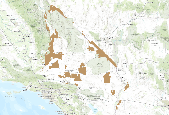
The spring 2017 mainland sea otter count began on April 30, and although the shore-based counts were completed by May 12, 2017, the aerial counts were not completed until July 12, 2017. Overall viewing conditions this year were good, although not as good as conditions experienced during the 2016 spring census (View Score 2.4 versus 3.1, where 0=poor, 1=fair, 2=good, 3=very good, and 4=excellent). The surface canopies of kelp (Macrocystis sp.) were considered by most participants to be considerably below normal for this time of year in most areas of the mainland range. Sea otters along the mainland coast were surveyed from Pillar Point in San Mateo County in the north to Rincon Point in the south at the Santa Barbara/Ventura...
This dataset represents an archived record of annual California sea otter surveys from 1985-2014. Survey procedures involve counting animals during the "spring survey" -- generally beginning in late April or early May and usually ending in late May early June but may extend into early July, depending on weather conditions. Annual surveys are organized by survey year and within each year, three shapefiles are included: census summary of southern sea otter, extra limit counts of southern sea otter, and range extent of southern sea otter. The surveys, conducted cooperatively by scientists of the U.S. Geological Survey, California Department of Fish and Wildlife, U.S. Fish and Wildlife Service and Monterey Bay Aquarium...
Categories: Data;
Tags: California,
Central California Coastal,
Coast,
Southern California Coastal,
USGS Science Data Catalog (SDC),

Species range maps for Wyoming developed by the Wyoming Natural Diversity Database.

Bureau of Land management shape file depicting Oil and Gas lease Areas in Utah, USA This data set contains Oil and Gas Leases, derived from Legal Land Descriptions (LLD) contained in the US Bureau of Land Management's LR2000 Database, and geocoded (mapped) using the Public Land Survey System (PLSS)/Geographic Coordinate Data Base (GCDB) derived from the most accurate survey data available through BLM Cadastral Survey workforce, and the Premier Data Services CarteView Software.

This metadata references the polygonal ARC/INFO GIS cover showing the current and historic distribution of potential habitat, or range, of the Greater Sage-grouse (Centrocercus urophasianus) and Gunnison Sage-grouse (Centrocercus minimus) in Western North America. This data was initially researched and compiled by Dr. Michael A. Schroeder, research biologist for the Washington State Department of Fish and Wildlife. The initial draft of current and historic range data was mapped and submitted to state, federal, or provincial natural resource agencies and other experts for review, comment, and editing. The final product represents the best available science and expert review available at the time of compilation. ...

Breeding range of Chestnut-sided Warbler

The RMU_UNIT feature class depicts the boundaries of the range allotments, general resource areas, and wild horse and burro territories on the Prescott National Forest and is part of the USFS Southwestern Region Core Data Project. This project is designed to generate and maintain 15 vertically integrated resource data layers which are standardized across the Southwestern Region. These 15 layers are derived from a Master Arc coverage which maintains vertical integration.The RMU_UNIT feature class depicts the boundaries of the range allotments, general resource areas, and wild horse and burro territories on the Prescott National Forest and is part of the USFS Southwestern Region Core Data Project. This project is...

This metadata references the polygonal ARC/INFO GIS cover showing the current and historic distribution of potential habitat, or range, of the Greater Sage-grouse (Centrocercus urophasianus) and Gunnison Sage-grouse (Centrocercus minimus) in Western North America. This data was initially researched and compiled by Dr. Michael A. Schroeder, research biologist for the Washington State Department of Fish and Wildlife. The initial draft of current and historic range data was mapped and submitted to state, federal, or provincial natural resource agencies and other experts for review, comment, and editing. The final product represents the best available science and expert review available at the time of compilation. ...
This is an aggregate dataset for the DRECP 12 km buffer region, depicting the geographic boundaries of Grazing Allotments within BLM managed public lands. An allotment is an area of land designated and managed for grazing of livestock (43 CFR 4100.0-5). An allotment may include private, state, and public lands under the jurisdiction of the Bureau of Land Management and/or other federal agencies. An allotment may be subdivided into pastures. Range improvement projects are not depicted within this dataset.

This digital range map represents the range of Colorado pinyon pine (Pinus edulis) in western North America. Data from multiple sources, including existing digitized maps, tabular data, personal communications, USDA Forest Service Inventory and Analysis data, and figures from other publications, were synthesized to create a single digital distribution. The distribution was peer reviewed and iteratively revised based on personal observations of regional authorities.
This data set contains distribution information for all terrestrial and aquatic reptiles, crocodilians, and turtles occurring in the United States and Canada.
This data set contains distribution information for all birds occurring in the Western Hemisphere. The goal of this project is to make this distributional information freely available to the public to inform conservation and other landuse decisions. A Memorandum of Understanding signed by NatureServe (then known as the Association for Biodiversity Information), The Nature Conservancy/Migratory Bird Program, Conservation International/CABS, World Wildlife Fund-US, and in 2000, with the subsequent addition of Environment Canada, governed the initial development and guidelines for sharing of these data. The MOU expired in 2003, but NatureServe, the compiler of the data set, continues to maintain the data largely in...
This data set contains distribution information for all terrestrial and aquatic reptiles, crocodilians, and turtles occurring in the United States and Canada.
Zonal statistic was used to determine the percentage of Level 2 large Intact Blocks in a grazing allotment.
This data set contains distribution information for all terrestrial and aquatic reptiles, crocodilians, and turtles occurring in the United States and Canada.
This data set contains distribution information for all terrestrial and aquatic reptiles, crocodilians, and turtles occurring in the United States and Canada.
WGA Large Intact Blocks within Grazing Allotments (Level 2 Blocks). These data are provided by Bureau of Land Management (BLM) "as is" and may contain errors or omissions. The User assumes the entire risk associated with its use of these data and bears all responsibility in determining whether these data are fit for the User's intended use. These data may not have the accuracy, resolution, completeness, timeliness, or other characteristics appropriate for applications that potential users of the data may contemplate. The User is encouraged to carefully consider the content of the metadata file associated with these data. The BLM should be cited as the data source in any products derived from these data.
In addition to current distribution of each bird species, this map shows their current and near-term status within the ecoregion. Current, long-term, and summary bioclimate data is also include for several of these bird species. The input datasets used in the distribution model are also included. These data are provided by Bureau of Land Management (BLM) "as is" and may contain errors or omissions. The User assumes the entire risk associated with its use of these data and bears all responsibility in determining whether these data are fit for the User's intended use. These data may not have the accuracy, resolution, completeness, timeliness, or other characteristics appropriate for applications that potential users...
In addition to current distribution of each bird species, this map shows their current and near-term status within the ecoregion. Current, long-term, and summary bioclimate data is also include for several of these bird species. The input datasets used in the distribution model are also included. These data are provided by Bureau of Land Management (BLM) "as is" and may contain errors or omissions. The User assumes the entire risk associated with its use of these data and bears all responsibility in determining whether these data are fit for the User's intended use. These data may not have the accuracy, resolution, completeness, timeliness, or other characteristics appropriate for applications that potential users...
This data set contains distribution information for all birds occurring in the Western Hemisphere. The goal of this project is to make this distributional information freely available to the public to inform conservation and other landuse decisions. A Memorandum of Understanding signed by NatureServe (then known as the Association for Biodiversity Information), The Nature Conservancy/Migratory Bird Program, Conservation International/CABS, World Wildlife Fund-US, and in 2000, with the subsequent addition of Environment Canada, governed the initial development and guidelines for sharing of these data. The MOU expired in 2003, but NatureServe, the compiler of the data set, continues to maintain the data largely in...
|

|
