Filters: Tags: renewable (X)
73 results (4ms)|
Filters
|
Some theoretical results concerning the nature of the relationship between the scientific quality and economic value of imperfect weather forecasts are obtained. A prototype multistage decision-making model is considered, involving only two possible actions and two possible states of weather. This particular form of model is motivated by a real-world application known as the fruit-frost problem. For an infinite-horizon, discounted version of this model it is shown that economic value remains zero below a forecast quality threshold and then rises monotonically but nonlinearly above this threshold. In particular, the relative sensitivity of economic value to changes in the quality of forecasts increases as perfect...
Categories: Publication;
Types: Citation;
Tags: Quantifying,
energy,
photovoltaic,
policy,
potential,
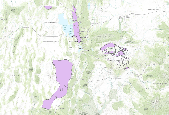
This dataset depicts renewable geothermal resources identified by the Utah Renewable Energy Zone (UREZ) task force.
The Utah Well & Spring database contains data of 2981 wells, springs, and miscellaneous sites such as collector wells and mines. It is available from the Utah Geological Survey at:http://geology.utah.gov/emp/geothermal/wells_springs_database.htmThe Conservation Biology Institute selected geothermal wells from this database. The geothermal well layer was then used in further analysis and modeling.
The Desert Renewable Energy Conservation Plan (DRECP), a major component of California's renewable energy planning efforts, will help provide effective protection and conservation of desert ecosystems while allowing for the appropriate development of renewable energy projects. The DRECP is focused on the desert regions and adjacent lands of seven California counties - Imperial, Inyo, Kern, Los Angeles, Riverside, San Bernardino, and San Diego. It is being prepared through an unprecedented collaborative effort between the California Energy Commission, California Department of Fish and Wildlife, the U.S. Bureau of Land Management, and the U.S. Fish and Wildlife Service also known as the Renewable Energy Action Team....
Categories: Publication;
Types: Citation,
Map Service,
OGC WFS Layer,
OGC WMS Layer,
OGC WMS Service;
Tags: English,
GIS,
OHV,
US,
bird,
What are current conditions for important park natural resources? What are the critical data and knowledge gaps? What are some of the factors that are influencing park resource conditions? Natural Resource Condition Assessments (NRCAs) evaluate and report on the above for a subset of important natural resources in national park units (hereafter, parks). Focal study resources and indicators are selected on a park-by-park basis, guided by use of structured resource assessment and reporting frameworks. Considerations include park resource setting and enabling legislation (what are this park's most important natural resources?) and presently available data and expertise (what can be evaluated at this time?). In addition...
Categories: Data;
Types: ArcGIS REST Map Service,
Map Service,
OGC WFS Layer,
OGC WMS Layer,
OGC WMS Service;
Tags: Chihuahuan Desert,
English,
GIS,
Madrean,
Mojave Desert,
Welcome to the Wind and Wildlife Landscape Assessment Tool (LAT), a collaboration organized by the American Wind Wildlife Institute (AWWI) and The Nature Conservancy (TNC). The LAT is designed as a landscape-level planning tool to identify sensitive wildlife habitat and areas that are likely to have low wildlife risk where wind energy development could be prioritized. Although the siting of individual wind energy projects will require on-the-ground surveys to verify data shown here, our hope is that this tool will provide stakeholders with information that facilitates the siting of wind energy in areas with minimal impacts to wildlife, as well as the development of conservation plans, monitoring plans and mitigation...
Types: Map Service,
OGC WFS Layer,
OGC WMS Layer,
OGC WMS Service;
Tags: English,
GIS,
US,
agriculture,
amphibian,
The success of carbon capture, storage and sequestration as a greenhouse gas mitigation strategy will be, in part, dependent on the regulatory framework used to govern its implementation. Creating a science-based regulatory framework that is designed with enough flexibility to encourage greenhouse gas offset activity, effective means of measuring the costs of taking action to reduce greenhouse gas emissions, and ample protection for human and ecosystem health may prove challenging. For the purposes of this paper we will assume that there is an existing incentive to capture, store and sequester carbon and focus on how to regulate the process. Accounting practices and precursory crediting rules for biological sinks...
Categories: Publication;
Types: Citation;
Tags: Renewable,
Renewable energies,
energy,
siting,
study
For grading different types of renewable energy based electricity generation systems, a figure of merit has been proposed and evaluated. The figure of merit has been obtained by analyzing total energy utilization in constructing and installing the systems and by their respective electricity generation. The gross carbon emission has also been estimated for evaluation of figure of merit. This figure of merit clearly indicates that wind power is the most sustainable source for electricity generation, followed by small hydropower and solar photovoltaics.
Categories: Publication;
Types: Citation;
Tags: Electricity,
Figure of merit,
Gross carbon,
Renewable,
Sustainability
This data set provides industrial-scale onshore wind turbine locations, corresponding facility information, and turbine technical specifications, in the United States to March 2014. The database has nearly 49,000 wind turbine records that have been collected, digitized, locationally verified, and internally quality assured and quality controlled. Turbines from the Federal Aviation Administration Digital Obstacle File, product date March 2, 2014, were used as the primary source of turbine data points. Verification of the position of turbines was done by visual interpretation using high-resolution aerial imagery in ESRI ArcGIS Desktop. Turbines without Federal Aviation Administration Obstacle Repository System (FAA...
Categories: Data;
Types: ArcGIS REST Map Service,
Citation,
Map Service;
Tags: Alabama,
Alaska,
Arizona,
Arkansas,
California,
The timely development of the nation's energy production capacity in a manner that minimizes potential adverse local and regional impacts associated with energy facilities requires the use of sophisticated techniques for evaluation of siting alternatives and fuel cycle options. This report is a documentation of the computerized SITE methodology that has been developed for evaluating health, environmental, and socioeconomic impacts related to utilization of alternate sites for energy production within a region of interest. The cost, impact, and attribute vectors, which are generated and displayed on density maps, can be used in a multiparameter overlay process to identify preferable siting areas. The assessment of...
Categories: Publication;
Types: Citation;
Tags: analysis,
energy,
facility siting,
pitfalls,
promises,

This dataset depicts renewable wind resources identified by the Utah Renewable Energy Zone (UREZ) task force and contains the site name, wind potential, location comments and more.
LandScope America—a collaborative project of NatureServe and the National Geographic Society—is a new online resource for the land-protection community and the public. By bringing together maps, data, photos, and stories about America’s natural places and open spaces, our goal is to inform and inspire conservation of our lands and waters.
Types: Map Service,
OGC WFS Layer,
OGC WMS Layer,
OGC WMS Service;
Tags: Chihuahuan Desert,
English,
GIS,
Mojave Desert,
Sonoran Desert,

Utah Renewable Energy Zone (UREZ) Phase 1 Transmission (SGID93 Energy)
The success of carbon capture, storage and sequestration as a greenhouse gas mitigation strategy will be, in part, dependent on the regulatory framework used to govern its implementation. Creating a science-based regulatory framework that is designed with enough flexibility to encourage greenhouse gas offset activity, effective means of measuring the costs of taking action to reduce greenhouse gas emissions, and ample protection for human and ecosystem health may prove challenging. For the purposes of this paper we will assume that there is an existing incentive to capture, store and sequester carbon and focus on how to regulate the process. Accounting practices and precursory crediting rules for biological sinks...
The success of carbon capture, storage and sequestration as a greenhouse gas mitigation strategy will be, in part, dependent on the regulatory framework used to govern its implementation. Creating a science-based regulatory framework that is designed with enough flexibility to encourage greenhouse gas offset activity, effective means of measuring the costs of taking action to reduce greenhouse gas emissions, and ample protection for human and ecosystem health may prove challenging. For the purposes of this paper we will assume that there is an existing incentive to capture, store and sequester carbon and focus on how to regulate the process. Accounting practices and precursory crediting rules for biological sinks...
Categories: Publication;
Types: Citation;
Tags: Increased,
Renewable,
Renewable energies,
challenges,
development,
Mining and civil engineering industries sometimes use drilling muds for stabilizing a borehole during drilling wells for methane drainage, geothermal energy and radioactive waste disposal. Standard theories predicting borehole breakdown pressure assume breakdown occurs when a small fracture initiates at a location where the largest tangential stress at the borehole reaches the tensile strength of formation. Fracturing tests conducted in this study, how- ever, showed that when drilling fluid was used as an injection fluid, borehole breakdown did not occur even if a fracture initiated at a borehole wall. Bore- hole breakdown occurred when the initiated fracture became unstable after significant growth with O. 76cm...
Electric and magnetic fields were measured during the summer of 1998 in south-central Ontario within the business district of 60 communities, ranging in size from 1000 to 2.3 million people. The mean magnetic flux density for the 60 communities was 5.8 mG. Communities with larger populations generally had higher magnetic flux densities than those with smaller populations.Communities with populations above 100 000, between 50 000 and 100 000, between 10 000 and 50 000, and less than 10 000 had mean magnetic flux densities of 14, 7, 4 and 2.4 mG, respectively. The city of Kingston, population 123 000, had the highest mean magnetic flux density (47 mG) while Burks Falls, population 1000, had the lowest (0.8 mG).Mor...
Categories: Publication;
Types: Citation;
Tags: Interactions,
UK,
climate change policy,
energy scenarios,
implications,
This report provides an analysis of the geothermal energy sites on public lands that represent the best opportunities for near-term development. Excerpts from this analysis were published in Assessing the Potential for Renewable Energy on Public Lands, a report from the U.S. Department of the Interior and the U.S. Department of Energy prepared by the National Renewable Energy Laboratory. The assessment report, which focused on the opportunities for electricity generation from solar, wind, biomass, and geothermal resources, was released in February 2003.
Types: Map Service,
OGC WFS Layer,
OGC WMS Layer,
OGC WMS Service;
Tags: English,
GIS,
US,
assessment,
development ,
Types: Map Service,
OGC WFS Layer,
OGC WMS Layer,
OGC WMS Service;
Tags: California,
GIS,
energy,
fire,
grazing,
|

|
