Filters
Date Range
Extensions
Types
Contacts
Categories
Tag Types
Tag Schemes
|
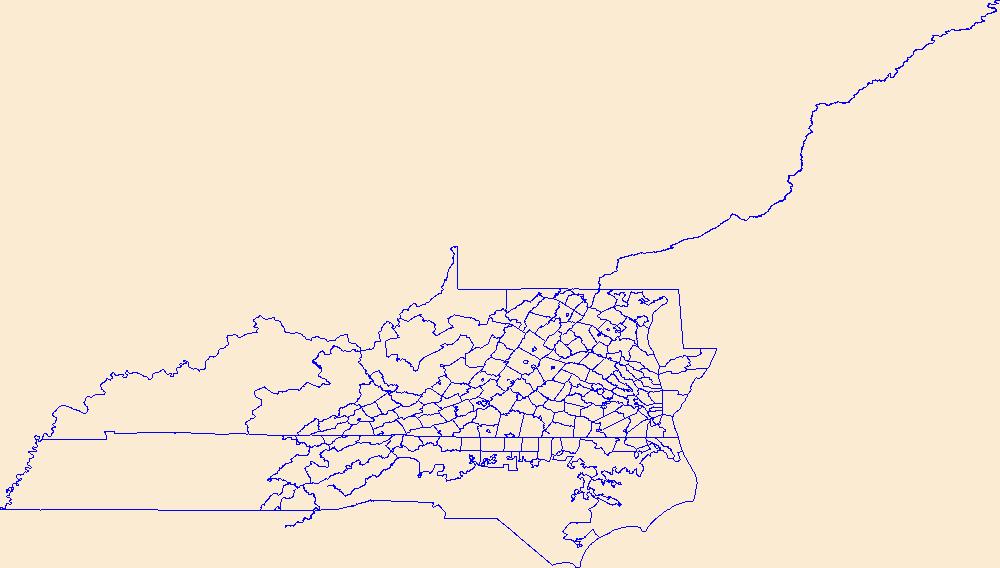
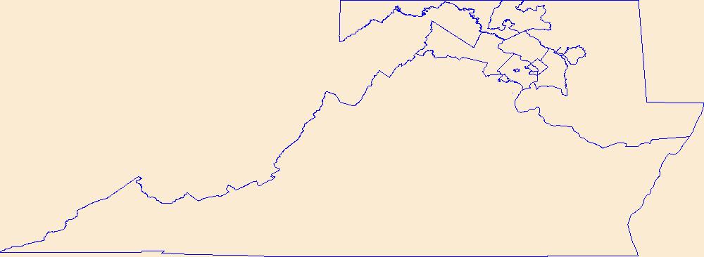
Geospatial data is comprised of government boundaries.
Tags: Accomack,
Albemarle,
Alexandria,
Alleghany,
Amelia, All tags...
Amherst,
Appomattox,
Arlington,
Augusta,
Bath,
Bedford,
Bland,
Botetourt,
Boundaries,
Bristol,
Brunswick,
Buchanan,
Buckingham,
Buena Vista,
Campbell,
Caroline,
Carroll,
Charles City,
Charlotte,
Charlottesville,
Chesapeake,
Chesterfield,
Clarke,
Colonial Heights,
County or Equivalent,
Covington,
Craig,
Culpeper,
Cumberland,
Danville,
Dickenson,
Dinwiddie,
Downloadable Data,
Emporia,
Esri Shapefile nan,
Essex,
Fairfax,
Falls Church,
Fauquier,
Floyd,
Fluvanna,
Franklin,
Frederick,
Fredericksburg,
Galax,
Giles,
Gloucester,
Goochland,
Grayson,
Greene,
Greensville,
Halifax,
Hampton,
Hanover,
Harrisonburg,
Henrico,
Henry,
Highland,
Hopewell,
Incorporated Place,
Isle of Wight,
James City,
Jurisdictional,
King George,
King William,
King and Queen,
Lancaster,
Lee,
Lexington,
Loudoun,
Louisa,
Lunenburg,
Lynchburg,
Madison,
Manassas,
Manassas Park,
Martinsville,
Mathews,
Mecklenburg,
Middlesex,
Minor Civil Division,
Montgomery,
National Boundary Dataset (NBD),
National Boundary Dataset (NBD),
Native American Area,
Nelson,
New Kent,
Newport News,
Norfolk,
Northampton,
Northumberland,
Norton,
Nottoway,
Orange,
PLSS First Division,
PLSS Special Survey,
PLSS Township,
Page,
Patrick,
Petersburg,
Pittsylvania,
Poquoson,
Portsmouth,
Powhatan,
Prince Edward,
Prince George,
Prince William,
Public Land Survey System,
Pulaski,
Radford,
Rappahannock,
Reserve,
Richmond,
Roanoke,
Rockbridge,
Rockingham,
Russell,
Salem,
Scott,
Shapefile,
Shenandoah,
Smyth,
Southampton,
Spotsylvania,
Stafford,
State,
State,
State or Territory,
Staunton,
Suffolk,
Surry,
Sussex,
Tazewell,
U.S. National Grid,
US,
Unincorporated Place,
United States,
VA,
Virginia,
Virginia Beach,
Warren,
Washington,
Waynesboro,
Westmoreland,
Williamsburg,
Winchester,
Wise,
Wythe,
York,
boundaries,
boundary,
cadastral surveys,
geographic names,
land ownership,
land use maps,
legal land descriptions,
political and administrative boundaries,
zoning maps, Fewer tags
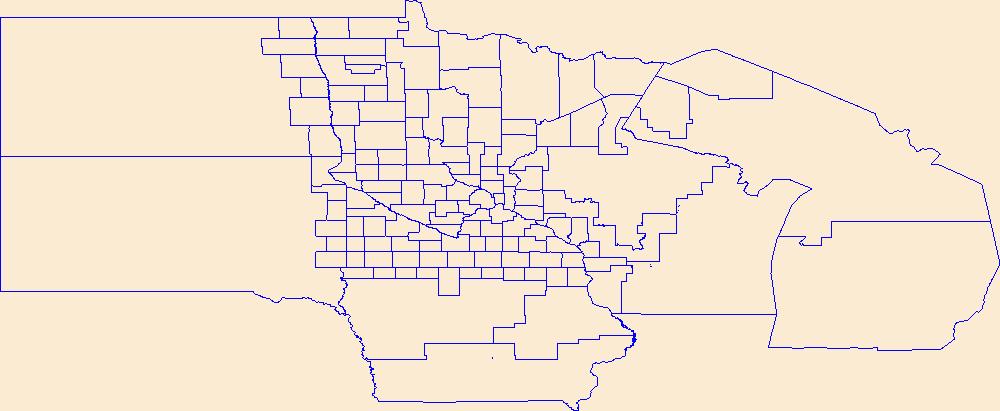
Geospatial data is comprised of government boundaries.
Tags: Aitkin,
Anoka,
Becker,
Beltrami,
Benton, All tags...
Big Stone,
Blue Earth,
Boundaries,
Brown,
Carlton,
Carver,
Cass,
Chippewa,
Chisago,
Clay,
Clearwater,
Cook,
Cottonwood,
County or Equivalent,
Crow Wing,
Dakota,
Dodge,
Douglas,
Downloadable Data,
Esri Shapefile nan,
Faribault,
Fillmore,
Freeborn,
Goodhue,
Grant,
Hennepin,
Houston,
Hubbard,
Incorporated Place,
Isanti,
Itasca,
Jackson,
Jurisdictional,
Kanabec,
Kandiyohi,
Kittson,
Koochiching,
Lac qui Parle,
Lake,
Lake of the Woods,
Le Sueur,
Lincoln,
Lyon,
MN,
Mahnomen,
Marshall,
Martin,
McLeod,
Meeker,
Mille Lacs,
Minnesota,
Minor Civil Division,
Morrison,
Mower,
Murray,
National Boundary Dataset (NBD),
National Boundary Dataset (NBD),
Native American Area,
Nicollet,
Nobles,
Norman,
Olmsted,
Otter Tail,
PLSS First Division,
PLSS Special Survey,
PLSS Township,
Pennington,
Pine,
Pipestone,
Polk,
Pope,
Public Land Survey System,
Ramsey,
Red Lake,
Redwood,
Renville,
Reserve,
Rice,
Rock,
Roseau,
Scott,
Shapefile,
Sherburne,
Sibley,
St. Louis,
State,
State,
State or Territory,
Stearns,
Steele,
Stevens,
Swift,
Todd,
Traverse,
U.S. National Grid,
US,
Unincorporated Place,
United States,
Wabasha,
Wadena,
Waseca,
Washington,
Watonwan,
Wilkin,
Winona,
Wright,
Yellow Medicine,
boundaries,
boundary,
cadastral surveys,
geographic names,
land ownership,
land use maps,
legal land descriptions,
political and administrative boundaries,
zoning maps, Fewer tags
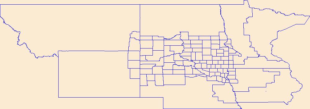
Geospatial data is comprised of government boundaries.
Tags: Aurora,
Beadle,
Bennett,
Bon Homme,
Boundaries, All tags...
Brookings,
Brown,
Brule,
Buffalo,
Butte,
Campbell,
Charles Mix,
Clark,
Clay,
Codington,
Corson,
County or Equivalent,
Custer,
Davison,
Day,
Deuel,
Dewey,
Douglas,
Downloadable Data,
Edmunds,
Esri Shapefile nan,
Fall River,
Faulk,
Grant,
Gregory,
Haakon,
Hamlin,
Hand,
Hanson,
Harding,
Hughes,
Hutchinson,
Hyde,
Incorporated Place,
Jackson,
Jerauld,
Jones,
Jurisdictional,
Kingsbury,
Lake,
Lawrence,
Lincoln,
Lyman,
Marshall,
McCook,
McPherson,
Meade,
Mellette,
Miner,
Minnehaha,
Minor Civil Division,
Moody,
National Boundary Dataset (NBD),
National Boundary Dataset (NBD),
Native American Area,
Oglala Lakota,
PLSS First Division,
PLSS Special Survey,
PLSS Township,
Pennington,
Perkins,
Potter,
Public Land Survey System,
Reserve,
Roberts,
SD,
Sanborn,
Shapefile,
South Dakota,
Spink,
Stanley,
State,
State,
State or Territory,
Sully,
Todd,
Tripp,
Turner,
U.S. National Grid,
US,
Unincorporated Place,
Union,
United States,
Walworth,
Yankton,
Ziebach,
boundaries,
boundary,
cadastral surveys,
geographic names,
land ownership,
land use maps,
legal land descriptions,
political and administrative boundaries,
zoning maps, Fewer tags
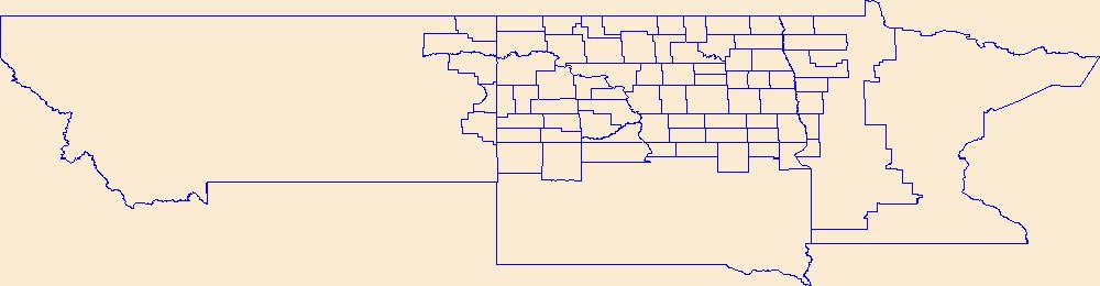
Geospatial data is comprised of government boundaries.
Tags: Adams,
Barnes,
Benson,
Billings,
Bottineau, All tags...
Boundaries,
Bowman,
Burke,
Burleigh,
Cass,
Cavalier,
County or Equivalent,
Dickey,
Divide,
Downloadable Data,
Dunn,
Eddy,
Emmons,
Foster,
GeoPackage,
Golden Valley,
Grand Forks,
Grant,
Griggs,
Hettinger,
Incorporated Place,
Jurisdictional,
Kidder,
LaMoure,
Logan,
McHenry,
McIntosh,
McKenzie,
McLean,
Mercer,
Minor Civil Division,
Morton,
Mountrail,
ND,
National Boundary Dataset (NBD),
National Boundary Dataset (NBD),
Native American Area,
Nelson,
North Dakota,
Oliver,
Open Geospatial Consortium GeoPackage 1.2,
PLSS First Division,
PLSS Special Survey,
PLSS Township,
Pembina,
Pierce,
Public Land Survey System,
Ramsey,
Ransom,
Renville,
Reserve,
Richland,
Rolette,
Sargent,
Sheridan,
Sioux,
Slope,
Stark,
State,
State,
State or Territory,
Steele,
Stutsman,
Towner,
Traill,
U.S. National Grid,
US,
Unincorporated Place,
United States,
Walsh,
Ward,
Wells,
Williams,
boundaries,
boundary,
cadastral surveys,
geographic names,
land ownership,
land use maps,
legal land descriptions,
political and administrative boundaries,
zoning maps, Fewer tags
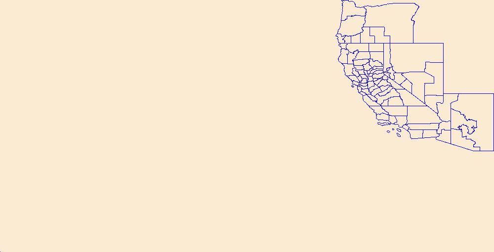
Geospatial data is comprised of government boundaries.
Types: Citation;
Tags: Alameda,
Alpine,
Amador,
Boundaries,
Butte, All tags...
CA,
Calaveras,
California,
Colusa,
Contra Costa,
County or Equivalent,
Del Norte,
Downloadable Data,
El Dorado,
Esri File GeoDatabase 10,
FileGDB,
Fresno,
Glenn,
Humboldt,
Imperial,
Incorporated Place,
Inyo,
Jurisdictional,
Kern,
Kings,
Lake,
Lassen,
Los Angeles,
Madera,
Marin,
Mariposa,
Mendocino,
Merced,
Minor Civil Division,
Modoc,
Mono,
Monterey,
Napa,
National Boundary Dataset (NBD),
National Boundary Dataset (NBD),
Native American Area,
Nevada,
Orange,
PLSS First Division,
PLSS Special Survey,
PLSS Township,
Placer,
Plumas,
Public Land Survey System,
Reserve,
Riverside,
Sacramento,
San Benito,
San Bernardino,
San Diego,
San Francisco,
San Joaquin,
San Luis Obispo,
San Mateo,
Santa Barbara,
Santa Clara,
Santa Cruz,
Shasta,
Sierra,
Siskiyou,
Solano,
Sonoma,
Stanislaus,
State,
State,
State or Territory,
Sutter,
Tehama,
Trinity,
Tulare,
Tuolumne,
U.S. National Grid,
US,
Unincorporated Place,
United States,
Ventura,
Yolo,
Yuba,
boundaries,
boundary,
cadastral surveys,
geographic names,
land ownership,
land use maps,
legal land descriptions,
political and administrative boundaries,
zoning maps, Fewer tags
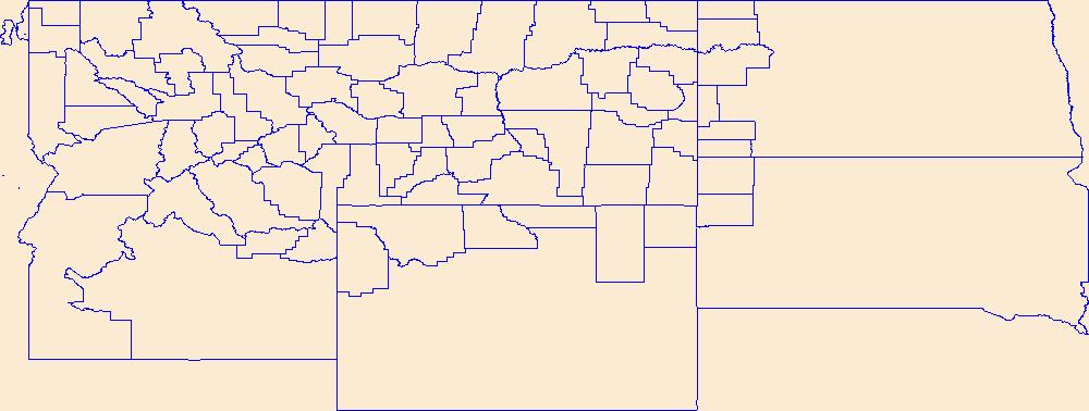
Geospatial data is comprised of government boundaries.
Tags: Beaverhead,
Big Horn,
Blaine,
Boundaries,
Broadwater, All tags...
Carbon,
Carter,
Cascade,
Chouteau,
County or Equivalent,
Custer,
Daniels,
Dawson,
Deer Lodge,
Downloadable Data,
Fallon,
Fergus,
Flathead,
Gallatin,
Garfield,
GeoPackage,
Glacier,
Golden Valley,
Granite,
Hill,
Incorporated Place,
Jefferson,
Judith Basin,
Jurisdictional,
Lake,
Lewis and Clark,
Liberty,
Lincoln,
MT,
Madison,
McCone,
Meagher,
Mineral,
Minor Civil Division,
Missoula,
Montana,
Musselshell,
National Boundary Dataset (NBD),
National Boundary Dataset (NBD),
Native American Area,
Open Geospatial Consortium GeoPackage 1.2,
PLSS First Division,
PLSS Special Survey,
PLSS Township,
Park,
Petroleum,
Phillips,
Pondera,
Powder River,
Powell,
Prairie,
Public Land Survey System,
Ravalli,
Reserve,
Richland,
Roosevelt,
Rosebud,
Sanders,
Sheridan,
Silver Bow,
State,
State,
State or Territory,
Stillwater,
Sweet Grass,
Teton,
Toole,
Treasure,
U.S. National Grid,
US,
Unincorporated Place,
United States,
Valley,
Wheatland,
Wibaux,
Yellowstone,
boundaries,
boundary,
cadastral surveys,
geographic names,
land ownership,
land use maps,
legal land descriptions,
political and administrative boundaries,
zoning maps, Fewer tags
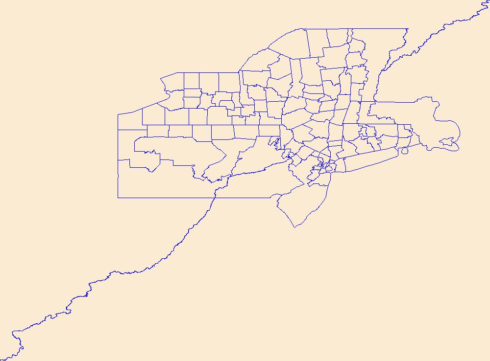
Geospatial data is comprised of government boundaries.
Tags: Albany,
Allegany,
Boundaries,
Bronx,
Broome, All tags...
Cattaraugus,
Cayuga,
Chautauqua,
Chemung,
Chenango,
Clinton,
Columbia,
Cortland,
County or Equivalent,
Delaware,
Downloadable Data,
Dutchess,
Erie,
Esri Shapefile nan,
Essex,
Franklin,
Fulton,
Genesee,
Greene,
Hamilton,
Herkimer,
Incorporated Place,
Jefferson,
Jurisdictional,
Kings,
Lewis,
Livingston,
Madison,
Minor Civil Division,
Monroe,
Montgomery,
NY,
Nassau,
National Boundary Dataset (NBD),
National Boundary Dataset (NBD),
Native American Area,
New York,
New York,
Niagara,
Oneida,
Onondaga,
Ontario,
Orange,
Orleans,
Oswego,
Otsego,
PLSS First Division,
PLSS Special Survey,
PLSS Township,
Public Land Survey System,
Putnam,
Queens,
Rensselaer,
Reserve,
Richmond,
Rockland,
Saratoga,
Schenectady,
Schoharie,
Schuyler,
Seneca,
Shapefile,
St. Lawrence,
State,
State,
State or Territory,
Steuben,
Suffolk,
Sullivan,
Tioga,
Tompkins,
U.S. National Grid,
US,
Ulster,
Unincorporated Place,
United States,
Warren,
Washington,
Wayne,
Westchester,
Wyoming,
Yates,
boundaries,
boundary,
cadastral surveys,
geographic names,
land ownership,
land use maps,
legal land descriptions,
political and administrative boundaries,
zoning maps, Fewer tags
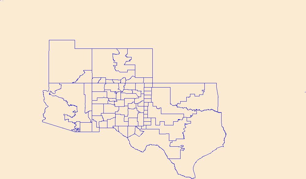
Geospatial data is comprised of government boundaries.
Tags: Bernalillo,
Boundaries,
Catron,
Chaves,
Cibola, All tags...
Colfax,
County or Equivalent,
Curry,
De Baca,
Downloadable Data,
Doña Ana,
Eddy,
GeoPackage,
Grant,
Guadalupe,
Harding,
Hidalgo,
Incorporated Place,
Jurisdictional,
Lea,
Lincoln,
Los Alamos,
Luna,
McKinley,
Minor Civil Division,
Mora,
NM,
National Boundary Dataset (NBD),
National Boundary Dataset (NBD),
Native American Area,
New Mexico,
Open Geospatial Consortium GeoPackage 1.2,
Otero,
PLSS First Division,
PLSS Special Survey,
PLSS Township,
Public Land Survey System,
Quay,
Reserve,
Rio Arriba,
Roosevelt,
San Juan,
San Miguel,
Sandoval,
Santa Fe,
Sierra,
Socorro,
State,
State,
State or Territory,
Taos,
Torrance,
U.S. National Grid,
US,
Unincorporated Place,
Union,
United States,
Valencia,
boundaries,
boundary,
cadastral surveys,
geographic names,
land ownership,
land use maps,
legal land descriptions,
political and administrative boundaries,
zoning maps, Fewer tags
Geospatial data is comprised of government boundaries.
Tags: Boundaries,
County or Equivalent,
DC,
District of Columbia,
District of Columbia, All tags...
Downloadable Data,
Esri Shapefile nan,
Incorporated Place,
Jurisdictional,
Minor Civil Division,
National Boundary Dataset (NBD),
National Boundary Dataset (NBD),
Native American Area,
PLSS First Division,
PLSS Special Survey,
PLSS Township,
Public Land Survey System,
Reserve,
Shapefile,
State,
State,
State or Territory,
U.S. National Grid,
US,
Unincorporated Place,
United States,
boundaries,
boundary,
cadastral surveys,
geographic names,
land ownership,
land use maps,
legal land descriptions,
political and administrative boundaries,
zoning maps, Fewer tags
This data set contains imagery from the National Agriculture Imagery Program (NAIP). The NAIP program is administered by USDA FSA and has been established to support two main FSA strategic goals centered on agricultural production. These are, increase stewardship of America's natural resources while enhancing the environment, and to ensure commodities are procured and distributed effectively and efficiently to increase food security. The NAIP program supports these goals by acquiring and providing ortho imagery that has been collected during the agricultural growing season in the U.S. The NAIP ortho imagery is tailored to meet FSA requirements and is a fundamental tool used to support FSA farm and conservation programs....
Types: Citation;
Tags: 3.75 x 3.75 minute,
30091,
4810429,
Aerial Compliance,
Compliance, All tags...
Digital Ortho rectified Image,
Downloadable Data,
JPEG2000,
MT,
MT091,
NAIP,
Ortho Rectification,
Orthoimagery,
Quarter Quadrangle,
RESERVE,
RESERVE, NE,
SHERIDAN CO MT FSA,
Sheridan,
USDA National Agriculture Imagery Program (NAIP),
farming, Fewer tags
This data set contains imagery from the National Agriculture Imagery Program (NAIP). The NAIP program is administered by USDA FSA and has been established to support two main FSA strategic goals centered on agricultural production. These are, increase stewardship of America's natural resources while enhancing the environment, and to ensure commodities are procured and distributed effectively and efficiently to increase food security. The NAIP program supports these goals by acquiring and providing ortho imagery that has been collected during the agricultural growing season in the U.S. The NAIP ortho imagery is tailored to meet FSA requirements and is a fundamental tool used to support FSA farm and conservation programs....
Types: Citation;
Tags: 22095,
3.75 x 3.75 minute,
3009060,
Aerial Compliance,
Compliance, All tags...
Digital Ortho rectified Image,
Downloadable Data,
JPEG2000,
LA,
LA095,
NAIP,
Ortho Rectification,
Orthoimagery,
Quarter Quadrangle,
RESERVE,
RESERVE, NE,
ST JOHN THE BAPTIS PARISH LA FSA,
St. John the Baptist,
USDA National Agriculture Imagery Program (NAIP),
farming, Fewer tags
This data set contains imagery from the National Agriculture Imagery Program (NAIP). The NAIP program is administered by USDA FSA and has been established to support two main FSA strategic goals centered on agricultural production. These are, increase stewardship of America's natural resources while enhancing the environment, and to ensure commodities are procured and distributed effectively and efficiently to increase food security. The NAIP program supports these goals by acquiring and providing ortho imagery that has been collected during the agricultural growing season in the U.S. The NAIP ortho imagery is tailored to meet FSA requirements and is a fundamental tool used to support FSA farm and conservation programs....
Types: Citation;
Tags: 20013,
3.75 x 3.75 minute,
3909504,
Aerial Compliance,
BROWN CO KS FSA, All tags...
Brown,
Compliance,
Digital Ortho rectified Image,
Downloadable Data,
JPEG2000,
KS,
KS013,
NAIP,
Ortho Rectification,
Orthoimagery,
Quarter Quadrangle,
RESERVE,
RESERVE, NE,
USDA National Agriculture Imagery Program (NAIP),
farming, Fewer tags
This data set contains imagery from the National Agriculture Imagery Program (NAIP). The NAIP program is administered by USDA FSA and has been established to support two main FSA strategic goals centered on agricultural production. These are, increase stewardship of America's natural resources while enhancing the environment, and to ensure commodities are procured and distributed effectively and efficiently to increase food security. The NAIP program supports these goals by acquiring and providing ortho imagery that has been collected during the agricultural growing season in the U.S. The NAIP ortho imagery is tailored to meet FSA requirements and is a fundamental tool used to support FSA farm and conservation programs....
Types: Citation;
Tags: 3.75 x 3.75 minute,
4509105,
55113,
Aerial Compliance,
Compliance, All tags...
Digital Ortho rectified Image,
Downloadable Data,
JPEG2000,
NAIP,
Ortho Rectification,
Orthoimagery,
Quarter Quadrangle,
RESERVE,
RESERVE, NW,
SAWYER CO WI FSA,
Sawyer,
USDA National Agriculture Imagery Program (NAIP),
WI,
WI113,
farming, Fewer tags
This data set contains imagery from the National Agriculture Imagery Program (NAIP). The NAIP program is administered by USDA FSA and has been established to support two main FSA strategic goals centered on agricultural production. These are, increase stewardship of America's natural resources while enhancing the environment, and to ensure commodities are procured and distributed effectively and efficiently to increase food security. The NAIP program supports these goals by acquiring and providing ortho imagery that has been collected during the agricultural growing season in the U.S. The NAIP ortho imagery is tailored to meet FSA requirements and is a fundamental tool used to support FSA farm and conservation programs....
Types: Citation;
Tags: 3.75 x 3.75 minute,
4509105,
55113,
Aerial Compliance,
Compliance, All tags...
Digital Ortho rectified Image,
Downloadable Data,
JPEG2000,
NAIP,
Ortho Rectification,
Orthoimagery,
Quarter Quadrangle,
RESERVE,
RESERVE, SW,
SAWYER CO WI FSA,
Sawyer,
USDA National Agriculture Imagery Program (NAIP),
WI,
WI113,
farming, Fewer tags

The datatset is a compilation of all permanent (legally established) protected areas in Newfoundland and Labrador, Canada.
Tags: canada,
habitat,
labrador,
landscape,
marine, All tags...
newfoundland,
park,
protected areas,
rangeland,
reserve,
sanctuary,
wildland,
wildlife management area, Fewer tags

The datatset is a compilation of all permanent (legally established) protected areas in Saskatchewan, Canada.
Tags: canada,
habitat,
landscape,
marine,
park, All tags...
protected areas,
rangeland,
reserve,
sanctuary,
saskatchewan,
wildland,
wildlife management area, Fewer tags

The datatset is a compilation of all permanent (legally established) protected areas in Alberta, Canada.
Tags: alberta,
canada,
habitat,
landscape,
marine, All tags...
park,
protected areas,
rangeland,
reserve,
sanctuary,
wildland,
wildlife management area, Fewer tags

This DRAFT datatset is a compilation of all interim (time limited) protected areas in Canada.
Tags: canada,
habitat,
landscape,
marine,
park, All tags...
protected areas,
rangeland,
reserve,
sanctuary,
wilderness,
wildland,
wildlife management area, Fewer tags
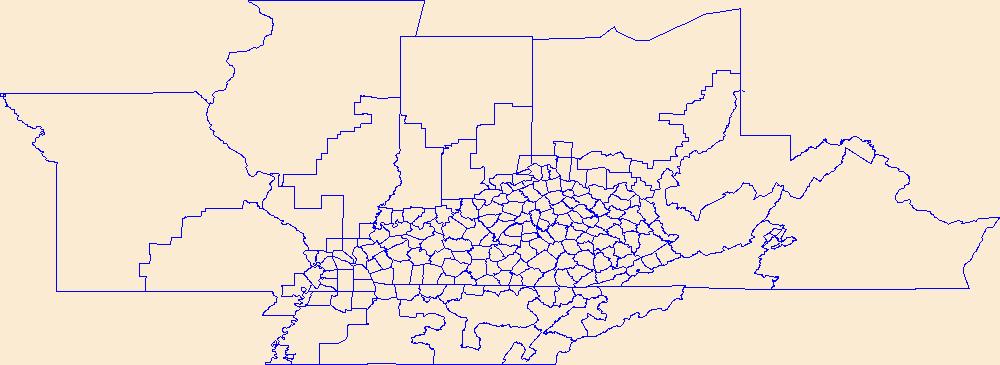
Geospatial data is comprised of government boundaries.
Tags: Adair,
Allen,
Anderson,
Ballard,
Barren, All tags...
Bath,
Bell,
Boone,
Boundaries,
Bourbon,
Boyd,
Boyle,
Bracken,
Breathitt,
Breckinridge,
Bullitt,
Butler,
Caldwell,
Calloway,
Campbell,
Carlisle,
Carroll,
Carter,
Casey,
Christian,
Clark,
Clay,
Clinton,
County or Equivalent,
Crittenden,
Cumberland,
Daviess,
Downloadable Data,
Edmonson,
Elliott,
Esri Shapefile nan,
Estill,
Fayette,
Fleming,
Floyd,
Franklin,
Fulton,
Gallatin,
Garrard,
Grant,
Graves,
Grayson,
Green,
Greenup,
Hancock,
Hardin,
Harlan,
Harrison,
Hart,
Henderson,
Henry,
Hickman,
Hopkins,
Incorporated Place,
Jackson,
Jefferson,
Jessamine,
Johnson,
Jurisdictional,
KY,
Kenton,
Kentucky,
Knott,
Knox,
Larue,
Laurel,
Lawrence,
Lee,
Leslie,
Letcher,
Lewis,
Lincoln,
Livingston,
Logan,
Lyon,
Madison,
Magoffin,
Marion,
Marshall,
Martin,
Mason,
McCracken,
McCreary,
McLean,
Meade,
Menifee,
Mercer,
Metcalfe,
Minor Civil Division,
Monroe,
Montgomery,
Morgan,
Muhlenberg,
National Boundary Dataset (NBD),
National Boundary Dataset (NBD),
Native American Area,
Nelson,
Nicholas,
Ohio,
Oldham,
Owen,
Owsley,
PLSS First Division,
PLSS Special Survey,
PLSS Township,
Pendleton,
Perry,
Pike,
Powell,
Public Land Survey System,
Pulaski,
Reserve,
Robertson,
Rockcastle,
Rowan,
Russell,
Scott,
Shapefile,
Shelby,
Simpson,
Spencer,
State,
State,
State or Territory,
Taylor,
Todd,
Trigg,
Trimble,
U.S. National Grid,
US,
Unincorporated Place,
Union,
United States,
Warren,
Washington,
Wayne,
Webster,
Whitley,
Wolfe,
Woodford,
boundaries,
boundary,
cadastral surveys,
geographic names,
land ownership,
land use maps,
legal land descriptions,
political and administrative boundaries,
zoning maps, Fewer tags
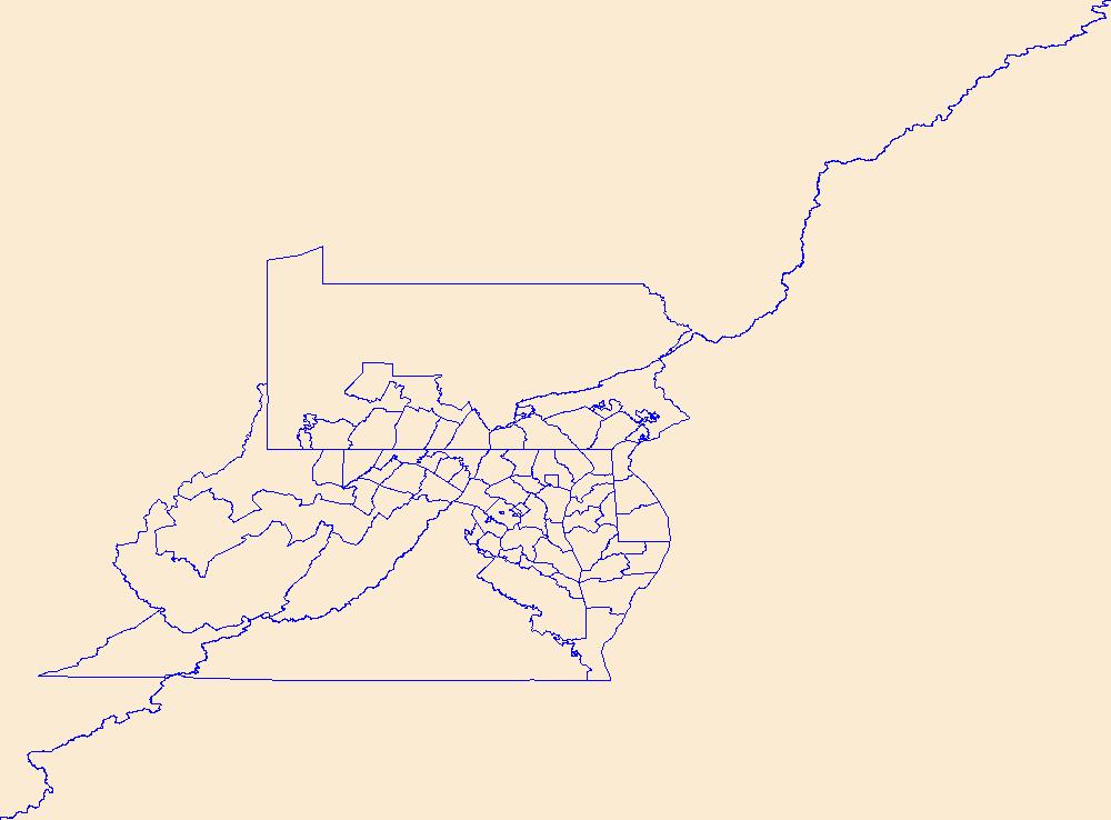
Geospatial data is comprised of government boundaries.
Tags: Allegany,
Anne Arundel,
Baltimore,
Boundaries,
Calvert, All tags...
Caroline,
Carroll,
Cecil,
Charles,
County or Equivalent,
Dorchester,
Downloadable Data,
Esri Shapefile nan,
Frederick,
Garrett,
Harford,
Howard,
Incorporated Place,
Jurisdictional,
Kent,
MD,
Maryland,
Minor Civil Division,
Montgomery,
National Boundary Dataset (NBD),
National Boundary Dataset (NBD),
Native American Area,
PLSS First Division,
PLSS Special Survey,
PLSS Township,
Prince George's,
Public Land Survey System,
Queen Anne's,
Reserve,
Shapefile,
Somerset,
St. Mary's,
State,
State,
State or Territory,
Talbot,
U.S. National Grid,
US,
Unincorporated Place,
United States,
Washington,
Wicomico,
Worcester,
boundaries,
boundary,
cadastral surveys,
geographic names,
land ownership,
land use maps,
legal land descriptions,
political and administrative boundaries,
zoning maps, Fewer tags
|
|

