Filters
Date Range
Extensions
Types
Contacts
Categories
Tag Types
Tag Schemes
|
This data set contains imagery from the National Agriculture Imagery Program (NAIP). The NAIP program is administered by USDA FSA and has been established to support two main FSA strategic goals centered on agricultural production. These are, increase stewardship of America's natural resources while enhancing the environment, and to ensure commodities are procured and distributed effectively and efficiently to increase food security. The NAIP program supports these goals by acquiring and providing ortho imagery that has been collected during the agricultural growing season in the U.S. The NAIP ortho imagery is tailored to meet FSA requirements and is a fundamental tool used to support FSA farm and conservation programs....
Types: Citation;
Tags: 22095,
3.75 x 3.75 minute,
3009060,
Aerial Compliance,
Compliance, All tags...
Digital Ortho rectified Image,
Downloadable Data,
JPEG2000,
LA,
LA095,
NAIP,
Ortho Rectification,
Orthoimagery,
Quarter Quadrangle,
RESERVE,
RESERVE, SW,
ST JOHN THE BAPTIS PARISH LA FSA,
St. John the Baptist,
USDA National Agriculture Imagery Program (NAIP),
farming, Fewer tags

The purpose of the Coral Reef Evaluation and Monitoring Project (CREMP) is to monitor the status and trends of selected reefs in the Florida Keys National Marine Sanctuary(FKNMS). CREMP assessments have been conducted annually at fixed sites since 1996 and data collected provides information on the temporal changes in benthic cover and diversity of stony corals and associated marine flora and fauna. The core field methods continue to be underwater videography and timed coral species inventories. Findings presented in this report include data from 109 stations at 37 sites sampled from 1996 through 2008 in the Florida Keys and 1999 through 2008 in the Dry Tortugas. The report describes the annual differences (between...
Categories: Data;
Tags: Florida Keys Coral Reef Monitoring Project2002,
absence,
aphia,
area,
array, All tags...
array-data,
authorship,
basis,
basisOfRecord,
biology,
body,
bottom,
bottomType,
calculated,
celsius,
class,
code,
common,
comprehensive,
coral,
coral monitoring,
country,
cover,
coverage,
data,
data_set_ID,
database,
dataset,
datasetID,
date,
datum,
dep,
depth,
dry,
dry tortugas,
dynamic,
dynamicProperties,
ecological,
event,
eventDate,
eventDateRemarks,
eventDateTimeZone,
eventdate,
eventdateremarks,
eventdatetimezone,
family,
first,
firstYear,
first_year_of_observation,
fish,
florida,
florida keys,
fwri,
genus,
geodetic,
geodeticDatum,
geoscientificInformation,
gulf of mexico,
habitat,
hierarchy,
higher,
higherInstitutionCode,
identification,
information,
institude,
institution,
institutionCode,
itis,
keys,
kingdom,
large,
lastYear,
lastt,
lastt_year_of_observation,
latitude,
locality,
longitude,
max,
max_depth,
maximum,
maximumDepthInMeters,
meters,
method,
min,
min_depth,
minimum,
minimumDepthInMeters,
monitoring,
name,
north,
not,
notsampled,
number,
observation,
observed,
occurence,
order,
owner,
ownerInstitutionCode,
park,
phylum,
presence,
project,
properties,
protected,
protection,
province,
quantification,
quantificationMethod,
quantificationName,
quantificationStatus,
quantificationValue,
rank,
record,
recorded,
recordedBy,
reef,
remarks,
research,
reserve,
sample,
sampleAreaInSquareMeters,
samples,
sampling,
scientific,
scientificNameAuthorship,
scientificNameIDITIS,
scientificNameIDWoRMS,
scientificname,
sea,
seawater,
serial,
service,
set,
spatial,
species,
specificEpithet,
square,
state,
stateProvince,
station,
status,
stewardship,
strata,
system,
taxon,
taxonRank,
taxonomic,
temperature,
time,
tner,
tortuga,
transect,
type,
vernacularName,
vertical,
verticalDatum,
verticaldatum,
video,
water,
waterBody,
waterTemperatureInCelsius,
wildlife,
worms,
year,
zone, Fewer tags
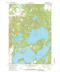
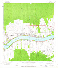
USGS Historical Quadrangle in GeoPDF.
Tags: 7.5 x 7.5 minute,
Downloadable Data,
GeoPDF,
GeoTIFF,
Historical Topographic Maps, All tags...
Historical Topographic Maps 7.5 x 7.5 Minute Map Series,
Map,
Reserve,
WI,
imageryBaseMapsEarthCover, Fewer tags
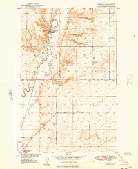
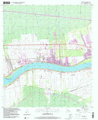
USGS Historical Quadrangle in GeoPDF.
Tags: 7.5 x 7.5 minute,
Downloadable Data,
GeoPDF,
GeoTIFF,
Historical Topographic Maps, All tags...
Historical Topographic Maps 7.5 x 7.5 Minute Map Series,
MT,
Map,
Reserve,
imageryBaseMapsEarthCover, Fewer tags
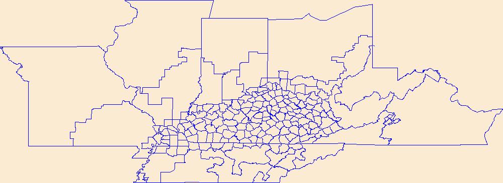
Geospatial data is comprised of government boundaries.
Tags: Adair,
Allen,
Anderson,
Ballard,
Barren, All tags...
Bath,
Bell,
Boone,
Boundaries,
Bourbon,
Boyd,
Boyle,
Bracken,
Breathitt,
Breckinridge,
Bullitt,
Butler,
Caldwell,
Calloway,
Campbell,
Carlisle,
Carroll,
Carter,
Casey,
Christian,
Clark,
Clay,
Clinton,
County or Equivalent,
Crittenden,
Cumberland,
Daviess,
Downloadable Data,
Edmonson,
Elliott,
Estill,
Fayette,
Fleming,
Floyd,
Franklin,
Fulton,
Gallatin,
Garrard,
GeoPackage,
Grant,
Graves,
Grayson,
Green,
Greenup,
Hancock,
Hardin,
Harlan,
Harrison,
Hart,
Henderson,
Henry,
Hickman,
Hopkins,
Incorporated Place,
Jackson,
Jefferson,
Jessamine,
Johnson,
Jurisdictional,
KY,
Kenton,
Kentucky,
Knott,
Knox,
Larue,
Laurel,
Lawrence,
Lee,
Leslie,
Letcher,
Lewis,
Lincoln,
Livingston,
Logan,
Lyon,
Madison,
Magoffin,
Marion,
Marshall,
Martin,
Mason,
McCracken,
McCreary,
McLean,
Meade,
Menifee,
Mercer,
Metcalfe,
Minor Civil Division,
Monroe,
Montgomery,
Morgan,
Muhlenberg,
National Boundary Dataset (NBD),
National Boundary Dataset (NBD),
Native American Area,
Nelson,
Nicholas,
Ohio,
Oldham,
Open Geospatial Consortium GeoPackage 1.2,
Owen,
Owsley,
PLSS First Division,
PLSS Special Survey,
PLSS Township,
Pendleton,
Perry,
Pike,
Powell,
Public Land Survey System,
Pulaski,
Reserve,
Robertson,
Rockcastle,
Rowan,
Russell,
Scott,
Shelby,
Simpson,
Spencer,
State,
State,
State or Territory,
Taylor,
Todd,
Trigg,
Trimble,
U.S. National Grid,
US,
Unincorporated Place,
Union,
United States,
Warren,
Washington,
Wayne,
Webster,
Whitley,
Wolfe,
Woodford,
boundaries,
boundary,
cadastral surveys,
geographic names,
land ownership,
land use maps,
legal land descriptions,
political and administrative boundaries,
zoning maps, Fewer tags
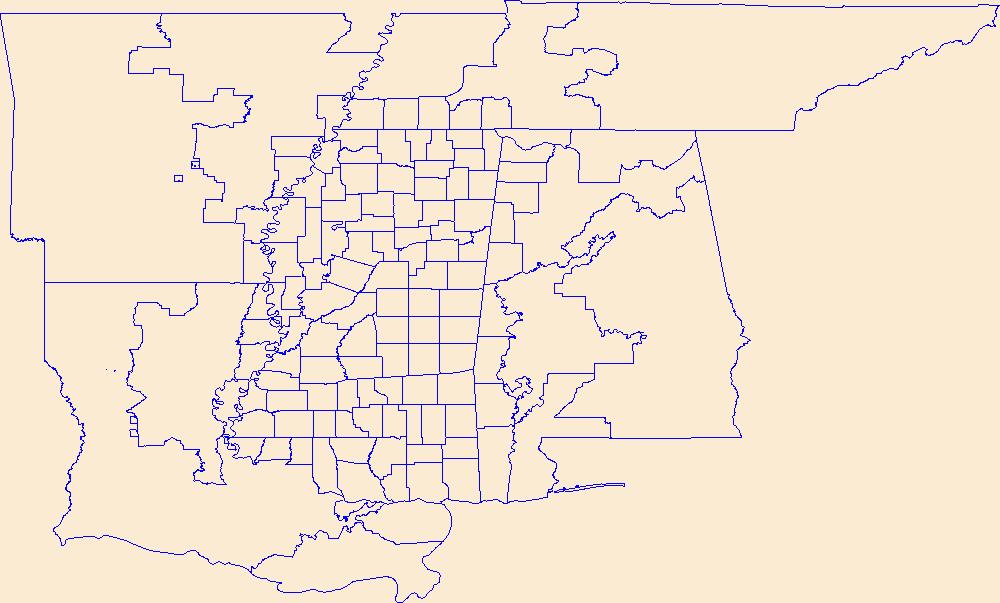
Geospatial data is comprised of government boundaries.
Tags: Adams,
Alcorn,
Amite,
Attala,
Benton, All tags...
Bolivar,
Boundaries,
Calhoun,
Carroll,
Chickasaw,
Choctaw,
Claiborne,
Clarke,
Clay,
Coahoma,
Copiah,
County or Equivalent,
Covington,
DeSoto,
Downloadable Data,
Forrest,
Franklin,
GeoPackage,
George,
Greene,
Grenada,
Hancock,
Harrison,
Hinds,
Holmes,
Humphreys,
Incorporated Place,
Issaquena,
Itawamba,
Jackson,
Jasper,
Jefferson,
Jefferson Davis,
Jones,
Jurisdictional,
Kemper,
Lafayette,
Lamar,
Lauderdale,
Lawrence,
Leake,
Lee,
Leflore,
Lincoln,
Lowndes,
MS,
Madison,
Marion,
Marshall,
Minor Civil Division,
Mississippi,
Monroe,
Montgomery,
National Boundary Dataset (NBD),
National Boundary Dataset (NBD),
Native American Area,
Neshoba,
Newton,
Noxubee,
Oktibbeha,
Open Geospatial Consortium GeoPackage 1.2,
PLSS First Division,
PLSS Special Survey,
PLSS Township,
Panola,
Pearl River,
Perry,
Pike,
Pontotoc,
Prentiss,
Public Land Survey System,
Quitman,
Rankin,
Reserve,
Scott,
Sharkey,
Simpson,
Smith,
State,
State,
State or Territory,
Stone,
Sunflower,
Tallahatchie,
Tate,
Tippah,
Tishomingo,
Tunica,
U.S. National Grid,
US,
Unincorporated Place,
Union,
United States,
Walthall,
Warren,
Washington,
Wayne,
Webster,
Wilkinson,
Winston,
Yalobusha,
Yazoo,
boundaries,
boundary,
cadastral surveys,
geographic names,
land ownership,
land use maps,
legal land descriptions,
political and administrative boundaries,
zoning maps, Fewer tags
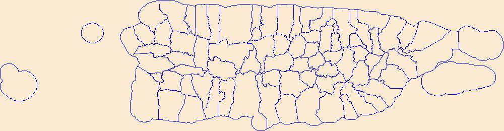
Geospatial data is comprised of government boundaries.
Tags: Adjuntas,
Aguada,
Aguadilla,
Aguas Buenas,
Aibonito, All tags...
Arecibo,
Arroyo,
Añasco,
Barceloneta,
Barranquitas,
Bayamón,
Boundaries,
Cabo Rojo,
Caguas,
Camuy,
Canóvanas,
Carolina,
Cataño,
Cayey,
Ceiba,
Ciales,
Cidra,
Coamo,
Comerío,
Corozal,
County or Equivalent,
Culebra,
Dorado,
Downloadable Data,
Fajardo,
Florida,
GeoPackage,
Guayama,
Guayanilla,
Guaynabo,
Gurabo,
Guánica,
Hatillo,
Hormigueros,
Humacao,
Incorporated Place,
Isabela,
Jayuya,
Juana Díaz,
Juncos,
Jurisdictional,
Lajas,
Lares,
Las Marías,
Las Piedras,
Loíza,
Luquillo,
Manatí,
Maricao,
Maunabo,
Mayagüez,
Minor Civil Division,
Moca,
Morovis,
Naguabo,
Naranjito,
National Boundary Dataset (NBD),
National Boundary Dataset (NBD),
Native American Area,
Open Geospatial Consortium GeoPackage 1.2,
Orocovis,
PLSS First Division,
PLSS Special Survey,
PLSS Township,
PR,
Patillas,
Peñuelas,
Ponce,
Public Land Survey System,
Puerto Rico,
Quebradillas,
Reserve,
Rincón,
Río Grande,
Sabana Grande,
Salinas,
San Germán,
San Juan,
San Lorenzo,
San Sebastián,
Santa Isabel,
State,
State,
State or Territory,
Toa Alta,
Toa Baja,
Trujillo Alto,
U.S. National Grid,
US,
Unincorporated Place,
United States,
Utuado,
Vega Alta,
Vega Baja,
Vieques,
Villalba,
Yabucoa,
Yauco,
boundaries,
boundary,
cadastral surveys,
geographic names,
land ownership,
land use maps,
legal land descriptions,
political and administrative boundaries,
zoning maps, Fewer tags

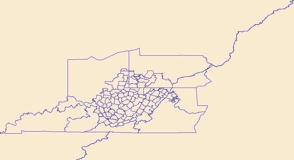
Geospatial data is comprised of government boundaries.
Types: Citation;
Tags: Barbour,
Berkeley,
Boone,
Boundaries,
Braxton, All tags...
Brooke,
Cabell,
Calhoun,
Clay,
County or Equivalent,
Doddridge,
Downloadable Data,
Esri File GeoDatabase 10,
Fayette,
FileGDB,
Gilmer,
Grant,
Greenbrier,
Hampshire,
Hancock,
Hardy,
Harrison,
Incorporated Place,
Jackson,
Jefferson,
Jurisdictional,
Kanawha,
Lewis,
Lincoln,
Logan,
Marion,
Marshall,
Mason,
McDowell,
Mercer,
Mineral,
Mingo,
Minor Civil Division,
Monongalia,
Monroe,
Morgan,
National Boundary Dataset (NBD),
National Boundary Dataset (NBD),
Native American Area,
Nicholas,
Ohio,
PLSS First Division,
PLSS Special Survey,
PLSS Township,
Pendleton,
Pleasants,
Pocahontas,
Preston,
Public Land Survey System,
Putnam,
Raleigh,
Randolph,
Reserve,
Ritchie,
Roane,
State,
State,
State or Territory,
Summers,
Taylor,
Tucker,
Tyler,
U.S. National Grid,
US,
Unincorporated Place,
United States,
Upshur,
WV,
Wayne,
Webster,
West Virginia,
Wetzel,
Wirt,
Wood,
Wyoming,
boundaries,
boundary,
cadastral surveys,
geographic names,
land ownership,
land use maps,
legal land descriptions,
political and administrative boundaries,
zoning maps, Fewer tags
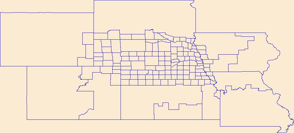
Geospatial data is comprised of government boundaries.
Tags: Adams,
Antelope,
Arthur,
Banner,
Blaine, All tags...
Boone,
Boundaries,
Box Butte,
Boyd,
Brown,
Buffalo,
Burt,
Butler,
Cass,
Cedar,
Chase,
Cherry,
Cheyenne,
Clay,
Colfax,
County or Equivalent,
Cuming,
Custer,
Dakota,
Dawes,
Dawson,
Deuel,
Dixon,
Dodge,
Douglas,
Downloadable Data,
Dundy,
Esri Shapefile nan,
Fillmore,
Franklin,
Frontier,
Furnas,
Gage,
Garden,
Garfield,
Gosper,
Grant,
Greeley,
Hall,
Hamilton,
Harlan,
Hayes,
Hitchcock,
Holt,
Hooker,
Howard,
Incorporated Place,
Jefferson,
Johnson,
Jurisdictional,
Kearney,
Keith,
Keya Paha,
Kimball,
Knox,
Lancaster,
Lincoln,
Logan,
Loup,
Madison,
McPherson,
Merrick,
Minor Civil Division,
Morrill,
NE,
Nance,
National Boundary Dataset (NBD),
National Boundary Dataset (NBD),
Native American Area,
Nebraska,
Nemaha,
Nuckolls,
Otoe,
PLSS First Division,
PLSS Special Survey,
PLSS Township,
Pawnee,
Perkins,
Phelps,
Pierce,
Platte,
Polk,
Public Land Survey System,
Red Willow,
Reserve,
Richardson,
Rock,
Saline,
Sarpy,
Saunders,
Scotts Bluff,
Seward,
Shapefile,
Sheridan,
Sherman,
Sioux,
Stanton,
State,
State,
State or Territory,
Thayer,
Thomas,
Thurston,
U.S. National Grid,
US,
Unincorporated Place,
United States,
Valley,
Washington,
Wayne,
Webster,
Wheeler,
York,
boundaries,
boundary,
cadastral surveys,
geographic names,
land ownership,
land use maps,
legal land descriptions,
political and administrative boundaries,
zoning maps, Fewer tags
Geospatial data is comprised of government boundaries.
Tags: Barbour,
Berkeley,
Boone,
Boundaries,
Braxton, All tags...
Brooke,
Cabell,
Calhoun,
Clay,
County or Equivalent,
Doddridge,
Downloadable Data,
Fayette,
GeoPackage,
Gilmer,
Grant,
Greenbrier,
Hampshire,
Hancock,
Hardy,
Harrison,
Incorporated Place,
Jackson,
Jefferson,
Jurisdictional,
Kanawha,
Lewis,
Lincoln,
Logan,
Marion,
Marshall,
Mason,
McDowell,
Mercer,
Mineral,
Mingo,
Minor Civil Division,
Monongalia,
Monroe,
Morgan,
National Boundary Dataset (NBD),
National Boundary Dataset (NBD),
Native American Area,
Nicholas,
Ohio,
Open Geospatial Consortium GeoPackage 1.2,
PLSS First Division,
PLSS Special Survey,
PLSS Township,
Pendleton,
Pleasants,
Pocahontas,
Preston,
Public Land Survey System,
Putnam,
Raleigh,
Randolph,
Reserve,
Ritchie,
Roane,
State,
State,
State or Territory,
Summers,
Taylor,
Tucker,
Tyler,
U.S. National Grid,
US,
Unincorporated Place,
United States,
Upshur,
WV,
Wayne,
Webster,
West Virginia,
Wetzel,
Wirt,
Wood,
Wyoming,
boundaries,
boundary,
cadastral surveys,
geographic names,
land ownership,
land use maps,
legal land descriptions,
political and administrative boundaries,
zoning maps, Fewer tags

Geospatial data is comprised of government boundaries.
Tags: Boundaries,
County or Equivalent,
Downloadable Data,
Esri Shapefile nan,
Incorporated Place, All tags...
Jurisdictional,
Minor Civil Division,
National Boundary Dataset (NBD),
National Boundary Dataset (NBD),
Native American Area,
PLSS First Division,
PLSS Special Survey,
PLSS Township,
Public Land Survey System,
Reserve,
Shapefile,
St. Croix,
St. John,
St. Thomas,
State,
State,
State or Territory,
U.S. National Grid,
US,
Unincorporated Place,
United States,
VI,
Virgin Islands,
boundaries,
boundary,
cadastral surveys,
geographic names,
land ownership,
land use maps,
legal land descriptions,
political and administrative boundaries,
zoning maps, Fewer tags
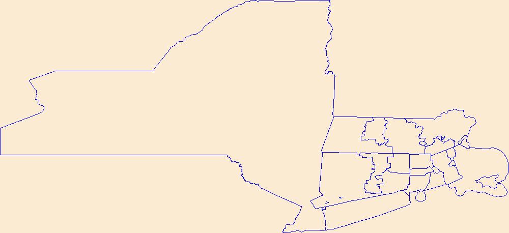
Geospatial data is comprised of government boundaries.
Types: Citation;
Tags: Boundaries,
Bristol,
County or Equivalent,
Downloadable Data,
Esri File GeoDatabase 10, All tags...
FileGDB,
Incorporated Place,
Jurisdictional,
Kent,
Minor Civil Division,
National Boundary Dataset (NBD),
National Boundary Dataset (NBD),
Native American Area,
Newport,
PLSS First Division,
PLSS Special Survey,
PLSS Township,
Providence,
Public Land Survey System,
RI,
Reserve,
Rhode Island,
State,
State,
State or Territory,
U.S. National Grid,
US,
Unincorporated Place,
United States,
Washington,
boundaries,
boundary,
cadastral surveys,
geographic names,
land ownership,
land use maps,
legal land descriptions,
political and administrative boundaries,
zoning maps, Fewer tags

Geospatial data is comprised of government boundaries.
Tags: Boundaries,
Bristol,
County or Equivalent,
Downloadable Data,
Esri Shapefile nan, All tags...
Incorporated Place,
Jurisdictional,
Kent,
Minor Civil Division,
National Boundary Dataset (NBD),
National Boundary Dataset (NBD),
Native American Area,
Newport,
PLSS First Division,
PLSS Special Survey,
PLSS Township,
Providence,
Public Land Survey System,
RI,
Reserve,
Rhode Island,
Shapefile,
State,
State,
State or Territory,
U.S. National Grid,
US,
Unincorporated Place,
United States,
Washington,
boundaries,
boundary,
cadastral surveys,
geographic names,
land ownership,
land use maps,
legal land descriptions,
political and administrative boundaries,
zoning maps, Fewer tags
This data set contains imagery from the National Agriculture Imagery Program (NAIP). The NAIP program is administered by USDA FSA and has been established to support two main FSA strategic goals centered on agricultural production. These are, increase stewardship of America's natural resources while enhancing the environment, and to ensure commodities are procured and distributed effectively and efficiently to increase food security. The NAIP program supports these goals by acquiring and providing ortho imagery that has been collected during the agricultural growing season in the U.S. The NAIP ortho imagery is tailored to meet FSA requirements and is a fundamental tool used to support FSA farm and conservation programs....
Types: Citation;
Tags: 20013,
3.75 x 3.75 minute,
3909504,
Aerial Compliance,
BROWN CO KS FSA, All tags...
Brown,
Compliance,
Digital Ortho rectified Image,
Downloadable Data,
JPEG2000,
KS,
KS013,
NAIP,
Ortho Rectification,
Orthoimagery,
Quarter Quadrangle,
RESERVE,
RESERVE, SW,
USDA National Agriculture Imagery Program (NAIP),
farming, Fewer tags
This study analyses three feasible regulation methods of an in-service cogeneration plant. The main task is to study the potential energy savings, CO2 reduction and the increase in profitability compatible with the lowest transformation costs. The cogeneration system is composed of two General Electric LM2500 gas turbines and a heat recovery steam generator (HRSG). Two plant localizations in Spain have been considered; San Fernando (Cádiz) where the current plant is located, and Burgos. The latter has been taken into account to analyze the effect of cooler weather on the regulation methods. The paper has been divided into three parts. First, a revision of the current legislation regarding cogeneration in Spain is...

This data set contains imagery from the National Agriculture Imagery Program (NAIP). The NAIP program is administered by USDA FSA and has been established to support two main FSA strategic goals centered on agricultural production. These are, increase stewardship of America's natural resources while enhancing the environment, and to ensure commodities are procured and distributed effectively and efficiently to increase food security. The NAIP program supports these goals by acquiring and providing ortho imagery that has been collected during the agricultural growing season in the U.S. The NAIP ortho imagery is tailored to meet FSA requirements and is a fundamental tool used to support FSA farm and conservation programs....
Types: Citation;
Tags: 3.75 x 3.75 minute,
31147,
3909504,
Aerial Compliance,
Compliance, All tags...
Digital Ortho rectified Image,
Downloadable Data,
JPEG2000,
NAIP,
NE,
NE147,
Ortho Rectification,
Orthoimagery,
Quarter Quadrangle,
RESERVE,
RESERVE, NE,
RICHARDSON CO NE FSA,
Richardson,
USDA National Agriculture Imagery Program (NAIP),
farming, Fewer tags
USGS Historical Quadrangle in GeoPDF.
Tags: 7.5 x 7.5 minute,
Downloadable Data,
GeoPDF,
GeoTIFF,
Historical Topographic Maps, All tags...
Historical Topographic Maps 7.5 x 7.5 Minute Map Series,
LA,
Map,
Reserve,
imageryBaseMapsEarthCover, Fewer tags
USGS Historical Quadrangle in GeoPDF.
Tags: 7.5 x 7.5 minute,
Downloadable Data,
GeoPDF,
GeoTIFF,
Historical Topographic Maps, All tags...
Historical Topographic Maps 7.5 x 7.5 Minute Map Series,
LA,
Map,
Reserve,
imageryBaseMapsEarthCover, Fewer tags
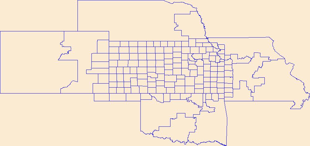
Geospatial data is comprised of government boundaries.
Tags: Allen,
Anderson,
Atchison,
Barber,
Barton, All tags...
Boundaries,
Bourbon,
Brown,
Butler,
Chase,
Chautauqua,
Cherokee,
Cheyenne,
Clark,
Clay,
Cloud,
Coffey,
Comanche,
County or Equivalent,
Cowley,
Crawford,
Decatur,
Dickinson,
Doniphan,
Douglas,
Downloadable Data,
Edwards,
Elk,
Ellis,
Ellsworth,
Esri Shapefile nan,
Finney,
Ford,
Franklin,
Geary,
Gove,
Graham,
Grant,
Gray,
Greeley,
Greenwood,
Hamilton,
Harper,
Harvey,
Haskell,
Hodgeman,
Incorporated Place,
Jackson,
Jefferson,
Jewell,
Johnson,
Jurisdictional,
KS,
Kansas,
Kearny,
Kingman,
Kiowa,
Labette,
Lane,
Leavenworth,
Lincoln,
Linn,
Logan,
Lyon,
Marion,
Marshall,
McPherson,
Meade,
Miami,
Minor Civil Division,
Mitchell,
Montgomery,
Morris,
Morton,
National Boundary Dataset (NBD),
National Boundary Dataset (NBD),
Native American Area,
Nemaha,
Neosho,
Ness,
Norton,
Osage,
Osborne,
Ottawa,
PLSS First Division,
PLSS Special Survey,
PLSS Township,
Pawnee,
Phillips,
Pottawatomie,
Pratt,
Public Land Survey System,
Rawlins,
Reno,
Republic,
Reserve,
Rice,
Riley,
Rooks,
Rush,
Russell,
Saline,
Scott,
Sedgwick,
Seward,
Shapefile,
Shawnee,
Sheridan,
Sherman,
Smith,
Stafford,
Stanton,
State,
State,
State or Territory,
Stevens,
Sumner,
Thomas,
Trego,
U.S. National Grid,
US,
Unincorporated Place,
United States,
Wabaunsee,
Wallace,
Washington,
Wichita,
Wilson,
Woodson,
Wyandotte,
boundaries,
boundary,
cadastral surveys,
geographic names,
land ownership,
land use maps,
legal land descriptions,
political and administrative boundaries,
zoning maps, Fewer tags
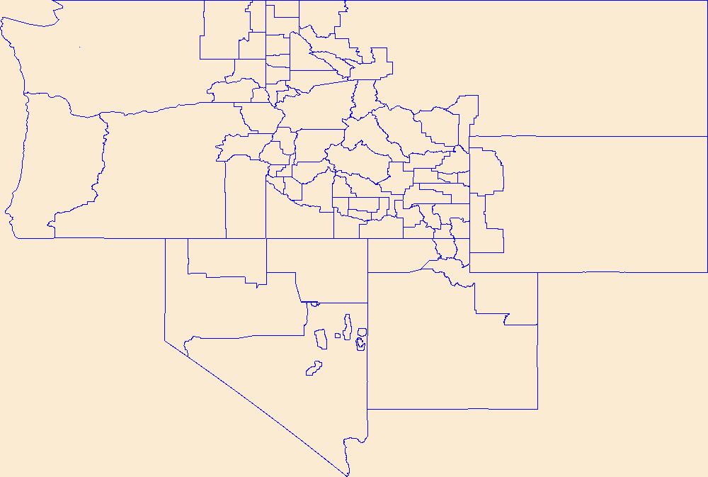
Geospatial data is comprised of government boundaries.
Tags: Ada,
Adams,
Bannock,
Bear Lake,
Benewah, All tags...
Bingham,
Blaine,
Boise,
Bonner,
Bonneville,
Boundaries,
Boundary,
Butte,
Camas,
Canyon,
Caribou,
Cassia,
Clark,
Clearwater,
County or Equivalent,
Custer,
Downloadable Data,
Elmore,
Esri Shapefile nan,
Franklin,
Fremont,
Gem,
Gooding,
ID,
Idaho,
Idaho,
Incorporated Place,
Jefferson,
Jerome,
Jurisdictional,
Kootenai,
Latah,
Lemhi,
Lewis,
Lincoln,
Madison,
Minidoka,
Minor Civil Division,
National Boundary Dataset (NBD),
National Boundary Dataset (NBD),
Native American Area,
Nez Perce,
Oneida,
Owyhee,
PLSS First Division,
PLSS Special Survey,
PLSS Township,
Payette,
Power,
Public Land Survey System,
Reserve,
Shapefile,
Shoshone,
State,
State,
State or Territory,
Teton,
Twin Falls,
U.S. National Grid,
US,
Unincorporated Place,
United States,
Valley,
Washington,
boundaries,
boundary,
cadastral surveys,
geographic names,
land ownership,
land use maps,
legal land descriptions,
political and administrative boundaries,
zoning maps, Fewer tags
|
|

