Filters: Tags: scenario (X) > partyWithName: Conservation Biology Institute (X)
61 results (11ms)|
Filters
Date Range
Tag Schemes |
The Nature Conservancy (TNC) has derived climate suitability forecasts for most species of trees and shrubs considered to be ecological dominants of terrestrial Californian habitat types. Our plant projections are compiled as decision support tools to help Conservancy project staff, as well as our external partners, develop the necessary plans, priorities and strategies to successfully adapt to uncertain changes in future climate. In the recently completed Southern Sierra Partnership's 2010 Climate-Adapted Conservation Plan for the Southern Sierra Nevada and Tehachapi Mountains, species and habitat forecasts shown here informed the development of a regional conservation design that explicitly incorporates long-term...

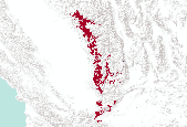
This dataset represents presence of Jack Pine (Pinus banksiana) in Minnesota (USA) at year 50 (2045) from a single model run of LANDIS-II. The simulation assumed Intergovernmental Panel on Climate Change (IPCC) B2 emissions (moderate) and used the Hadley 3 global circulation model. Restoration harvest rates and intensities were simulated.

This dataset represents presence of Sugar Maple (Acer saccharum) in Minnesota (USA) at year 0 (2145) from a single model run of LANDIS-II. The simulation assumed Intergovernmental Panel on Climate Change (IPCC) B2 emissions (moderate) and used the Hadley 3 global circulation model. Contemporary harvest rates and intensities were simulated.

Ken Ferschweiler (CBI) used climate data from the PRISM group (Chris Daly, Oregon State University) at 4kmx4km spatial grain across the conterminous USA to generate a climatology or baseline. He then created future climate change scenarios using statistical downscaling and created anomalies from the Hadley CM3 General Circulation Model (GCM) run through the A2 emission scenario (SRES - special report on emission scenarios published in 2000). To run the MAPSS model (Neilson 1995), average monthly precipitation values were calculated for the period 2045-2060. This dataset shows the standard deviation of the annual precipitation for that period.

This dataset represents presence of white pine (Pinus strobus) at year 100 (2095) from a single model run of LANDIS-II. The simulation assumed Intergovernmental Panel on Climate Change (IPCC) B2 emissions (moderate) and used the Hadley 3 global circulation model. Contemporary harvest rates and intensities were simulated.

Standard Deviation of Annual Temperature (2045-2060) from HadCM3 GCM under A2 scenario (Western USA)
Ken Ferschweiler (CBI) used climate data from the PRISM group (Chris Daly, Oregon State University) at 4kmx4km spatial grain across the conterminous USA to generate a climatology or baseline. He then created future climate change scenarios using statistical downscaling and created anomalies from the Hadley CM3 General Circulation Model (GCM) run through the A2 emission scenario (SRES - special report on emission scenarios published in 2000). To run the MAPSS model (Neilson 1995), average monthly temperatures were calculated for the period 2045-2060. This dataset shows the standard deviation of the annual mean temperature for that period.

This dataset represents presence of Black Spruce (Picea mariana) at year 100 (2095) from a single model run of LANDIS-II. The simulation assumed Intergovernmental Panel on Climate Change (IPCC) B2 emissions (moderate) and used the Hadley 3 global circulation model. Contemporary harvest rates and intensities were simulated.

The Nature Conservancy (TNC) has derived climate suitability forecasts for most species of trees and shrubs considered to be ecological dominants of terrestrial Californian habitat types. Our plant projections are compiled as decision support tools to help Conservancy project staff, as well as our external partners, develop the necessary plans, priorities and strategies to successfully adapt to uncertain changes in future climate. In the recently completed Southern Sierra Partnership's 2010 Climate-Adapted Conservation Plan for the Southern Sierra Nevada and Tehachapi Mountains, species and habitat forecasts shown here informed the development of a regional conservation design that explicitly incorporates long-term...

This dataset represents presence of Red Pine (Pinus resinosa) at year 50 (2045) in Minnesota (USA) from a single model run of LANDIS-II. The simulation assumed Intergovernmental Panel on Climate Change (IPCC) B2 emissions (moderate) and used the Hadley 3 global circulation model. Contemporary harvest rates and intensities were simulated.

This dataset represents presence of Red Pine (Pinus resinosa) at year 0 (1995) in Minnesota (USA) from a single model run of LANDIS-II. The simulation assumed Intergovernmental Panel on Climate Change (IPCC) B2 emissions (moderate) and used the Hadley 3 global circulation model. Restoration harvest rates and intensities were simulated.

This dataset represents presence of Black Spruce (Picea mariana) at year 150 (2145) from a single model run of LANDIS-II. The simulation assumed Intergovernmental Panel on Climate Change (IPCC) B2 emissions (moderate) and used the Hadley 3 global circulation model. Restoration harvest rates and intensities were simulated.

This dataset represents presence of Sugar Maple (Acer saccharum) at year 100 (2095) from a single model run of LANDIS-II. The simulation assumed Intergovernmental Panel on Climate Change (IPCC) B2 emissions (moderate) and used the Hadley 3 global circulation model. Restoration harvest rates and intensities were simulated.

Ken Ferschweiler (CBI) used climate data from the PRISM group (Chris Daly, Oregon State University) at 4kmx4km spatial grain across the conterminous USA to generate a climatology or baseline. He then created future climate change scenarios using statistical downscaling and created anomalies from the Hadley CM3 General Circulation Model (GCM) run through the A2 emission scenario (SRES - special report on emission scenarios published in 2000). To run the MAPSS model (Neilson 1995), average monthly precipitation values were calculated for the period 2045-2060. This dataset shows the mean anomaly (difference) in the annual precipitation for that period with respect to the 1971-2000 baseline period.

Ken Ferschweiler (CBI) used climate data from the PRISM group (Chris Daly, Oregon State University) at 4kmx4km spatial grain across the conterminous USA to generate a climatology or baseline. He then created future climate change scenarios using statistical downscaling and created anomalies from the Hadley CM3 General Circulation Model (GCM) run through the A2 emission scenario (SRES - special report on emission scenarios published in 2000). To run the MAPSS model (Neilson 1995), average monthly temperatures were calculated for the period 2045-2060. This dataset shows the mean anomaly (difference) in the annual mean temperature for that period with respect to the 1971-2000 baseline period.

This dataset depicts dominant species groups in Minnesota (USA) at year 0 (1995) from a single model run of LANDIS-II. The simulation assumed Intergovernmental Panel on Climate Change (IPCC) A2 emissions (moderate) and used the Hadley 3 global circulation model. Restoration harvest rates and intensities were simulated. Restoration harvesting was spatially allocated following ecological land units (rather than ownership) and harvest frequency, severity, and size distributions were based on historic wind and fire regimes. The projected dominant species were listed as follows: 1) Spruce and Fir; 2) Northern Hardwoods: Sugar Maple; 3) Northern Hardwoods: Red Maple; 4) Aspen and Birch; 5) White, Red, and Jack Pine; 6)...

This dataset represents presence of Red Pine (Pinus resinosa) at year 100 (2095) in Minnesota (USA) from a single model run of LANDIS-II. The simulation assumed Intergovernmental Panel on Climate Change (IPCC) B2 emissions (moderate) and used the Hadley 3 global circulation model. Contemporary harvest rates and intensities were simulated.

This dataset represents presence of Sugar Maple (Acer saccharum) in Minnesota (USA) at year 100 (2095) from a single model run of LANDIS-II. The simulation assumed Intergovernmental Panel on Climate Change (IPCC) B2 emissions (moderate) and used the Hadley 3 global circulation model. Contemporary harvest rates and intensities were simulated.

This dataset depicts Lynx (Lynx canadensis) habitat in the Northern Appalachians predicted using the spatially explicit population model PATCH under the no population cycling scenario (A1; Carrol 2007). This dataset represents one of several scenarios testing the interacting effects of population cycling, trapping, territory size, and climate change on lynx populations. Static habitat suitability models for lynx were fed through PATCH to predict source and sink habitat areas across the landscape. The static models for lynx were created based on a logistic regression model of reported lynx locations against the proportion of the landscape in deciduous forest cover and annual snowfall. Demographic parameters were...

This dataset represents presence of Red Pine (Pinus resinosa) at year 150 (2145) in Minnesota (USA) from a single model run of LANDIS-II. The simulation assumed Intergovernmental Panel on Climate Change (IPCC) B2 emissions (moderate) and used the Hadley 3 global circulation model. Contemporary harvest rates and intensities were simulated.

This dataset represents presence of Jack Pine (Pinus banksiana) in Minnesota (USA) at year 50 (2045) from a single model run of LANDIS-II. The simulation assumed Intergovernmental Panel on Climate Change (IPCC) B2 emissions (moderate) and used the Hadley 3 global circulation model. Contemporary harvest rates and intensities were simulated.
|

|
