Filters: Tags: shrub (X)
139 results (53ms)|
Filters
Date Range
Extensions Types Contacts
Categories Tag Types
|
The need to monitor change in sagebrush steppe is urgent due to the increasing impacts of climate change, shifting fire regimes, and management practices on ecosystem health. Remote sensing provides a cost-effective and reliable method for monitoring change through time and attributing changes to drivers. We report an automated method of mapping rangeland fractional component cover over a large portion of the Northern Great Basin, USA, from 1986 to 2016 using a dense Landsat imagery time series. 2012 was excluded from the time-series due to a lack of quality imagery. Our method improved upon the traditional change vector method by considering the legacy of change at each pixel. We evaluate cover trends stratified...
Rangelands have immense inherent spatial and temporal variability, yet assessments of land condition and trends are often assessed relative to the condition of a limited number of representative points. Ecological Potential (EP) data are spatially comprehensive, quantitative, and needed as a baseline for comparison of current rangeland vegetation conditions, trends, and management targets. We define EP as the potential fractional cover of vegetation components bare ground, herbaceous, litter, shrub, and sagebrush represented in the least disturbed and most productive portion of the western U.S. This dataset enables: 1) setting realistic expectations for restoration and management targets at 30-meter resolution,...
LandScope America—a collaborative project of NatureServe and the National Geographic Society—is a new online resource for the land-protection community and the public. By bringing together maps, data, photos, and stories about America’s natural places and open spaces, our goal is to inform and inspire conservation of our lands and waters.
Types: Map Service,
OGC WFS Layer,
OGC WMS Layer,
OGC WMS Service;
Tags: Chihuahuan Desert,
English,
GIS,
Mojave Desert,
Sonoran Desert,
The Central Mojave Vegetation Map (mojveg.e00) displays vegetation and other land cover types in the eastern Mojave of California. Map labels represent alliances and groups of alliances as described by the National Vegetation Classification. The nominal minimum mapping unit is 5 hectares. Each map unit is labeled by a primary land cover type and a secondary type where applicable. In addition, the source of data for labeling each map unit is also identified in the attribute table for each map unit. Data were developed using field visits, 1:32,000 aerial photography, SPOT satellite imagery, and predictive modeling.
Categories: Data;
Types: ArcGIS REST Map Service,
ArcGIS Service Definition,
Downloadable,
Map Service,
OGC WFS Layer,
OGC WMS Layer,
OGC WMS Service;
Tags: California,
English,
GIS,
US,
agriculture,
The Southwest Regional Gap Analysis Project (SWReGAP) is an update of the Gap Analysis Program’s mapping and assessment of biodiversity for the five-state region encompassing Arizona, Colorado, Nevada, New Mexico, and Utah. It is a multi-institutional cooperative effort coordinated by the U.S. Geological Survey Gap Analysis Program. The primary objective of the update is to use a coordinated mapping approach to create detailed, seamless GIS maps of land cover, all native terrestrial vertebrate species, land stewardship, and management status, and to analyze this information to identify those biotic elements that are underrepresented on lands managed for their long term conservation or are “gaps.”
Types: Map Service,
OGC WFS Layer,
OGC WMS Layer,
OGC WMS Service;
Tags: Chihuahuan Desert,
English,
GIS,
Madrean,
Mojave Desert,
Congress passed the State Wildlife Grants program (SWG) in 2001 in recognition of the need for funding of wildlife diversity programs. Congress mandated each state and territory to develop a Comprehensive Wildlife Conservation Strategy (now named Wildlife Action Plans) by 2005 in order to continue to receive federal funds through the SWG program. Nevada’s Wildlife Action Plan (WAP) was completed and approved by the U.S. Fish and Wildlife Service (USFWS) in 2005. Nevada’s WAP has served as a plan of action for state wildlife conservation and funding by targeting the species of greatest conservation need and the key habitats on which they depend. To date, NDOW has received over $11 million in federal dollars through...
Categories: Publication;
Types: Citation,
Map Service,
OGC WFS Layer,
OGC WMS Layer,
OGC WMS Service;
Tags: climate,
map,
plan,
priority,
rare,
North American sagebrush-steppe ecosystems have decreased by about 50 percent since European settlement. As a result, sagebrush-steppe dependent species, such as the Gunnison sage-grouse, have experienced drastic range contractions and population declines. Coordinated ecosystem-wide research, integrated with monitoring and management activities, is needed to help maintain existing sagebrush habitats; however, products that accurately model and map sagebrush habitats in detail over the Gunnison Basin in Colorado are still unavailable. This research employs a combination of methods, including (1) modeling sagebrush rangeland as a series of independent objective components that can be combined and customized by any...
Categories: Data;
Types: Downloadable,
GeoTIFF,
Map Service,
Raster;
Tags: 002,
007,
010,
CO,
Chaffee,
Accurate and consistent estimates of shrubland ecosystem components are crucial to a better understanding of ecosystems condition in arid and semiarid lands. We developed an innovative approach by integrating multiple information to quantify shrubland components as continuous field products within the National Land Cover Database (NLCD). The approach consists of five major parts: field sample collection, high-resolution mapping of shrubland components using WorldView-2 imagery and regression tree models, Landsat 8 radiometric balancing and phenological mosaicking, coarse resolution estimate of shrubland components across a large geographic extent using Landsat 8 phenological mosaics and regression tree models, and...
The response of vegetation distribution, carbon, and fire to three scenarios of future climate change was simulated for California using the MC1 Dynamic General Vegetation Model. Under all three scenarios, Alpine/Subalpine Forest cover declined, and increases in the productivity of evergreen hardwoods led to the displacement of Evergreen Conifer Forest by Mixed Evergreen Forest. Grassland expanded, largely at the expense of Woodland and Shrubland, even under the cooler and less dry climate scenario where increased woody plant production was offset by increased wildfire. Increases in net primary productivity under the cooler and less dry scenario contributed to a simulated carbon sink of about 321 teragrams for California...
Categories: Publication;
Types: Citation,
Map Service,
OGC WFS Layer,
OGC WMS Layer,
OGC WMS Service;
Tags: California,
English,
climate,
fire,
grassland,
The Sevilleta LTER supports a long-term, integrated, interdisciplinary research program addressing key hypotheses on pattern and process in aridland ecosystems. Sevilleta LTER research includes studies in desert grassland and shrubland communities, and riparian and mountain forests emphasizing pulse driven processes in space and time. Key drivers (e.g., climate, fire, water, resource availability) govern dynamics in each landscape component. Our focus on how biotic and abiotic drivers affect spatial and temporal dynamics of aridland ecosystems allows us to conduct long-term research that addresses important basic theories and yet has significant relevance to regional, national and international priorities. The...
Types: Map Service,
OGC WFS Layer,
OGC WMS Layer,
OGC WMS Service;
Tags: Chihuahuan Desert,
English,
New Mexico,
US,
agency,
Grasslands of the Sky Islands region once covered over 13 million acres in southeastern Arizona and adjacent portions of New Mexico, Sonora, and Chihuahua. Attempts to evaluate current ecological conditions suggest that approximately two thirds of these remain as intact or restorable grassland habitat. These grasslands provide watershed services such as flood control and aquifer recharge across the region, and continue to support dozens of species of concern. Prioritizing conservation interventions for these remaining grassland blocks has been challenging. Reliable data on condition and conservation value of grasslands in the region have not been systematically summarized. State and national boundaries further complicate...
Categories: Publication;
Types: Citation,
Map Service,
OGC WFS Layer,
OGC WMS Layer,
OGC WMS Service;
Tags: Chihuahuan Desert,
English,
Madrean,
Mexico,
US,
NPScape is a landscape dynamics monitoring project that provides landscape-level data, tools, and evaluations for natural resource management, planning, and interpretation. The target audience for NPScape spans the range from GIS specialists who will benefit from the geospatial products, to ecologists and natural resource specialists who will be interested in the landscape metrics presented in a local and regional context, to park superintendents and other land managers who can incorporate the maps and graphics into reports or briefings.
Categories: Data;
Types: ArcGIS REST Map Service,
Map Service,
OGC WFS Layer,
OGC WMS Layer,
OGC WMS Service;
Tags: English,
GIS,
US,
connectivity,
development,
The RCMAP (Rangeland Condition Monitoring Assessment and Projection) dataset quantifies the percent cover of rangeland components across western North America using Landsat imagery from 1985-2023. The RCMAP product suite consists of ten fractional components: annual herbaceous, bare ground, herbaceous, litter, non-sagebrush shrub, perennial herbaceous, sagebrush, shrub, tree, and shrub height in addition to the temporal trends of each component. Several enhancements were made to the RCMAP process relative to prior generations. First, high-resolution training was revised using an improved neural-net classifier and modelling approach. These data serve as foundation to the RCMAP approach. The training database was...
The RCMAP (Rangeland Condition Monitoring Assessment and Projection) dataset quantifies the percent cover of rangeland components across the western U.S. using Landsat imagery from 1985-2021. The RCMAP product suite consists of nine fractional components: annual herbaceous, bare ground, herbaceous, litter, non-sagebrush shrub, perennial herbaceous, sagebrush, shrub, and tree, in addition to the temporal trends of each component. Several enhancements were made to the RCMAP process relative to prior generations. First, we have trained time-series predictions directly from 331 high-resolution sites collected from 2013-2018 from Assessment, Inventory, and Monitoring (AIM) instead of using the 2016 “base” map as an intermediary....
The need to monitor change in sagebrush steppe is urgent due to the increasing impacts of climate change, shifting fire regimes, and management practices on ecosystem health. Remote sensing provides a cost-effective and reliable method for monitoring change through time and attributing changes to drivers. We report an automated method of mapping rangeland fractional component cover over a large portion of the Northern Great Basin, USA, from 1986 to 2016 using a dense Landsat imagery time series. 2012 was excluded from the time-series due to a lack of quality imagery. Our method improved upon the traditional change vector method by considering the legacy of change at each pixel. We evaluate cover trends stratified...
Sagebrush ecosystems in North America have experienced extensive degradation since European settlement, and continue to further degrade from exotic invasive plants, greater fire frequency, intensive grazing practices, increased oil and gas development, climate change, and other factors. Remote sensing is often identified as a key information source to facilitate broad-area ecosystem-wide characterization, monitoring and analysis, however, approaches that characterize sagebrush with sufficient and accurate local detail across large areas to support ecosystem research and analysis are unavailable. We have developed a new remote sensing sagebrush ecosystem characterization approach for the state of Wyoming, U.S.A....
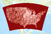
NLCD 2006 Shrub Percent Cover
Sagebrush ecosystems in North America have experienced extensive degradation since European settlement, and continue to further degrade from exotic invasive plants, greater fire frequency, intensive grazing practices, increased oil and gas development, climate change, and other factors. Remote sensing is often identified as a key information source to facilitate broad-area ecosystem-wide characterization, monitoring and analysis, however, approaches that characterize sagebrush with sufficient and accurate local detail across large areas to support ecosystem research and analysis are unavailable. We have developed a new remote sensing sagebrush ecosystem characterization approach for the state of Wyoming, U.S.A....
Accurate and consistent estimates of shrubland ecosystem components are crucial to a better understanding of ecosystems condition in arid and semiarid lands. We developed an innovative approach by integrating multiple information to quantify shrubland components as continuous field products within the National Land Cover Database (NLCD). The approach consists of five major parts: field sample collection, high-resolution mapping of shrubland components using WorldView-2 imagery and regression tree models, Landsat 8 radiometric balancing and phenological mosaicking, coarse resolution estimate of shrubland components across a large geographic extent using Landsat 8 phenological mosaics and regression tree models, and...
|

|
