Filters: Tags: society (X)
1,283 results (115ms)|
Filters
Date Range
Extensions Types
Contacts
Categories Tag Types
|

The Geographic Names Information System (GNIS) is the Federal standard for geographic nomenclature. The U.S. Geological Survey developed the GNIS for the U.S. Board on Geographic Names, a Federal inter-agency body chartered by public law to maintain uniform feature name usage throughout the Government and to promulgate standard names to the public. The GNIS is the official repository of domestic geographic names data; the official vehicle for geographic names use by all departments of the Federal Government; and the source for applying geographic names to Federal electronic and printed products of all types.
This report is one in a series developed in a collaboration between Mississippi State University and Duke University to identify opportunities to engage private landowners in the GCPO LCC in conservation and restoration activities by focusing on ecosystem service outcomes that are important to them. There are three main pieces of interrelated work: 1) a survey of landowners to identify what services are important to them and how willing they are to participate in conservation or restoration activities; 2) coarse resolution maps of the provision and where possible demand for ecosystem services in the region; and 3) a social network analysis to understand how best to engage private landowners across the region. The...
This Extension Programming describes a collaboration between Mississippi State University and Duke University to identify opportunities to engage private landowners in the GCPO LCC in conservation and restoration activities by focusing on ecosystem service outcomes that are important to them. There are three main pieces of interrelated work described in separate reports: 1) a survey of landowners to identify what services are important to them and how willing they are to participate in conservation or restoration activities; 2) coarse resolution maps of the provision and where possible demand for ecosystem services lies within the region; and 3) a social network analysis to understand how best to engage private...
This project supported a climate assessment workshop for the Northwest region. The workshop brought together regional stakeholders interested in understanding regional climate impacts and identifying strategies for adapting resources to changing conditions. The workshop also initiated a process of participatory activities and communication about the climate assessment, which helped contribute to the broader National Climate Assessment (NCA). By discussing adaptive management solutions with regional stakeholders, the workshop provided regional case study results to the NCA, such as information on local lessons and best practices. Specific workshop objectives included (1) convening and launching a process for coordinating...
Categories: Project;
Types: Map Service,
OGC WFS Layer,
OGC WMS Layer,
OGC WMS Service;
Tags: 2011,
CASC,
Climate Change,
Completed,
Northwest,
This dataset consists of 119,494 lines of data consisting of idle well fluid level depth, auxiliary measurements, and well parameters from California oil and gas wells that were reported to the California Department of Conservation, Geologic Energy Management Division (CalGEM). The dataset was provided by CalGEM in March 2018 and includes measurements made from 1976 to 2018. There are 5 sets of operator-reported data: idle well fluid level depth (N=101,734), well clean out depth (N=8,402), depth of base of fresh water (N=108,216), well top perforation depth (N=93,569), and depth reached (N=15,756). These are associated with a well, defined by API number, well number, operator name, test date, township, section,...
Categories: Data;
Tags: California,
Energy Resources,
Hydrology,
Stratigraphy,
USGS Science Data Catalog (SDC),

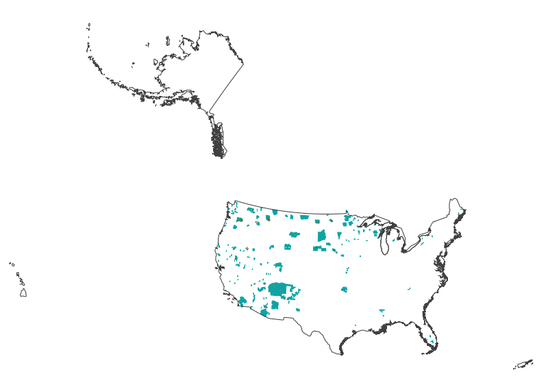
This map layer shows Indian lands of the United States. For the most part, only areas of 320 acres or more are included; some smaller areas deemed to be important or significant are also included. Federally-administered lands within a reservation are included for continuity; these may or may not be considered part of the reservation and are simply described with their feature type and the administrating Federal agency. Some established Indian lands which are larger than 320 acres are not included in this map layer because their boundaries were not available from the owning or administering agency.
The vertical land change activity focuses on the detection, analysis, and explanation of topographic change. These detection techniques include both quantitative methods, for example, using difference metrics derived from multi-temporal topographic digital elevation models (DEMs), such as, light detection and ranging (lidar), National Elevation Dataset (NED), Shuttle Radar Topography Mission (SRTM), and Interferometric Synthetic Aperture Radar (IFSAR), and qualitative methods, for example, using multi-temporal aerial photography to visualize topographic change. The geographic study area of this activity is Perry County, Kentucky. Available multi-temporal lidar, NED, SRTM, IFSAR, and other topographic elevation datasets,...

These data area an extraction of the "dominant" non-consumptive data from the New Hampshire and Southern Maine Ocean Uses Atlas. For the full dataset please visit, http://www.mpa.gov/dataanalysis/atlas_nhsm/. The New Hampshire and Southern Maine Ocean Uses Atlas Project is an innovative partnership between NOAA's Marine Protected Areas Center and the University of New Hampshire’s Coastal Response Resource Center CRCC. Inspired by and used in the March 2010 Spill of National Significance drill (SONS 2010 ), the Atlas project fills a critical information gap in response efforts and ocean management by mapping, for the first time, the full range of significant human uses of the ocean in state and federal waters off...

These data area an extraction of the "dominant" fishing data from the New Hampshire and Southern Maine Ocean Uses Atlas. For the full dataset please visit, http://www.mpa.gov/dataanalysis/atlas_nhsm/. The New Hampshire and Southern Maine Ocean Uses Atlas Project is an innovative partnership between NOAA's Marine Protected Areas Center and the University of New Hampshire’s Coastal Response Resource Center CRCC. Inspired by and used in the March 2010 Spill of National Significance drill (SONS 2010 ), the Atlas project fills a critical information gap in response efforts and ocean management by mapping, for the first time, the full range of significant human uses of the ocean in state and federal waters off of the...

Cette couche SIG rassemble tous les lieux habités de la République centrafricaine; y sont rassemblés tous les villages de tailles importantes, les chefs-lieux de sous-préfecture, les capitales régionales (capitale de préfecture) et la capitale du pays. Cette couche SIG a été obtenue à partir des relevés-terrains (prises de points GPS) par le Bureau Central de Recensement (BCR) de la République centrafricaine, réalisés en 2003. This dataset represents all of the inhabited places of the Central African Republic. They were assembled from all of the villages and important places, administrative centers, municipalities, regional capitals and the country capital. This dataset was obtained from topographic maps with GPS...
Taxing Entities consist of a group of people who organize to tax themselves for specific purposes. These may include, but are not limited to: improvement and service districts for repairing or replacing a local road; water and sewer to provide infrastructure to a rural area for water and sewer facilities; conservation districts to help protect natural resources; and fire to provide fire protection services to rural areas, etc.
Categories: Data;
Types: Downloadable;
Tags: Counties,
Tax Entities,
United States,
Wyoming,
boundaries,
Population by town, 2000. Includes total population, population by race, and differnce in total population and race population from 1990. Data collected from the US Census Bureau. Refer to US Census for updated information: http://www.census.gov.
Categories: Data;
Types: Downloadable;
Tags: Communication,
Culture,
Department of Geography,
Economy,
Environment,
The Idaho Geospatial Committee (IGC), in April 2002, recognized INSIDE Idaho as the clearinghouse for computerized geographic information for the state. INSIDE Idaho serves as the mechanism to share data, resources, technologies, and expertise to meet the increasing demands for Idaho’s geospatial information by educational institutions, government and business professionals, as well as Idaho citizens.
Categories: Data;
Types: Clearinghouse;
Tags: biota,
boundaries,
climatologyMeteorologyAtmosphere,
economy,
elevation,
Power plant locations, including coal-burning, hydroelectric, and wind generated. Data upto date as of 2000.
Categories: Data;
Types: Downloadable;
Tags: Communication,
Culture,
Department of Geography,
Economy,
Environment,
This geographic data file presents polygon data for the boundaries of the Louisiana Purchase of 1803. Its purchase became the final catalyst in launching Thomas Jefferson's long-held dream of a major expedition of the American west.
Categories: Data;
Types: Downloadable;
Tags: Expedition,
History,
Lewis and Clark,
United States,
boundaries,
A supset of geysers from an automated inventory of the names and locations of physical and cultural geographic features located throughout the United States.
This report presents information about subsistence uses of fish, wildlife, and plant resources in Lime Village, Interior Alaska. This is the first harvest assessment survey for this community since a compilation of qualitative harvest data was completed in 1983. The Alaska Department of Fish and Game Division of Subsistence conducted the project in collaboration with Stephen R. Braund & Associates as part of a multiyear, multiphase study in a region of Southwest Alaska being considered for the development of a large scale mine. The Pebble Project is a mineral deposit in an advanced exploration stage located near Frying Pan Lake, which is 100 miles south of Lime Village. The Pebble Project requires updated baseline...
This data set contains potential threat based on housing density for the Greater Sage-Grouse in the Middle Rockies Ecoregion. This data set contains reclassified ICLUS base housing density data. Data was reclassified into categorical values showing potential threats based on housing density for the Greater Sage-Grouse.
Geographic locations and general information about recreation sites on the San Juan National Forest. Locations are those reported on the Federal Real Property Profile, attributes are from the I-Web Infra user view II_REC_MAP_SYMBOLS_V.
|

|