Filters: Tags: storage (X)
59 results (6ms)|
Filters
|
The primary supposition about renewable forms of energy is that use of such resources will not result in depletion or exhaustion. While it is true that natural energy flows such as sun and wind are not directly subject to degradation by use, there may still be indirect limitations on renewability. The exploitation of natural energy flows may require that systems of nonrenewable "support" resources be used to capture, store, and convert natural energy into useful forms. Poor resource management practices that degrade the support resources may therefore, in effect, endanger renewability. Biomass is an illustrative case of a renewable energy resource with nonrenewable support components. The soil and water management...
The primary supposition about renewable forms of energy is that use of such resources will not result in depletion or exhaustion. While it is true that natural energy flows such as sun and wind are not directly subject to degradation by use, there may still be indirect limitations on renewability. The exploitation of natural energy flows may require that systems of nonrenewable "support" resources be used to capture, store, and convert natural energy into useful forms. Poor resource management practices that degrade the support resources may therefore, in effect, endanger renewability. Biomass is an illustrative case of a renewable energy resource with nonrenewable support components. The soil and water management...
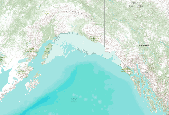
This dataset represents the soil water storage capacity (AWS in mm at 0.25 m depth) from SSURGO and STATSGO soil descriptions for soil map units in the state of southern Alaska that lie within the North Pacific Landscape Conservation Cooperative. Available Water Storage 0-25 cm - Weighted Average (centimeters). Available water storage (AWS). The volume of water that the soil, to a depth of 25 centimeters, can store that is available to plants. It is reported as the weighted average of all components in the map unit, and is expressed as centimeters of water. AWS is calculated from AWC (available water capacity) which is commonly estimated as the difference between the water contents at 1/10 or 1/3 bar (field capacity)...

This dataset represents the soil water storage capacity (AWS in mm at 0.5 m depth) from SSURGO and STATSGO soil descriptions for soil map units in the state of southern Alaska that lie within the North Pacific Landscape Conservation Cooperative. Available Water Storage 0-50 cm - Weighted Average (centimeters). Available water storage (AWS). The volume of water that the soil, to a depth of 50 centimeters, can store that is available to plants. It is reported as the weighted average of all components in the map unit, and is expressed as centimeters of water. AWS is calculated from AWC (available water capacity) which is commonly estimated as the difference between the water contents at 1/10 or 1/3 bar (field capacity)...

This dataset represents the soil water storage capacity (AWS in mm at 0.5 m depth) from SSURGO and STATSGO soil descriptions for soil map units in the state of northern California that lie within the North Pacific Landscape Conservation Cooperative. Available Water Storage 0-50 cm - Weighted Average (centimeters). Available water storage (AWS). The volume of water that the soil, to a depth of 50 centimeters, can store that is available to plants. It is reported as the weighted average of all components in the map unit, and is expressed as centimeters of water. AWS is calculated from AWC (available water capacity) which is commonly estimated as the difference between the water contents at 1/10 or 1/3 bar (field...

This dataset represents the soil water storage capacity (AWS in mm at 0.5 m depth) from SSURGO and STATSGO soil descriptions for soil map units in the state of western Oregon that lie within the North Pacific Landscape Conservation Cooperative. Available Water Storage 0-50 cm - Weighted Average (centimeters). Available water storage (AWS). The volume of water that the soil, to a depth of 50 centimeters, can store that is available to plants. It is reported as the weighted average of all components in the map unit, and is expressed as centimeters of water. AWS is calculated from AWC (available water capacity) which is commonly estimated as the difference between the water contents at 1/10 or 1/3 bar (field capacity)...

This dataset covers the southern half of the Southern Rockies Landscape Conservation Cooperative. It was aggregated and converted to raster by Conservation Biology Institute as part of a soil vulnerability study funded in part by the Southern Rockies LCC. The soil data come from a digital soil survey, the most detailed level of soil geographic data developed by the National Cooperative Soil Survey. The information was prepared by digitizing maps, by compiling information onto a planimetric correct base and digitizing, or by revising digitized maps using remotely sensed and other information. This data set consists of georeferenced digital map data and computerized attribute data. The map data are in a soil survey...

This dataset covers the southern half of the Southern Rockies Landscape Conservation Cooperative. It was aggregated and converted to raster by Conservation Biology Institute as part of a soil vulnerability study funded in part by the Southern Rockies LCC. The soil data come from a digital soil survey, the most detailed level of soil geographic data developed by the National Cooperative Soil Survey. The information was prepared by digitizing maps, by compiling information onto a planimetric correct base and digitizing, or by revising digitized maps using remotely sensed and other information. This data set consists of georeferenced digital map data and computerized attribute data. The map data are in a soil survey...
This map service is an information surface representing the amount of available water storage (AWS) that is available to plants in the top 50cm (1.64 Feet) of soil. Available Water Storage (AWS) is expressed as centimeters of water, reported as the average of all components in the map unit. AWS is calculated from AWC (Available Water Capacity) which is commonly estimated as the difference between the water contents at 1/10 or 1/3 bar (field capacity) and 15 bars (permanent wilting point) tension, and adjusted for salinity and fragments. Available Water Storage (AWS) surfaces are available through arcgis.com for four soil depths, 25, 50, 100, and 150 centimeters from the surface of the soil. They are available...
Categories: Data;
Types: ArcGIS REST Map Service,
Map Service;
Tags: Cultivation,
moisture,
soil,
storage,
vegetables,
A bathymetric survey of DeQueen Lake, Sevier County, Arkansas was conducted in July, 2015, by the Lower Mississippi-Gulf Water Science Center of the U.S. Geological Survey (USGS) using methodologies for multi-beam sonar surveys similar to those described by Lee, K.G. (2013) and Huizinga (2016). Data from the bathymetric survey were merged with data from an aerial LiDAR survey conducted in March, 2008 for the U.S. Army Corps of Engineers, Little Rock District and from the combined XYZ dataset, a digital terrain model (DTM) of the lakebed below flood pool elevation 474 feet above the North American Vertical Datum of 1988 (NAVD88) was created. Products derived from the DTM include a digital elevation model (DEM) in...
Available Water Storage (AWS). The volume of water that the soil, to a depth of 100 cm, can store that is available to plants. It is reported as the weighted average of all components in the map unit, and is expressed in cm of water. This map is made from NRCS SSURGO data table MUAGGATT, field AWS0100WTA. Note that the lines show connectivity a Available Water Storage (AWS). The volume of water that the soil, to a depth of 100 cm, can store that is available to plants. It is reported as the weighted average of all components in the map unit, and is expressed in cm of water. This map is made from NRCS SSURGO data table MUAGGATT, field AWS0100WTA. Note that the lines show connectivity and flow even through...
Categories: Data;
Types: ArcGIS REST Map Service,
Map Service;
Tags: AWS,
Hydrology,
SSURGO,
Soils,
storage,

This dataset represents the soil water storage capacity (AWS in mm at 0.25 m depth) from SSURGO and STATSGO soil descriptions for soil map units in the state of southern Alaska that lie within the North Pacific Landscape Conservation Cooperative. Available Water Storage 0-25 cm - Weighted Average (centimeters). Available water storage (AWS). The volume of water that the soil, to a depth of 25 centimeters, can store that is available to plants. It is reported as the weighted average of all components in the map unit, and is expressed as centimeters of water. AWS is calculated from AWC (available water capacity) which is commonly estimated as the difference between the water contents at 1/10 or 1/3 bar (field capacity)...

This dataset covers the northern half of the Southern Rockies Landscape Conservation Cooperative. It was aggregated and converted to raster by Conservation Biology Institute as part of a soil vulnerability study funded in part by the Southern Rockies LCC. The soil data come from a digital soil survey, the most detailed level of soil geographic data developed by the National Cooperative Soil Survey. The information was prepared by digitizing maps, by compiling information onto a planimetric correct base and digitizing, or by revising digitized maps using remotely sensed and other information. This data set consists of georeferenced digital map data and computerized attribute data. The map data are in a soil survey...
As wind power development continues at a rapid pace in the United States, there is increasing interest in its economic impacts. Because good wind resources are typically far from electrical loads, wind power plants are often built in rural areas. The economic impacts that arise from building and operating a power plant can be significant but are often not considered by public utility commission processes. Although these impacts vary from state to state because of the differences in wind resource and state infrastructure, economic development from new wind provides important impacts from necessary power system expansion and should play a more prominent role in decision-making processes. This paper uses the National...
Categories: Publication;
Types: Citation;
Tags: CO2,
Economic,
evaluation,
options,
sink enhancement,
Plug-in hybrid electric vehicles (PHEVs) have the potential to be an economic means of reducing direct (or tailpipe) carbon dioxide (CO2) emissions from the transportation sector However, without a Climate policy that places a limit on CO2 emissions from the electric generation sector, the net impact of widespread deployment of PFIEVs on overall US CO2 emissions is not as clear. A comprehensive analysis must consider jointly the transportation and electricity sectors. along with feedbacks to the rest of the energy system. In this paper, we use the Pacific Northwest National Laboratory's MiniCAM model to perform an integrated economic analysis of the penetration of PFIEVs and the resulting impact oil total U.S. CO2...
Categories: Publication;
Types: Citation;
Tags: Carbon dioxide,
United States,
capture,
carbon dioxide,
climate policy,
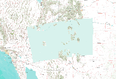
This dataset covers the southern half of the Southern Rockies Landscape Conservation Cooperative. It was aggregated and converted to raster by Conservation Biology Institute as part of a soil vulnerability study funded in part by the Southern Rockies LCC. The soil data come from a digital soil survey, the most detailed level of soil geographic data developed by the National Cooperative Soil Survey. The information was prepared by digitizing maps, by compiling information onto a planimetric correct base and digitizing, or by revising digitized maps using remotely sensed and other information. This data set consists of georeferenced digital map data and computerized attribute data. The map data are in a soil survey...

This dataset represents the soil water storage capacity (AWS in mm at 0.25 m depth) from SSURGO and STATSGO soil descriptions for soil map units in the state of northern California that lie within the North Pacific Landscape Conservation Cooperative. Available Water Storage 0-25 cm - Weighted Average (centimeters). Available water storage (AWS). The volume of water that the soil, to a depth of 25 centimeters, can store that is available to plants. It is reported as the weighted average of all components in the map unit, and is expressed as centimeters of water. AWS is calculated from AWC (available water capacity) which is commonly estimated as the difference between the water contents at 1/10 or 1/3 bar (field...

This dataset represents the soil water storage capacity (AWS in mm at 0.5 m depth) from SSURGO and STATSGO soil descriptions for soil map units in the state of southern Alaska that lie within the North Pacific Landscape Conservation Cooperative. Available Water Storage 0-50 cm - Weighted Average (centimeters). Available water storage (AWS). The volume of water that the soil, to a depth of 50 centimeters, can store that is available to plants. It is reported as the weighted average of all components in the map unit, and is expressed as centimeters of water. AWS is calculated from AWC (available water capacity) which is commonly estimated as the difference between the water contents at 1/10 or 1/3 bar (field capacity)...
One of the first government-sponsored demands for integrated assessment to support decision making in the United States is embodied in the National Environmental Policy Act of 1969 (NEPA). Over the past 25 years, Oak Ridge National Laboratory (ORNL) has supported federal agencies’ in evaluating health and environmental impacts as required by NEPA. Many of ORNL’s efforts have focused on complex, programmatic assessments that break new ground and require and integrate expertise from a wide range of technical disciplines. Examples of ORNL projects that illustrate the use of integrated assessment approaches include environmental documentation for: (1) the Department of the Army’s Chemical Stockpile Disposal Program,...
Categories: Publication;
Types: Citation;
Tags: Lessons,
analogues,
carbon dioxide,
formations,
geological,

This dataset represents the soil water storage capacity (AWS in mm at 1.0 m depth) from SSURGO and STATSGO soil descriptions for soil map units in the state of western Oregon that lie within the North Pacific Landscape Conservation Cooperative. Available Water Storage 0-100 cm - Weighted Average (centimeters). Available water storage (AWS). The volume of water that the soil, to a depth of 100 centimeters, can store that is available to plants. It is reported as the weighted average of all components in the map unit, and is expressed as centimeters of water. AWS is calculated from AWC (available water capacity) which is commonly estimated as the difference between the water contents at 1/10 or 1/3 bar (field capacity)...
|

|
