Filters
Date Range
Extensions
Types
Contacts
Categories
Tag Types
Tag Schemes
|

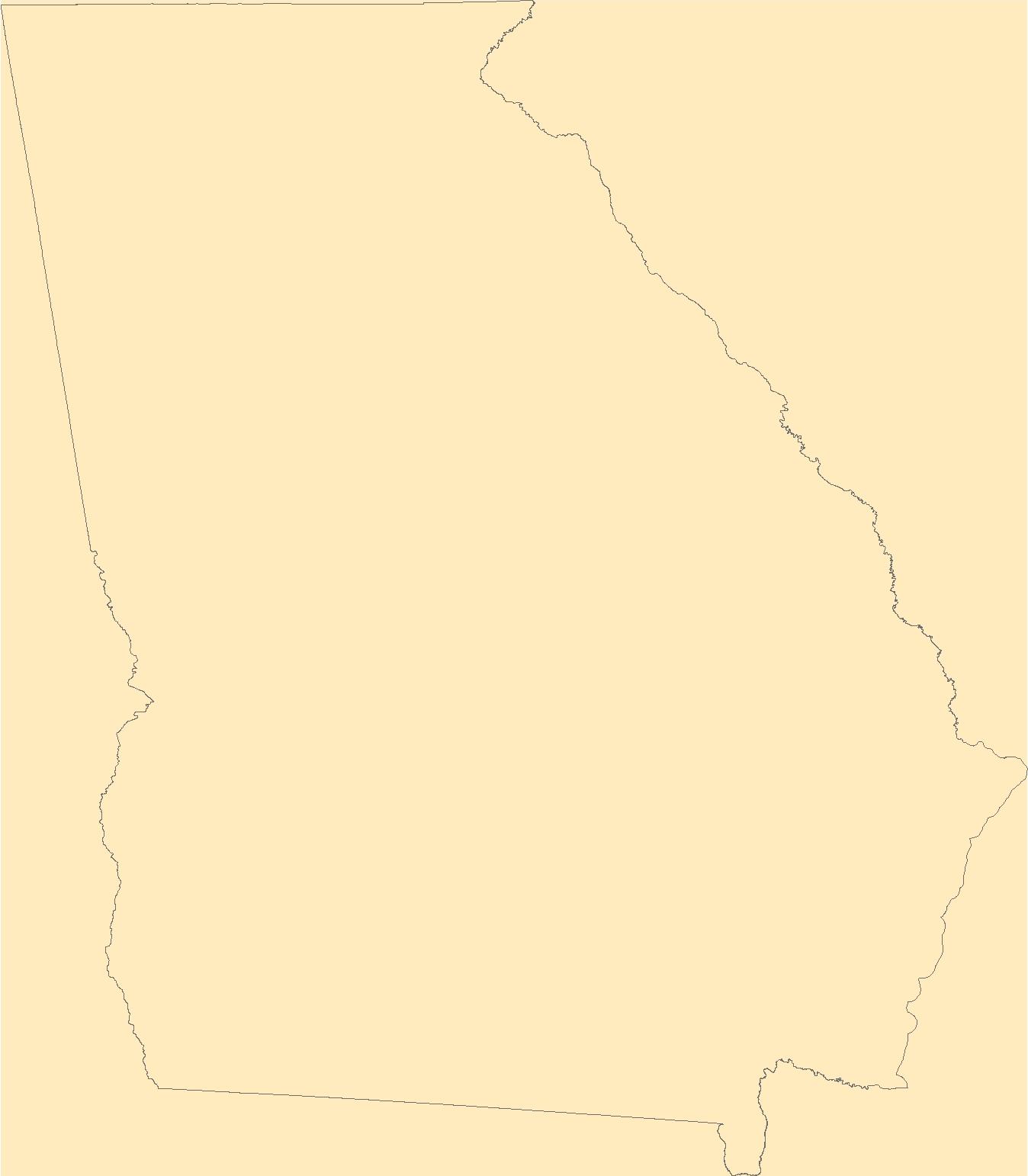
Line feature class showing powerlines in the COP 2014 study area
Types: Downloadable;
Tags: BLM,
Bureau of Land Management,
CBI,
COP 2014,
Colorado Plateau, All tags...
DOI,
DQR,
Facility,
Geospatial,
REA,
Rapid Ecoregional Assessment,
climate stress logic,
economy,
ecoregion,
habitat,
structure, Fewer tags

Point locations are digitized from actual community locations based on satellite imagery. The footprint feature class was produced by digitally tracing the built areas from satellite imagery. This was done to represent the actual footprints more accurately than would have been possible from the U.S. Census Bureau’s Topologically Integrated Geographic Encoding and Referencing (TIGER) files. TIGER files are geospatial files with information on several political and administrative units. These shapefiles include polygon boundaries of geographic areas and features, linear features including roads and hydrography, and point features. The communities in Alaska were released as a polygon shapefile, with each community’s...
Types: Downloadable;
Tags: BLM,
Bureau of Land Management,
DOI,
Facility,
Geospatial, All tags...
NOS 2012,
North Slope,
REA,
Rapid Ecoregional Assessment,
human dimension,
society,
structure, Fewer tags

Some of the NOS rasters intentionally do not align or have the same extent. These rasters were not snapped to a common raster per the authors' discretion. Please review selected rasters prior to use. These varying alignments are a result of the use of differing source data sets and all products derived from them. We recommend that users snap or align rasters as best suits their own projects. - As a final measure of potential human impacts to the ecoregions, the impacts of current anthropogenic development are summarized in a 60 x 60 m grid by the landscape condition model (LCM). The LCM weights the relative influence of different types of human footprints based on factors like permanence, nature of the activity,...
Types: Downloadable;
Tags: BLM,
Bureau of Land Management,
DOI,
Disturbance,
Geospatial, All tags...
NOS 2012,
North Slope,
REA,
Rapid Ecoregional Assessment,
Structure,
economy,
environment,
human dimension, Fewer tags

Road densities derived from the TIGER data were analyzed to determine the relationship between road density and Bald eagle potential suitable habitat. The quality of a HUC in relation to road density was defined as good (3), fair (2), or poor (1). The score indicates the threat level for each attribute. A low score indicates a low threat, a medium score indicates a medium threat, and a high score indicates a high threat to the species. The values for each score were characterized in relation to road density by >10 km/km2 = good, 5-10 km/km2 = fair, and 2 = poor.
Types: Downloadable;
Tags: BLM,
Bald Eagle,
Bureau of Land Management,
DOI,
Geospatial, All tags...
NGB 2011,
Northern Great Basin,
Northern Great Basin Ecoregion,
REA,
Rapid Ecoregional Assessment,
Road Density,
Wildlife,
biota,
structure,
transportation, Fewer tags

Some of the CYR rasters intentionally do not align or have the same extent. These rasters were not snapped to a common raster per the authors' discretion. Please review selected rasters prior to use. These varying alignments are a result of the use of differing source data sets and all products derived from them. We recommend that users snap or align rasters as best suits their own projects. - The Cumulative Impacts analysis included the primary, measurable Change Agent variables that are likely to have the largest and most direct impact in the Central Yukon study area in the future. However, in order to “sum” the impacts, thresholds for meaningful change had to be defined for each variable. Cumulative Impacts are...
Types: Downloadable;
Tags: BLM,
Bureau of Land Management,
CYR 2013,
Central Yukon,
DOI, All tags...
Disturbance,
Geospatial,
REA,
Rapid Ecoregional Assessment,
Structure,
Wildlife,
biota,
environment,
human dimension, Fewer tags

4KM grid cell reporting units for the Colorado Plateau Ecoregion Used as analytical reporting unit for terrestrial conservation elements and terrestrial intactness.
Types: Downloadable;
Tags: BLM,
Bureau of Land Management,
COP 2010,
Colorado Plateau,
DOI, All tags...
Disturbance,
Framework,
Geospatial,
REA,
Rapid Ecoregional Assessment,
boundaries,
structure, Fewer tags

Some of the CYR rasters intentionally do not align or have the same extent. These rasters were not snapped to a common raster per the authors' discretion. Please review selected rasters prior to use. These varying alignments are a result of the use of differing source data sets and all products derived from them. We recommend that users snap or align rasters as best suits their own projects. - As a final measure of potential human impacts to the ecoregions, the impacts of current anthropogenic development are summarized in a 60 x 60 m grid by the landscape condition model (LCM). The LCM weighs the relative influence of different types of human footprints based on factors like permanence, nature of the activity,...
Types: Downloadable;
Tags: BLM,
Bureau of Land Management,
CYR 2013,
Central Yukon,
DOI, All tags...
Disturbance,
Geospatial,
REA,
Rapid Ecoregional Assessment,
Structure,
Wildlife,
biota,
environment,
human dimension, Fewer tags
Geospatial data includes structures and other selected map features.
Tags: Adair,
Allen,
Anderson,
Ballard,
Barren, All tags...
Bath,
Bell,
Boone,
Bourbon,
Boyd,
Boyle,
Bracken,
Breathitt,
Breckinridge,
Bullitt,
Butler,
Caldwell,
Calloway,
Campbell,
Campground,
Carlisle,
Carroll,
Carter,
Casey,
Christian,
Clark,
Clay,
Clinton,
College / University,
Courthouse,
Crittenden,
Cumberland,
Daviess,
Downloadable Data,
Edmonson,
Elliott,
Esri Shapefile nan,
Estill,
Fayette,
Fire Station/ EMS Station,
Fleming,
Floyd,
Franklin,
Fulton,
Gallatin,
Garrard,
Grant,
Graves,
Grayson,
Green,
Greenup,
Hancock,
Hardin,
Harlan,
Harrison,
Hart,
Henderson,
Henry,
Hickman,
Hopkins,
Hospital/Medical Center,
Information Center,
Jackson,
Jefferson,
Jessamine,
Johnson,
KY,
Kenton,
Kentucky,
Knott,
Knox,
Larue,
Laurel,
Law Enforcement,
Lawrence,
Lee,
Leslie,
Letcher,
Lewis,
Lincoln,
Livingston,
Logan,
Lyon,
Madison,
Magoffin,
Marion,
Marshall,
Martin,
Mason,
McCracken,
McCreary,
McLean,
Meade,
Menifee,
Mercer,
Metcalfe,
Monroe,
Montgomery,
Morgan,
Muhlenberg,
National Structures Dataset (NSD),
National Structures Dataset (NSD),
Nelson,
Nicholas,
Ohio,
Oldham,
Owen,
Owsley,
Pendleton,
Perry,
Pike,
Post Office,
Powell,
Prison/ Correctional Facility,
Pulaski,
Robertson,
Rockcastle,
Rowan,
Russell,
School,
School:Elementary,
School:High School,
School:Middle School,
Scott,
Shapefile,
Shelby,
Simpson,
Spencer,
State,
State,
State Capitol,
Structures,
Taylor,
Technical School,
Todd,
Town Hall,
Trade School,
Trailhead,
Trigg,
Trimble,
US,
Union,
United States,
Visitor Center,
Warren,
Washington,
Wayne,
Webster,
Whitley,
Wolfe,
Woodford,
structure, Fewer tags
Geospatial data includes structures and other selected map features.
Tags: Allen,
Anderson,
Atchison,
Barber,
Barton, All tags...
Bourbon,
Brown,
Butler,
Campground,
Chase,
Chautauqua,
Cherokee,
Cheyenne,
Clark,
Clay,
Cloud,
Coffey,
College / University,
Comanche,
Courthouse,
Cowley,
Crawford,
Decatur,
Dickinson,
Doniphan,
Douglas,
Downloadable Data,
Edwards,
Elk,
Ellis,
Ellsworth,
Esri File GeoDatabase 10,
FileGDB,
Finney,
Fire Station/ EMS Station,
Ford,
Franklin,
Geary,
Gove,
Graham,
Grant,
Gray,
Greeley,
Greenwood,
Hamilton,
Harper,
Harvey,
Haskell,
Hodgeman,
Hospital/Medical Center,
Information Center,
Jackson,
Jefferson,
Jewell,
Johnson,
KS,
Kansas,
Kearny,
Kingman,
Kiowa,
Labette,
Lane,
Law Enforcement,
Leavenworth,
Lincoln,
Linn,
Logan,
Lyon,
Marion,
Marshall,
McPherson,
Meade,
Miami,
Mitchell,
Montgomery,
Morris,
Morton,
National Structures Dataset (NSD),
National Structures Dataset (NSD),
Nemaha,
Neosho,
Ness,
Norton,
Osage,
Osborne,
Ottawa,
Pawnee,
Phillips,
Post Office,
Pottawatomie,
Pratt,
Prison/ Correctional Facility,
Rawlins,
Reno,
Republic,
Rice,
Riley,
Rooks,
Rush,
Russell,
Saline,
School,
School:Elementary,
School:High School,
School:Middle School,
Scott,
Sedgwick,
Seward,
Shawnee,
Sheridan,
Sherman,
Smith,
Stafford,
Stanton,
State,
State,
State Capitol,
Stevens,
Structures,
Sumner,
Technical School,
Thomas,
Town Hall,
Trade School,
Trailhead,
Trego,
US,
United States,
Visitor Center,
Wabaunsee,
Wallace,
Washington,
Wichita,
Wilson,
Woodson,
Wyandotte,
structure, Fewer tags
Geospatial data includes structures and other selected map features.
Tags: Adams,
Barnes,
Benson,
Billings,
Bottineau, All tags...
Bowman,
Burke,
Burleigh,
Campground,
Cass,
Cavalier,
College / University,
Courthouse,
Dickey,
Divide,
Downloadable Data,
Dunn,
Eddy,
Emmons,
Esri File GeoDatabase 10,
FileGDB,
Fire Station/ EMS Station,
Foster,
Golden Valley,
Grand Forks,
Grant,
Griggs,
Hettinger,
Hospital/Medical Center,
Information Center,
Kidder,
LaMoure,
Law Enforcement,
Logan,
McHenry,
McIntosh,
McKenzie,
McLean,
Mercer,
Morton,
Mountrail,
ND,
National Structures Dataset (NSD),
National Structures Dataset (NSD),
Nelson,
North Dakota,
Oliver,
Pembina,
Pierce,
Post Office,
Prison/ Correctional Facility,
Ramsey,
Ransom,
Renville,
Richland,
Rolette,
Sargent,
School,
School:Elementary,
School:High School,
School:Middle School,
Sheridan,
Sioux,
Slope,
Stark,
State,
State,
State Capitol,
Steele,
Structures,
Stutsman,
Technical School,
Town Hall,
Towner,
Trade School,
Trailhead,
Traill,
US,
United States,
Visitor Center,
Walsh,
Ward,
Wells,
Williams,
structure, Fewer tags
Geospatial data includes structures and other selected map features.
Tags: Alamance,
Alexander,
Alleghany,
Anson,
Ashe, All tags...
Avery,
Beaufort,
Bertie,
Bladen,
Brunswick,
Buncombe,
Burke,
Cabarrus,
Caldwell,
Camden,
Campground,
Carteret,
Caswell,
Catawba,
Chatham,
Cherokee,
Chowan,
Clay,
Cleveland,
College / University,
Columbus,
Courthouse,
Craven,
Cumberland,
Currituck,
Dare,
Davidson,
Davie,
Downloadable Data,
Duplin,
Durham,
Edgecombe,
Esri Shapefile nan,
Fire Station/ EMS Station,
Forsyth,
Franklin,
Gaston,
Gates,
Graham,
Granville,
Greene,
Guilford,
Halifax,
Harnett,
Haywood,
Henderson,
Hertford,
Hoke,
Hospital/Medical Center,
Hyde,
Information Center,
Iredell,
Jackson,
Johnston,
Jones,
Law Enforcement,
Lee,
Lenoir,
Lincoln,
Macon,
Madison,
Martin,
McDowell,
Mecklenburg,
Mitchell,
Montgomery,
Moore,
NC,
Nash,
National Structures Dataset (NSD),
National Structures Dataset (NSD),
New Hanover,
North Carolina,
Northampton,
Onslow,
Orange,
Pamlico,
Pasquotank,
Pender,
Perquimans,
Person,
Pitt,
Polk,
Post Office,
Prison/ Correctional Facility,
Randolph,
Richmond,
Robeson,
Rockingham,
Rowan,
Rutherford,
Sampson,
School,
School:Elementary,
School:High School,
School:Middle School,
Scotland,
Shapefile,
Stanly,
State,
State,
State Capitol,
Stokes,
Structures,
Surry,
Swain,
Technical School,
Town Hall,
Trade School,
Trailhead,
Transylvania,
Tyrrell,
US,
Union,
United States,
Vance,
Visitor Center,
Wake,
Warren,
Washington,
Watauga,
Wayne,
Wilkes,
Wilson,
Yadkin,
Yancey,
structure, Fewer tags
Geospatial data includes structures and other selected map features.
Tags: Beaverhead,
Big Horn,
Blaine,
Broadwater,
Campground, All tags...
Carbon,
Carter,
Cascade,
Chouteau,
College / University,
Courthouse,
Custer,
Daniels,
Dawson,
Deer Lodge,
Downloadable Data,
Esri File GeoDatabase 10,
Fallon,
Fergus,
FileGDB,
Fire Station/ EMS Station,
Flathead,
Gallatin,
Garfield,
Glacier,
Golden Valley,
Granite,
Hill,
Hospital/Medical Center,
Information Center,
Jefferson,
Judith Basin,
Lake,
Law Enforcement,
Lewis and Clark,
Liberty,
Lincoln,
MT,
Madison,
McCone,
Meagher,
Mineral,
Missoula,
Montana,
Musselshell,
National Structures Dataset (NSD),
National Structures Dataset (NSD),
Park,
Petroleum,
Phillips,
Pondera,
Post Office,
Powder River,
Powell,
Prairie,
Prison/ Correctional Facility,
Ravalli,
Richland,
Roosevelt,
Rosebud,
Sanders,
School,
School:Elementary,
School:High School,
School:Middle School,
Sheridan,
Silver Bow,
State,
State,
State Capitol,
Stillwater,
Structures,
Sweet Grass,
Technical School,
Teton,
Toole,
Town Hall,
Trade School,
Trailhead,
Treasure,
US,
United States,
Valley,
Visitor Center,
Wheatland,
Wibaux,
Yellowstone,
structure, Fewer tags
Geospatial data includes structures and other selected map features.
Tags: Adams,
Antelope,
Arthur,
Banner,
Blaine, All tags...
Boone,
Box Butte,
Boyd,
Brown,
Buffalo,
Burt,
Butler,
Campground,
Cass,
Cedar,
Chase,
Cherry,
Cheyenne,
Clay,
Colfax,
College / University,
Courthouse,
Cuming,
Custer,
Dakota,
Dawes,
Dawson,
Deuel,
Dixon,
Dodge,
Douglas,
Downloadable Data,
Dundy,
Esri Shapefile nan,
Fillmore,
Fire Station/ EMS Station,
Franklin,
Frontier,
Furnas,
Gage,
Garden,
Garfield,
Gosper,
Grant,
Greeley,
Hall,
Hamilton,
Harlan,
Hayes,
Hitchcock,
Holt,
Hooker,
Hospital/Medical Center,
Howard,
Information Center,
Jefferson,
Johnson,
Kearney,
Keith,
Keya Paha,
Kimball,
Knox,
Lancaster,
Law Enforcement,
Lincoln,
Logan,
Loup,
Madison,
McPherson,
Merrick,
Morrill,
NE,
Nance,
National Structures Dataset (NSD),
National Structures Dataset (NSD),
Nebraska,
Nemaha,
Nuckolls,
Otoe,
Pawnee,
Perkins,
Phelps,
Pierce,
Platte,
Polk,
Post Office,
Prison/ Correctional Facility,
Red Willow,
Richardson,
Rock,
Saline,
Sarpy,
Saunders,
School,
School:Elementary,
School:High School,
School:Middle School,
Scotts Bluff,
Seward,
Shapefile,
Sheridan,
Sherman,
Sioux,
Stanton,
State,
State,
State Capitol,
Structures,
Technical School,
Thayer,
Thomas,
Thurston,
Town Hall,
Trade School,
Trailhead,
US,
United States,
Valley,
Visitor Center,
Washington,
Wayne,
Webster,
Wheeler,
York,
structure, Fewer tags
Geospatial data includes structures and other selected map features.
Tags: Barnstable,
Berkshire,
Bristol,
Campground,
College / University, All tags...
Courthouse,
Downloadable Data,
Dukes,
Esri Shapefile nan,
Essex,
Fire Station/ EMS Station,
Franklin,
Hampden,
Hampshire,
Hospital/Medical Center,
Information Center,
Law Enforcement,
MA,
Massachusetts,
Middlesex,
Nantucket,
National Structures Dataset (NSD),
National Structures Dataset (NSD),
Norfolk,
Plymouth,
Post Office,
Prison/ Correctional Facility,
School,
School:Elementary,
School:High School,
School:Middle School,
Shapefile,
State,
State,
State Capitol,
Structures,
Suffolk,
Technical School,
Town Hall,
Trade School,
Trailhead,
US,
United States,
Visitor Center,
Worcester,
structure, Fewer tags
Geospatial data includes structures and other selected map features.
Tags: Baker,
Benton,
Campground,
Clackamas,
Clatsop, All tags...
College / University,
Columbia,
Coos,
Courthouse,
Crook,
Curry,
Deschutes,
Douglas,
Downloadable Data,
Esri File GeoDatabase 10,
FileGDB,
Fire Station/ EMS Station,
Gilliam,
Grant,
Harney,
Hood River,
Hospital/Medical Center,
Information Center,
Jackson,
Jefferson,
Josephine,
Klamath,
Lake,
Lane,
Law Enforcement,
Lincoln,
Linn,
Malheur,
Marion,
Morrow,
Multnomah,
National Structures Dataset (NSD),
National Structures Dataset (NSD),
OR,
Oregon,
Polk,
Post Office,
Prison/ Correctional Facility,
School,
School:Elementary,
School:High School,
School:Middle School,
Sherman,
State,
State,
State Capitol,
Structures,
Technical School,
Tillamook,
Town Hall,
Trade School,
Trailhead,
US,
Umatilla,
Union,
United States,
Visitor Center,
Wallowa,
Wasco,
Washington,
Wheeler,
Yamhill,
structure, Fewer tags
Geospatial data includes structures and other selected map features.
Tags: Bernalillo,
Campground,
Catron,
Chaves,
Cibola, All tags...
Colfax,
College / University,
Courthouse,
Curry,
De Baca,
Downloadable Data,
Doña Ana,
Eddy,
Esri File GeoDatabase 10,
FileGDB,
Fire Station/ EMS Station,
Grant,
Guadalupe,
Harding,
Hidalgo,
Hospital/Medical Center,
Information Center,
Law Enforcement,
Lea,
Lincoln,
Los Alamos,
Luna,
McKinley,
Mora,
NM,
National Structures Dataset (NSD),
National Structures Dataset (NSD),
New Mexico,
Otero,
Post Office,
Prison/ Correctional Facility,
Quay,
Rio Arriba,
Roosevelt,
San Juan,
San Miguel,
Sandoval,
Santa Fe,
School,
School:Elementary,
School:High School,
School:Middle School,
Sierra,
Socorro,
State,
State,
State Capitol,
Structures,
Taos,
Technical School,
Torrance,
Town Hall,
Trade School,
Trailhead,
US,
Union,
United States,
Valencia,
Visitor Center,
structure, Fewer tags
Geospatial data includes structures and other selected map features.
Tags: Campground,
College / University,
Courthouse,
Downloadable Data,
Esri Shapefile nan, All tags...
Fire Station/ EMS Station,
HI,
Hawaii,
Hawaii,
Honolulu,
Hospital/Medical Center,
Information Center,
Kalawao,
Kauai,
Law Enforcement,
Maui,
National Structures Dataset (NSD),
National Structures Dataset (NSD),
Post Office,
Prison/ Correctional Facility,
School,
School:Elementary,
School:High School,
School:Middle School,
Shapefile,
State,
State,
State Capitol,
Structures,
Technical School,
Town Hall,
Trade School,
Trailhead,
US,
United States,
Visitor Center,
structure, Fewer tags
Geospatial data includes structures and other selected map features.
Tags: Alachua,
Baker,
Bay,
Bradford,
Brevard, All tags...
Broward,
Calhoun,
Campground,
Charlotte,
Citrus,
Clay,
College / University,
Collier,
Columbia,
Courthouse,
DeSoto,
Dixie,
Downloadable Data,
Duval,
Escambia,
Esri File GeoDatabase 10,
FL,
FileGDB,
Fire Station/ EMS Station,
Flagler,
Florida,
Franklin,
Gadsden,
Gilchrist,
Glades,
Gulf,
Hamilton,
Hardee,
Hendry,
Hernando,
Highlands,
Hillsborough,
Holmes,
Hospital/Medical Center,
Indian River,
Information Center,
Jackson,
Jefferson,
Lafayette,
Lake,
Law Enforcement,
Lee,
Leon,
Levy,
Liberty,
Madison,
Manatee,
Marion,
Martin,
Miami-Dade,
Monroe,
Nassau,
National Structures Dataset (NSD),
National Structures Dataset (NSD),
Okaloosa,
Okeechobee,
Orange,
Osceola,
Palm Beach,
Pasco,
Pinellas,
Polk,
Post Office,
Prison/ Correctional Facility,
Putnam,
Santa Rosa,
Sarasota,
School,
School:Elementary,
School:High School,
School:Middle School,
Seminole,
St. Johns,
St. Lucie,
State,
State,
State Capitol,
Structures,
Sumter,
Suwannee,
Taylor,
Technical School,
Town Hall,
Trade School,
Trailhead,
US,
Union,
United States,
Visitor Center,
Volusia,
Wakulla,
Walton,
Washington,
structure, Fewer tags
Geospatial data includes structures and other selected map features.
Tags: Abbeville,
Aiken,
Allendale,
Anderson,
Bamberg, All tags...
Barnwell,
Beaufort,
Berkeley,
Calhoun,
Campground,
Charleston,
Cherokee,
Chester,
Chesterfield,
Clarendon,
College / University,
Colleton,
Courthouse,
Darlington,
Dillon,
Dorchester,
Downloadable Data,
Edgefield,
Esri File GeoDatabase 10,
Fairfield,
FileGDB,
Fire Station/ EMS Station,
Florence,
Georgetown,
Greenville,
Greenwood,
Hampton,
Horry,
Hospital/Medical Center,
Information Center,
Jasper,
Kershaw,
Lancaster,
Laurens,
Law Enforcement,
Lee,
Lexington,
Marion,
Marlboro,
McCormick,
National Structures Dataset (NSD),
National Structures Dataset (NSD),
Newberry,
Oconee,
Orangeburg,
Pickens,
Post Office,
Prison/ Correctional Facility,
Richland,
SC,
Saluda,
School,
School:Elementary,
School:High School,
School:Middle School,
South Carolina,
Spartanburg,
State,
State,
State Capitol,
Structures,
Sumter,
Technical School,
Town Hall,
Trade School,
Trailhead,
US,
Union,
United States,
Visitor Center,
Williamsburg,
York,
structure, Fewer tags
The Geographic Names Information System (GNIS) is the Federal standard for geographic nomenclature. The U.S. Geological Survey developed the GNIS for the U.S. Board on Geographic Names, a Federal inter-agency body chartered by public law to maintain uniform feature name usage throughout the Government and to promulgate standard names to the public. The GNIS is the official repository of domestic geographic names data; the official vehicle for geographic names use by all departments of the Federal Government; and the source for applying geographic names to Federal electronic and printed products of all types.
Tags: Antarctica,
Antarctica,
Appling,
Atkinson,
BGN, All tags...
Bacon,
Baker,
Baldwin,
Banks,
Barrow,
Bartow,
Ben Hill,
Berrien,
Bibb,
Bleckley,
Board on Geographic Names,
Borough,
Brantley,
Brooks,
Bryan,
Bulloch,
Burke,
Butts,
Calhoun,
Camden,
Candler,
Carroll,
Catoosa,
Census Area,
Charlton,
Chatham,
Chattahoochee,
Chattooga,
Cherokee,
Clarke,
Clay,
Clayton,
Clinch,
Cobb,
Coffee,
Colquitt,
Columbia,
Commonwealth,
Cook,
County,
Coweta,
Crawford,
Crisp,
Dade,
Dawson,
DeKalb,
Decatur,
District,
Dodge,
Dooly,
Dougherty,
Douglas,
Downloadable Data,
Early,
Echols,
Effingham,
Elbert,
Emanuel,
Evans,
Fannin,
Fayette,
Feature class,
Feature coordinates,
Feature county,
Feature description,
Feature designation,
Feature history,
Feature indentification,
Feature name,
Feature state,
Floyd,
Forsyth,
Franklin,
Fulton,
GA,
GNIS,
GeoPackage,
Geographic Names,
Geographic Names Full Model,
Geographic Names Information System,
Geographic feature,
Geographic name,
Geographical feature,
Geographical name,
Georgia,
Gilmer,
Glascock,
Glynn,
Gordon,
Grady,
Greene,
Gwinnett,
Habersham,
Hall,
Hancock,
Haralson,
Harris,
Hart,
Heard,
Henry,
Houston,
Irwin,
Jackson,
Jasper,
Jeff Davis,
Jefferson,
Jenkins,
Johnson,
Jones,
Lamar,
Lanier,
Laurens,
Lee,
Liberty,
Lincoln,
Long,
Lowndes,
Lumpkin,
Macon,
Madison,
Marion,
McDuffie,
McIntosh,
Meriwether,
Miller,
Mitchell,
Monroe,
Montgomery,
Morgan,
Municipio,
Murray,
Muscogee,
National Geographic Names Information System (GNIS),
National Geographic Names Information System (GNIS),
Newton,
Oconee,
Official feature name,
Oglethorpe,
Open Geospatial Consortium GeoPackage 1.2,
Outlying Area,
Parish,
Paulding,
Peach,
Pickens,
Pierce,
Pike,
Place name,
Polk,
Populated Place,
Pulaski,
Putnam,
Quitman,
Rabun,
Randolph,
Richmond,
Rockdale,
Schley,
Screven,
Seminole,
Spalding,
State,
Stephens,
Stewart,
Sumter,
Talbot,
Taliaferro,
Tattnall,
Taylor,
Telfair,
Terrell,
Territories,
Territory,
Thomas,
Tift,
Toombs,
Topographic Map,
Towns,
Treutlen,
Troup,
Turner,
Twiggs,
U.S. Board on Geographic Names,
U.S. Geological Survey,
US,
USA,
USBGN,
USGS,
Union,
United States,
United States,
United States,
Upson,
Variant name,
Walker,
Walton,
Ware,
Warren,
Washington,
Wayne,
Webster,
Wheeler,
White,
Whitfield,
Wilcox,
Wilkes,
Wilkinson,
Worth,
antarctic,
database,
economy,
environment,
feature,
gazetteer,
geographic,
geographic names,
geographical,
geography,
geospatial,
imageryBaseMapsEarthCover,
inlandWaters,
location,
map,
name,
place,
placename,
society,
structure,
topographic map,
toponymy, Fewer tags
|
|

