Filters: Tags: texture (X)
69 results (8ms)|
Filters
Date Range
Extensions Types
Contacts
Categories Tag Types Tag Schemes |

This set of soils data consists of mineral depth, and three layers each of sand, clay, and rock fragment fractions. The soils data were obtained from Kern (2000), using methodology from Kern (1995) with corrected inconsistencies and gap filling from NRCS (1994).

This set of soils data consists of bulk density, mineral depth, and three layers each of sand, clay, and rock fragment fractions. The soils data were obtained from Kern (2000), using methodology from Kern (1995) with corrected inconsistencies and gap filling from NRCS (1994).
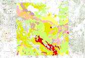
This dataset represents the soil texture from SSURGO and STATSGO soil descriptions for soil map units in the state of western Oregon that lie within the North Pacific Landscape Conservation Cooperative. Soil texture is the mineral particle size distribution of soil particles within a soil horizon. This dataset also documents rock fragments and organic matter that may contribute to water infiltration, storage and relocation within the surface horizons of the soil profile. For reference, see NRCS soil texture triangle: http://soils.usda.gov/technical/aids/investigations/texture/

Rock fragment percentage was summarized from SSURGO and STATSGO tabular data, joined to source feature data from the NRCS, and then converted to an 800m raster using the cell center to assign the values. This data set is a digital soil survey and generally is the most detailed level of soil geographic data developed by the National Cooperative Soil Survey. The information was prepared by digitizing maps, by compiling information onto a planimetric correct base and digitizing, or by revising digitized maps using remotely sensed and other information. This data set consists of georeferenced digital map data and computerized attribute data. The map data are in a soil survey area extent format and include a detailed,...

This set of soils data consists of bulk density, mineral depth, and three layers each of sand, clay, and rock fragment fractions. The soils data were obtained from Kern, using methodology from Kern (1995) with corrected inconsistencies and gap filling from NRCS (1994).

This set of soils data consists of bulk density, mineral depth, and three layers each of sand, clay, and rock fragment fractions. The soils data were obtained from Kern, using methodology from Kern (1995) with corrected inconsistencies and gap filling from NRCS (1994).

This dataset represents weighted risks of pinyon mortality based on soil order, texture, climate regime and horizons of salt accumulation. It was developed using STATSGO2 (2002) and the NRCS official soil series descriptions.

This set of soils data consists of mineral depth, and three layers each of sand, clay, and rock fragment fractions. The soils data were obtained from Kern, using methodology from Kern (1995) with corrected inconsistencies and gap filling from NRCS (1994).

This file contains soil data for 3 depths (0-0.5 meters, 0.5-1.5 meters, and greater than 1.5 meters) for percent sand, clay, and rockiness for the entire globe at a half degree grid resolution. A single bulk density value and mineral depth are also provided for each gridcell. Bulk density values came from the the International Geosphere Biosphere Programme (IGBP). Mineral depth, clay, sand, and rockiness values came from the International Satellite Land Surface Climatology Project (ISLSCP).

This set of soils data consists of bulk density, mineral depth, and three layers each of sand, clay, and rock fragment fractions. The soils data were obtained from Kern (2000), using methodology from Kern (1995) with corrected inconsistencies and gap filling from NRCS (1994).
To determine habitat attributes and processes suitable for the growth of Coccidioides, soils were collected from sites in Arizona, California, and Utah where Coccidioides is known to have been present. Humans or animals or both have been infected by Coccidioides at all of the sites. Soil variables considered in the upper 20 cm of the soil profile included pH, electrical conductivity, salinity, selected anions, texture, mineralogy, vegetation types and density, and the overall geomorphologic and ecological settings. Thermometers were buried to determine the temperature range in the upper part of the soil where Coccidioides is often found. With the exception of temperature regimes and soil textures, it is striking...
Categories: Publication;
Types: Citation,
Journal Citation;
Tags: Annals of the New York Academy of Sciences,
clay,
endemic zones,
habitat,
microorganisms,
All sediment samples from auger holes, outcrops, and cores are processed to determine texture. The 1-2 mm coarse sand fraction is packaged separately, and about half of these fractions are categorized lithologically by a glacial geologist. The data are recorded on paper data sheets and in a database.
Categories: Physical Item;
Types: Collection,
Map Service,
OGC WFS Layer,
OGC WMS Layer,
OGC WMS Service;
Tags: Geological Collection,
State,
glacial,
lithology,
ndc_collection,

Bulk density was summarized from SSURGO and STATSGO tabular data, joined to source feature data from the NRCS, and then converted to an 800m raster using the cell center to assign the values. Bulk density values in g/cc were multiplied by 100 to create an integer raster.This data set is a digital soil survey and generally is the most detailed level of soil geographic data developed by the National Cooperative Soil Survey. The information was prepared by digitizing maps, by compiling information onto a planimetric correct base and digitizing, or by revising digitized maps using remotely sensed and other information. This data set consists of georeferenced digital map data and computerized attribute data. The map...
This set of soils data consists of bulk density, mineral depth, and three layers each of sand, clay, and rock fragment fractions. The soils data were obtained from Kern, using methodology from Kern (1995) with corrected inconsistencies and gap filling from NRCS (1994).

This dataset represents the soil texture from SSURGO and STATSGO soil descriptions for soil map units in the state of western Oregon that lie within the North Pacific Landscape Conservation Cooperative. Soil texture is the mineral particle size distribution of soil particles within a soil horizon. This dataset also documents rock fragments and organic matter that may contribute to water infiltration, storage and relocation within the surface horizons of the soil profile. For reference, see NRCS soil texture triangle: http://soils.usda.gov/technical/aids/investigations/texture/

This file contains soil data for 3 depths (0-0.5 meters, 0.5-1.5 meters, and greater than 1.5 meters) for percent sand, clay, and rockiness for the entire globe at a half degree grid resolution. A single bulk density value and mineral depth are also provided for each gridcell. Bulk density values came from the the International Geosphere Biosphere Programme (IGBP). Mineral depth, clay, sand, and rockiness values came from the International Satellite Land Surface Climatology Project (ISLSCP).

This set of soils data consists of bulk density, mineral depth, and three layers each of sand, clay, and rock fragment fractions. The soils data were obtained from Kern (2000), using methodology from Kern (1995) with corrected inconsistencies and gap filling from NRCS (1994).

This set of soils data consists of mineral depth, and three layers each of sand, clay, and rock fragment fractions. The soils data were obtained from Kern (2000), using methodology from Kern (1995) with corrected inconsistencies and gap filling from NRCS (1994).

This dataset represents the soil texture from SSURGO and STATSGO soil descriptions for soil map units in the state of northern California that lie within the North Pacific Landscape Conservation Cooperative. Soil texture is the mineral particle size distribution of soil particles within a soil horizon. This dataset also documents rock fragments and organic matter that may contribute to water infiltration, storage and relocation within the surface horizons of the soil profile. For reference, see NRCS soil texture triangle: http://soils.usda.gov/technical/aids/investigations/texture/

This file contains soil data for 3 depths (0-0.5 meters, 0.5-1.5 meters, and greater than 1.5 meters) for percent sand, clay, and rockiness for the entire globe at a half degree grid resolution. A single bulk density value and mineral depth are also provided for each gridcell. Bulk density values came from the the International Geosphere Biosphere Programme (IGBP). Mineral depth, clay, sand, and rockiness values came from the International Satellite Land Surface Climatology Project (ISLSCP).
|

|
