Filters: Tags: topography (X) > partyWithName: Unknown (X)
595 results (152ms)|
Filters
Date Range
Contacts Tag Types Tag Schemes |

The High Resolution National Hydrography Dataset Plus (NHDPlus HR) is an integrated set of geospatial data layers, including the best available National Hydrography Dataset (NHD), the 10-meter 3D Elevation Program Digital Elevation Model (3DEP DEM), and the National Watershed Boundary Dataset (WBD). The NHDPlus HR combines the NHD, 3DEP DEMs, and WBD to create a stream network with linear referencing, feature naming, "value added attributes" (VAAs), elevation-derived catchments, and other features for hydrologic data analysis. The stream network with linear referencing is a system of data relationships applied to hydrographic systems so that one stream reach "flows" into another and "events" can be tied to and traced...

The High Resolution National Hydrography Dataset Plus (NHDPlus HR) is an integrated set of geospatial data layers, including the best available National Hydrography Dataset (NHD), the 10-meter 3D Elevation Program Digital Elevation Model (3DEP DEM), and the National Watershed Boundary Dataset (WBD). The NHDPlus HR combines the NHD, 3DEP DEMs, and WBD to create a stream network with linear referencing, feature naming, "value added attributes" (VAAs), elevation-derived catchments, and other features for hydrologic data analysis. The stream network with linear referencing is a system of data relationships applied to hydrographic systems so that one stream reach "flows" into another and "events" can be tied to and traced...

The High Resolution National Hydrography Dataset Plus (NHDPlus HR) is an integrated set of geospatial data layers, including the best available National Hydrography Dataset (NHD), the 10-meter 3D Elevation Program Digital Elevation Model (3DEP DEM), and the National Watershed Boundary Dataset (WBD). The NHDPlus HR combines the NHD, 3DEP DEMs, and WBD to create a stream network with linear referencing, feature naming, "value added attributes" (VAAs), elevation-derived catchments, and other features for hydrologic data analysis. The stream network with linear referencing is a system of data relationships applied to hydrographic systems so that one stream reach "flows" into another and "events" can be tied to and traced...

The High Resolution National Hydrography Dataset Plus (NHDPlus HR) is an integrated set of geospatial data layers, including the best available National Hydrography Dataset (NHD), the 10-meter 3D Elevation Program Digital Elevation Model (3DEP DEM), and the National Watershed Boundary Dataset (WBD). The NHDPlus HR combines the NHD, 3DEP DEMs, and WBD to create a stream network with linear referencing, feature naming, "value added attributes" (VAAs), elevation-derived catchments, and other features for hydrologic data analysis. The stream network with linear referencing is a system of data relationships applied to hydrographic systems so that one stream reach "flows" into another and "events" can be tied to and traced...

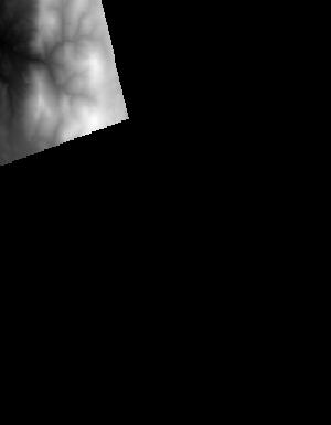
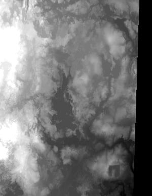
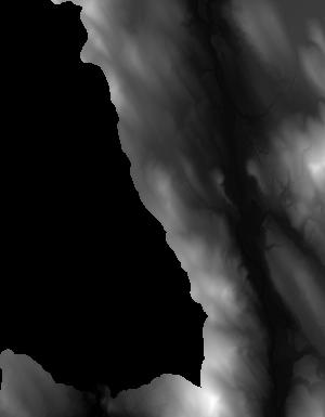
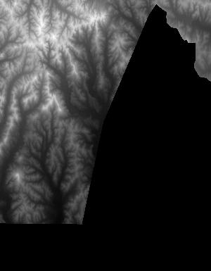
This is a tile of the standard one-meter resolution digital elevation model (DEM) produced through the 3D Elevation Program (3DEP) . The elevations in this DEM represent the topographic bare-earth surface. USGS standard one-meter DEMs are produced exclusively from high resolution light detection and ranging (lidar) source data of one-meter or higher resolution. One-meter DEM surfaces are seamless within collection projects, but, not necessarily seamless across projects. The spatial reference used for tiles of the one-meter DEM within the conterminous United States (CONUS) is Universal Transverse Mercator (UTM) in units of meters, and in conformance with the North American Datum of 1983 (NAD83). All bare earth elevation...
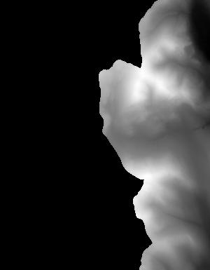
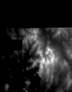
This is a tile of the standard one-meter resolution digital elevation model (DEM) produced through the 3D Elevation Program (3DEP) . The elevations in this DEM represent the topographic bare-earth surface. USGS standard one-meter DEMs are produced exclusively from high resolution light detection and ranging (lidar) source data of one-meter or higher resolution. One-meter DEM surfaces are seamless within collection projects, but, not necessarily seamless across projects. The spatial reference used for tiles of the one-meter DEM within the conterminous United States (CONUS) is Universal Transverse Mercator (UTM) in units of meters, and in conformance with the North American Datum of 1983 (NAD83). All bare earth elevation...
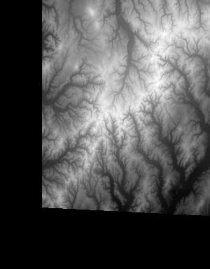
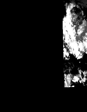
This is a tile of the standard one-meter resolution digital elevation model (DEM) produced through the 3D Elevation Program (3DEP). The elevations in this DEM represent the topographic bare-earth surface. USGS standard one-meter DEMs are produced exclusively from high resolution light detection and ranging (lidar) source data of one-meter or higher resolution. One-meter DEM surfaces are seamless within collection projects, but, not necessarily seamless across projects. The spatial reference used for tiles of the one-meter DEM within the conterminous United States (CONUS) is Universal Transverse Mercator (UTM) in units of meters, and in conformance with the North American Datum of 1983 (NAD83). All bare earth elevation...
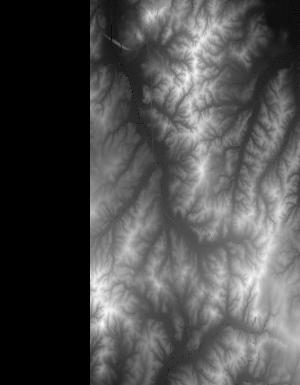
This is a tile of the standard one-meter resolution digital elevation model (DEM) produced through the 3D Elevation Program (3DEP). The elevations in this DEM represent the topographic bare-earth surface. USGS standard one-meter DEMs are produced exclusively from high resolution light detection and ranging (lidar) source data of one-meter or higher resolution. One-meter DEM surfaces are seamless within collection projects, but, not necessarily seamless across projects. The spatial reference used for tiles of the one-meter DEM within the conterminous United States (CONUS) is Universal Transverse Mercator (UTM) in units of meters, and in conformance with the North American Datum of 1983 (NAD83). All bare earth elevation...
This is a tile of the standard one-meter resolution digital elevation model (DEM) produced through the 3D Elevation Program (3DEP). The elevations in this DEM represent the topographic bare-earth surface. USGS standard one-meter DEMs are produced exclusively from high resolution light detection and ranging (lidar) source data of one-meter or higher resolution. One-meter DEM surfaces are seamless within collection projects, but, not necessarily seamless across projects. The spatial reference used for tiles of the one-meter DEM within the conterminous United States (CONUS) is Universal Transverse Mercator (UTM) in units of meters, and in conformance with the North American Datum of 1983 (NAD83). All bare earth elevation...
This is a tile of the standard one-meter resolution digital elevation model (DEM) produced through the 3D Elevation Program (3DEP). The elevations in this DEM represent the topographic bare-earth surface. USGS standard one-meter DEMs are produced exclusively from high resolution light detection and ranging (lidar) source data of one-meter or higher resolution. One-meter DEM surfaces are seamless within collection projects, but, not necessarily seamless across projects. The spatial reference used for tiles of the one-meter DEM within the conterminous United States (CONUS) is Universal Transverse Mercator (UTM) in units of meters, and in conformance with the North American Datum of 1983 (NAD83). All bare earth elevation...
This is a tile of the standard one-meter resolution digital elevation model (DEM) produced through the 3D Elevation Program (3DEP). The elevations in this DEM represent the topographic bare-earth surface. USGS standard one-meter DEMs are produced exclusively from high resolution light detection and ranging (lidar) source data of one-meter or higher resolution. One-meter DEM surfaces are seamless within collection projects, but, not necessarily seamless across projects. The spatial reference used for tiles of the one-meter DEM within the conterminous United States (CONUS) is Universal Transverse Mercator (UTM) in units of meters, and in conformance with the North American Datum of 1983 (NAD83). All bare earth elevation...
This is a tile of the standard one-meter resolution digital elevation model (DEM) produced through the 3D Elevation Program (3DEP). The elevations in this DEM represent the topographic bare-earth surface. USGS standard one-meter DEMs are produced exclusively from high resolution light detection and ranging (lidar) source data of one-meter or higher resolution. One-meter DEM surfaces are seamless within collection projects, but, not necessarily seamless across projects. The spatial reference used for tiles of the one-meter DEM within the conterminous United States (CONUS) is Universal Transverse Mercator (UTM) in units of meters, and in conformance with the North American Datum of 1983 (NAD83). All bare earth elevation...
This is a tile of the standard one-meter resolution digital elevation model (DEM) produced through the 3D Elevation Program (3DEP). The elevations in this DEM represent the topographic bare-earth surface. USGS standard one-meter DEMs are produced exclusively from high resolution light detection and ranging (lidar) source data of one-meter or higher resolution. One-meter DEM surfaces are seamless within collection projects, but, not necessarily seamless across projects. The spatial reference used for tiles of the one-meter DEM within the conterminous United States (CONUS) is Universal Transverse Mercator (UTM) in units of meters, and in conformance with the North American Datum of 1983 (NAD83). All bare earth elevation...
This is a tile of the standard one-meter resolution digital elevation model (DEM) produced through the 3D Elevation Program (3DEP). The elevations in this DEM represent the topographic bare-earth surface. USGS standard one-meter DEMs are produced exclusively from high resolution light detection and ranging (lidar) source data of one-meter or higher resolution. One-meter DEM surfaces are seamless within collection projects, but, not necessarily seamless across projects. The spatial reference used for tiles of the one-meter DEM within the conterminous United States (CONUS) is Universal Transverse Mercator (UTM) in units of meters, and in conformance with the North American Datum of 1983 (NAD83). All bare earth elevation...

This is a tile of the standard one-meter resolution digital elevation model (DEM) produced through the 3D Elevation Program (3DEP) . The elevations in this DEM represent the topographic bare-earth surface. USGS standard one-meter DEMs are produced exclusively from high resolution light detection and ranging (lidar) source data of one-meter or higher resolution. One-meter DEM surfaces are seamless within collection projects, but, not necessarily seamless across projects. The spatial reference used for tiles of the one-meter DEM within the conterminous United States (CONUS) is Universal Transverse Mercator (UTM) in units of meters, and in conformance with the North American Datum of 1983 (NAD83). All bare earth elevation...

This is a tile of the standard one-meter resolution digital elevation model (DEM) produced through the 3D Elevation Program (3DEP). The elevations in this DEM represent the topographic bare-earth surface. USGS standard one-meter DEMs are produced exclusively from high resolution light detection and ranging (lidar) source data of one-meter or higher resolution. One-meter DEM surfaces are seamless within collection projects, but, not necessarily seamless across projects. The spatial reference used for tiles of the one-meter DEM within the conterminous United States (CONUS) is Universal Transverse Mercator (UTM) in units of meters, and in conformance with the North American Datum of 1983 (NAD83). All bare earth elevation...

This is a tile of the standard one-meter resolution digital elevation model (DEM) produced through the 3D Elevation Program (3DEP). The elevations in this DEM represent the topographic bare-earth surface. USGS standard one-meter DEMs are produced exclusively from high resolution light detection and ranging (lidar) source data of one-meter or higher resolution. One-meter DEM surfaces are seamless within collection projects, but, not necessarily seamless across projects. The spatial reference used for tiles of the one-meter DEM within the conterminous United States (CONUS) is Universal Transverse Mercator (UTM) in units of meters, and in conformance with the North American Datum of 1983 (NAD83). All bare earth elevation...

This is a tile of the standard one-meter resolution digital elevation model (DEM) produced through the 3D Elevation Program (3DEP). The elevations in this DEM represent the topographic bare-earth surface. USGS standard one-meter DEMs are produced exclusively from high resolution light detection and ranging (lidar) source data of one-meter or higher resolution. One-meter DEM surfaces are seamless within collection projects, but, not necessarily seamless across projects. The spatial reference used for tiles of the one-meter DEM within the conterminous United States (CONUS) is Universal Transverse Mercator (UTM) in units of meters, and in conformance with the North American Datum of 1983 (NAD83). All bare earth elevation...
This is a tile of the standard one-meter resolution digital elevation model (DEM) produced through the 3D Elevation Program (3DEP). The elevations in this DEM represent the topographic bare-earth surface. USGS standard one-meter DEMs are produced exclusively from high resolution light detection and ranging (lidar) source data of one-meter or higher resolution. One-meter DEM surfaces are seamless within collection projects, but, not necessarily seamless across projects. The spatial reference used for tiles of the one-meter DEM within the conterminous United States (CONUS) is Universal Transverse Mercator (UTM) in units of meters, and in conformance with the North American Datum of 1983 (NAD83). All bare earth elevation...
This is a tile of the standard one-meter resolution digital elevation model (DEM) produced through the 3D Elevation Program (3DEP). The elevations in this DEM represent the topographic bare-earth surface. USGS standard one-meter DEMs are produced exclusively from high resolution light detection and ranging (lidar) source data of one-meter or higher resolution. One-meter DEM surfaces are seamless within collection projects, but, not necessarily seamless across projects. The spatial reference used for tiles of the one-meter DEM within the conterminous United States (CONUS) is Universal Transverse Mercator (UTM) in units of meters, and in conformance with the North American Datum of 1983 (NAD83). All bare earth elevation...
|

|
