Filters: Tags: u.s. fish and wildlife service (X)
155 results (4ms)|
Filters
|

This map layer consists of federally owned or administered lands of the United States, Puerto Rico, and the U.S. Virgin Islands. For the most part, only areas of 320 acres or more are included; some smaller areas deemed to be important or significant are also included. There may be private inholdings within the boundaries of Federal lands in this map layer. Some established Federal lands which are larger than 320 acres are not included in this map layer, because their boundaries were not available from the owning or administering agency.
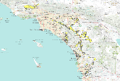
Using funds from an NRDAR settlement, FWS obligated $557,810 ($2011) to TNC of Massachusetts for the purchase of permanent conservation easements on approximately 200 acres of riparian lands along the Housatonic River in Salisbury, Connecticut. Conservation of riparian habitat will help to (1) protect water quality; (2) protect nesting habitat for migratory songbirds and other wildlife, including several rare and endangered plants, turtles, salamanders and dragonflies; and (3) maintain the scenic, agrarian character of the region. These efforts provide a beneficial tradeoff from the harm to the river and associated wildlife caused by historical polychlorinated biphenyls (PCBs) contamination. Economic Impacts of...
Categories: Project;
Types: Map Service,
OGC WFS Layer,
OGC WMS Layer,
OGC WMS Service;
Tags: Amphibians,
Bank stabilization/erosion control,
Birds,
Connecticut,
Farmland Preservation,

These data identify, in general, the areas where final critical habitat for Castilleja cinerea (Ash-gray Indian paintbrush) occur.

These data identify, in general, the areas where final critical habitat for Erigeron parishii (Parish's daisy) occur.

These data identify, in general, the areas where final critical habitat for the Coachella Valley fringe-toed lizard (Uma inornata) occur.
These data identify, in general, the areas where final critical habitat for the coastal California gnatcatcher (Polioptila californica californica) occur.
This data set represents the extent, approximate location and type of wetlands and deepwater habitats in the United States and its Territories. These data delineate the areal extent of wetlands and surface waters as defined by Cowardin et al. (1979). Certain wetland habitats are excluded from the National mapping program because of the limitations of aerial imagery as the primary data source used to detect wetlands. These habitats include seagrasses or submerged aquatic vegetation that are found in the intertidal and subtidal zones of estuaries and near shore coastal waters. Some deepwater reef communities (coral or tuberficid worm reefs) have also been excluded from the inventory. These habitats, because of their...
Categories: Data;
Types: Map Service,
OGC WFS Layer,
OGC WMS Layer,
OGC WMS Service;
Tags: Academics & scientific researchers,
Alabama,
Alabama,
Alaska,
Arizona,
Spatial analysis and statistical summaries of the Protected Areas Database of the United States (PAD-US) provide land managers and decision makers with a general assessment of management intent for biodiversity protection, natural resource management, and recreation access across the nation. The PAD-US 3.0 Combined Fee, Designation, Easement feature class in the full geodatabase inventory (with Military Lands and Tribal Areas from the Proclamation and Other Planning Boundaries feature class) was modified to prioritize overlapping designations, avoiding massive overestimation in protected area statistics, and simplified by the following PAD-US attributes to support user needs for raster analysis data: Manager Type,...
The USGS Protected Areas Database of the United States (PAD-US) is the nation's inventory of protected areas, including public open space and voluntarily provided, private protected areas, identified as an A-16 National Geospatial Data Asset in the Cadastral Theme (http://www.fgdc.gov/ngda-reports/NGDA_Datasets.html). PAD-US is an ongoing project with several published versions of a spatial database of areas dedicated to the preservation of biological diversity, and other natural, recreational or cultural uses, managed for these purposes through legal or other effective means. The geodatabase maps and describes public open space and other protected areas. Most areas are public lands owned in fee; however, long-term...
Types: Citation;
Tags: Agricultural Research Service,
Alabama (AL),
Alaska (AK),
American Samoa (AS),
Arizona (AZ),
U.S. Fish and Wildlife Service Road Inventory
Categories: Data;
Types: ArcGIS REST Map Service,
ArcGIS Service Definition,
Citation,
Downloadable,
Map Service,
OGC WFS Layer,
OGC WMS Layer,
Shapefile;
Tags: Bridge,
CRV,
Condition,
Culvert,
GIS,

These data identify, in general, the areas where final critical habitat exist for species listed as endangered or threatened.

These data identify, in general, the areas where the final revised critical habitat for Brodiaea filifolia (thread-leaved brodiaea) occur.
These data identify, in general, the areas of Final critical habitat for Monardella viminea (willowy monardella).

These data identify, in general, the areas where final critical habitat for Eriogonum ovalifolium var. vineum (Cushenbury buckwheat) occur.

Proposed revised critical habitat for the pacific coast western snowy plover. This dataset was created to revise the 2005 final critical habitat rule for the species. This dataset includes polygon features representing proposed unit boundaries and exempted unit boundaries from Washington, Oregon, and California. There are 55 units, some containing from 2 to 10 sub-units. The units are identified by state, unit number, and sub-unit alpha character. Unit boundaries were compiled from data developed in several field offices, including the Western Washington Fish and Wildlife Office (FWO) in Lacey, WA; the Newport Field Office, Newport, OR; the Arcata FWO, Arcata CA; the Sacramento FWO, Sacramento, CA; the Ventura FWO...
The USGS Protected Areas Database of the United States (PAD-US) is the nation's inventory of protected areas, including public open space and voluntarily provided, private protected areas, identified as an A-16 National Geospatial Data Asset in the Cadastral Theme (http://www.fgdc.gov/ngda-reports/NGDA_Datasets.html). PAD-US is an ongoing project with several published versions of a spatial database of areas dedicated to the preservation of biological diversity, and other natural, recreational or cultural uses, managed for these purposes through legal or other effective means. The geodatabase maps and describes public open space and other protected areas. Most areas are public lands owned in fee; however, long-term...
Types: Citation;
Tags: Agricultural Research Service,
Alabama (AL),
Alaska (AK),
American Samoa (AS),
Arizona (AZ),
|

|
