Filters: Tags: vegetation change (X)
120 results (155ms)|
Filters
Date Range
Extensions Types
Contacts
Categories Tag Types
|
This publication identifies areas where big sagebrush populations are most and least vulnerable to climate change and demonstrates where continued investment in sagebrush conservation and restoration could have the most impact.
Categories: Data,
Publication;
Types: Citation;
Tags: Academics & scientific researchers,
Artemisia,
Completed,
EARTH SCIENCE > LAND SURFACE > LANDSCAPE,
Federal resource managers,
The RCMAP (Rangeland Condition Monitoring Assessment and Projection) dataset quantifies the percent cover of rangeland components across western North America using Landsat imagery from 1985-2023. The RCMAP product suite consists of ten fractional components: annual herbaceous, bare ground, herbaceous, litter, non-sagebrush shrub, perennial herbaceous, sagebrush, shrub, tree, and shrub height in addition to the temporal trends of each component. Several enhancements were made to the RCMAP process relative to prior generations. First, high-resolution training was revised using an improved neural-net classifier and modelling approach. These data serve as foundation to the RCMAP approach. The training database was...
The RCMAP (Rangeland Condition Monitoring Assessment and Projection) dataset quantifies the percent cover of rangeland components across western North America using Landsat imagery from 1985-2023. The RCMAP product suite consists of ten fractional components: annual herbaceous, bare ground, herbaceous, litter, non-sagebrush shrub, perennial herbaceous, sagebrush, shrub, tree, and shrub height in addition to the temporal trends of each component. Several enhancements were made to the RCMAP process relative to prior generations. First, high-resolution training was revised using an improved neural-net classifier and modelling approach. These data serve as foundation to the RCMAP approach. The training database was...
The need to monitor change in sagebrush steppe is urgent due to the increasing impacts of climate change, shifting fire regimes, and management practices on ecosystem health. Remote sensing provides a cost-effective and reliable method for monitoring change through time and attributing changes to drivers. We report an automated method of mapping rangeland fractional component cover over a large portion of the Northern Great Basin, USA, from 1986 to 2016 using a dense Landsat imagery time series. 2012 was excluded from the time-series due to a lack of quality imagery. Our method improved upon the traditional change vector method by considering the legacy of change at each pixel. We evaluate cover trends stratified...
Potential future greater sage-grouse (Centrocercus urophasianus) habitat restoration was projected (2018-2068) for three sage-grouse Priority Area for Conservation (PACs) populations located along the northwestern, central, and eastern edge of the Great Basin using outputs from a spatially explicit state-transition simulation model (STSM) developed for sagebrush ecosystems. These datasets, for the Strawberry Utah, USA (STRAW) sage-grouse population, include: 1) a set of 78 categorical raster layers illustrating a time series (decade intervals) of potential future habitat, and 2) a set of 15 uncategorized raster layers illustrating potential change in habitat classification across space, after simulating 50 years...

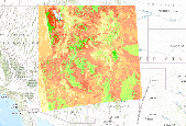
This dataset combines the sensitive soils datasets for the Southern Rockies Landscape Conservation Cooperative, the projected future vegetation and the simulated historic potential natural vegetation, created using the MC2 dynamic global vegetation model. Colors represent unique combinations of vegetation change and the number of sensitive soil factors present in a given area.
These data are satellite image-derived, classification maps of tamarisk (Tamarisk spp.) along the Colorado River in Grand Canyon National Park from river km 315 to 363, approximately from Parashant Canyon to Diamond Creek tributaries. The classification maps are published in TIF raster format. Two maps are published: 1) a classification of healthy, defoliated, and tamarisk canopy dieback from the tamarisk beetle (Diorhabda carinulata) in May 2019, and 2 a classification of healthy and beetle-impacted tamarisk in August 2019. Tamarisk was mapped using a Spectral Angle Mapper supervised classification derived from 2 m resolution, multispectral WorldView-2 imagery, with an overall accuracy of 80.0% in May 2019 and...
Climate change predictions include warming and drying trends, which are expected to be particularly pronounced in the southwestern United States. In this region, grassland dynamics are tightly linked to available moisture, yet it has proven difficult to resolve what aspects of climate drive vegetation change.Here, we combine climate and soil properties with a mechanistic soil water model to explain temporal fluctuations in perennial grass cover, quantify where and the degree to which incorporating soil water dynamics enhances our ability to understand temporal patterns, and explore the potential consequences of climate change by assessing future trajectories of important climate and soil water variables.Our analyses...
The RCMAP (Rangeland Condition Monitoring Assessment and Projection) dataset quantifies the percent cover of rangeland components across the western U.S. using Landsat imagery from 1985-2020. The RCMAP product suite consists of eight fractional components: annual herbaceous, bare ground, herbaceous, litter, non-sagebrush shrub, perennial herbaceous, sagebrush, shrub and rule-based error maps including the temporal trends of each component. Several enhancements were made to the RCMAP process relative to prior generations. We used an updated version of the 2016 base training data, with a more aggressive forest mask and reduced shrub and sagebrush cover bias in pinyon-juniper woodlands. We pooled training data in areas...
The RCMAP (Rangeland Condition Monitoring Assessment and Projection) dataset quantifies the percent cover of rangeland components across the western U.S. using Landsat imagery from 1985-2020. The RCMAP product suite consists of eight fractional components: annual herbaceous, bare ground, herbaceous, litter, non-sagebrush shrub, perennial herbaceous, sagebrush, shrub and rule-based error maps including the temporal trends of each component. Several enhancements were made to the RCMAP process relative to prior generations. We used an updated version of the 2016 base training data, with a more aggressive forest mask and reduced shrub and sagebrush cover bias in pinyon-juniper woodlands. We pooled training data in areas...
The RCMAP (Rangeland Condition Monitoring Assessment and Projection) dataset quantifies the percent cover of rangeland components across the western U.S. using Landsat imagery from 1985-2021. The RCMAP product suite consists of nine fractional components: annual herbaceous, bare ground, herbaceous, litter, non-sagebrush shrub, perennial herbaceous, sagebrush, shrub, and tree, in addition to the temporal trends of each component. Several enhancements were made to the RCMAP process relative to prior generations. First, we have trained time-series predictions directly from 331 high-resolution sites collected from 2013-2018 from Assessment, Inventory, and Monitoring (AIM) instead of using the 2016 “base” map as an intermediary....
The RCMAP (Rangeland Condition Monitoring Assessment and Projection) dataset quantifies the percent cover of rangeland components across the western U.S. using Landsat imagery from 1985-2020. The RCMAP product suite consists of eight fractional components: annual herbaceous, bare ground, herbaceous, litter, non-sagebrush shrub, perennial herbaceous, sagebrush, shrub and rule-based error maps including the temporal trends of each component. Several enhancements were made to the RCMAP process relative to prior generations. We used an updated version of the 2016 base training data, with a more aggressive forest mask and reduced shrub and sagebrush cover bias in pinyon-juniper woodlands. We pooled training data in areas...
The need to monitor change in sagebrush steppe is urgent due to the increasing impacts of climate change, shifting fire regimes, and management practices on ecosystem health. Remote sensing provides a cost-effective and reliable method for monitoring change through time and attributing changes to drivers. We report an automated method of mapping rangeland fractional component cover over a large portion of the Northern Great Basin, USA, from 1986 to 2016 using a dense Landsat imagery time series. 2012 was excluded from the time-series due to a lack of quality imagery. Our method improved upon the traditional change vector method by considering the legacy of change at each pixel. We evaluate cover trends stratified...

These data are forecast barren land change under the GFDL B1 scenarios, calculated using the outputs from runs of the USFS Pacific Northwest Research Station and WWETAC MC1 Vegetation model.MC1 Vegetation Model description: This collection of layers includes summary statistics from input and output data used for simulation of vegetation response to climate change in California. The simulations were performed using MC1 dynamic global vegetation model (DGVM), source code revision 152. The model was parameterized and evaluated by the DGVM research group at the US Forest Service Pacific Northwest Research Station, with support from the Western Wildland Environmental Threat Assessment Center. The model was parameterized...

This dataset combines the sensitive soils datasets for the Southern Rockies Landscape Conservation Cooperative, the projected future vegetation and the simulated historic potential natural vegetation, created using the MC2 dynamic global vegetation model. Colors represent unique combinations of vegetation change and the number of sensitive soil factors present in a given area.
This dataset combines the sensitive soils datasets for the Southern Rockies Landscape Conservation Cooperative, the projected future vegetation and the simulated historic potential natural vegetation, created using the MC2 dynamic global vegetation model. Colors represent unique combinations of vegetation change and the number of sensitive soil factors present in a given area.
The following files are designed to be run using the Path Landscape Model software, version 3.0.4. Later versions of the software cannot run these files. To get a copy of this software, please contact Apex RMS at path@apexrms.com. These files will open in the Path Landscape Model, version 3.0.4 or later. 1) In "Path Model" folder, path models MUST be run with the provided MCM mulitplier files to apply the required transition probability adjustments for procesess such as insect outbreaks, wildfire, and climate change trends. Each Path database is set up with three folders: - The 'Common' folder contains a single Path scenario (also named 'Common'). The Transitions tab within the Common scenario contains the climate-smart...
Categories: Data;
Tags: Birds,
Drought, Fire and Extreme Weather,
Fire,
Forests,
Grasslands and Plains,
Abstract: Climate change predictions include warming and drying trends, which are expected to be particularly pronounced in the southwestern United States. In this region, grassland dynamics are tightly linked to available moisture, yet it has proven difficult to resolve what aspects of climate drive vegetation change. In part, this is because it is unclear how heterogeneity in soils affects plant responses to climate. Here, we combine climate and soil properties with a mechanistic soil water model to explain temporal fluctuations in perennial grass cover, quantify where and the degree to which incorporating soil water dynamics enhances our ability to understand temporal patterns, and explore the potential consequences...
Categories: Data,
Publication;
Types: Citation,
Map Service,
OGC WFS Layer,
OGC WMS Layer,
OGC WMS Service;
Tags: 2012,
AZ-02,
AZ-03,
AZ-04,
Academics & scientific researchers,
The RCMAP (Rangeland Condition Monitoring Assessment and Projection) dataset quantifies the percent cover of rangeland components across western North America using Landsat imagery from 1985-2023. The RCMAP product suite consists of ten fractional components: annual herbaceous, bare ground, herbaceous, litter, non-sagebrush shrub, perennial herbaceous, sagebrush, shrub, tree, and shrub height in addition to the temporal trends of each component. Several enhancements were made to the RCMAP process relative to prior generations. First, high-resolution training was revised using an improved neural-net classifier and modelling approach. These data serve as foundation to the RCMAP approach. The training database was...
The need to monitor change in sagebrush steppe is urgent due to the increasing impacts of climate change, shifting fire regimes, and management practices on ecosystem health. Remote sensing provides a cost-effective and reliable method for monitoring change through time and attributing changes to drivers. We report an automated method of mapping rangeland fractional component cover over a large portion of the Northern Great Basin, USA, from 1986 to 2016 using a dense Landsat imagery time series. 2012 was excluded from the time-series due to a lack of quality imagery. Our method improved upon the traditional change vector method by considering the legacy of change at each pixel. We evaluate cover trends stratified...
|

|
