Filters: Tags: volcano (X)
171 results (13ms)|
Filters
Date Range
Extensions Types
Contacts
Categories Tag Types
|
Newberry Volcano, one of the largest Quaternary volcanoes in the conterminous United States, is a broad shield-shaped volcano measuring 60 km north-south by 30 km east-west with a maximum elevation of more than 2 km above sea level. It is the product of deposits from thousands of eruptions, including at least 25 in (approximately) the last 12,000 years (the Holocene Epoch). Newberry Volcano has erupted as recently as 1,300 years ago, but isotopic ages indicate that the volcano began its growth as early as 0.6 million years ago. Such a long eruptive history together with recent activity suggests that Newberry Volcano is likely to erupt in the future. This DEM (digital elevation model) of Newberry Volcano contributes...
Types: Citation,
Map Service,
OGC WFS Layer,
OGC WMS Layer,
OGC WMS Service;
Tags: DEM,
Deschutes County,
Deschutes County,
East Lake,
East Lake,
These feature data are part of a larger dataset containing shapefiles and associated metadata for lava flows erupted at Kilauea volcano from ca. 1790 through 1982. The complete dataset includes all known subaerial eruptions in the volcano's Southwest Rift Zone and East Rift Zone, and selected flows erupted within the summit caldera, during this time period. Two attributed shapefiles are associated with each eruption: a polyline shapefile for the lava flow contacts and eruptive fissures, and a polygon shapefile showing the full extent of the lava flow after emplacement. In total, this dataset contains 100 shapefiles, each with an associated metadata .txt file, representing 50 separate eruptions. The lava flow contacts...
Categories: Data;
Types: Downloadable,
Map Service,
OGC WFS Layer,
OGC WMS Layer,
Shapefile;
Tags: Hawai`i,
Hawai`i,
Hawaii,
Hawaii,
Kilauea,
The 2018 lower East Rift Zone eruption of Kilauea Volcano began in the late afternoon of 3 May, with fissure 1 opening and erupting lava onto Mohala Street in the Leilani Estates subdivision, part of the lower Puna District of the Island of Hawai'i. For the first week of the eruption, relatively viscous lava flowed only within a kilometer (0.6 miles) of the fissures within Leilani Estates, before activity shifted downrift (east-northeast) and out of the subdivision during mid-May. Around 18 May, activity along the lower East Rift Zone intensified, and fluid lava erupting at higher effusion rates from the downrift fissures reached the ocean within two days. Near the end of May, this more vigorous activity shifted...
Categories: Data;
Types: Downloadable,
Map Service,
OGC WFS Layer,
OGC WMS Layer,
Shapefile;
Tags: East Rift Zone,
Fissure06Flow,
Green Lake,
Hawai'i,
Hawaii,
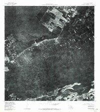
USGS Historical Quadrangle in GeoPDF.
Lava flow hazards are usually thought to end when the erupting vent becomes inactive, but this is not always the case. At Kīlauea in August 2014, a spiny ʻaʻā flow erupted from the levee of a crusted perched lava lake that had been inactive for a month, and the surface of the lava lake subsided as the flow advanced downslope over the following few days. Topography constructed from oblique aerial photographs using structure-from-motion (SfM) software shows that the volume of the flow (~68,000 m3) closely matches the volume of subsidence of the crusted lava lake (~64,000 m3). The similarity of these volumes, along with the textural characteristics of the lava, shows that the lava that fed the flow had been stored...
Types: Map Service,
OGC WFS Layer,
OGC WMS Layer,
OGC WMS Service;
Tags: East Rift Zone,
Island of Hawaiʻi,
June 27th flow,
Kīlauea,
Puʻuʻōʻō,
|

|
