Filters: Tags: watershed boundaries (X) > partyWithName: Conservation Biology Institute (X)
12 results (41ms)|
Filters
Date Range
Tag Schemes |

These data were provided by Dudek, for full metadata please contact them directly. Layer description from Appendix A: The California Interagency Watershed Map of 1999 (updated May 2004, "calw221") is the State of California's working definition of watershed boundaries. Previous Calwater versions (1.2 and 2.2) described California watersheds, beginning with the division of the State's 101 million acres into ten Hydrologic Regions (HR). Each HR is progressively subdivided into six smaller, nested levels: the Hydrologic Unit (HU, major rivers), Hydrologic Area (HA, major tributaries), Hydrologic Sub-Area (HSA), Super Planning Watershed (SPWS), and Planning Watershed (PWS). At the Planning Watershed (the most detailed...

This shapefile is a subset of the original data, containing only those HUC6s which intersect significantly with Washington State borders. It has been clipped to the Washington State border. The HUC6 watersheds have been attributed with the study's analysis regions for summary. Original metadata follows: This geospatial dataset is a hydrologic boundary layer containing nested hydrologic unit boundaries. The standard allows for mapping to the (16-digit) level. The dataset was developed by delineating the boundary lines on 1:24,000 base maps and digitizing the delineated lines. Digital Elevation Model data was used in part of the process to establish preliminary boundaries. This data set consists of geo-referenced...
This dataset contains 4th-level (8-digit) HUC units which intersect Nevada and Placer Counties, California. It was derived from the HUC-12 Watershed Boundary Dataset (WBD). For more information on the WBD, see http://www.ncgc.nrcs.usda.gov/products/datasets/watershed/index.html.

A map service on the www depicting hydrologic unit boundary layers for the entire United States. Watershed boundaries provide a uniquely identified and uniform method of subdividing large drainage areas. Watershed boundaries are useful for numerous application programs supported by a variety of local, State, and Federal Agencies. This map service is intended to be used as a tool for water-resource management and planning activities, requiring a level of detail provided by large-scale map information. This map service consists of layers for each hydrologic unit code 2-12. Polygon features are attributed with hydrologic unit codes for 1st(Region), 2nd(Sub-Region), 3rd(Basin), and 4th(Sub-Basin) Hydrologic Unit Level...

4th-level watersheds (HUC8) within basins (HUC6) intersecting the three eco-regions for the study (Colorado Plateau, Arizona/New Mexico Plateau, and Sonoran Desert). This is an extract from the national HUC8 dataset available at http://www.ncgc.nrcs.usda.gov/products/datasets/watershed/index.html .

This data set is a complete digital hydrologic unit boundary layer to the Subwatershed (12-digit) 6th level for the State of Utah. This data set consists of geo-referenced digital data and associated attributes created in accordance with the "FGDC Proposal, Version 1.0 - Federal Standards For Delineation of Hydrologic Unit Boundaries 3/01/02"(http://www.ftw.nrcs.usda.gov/huc_data.html). Polygons are attributed with hydrologic unit codes for 4th level sub-basins, 5th level watersheds, 6th level subwatersheds, name, size, downstream hydrologic unit, type of watershed, non-contributing areas and flow modification. Arcs are attributed with the highest hydrologic unit code for each watershed, linesource and a metadata...

This dataset contains subwatersheds (HUC 12-digit) within basins intersecting the Colorado Plateau, Arizona/New Mexico Plateau, and Sonoran Desert eco-regions in the southwestern United States. It is an extract of the National Watershed Boundary Dataset (WBD), obtained January 2011. For more information on the WBD, see http://www.ncgc.nrcs.usda.gov/products/datasets/watershed/index.html .

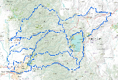
Project study area (polygon) for the Arizona Apache-Sitgreaves National Forest with six HUC5 study watersheds. Note this dataset includes the six (6) watersheds and supercedes the dataset with three (3) watersheds (http://app.databasin.org/app/pages/datasetPage.jsp?id=4d93a76be66543169c46365d08dd5283). Original Description: A data set describing the 2-dimensional spatial location of hierarchical hydrologic unit delineations based on Natural Resource Conservation Service and U.S. Geological Survey approved subbasins within or partially within a Forest Service administrative unit. Multiple subbasins are typically managed in a single data set for a Forest or administrative unit. This data is a set of merged datasets...

The California Interagency Watershed Map of 1999 (updated May 2004, "calw221") is the State of California's working definition of watershed boundaries. Previous Calwater versions (1.2 and 2.2) described California watersheds, beginning with the division of the State's 101 million acres into ten Hydrologic Regions (HR). Each HR is progressively subdivided into six smaller, nested levels: the Hydrologic Unit (HU, major rivers), Hydrologic Area (HA, major tributaries), Hydrologic Sub-Area (HSA), Super Planning Watershed (SPWS), and Planning Watershed (PWS). At the Planning Watershed (the most detailed level), where implemented, polygons range in size from approximately 3,000 to 10,000 acres. At all levels, a total...

This dataset contains 5th-level (10-digit) HUC units which intersect Nevada and Placer Counties, California. It was derived from the HUC-12 Watershed Boundary Dataset (WBD). For more information on the WBD, see http://www.ncgc.nrcs.usda.gov/products/datasets/watershed/index.html.

This geospatial dataset represents the 4th level (8-digit) hydrologic unit boundaries of the Watershed Boundary Dataset (WBD) layer for Oregon. It was created by dissolving boundaries from the finer resolution hydrologic units to create these broader boundaries. See metadata for the wbd_or_poly feature class for a more complete description of the WBD.

This Watershed Boundary Dataset (WBD) is a complete 1:24,000 scale digital hydrologic unit (HU) boundary layer for the 4th level subbasin (8 digit), the 5th level watershed (10 digit), and the 6th level (12-digit) subwatershed for the state of California.This dataset consists of georeferenced digital data and associated attributes created in accordance with the "USGS National Map Accuracy Standards and the NRCS Federal Standards for Delineation of Hydrologic Unit Boundaries, 10/01/04" (ftp://ftp-fc.sc.egov.usda.gov/NCGC/products/watershed/hu-standards.pdf). The dataset was developed by digitizing watershed and subwatershed boundary lines using 1:24,000-scale digital raster graphics (DRG), high-resolution digital...
|

|
