|
|
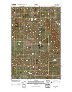
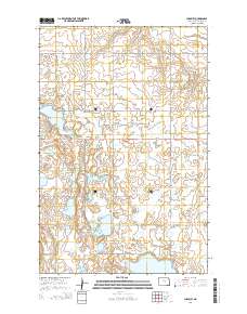
This data set contains imagery from the National Agriculture Imagery Program (NAIP). The NAIP program is administered by USDA FSA and has been established to support two main FSA strategic goals centered on agricultural production. These are, increase stewardship of America's natural resources while enhancing the environment, and to ensure commodities are procured and distributed effectively and efficiently to increase food security. The NAIP program supports these goals by acquiring and providing ortho imagery that has been collected during the agricultural growing season in the U.S. The NAIP ortho imagery is tailored to meet FSA requirements and is a fundamental tool used to support FSA farm and conservation programs....
Types: Citation;
Tags: 20143,
3.75 x 3.75 minute,
3909752,
Aerial Compliance,
Compliance, All tags...
Digital Ortho rectified Image,
Downloadable Data,
JPEG2000,
KS,
KS143,
NAIP,
OTTAWA CO KS FSA,
Ortho Rectification,
Orthoimagery,
Ottawa,
Quarter Quadrangle,
USDA National Agriculture Imagery Program (NAIP),
WELLS,
WELLS, SE,
farming, Fewer tags

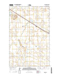
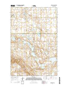
This dataset includes the magnetotelluric (MT) sounding data collected in 2005 along an east-west profile north of Wells, Nevada. It is important to know whether major mining districts in the Northern Nevada Gold Province are underlain by rocks of the Archean Wyoming craton, which are known to contain orogenic gold deposits, or by accreted rocks of the Paleoproterozoic Mojave province. It is also important to know the location and orientation of the Archean/Proterozoic suture zone between these provinces as well as major basement structures within these terranes because they may influence subsequent patterns of sedimentation, deformation, magmatism, and hydrothermal activity. This study was funded by the U.S. Geological...
Types: Citation;
Tags: Bishop Creek,
CGGSC,
Crustal Geophysics and Geochemistry Science Center,
Electromagnetic surveying,
Elko County, All tags...
GPS measurement,
Geophysics,
Gold Deposits,
Gold Mining,
MRP,
MT,
Magnetic field (earth),
Magnetic surveying,
Mineral Resources Program,
Montello,
Nevada,
Northern Nevada Gold Province,
Oasis,
Snake Mountains,
Wells,
Wilkins,
apparent resistivity,
aquifer,
geoscientificinformation,
impedance,
impedance phase,
impedance strike,
magnetotelluric,
sounding,
suture zone,
tipper, Fewer tags
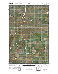
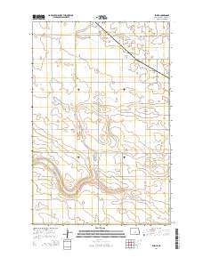
This data set contains imagery from the National Agriculture Imagery Program (NAIP). The NAIP program is administered by USDA FSA and has been established to support two main FSA strategic goals centered on agricultural production. These are, increase stewardship of America's natural resources while enhancing the environment, and to ensure commodities are procured and distributed effectively and efficiently to increase food security. The NAIP program supports these goals by acquiring and providing ortho imagery that has been collected during the agricultural growing season in the U.S. The NAIP ortho imagery is tailored to meet FSA requirements and is a fundamental tool used to support FSA farm and conservation programs....
Types: Citation;
Tags: 23031,
3.75 x 3.75 minute,
4307044,
Aerial Compliance,
Compliance, All tags...
Digital Ortho rectified Image,
Downloadable Data,
JPEG2000,
ME,
ME031,
NAIP,
Ortho Rectification,
Orthoimagery,
Quarter Quadrangle,
USDA National Agriculture Imagery Program (NAIP),
WELLS,
WELLS, NW,
YORK CO ME FSA,
York,
farming, Fewer tags

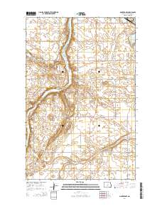
This dataset includes the magnetotelluric (MT) sounding data collected in 2005 along an east-west profile north of Wells, Nevada. It is important to know whether major mining districts in the Northern Nevada Gold Province are underlain by rocks of the Archean Wyoming craton, which are known to contain orogenic gold deposits, or by accreted rocks of the Paleoproterozoic Mojave province. It is also important to know the location and orientation of the Archean/Proterozoic suture zone between these provinces as well as major basement structures within these terranes because they may influence subsequent patterns of sedimentation, deformation, magmatism, and hydrothermal activity. This study was funded by the U.S. Geological...
Types: Citation;
Tags: Bishop Creek,
CGGSC,
Crustal Geophysics and Geochemistry Science Center,
Electromagnetic surveying,
Elko County, All tags...
GPS measurement,
Geophysics,
Gold Deposits,
Gold Mining,
Humboldt River,
MRP,
MT,
Magnetic field (earth),
Magnetic surveying,
Mineral Resources Program,
Montello,
Nevada,
Northern Nevada Gold Province,
Oasis,
Snake Mountains,
Tabor Creek,
Wells,
Wilkins,
apparent resistivity,
aquifer,
geoscientificinformation,
impedance,
impedance phase,
impedance strike,
magnetotelluric,
sounding,
suture zone,
tipper, Fewer tags
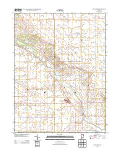
Layered GeoPDF 7.5 Minute Quadrangle Map. Layers of geospatial data include orthoimagery, roads, grids, geographic names, elevation contours, hydrography, and other selected map features.
Tags: 7.5 x 7.5 minute,
Downloadable Data,
EarthCover,
GeoPDF,
Imagery and Base Maps, All tags...
Kidder,
Map,
North Dakota,
Senior Lake, ND,
U.S. National Grid,
US,
US Topo,
US Topo Historical,
United States,
Wells,
contour,
geographic names,
hydrography,
imageryBaseMapsEarthCover,
orthoimage,
topographic,
transportation, Fewer tags
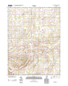
Layered GeoPDF 7.5 Minute Quadrangle Map. Layers of geospatial data include orthoimagery, roads, grids, geographic names, elevation contours, hydrography, and other selected map features.
Tags: 7.5 x 7.5 minute,
Downloadable Data,
EarthCover,
GeoPDF,
Imagery and Base Maps, All tags...
Manfred, ND,
Map,
North Dakota,
Public Land Survey System,
U.S. National Grid,
US,
US Topo,
US Topo Historical,
United States,
Wells,
boundary,
contour,
geographic names,
hydrography,
imageryBaseMapsEarthCover,
orthoimage,
structures,
topographic,
transportation,
woodland, Fewer tags
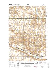
Layered GeoPDF 7.5 Minute Quadrangle Map. Layers of geospatial data include orthoimagery, roads, grids, geographic names, elevation contours, hydrography, and other selected map features.
Tags: 7.5 x 7.5 minute,
Downloadable Data,
EarthCover,
GeoPDF,
Imagery and Base Maps, All tags...
Manfred NW, ND,
Map,
North Dakota,
U.S. National Grid,
US,
US Topo,
US Topo Historical,
United States,
Wells,
contour,
geographic names,
hydrography,
imageryBaseMapsEarthCover,
orthoimage,
topographic,
transportation, Fewer tags
Layered GeoPDF 7.5 Minute Quadrangle Map. Layers of geospatial data include orthoimagery, roads, grids, geographic names, elevation contours, hydrography, and other selected map features.
Tags: 7.5 x 7.5 minute,
Downloadable Data,
EarthCover,
GeoPDF,
Imagery and Base Maps, All tags...
Manfred NW, ND,
Map,
North Dakota,
Public Land Survey System,
U.S. National Grid,
US,
US Topo,
US Topo Historical,
United States,
Wells,
boundary,
contour,
geographic names,
hydrography,
imageryBaseMapsEarthCover,
orthoimage,
structures,
topographic,
transportation,
woodland, Fewer tags
Layered GeoPDF 7.5 Minute Quadrangle Map. Layers of geospatial data include orthoimagery, roads, grids, geographic names, elevation contours, hydrography, and other selected map features.
Tags: 7.5 x 7.5 minute,
Downloadable Data,
EarthCover,
Eddy,
GeoPDF, All tags...
Imagery and Base Maps,
Map,
Munster, ND,
North Dakota,
Public Land Survey System,
U.S. National Grid,
US,
US Topo,
US Topo Historical,
United States,
Wells,
boundary,
contour,
geographic names,
hydrography,
imageryBaseMapsEarthCover,
orthoimage,
structures,
topographic,
transportation,
woodland, Fewer tags
Layered GeoPDF 7.5 Minute Quadrangle Map. Layers of geospatial data include orthoimagery, roads, grids, geographic names, elevation contours, hydrography, and other selected map features.
Tags: 7.5 x 7.5 minute,
Adams,
Downloadable Data,
EarthCover,
GeoPDF, All tags...
Imagery and Base Maps,
Indiana,
Linn Grove, IN,
Map,
Public Land Survey System,
U.S. National Grid,
US,
US Topo,
US Topo Historical,
United States,
Wells,
boundary,
contour,
geographic names,
hydrography,
imageryBaseMapsEarthCover,
orthoimage,
structures,
topographic,
transportation,
woodland, Fewer tags

This map shows oil and gas basins and current wells and pipelines. These data are provided by Bureau of Land Management (BLM) "as is" and may contain errors or omissions. The User assumes the entire risk associated with its use of these data and bears all responsibility in determining whether these data are fit for the User's intended use. These data may not have the accuracy, resolution, completeness, timeliness, or other characteristics appropriate for applications that potential users of the data may contemplate. The User is encouraged to carefully consider the content of the metadata file associated with these data. The BLM should be cited as the data source in any products derived from these data.
Types: Live Data;
Tags: BLM,
Bureau of Land Management,
CYR 2013,
Central Yukon,
DOI, All tags...
Energy,
Gas,
Geospatial,
MapServer,
Oil,
Pipelines,
REA,
Rapid Ecoregional Assessment,
Wells,
economy,
liveData,
service, Fewer tags
Layered GeoPDF 7.5 Minute Quadrangle Map. Layers of geospatial data include orthoimagery, roads, grids, geographic names, elevation contours, hydrography, and other selected map features.
Tags: 7.5 x 7.5 minute,
Adams,
Domestic, IN,
Downloadable Data,
EarthCover, All tags...
GeoPDF,
Imagery and Base Maps,
Indiana,
Jay,
Map,
Public Land Survey System,
U.S. National Grid,
US,
US Topo,
US Topo Historical,
United States,
Wells,
boundary,
contour,
geographic names,
hydrography,
imageryBaseMapsEarthCover,
orthoimage,
structures,
topographic,
transportation,
woodland, Fewer tags
Layered GeoPDF 7.5 Minute Quadrangle Map. Layers of geospatial data include orthoimagery, roads, grids, geographic names, elevation contours, hydrography, and other selected map features.
Tags: 7.5 x 7.5 minute,
Benson,
Downloadable Data,
EarthCover,
GeoPDF, All tags...
Hamberg, ND,
Imagery and Base Maps,
Map,
North Dakota,
Public Land Survey System,
U.S. National Grid,
US,
US Topo,
US Topo Historical,
United States,
Wells,
boundary,
contour,
geographic names,
hydrography,
imageryBaseMapsEarthCover,
orthoimage,
structures,
topographic,
transportation,
woodland, Fewer tags
Layered GeoPDF 7.5 Minute Quadrangle Map. Layers of geospatial data include orthoimagery, roads, grids, geographic names, elevation contours, hydrography, and other selected map features.
Tags: 7.5 x 7.5 minute,
Chaseley, ND,
Downloadable Data,
EarthCover,
GeoPDF, All tags...
Imagery and Base Maps,
Map,
North Dakota,
Public Land Survey System,
U.S. National Grid,
US,
US Topo,
US Topo Historical,
United States,
Wells,
boundary,
contour,
geographic names,
hydrography,
imageryBaseMapsEarthCover,
orthoimage,
structures,
topographic,
transportation,
woodland, Fewer tags
Layered GeoPDF 7.5 Minute Quadrangle Map. Layers of geospatial data include orthoimagery, roads, grids, geographic names, elevation contours, hydrography, and other selected map features.
Tags: 7.5 x 7.5 minute,
Downloadable Data,
EarthCover,
Emrick, ND,
GeoPDF, All tags...
Imagery and Base Maps,
Map,
North Dakota,
Public Land Survey System,
U.S. National Grid,
US,
US Topo,
US Topo Historical,
United States,
Wells,
boundary,
contour,
geographic names,
hydrography,
imageryBaseMapsEarthCover,
orthoimage,
structures,
topographic,
transportation,
woodland, Fewer tags
Layered GeoPDF 7.5 Minute Quadrangle Map. Layers of geospatial data include orthoimagery, roads, grids, geographic names, elevation contours, hydrography, and other selected map features.
Tags: 7.5 x 7.5 minute,
Bowdon SE, ND,
Downloadable Data,
EarthCover,
GeoPDF, All tags...
Imagery and Base Maps,
Kidder,
Map,
North Dakota,
Public Land Survey System,
U.S. National Grid,
US,
US Topo,
US Topo Historical,
United States,
Wells,
boundary,
contour,
geographic names,
hydrography,
imageryBaseMapsEarthCover,
orthoimage,
structures,
topographic,
transportation,
woodland, Fewer tags
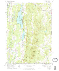
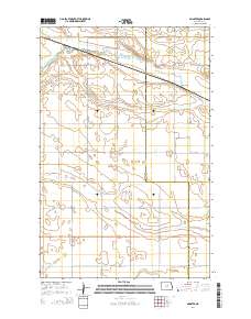
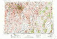
USGS Historical Quadrangle in GeoPDF.
Tags: 7.5 x 7.5 minute,
Downloadable Data,
GeoPDF,
GeoTIFF,
Historical Topographic Maps, All tags...
Historical Topographic Maps 7.5 x 7.5 Minute Map Series,
Map,
VT,
Wells,
imageryBaseMapsEarthCover, Fewer tags
USGS Historical Quadrangle in GeoPDF.
Tags: 1 x 2 degree,
Downloadable Data,
GeoPDF,
GeoTIFF,
Historical Topographic Maps, All tags...
Historical Topographic Maps 1 x 2 Degree Map Series,
Map,
NV,
Wells,
imageryBaseMapsEarthCover, Fewer tags
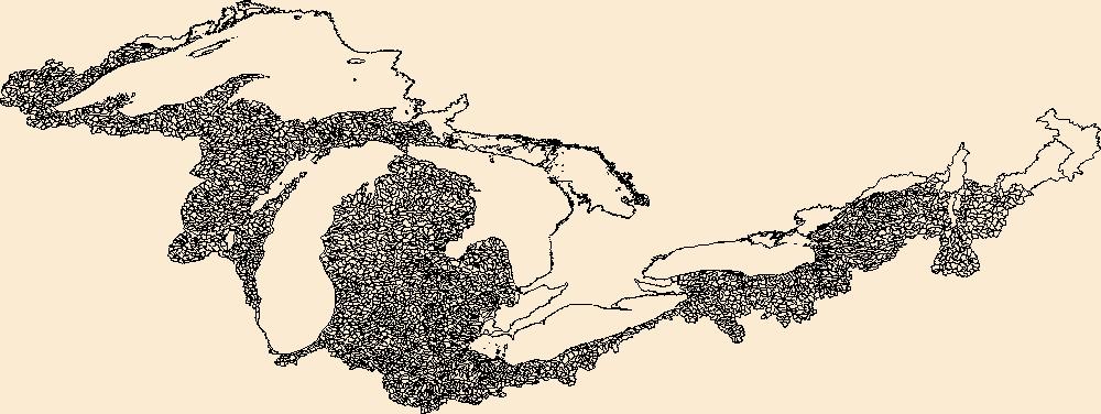
The Watershed Boundary Dataset (WBD) is a comprehensive aggregated collection of hydrologic unit data consistent with the national criteria for delineation and resolution. It defines the areal extent of surface water drainage to a point except in coastal or lake front areas where there could be multiple outlets as stated by the "Federal Standards and Procedures for the National Watershed Boundary Dataset (WBD)" "Standard" (https://pubs.usgs.gov/tm/11/a3/). Watershed boundaries are determined solely upon science-based hydrologic principles, not favoring any administrative boundaries or special projects, nor particular program or agency. This dataset represents the hydrologic unit boundaries to the 12-digit (6th level)...
Tags: 10-digit,
12-digit,
14-digit,
16-digit,
2-digit, All tags...
4-digit,
6-digit,
8-digit,
Adams,
Addison,
Aitkin,
Alcona,
Alger,
Allegan,
Allegany,
Allen,
Alpena,
Antrim,
Arenac,
Ashland,
Ashtabula,
Auglaize,
Baraga,
Barry,
Basin,
Bay,
Bayfield,
Bennington,
Benzie,
Berrien,
Branch,
Brown,
Caledonia,
Calhoun,
Calumet,
Carlton,
Cass,
Cattaraugus,
Cayuga,
Charlevoix,
Chautauqua,
Cheboygan,
Chemung,
Chippewa,
Chittenden,
Clare,
Clinton,
Columbia,
Cook,
Coos,
Cortland,
Crawford,
Cuyahoga,
DeKalb,
Defiance,
Delta,
Dickinson,
Dodge,
Door,
Douglas,
Downloadable Data,
Eaton,
Elkhart,
Emmet,
Erie,
Essex,
Florence,
Fond du Lac,
Forest,
Franklin,
Fulton,
Geauga,
Genesee,
GeoPackage,
Gladwin,
Gogebic,
Grand Isle,
Grand Traverse,
Gratiot,
Green Lake,
HU-2,
HU-2 Region,
HU2_04,
HUC,
Hamilton,
Hancock,
Hardin,
Henry,
Herkimer,
Hillsdale,
Houghton,
Huron,
Hydrography,
Hydrologic Unit Code,
Hydrologic Units,
IL,
IN,
Illinois,
Indiana,
Ingham,
Ionia,
Iosco,
Iron,
Isabella,
Itasca,
Jackson,
Jefferson,
Kalamazoo,
Kalkaska,
Kenosha,
Kent,
Kewaunee,
Keweenaw,
Kosciusko,
LaGrange,
LaPorte,
Lake,
Lamoille,
Langlade,
Lapeer,
Leelanau,
Lenawee,
Lewis,
Livingston,
Lorain,
Lucas,
Luce,
ME,
MI,
MN,
Mackinac,
Macomb,
Madison,
Maine,
Manistee,
Manitowoc,
Marathon,
Marinette,
Marion,
Marquette,
Mason,
Mecosta,
Medina,
Menominee,
Mercer,
Michigan,
Midland,
Milwaukee,
Minnesota,
Missaukee,
Monroe,
Montcalm,
Montmorency,
Muskegon,
NH,
NY,
National Watershed Boundary Dataset (WBD),
National Watershed Boundary Dataset (WBD),
New Hampshire,
New York,
Newaygo,
Niagara,
Noble,
OH,
Oakland,
Oceana,
Oconto,
Ogemaw,
Ohio,
Oneida,
Onondaga,
Ontario,
Ontonagon,
Open Geospatial Consortium GeoPackage 1.2,
Orange,
Orleans,
Osceola,
Oscoda,
Oswego,
Otsego,
Ottawa,
Outagamie,
Oxford,
Ozaukee,
PA,
Paulding,
Pennsylvania,
Pine,
Portage,
Porter,
Potter,
Presque Isle,
Putnam,
Racine,
Region,
Richland,
Roscommon,
Rutland,
Saginaw,
Sandusky,
Sanilac,
Schoolcraft,
Schuyler,
Seneca,
Shawano,
Sheboygan,
Shelby,
Shiawassee,
Somerset,
St. Clair,
St. Joseph,
St. Lawrence,
St. Louis,
Stark,
Steuben,
Sub-basin,
Sub-region,
Subwatershed,
Summit,
Tioga,
Tompkins,
Trumbull,
Tuscola,
US,
United States,
VT,
Van Buren,
Van Wert,
Vermont,
Vilas,
WBD,
WI,
Warren,
Washington,
Washtenaw,
Watershed,
Watershed Boundary Dataset,
Waukesha,
Waupaca,
Waushara,
Wayne,
Wells,
Wexford,
Whitley,
Williams,
Windsor,
Winnebago,
Wisconsin,
Wood,
Wyandot,
Wyoming,
Yates,
inlandWaters, Fewer tags

The Watershed Boundary Dataset (WBD) is a comprehensive aggregated collection of hydrologic unit data consistent with the national criteria for delineation and resolution. It defines the areal extent of surface water drainage to a point except in coastal or lake front areas where there could be multiple outlets as stated by the "Federal Standards and Procedures for the National Watershed Boundary Dataset (WBD)" "Standard" (https://pubs.usgs.gov/tm/11/a3/). Watershed boundaries are determined solely upon science-based hydrologic principles, not favoring any administrative boundaries or special projects, nor particular program or agency. This dataset represents the hydrologic unit boundaries to the 12-digit (6th level)...
Tags: 10-digit,
12-digit,
14-digit,
16-digit,
2-digit, All tags...
4-digit,
6-digit,
8-digit,
Adams,
Addison,
Aitkin,
Alcona,
Alger,
Allegan,
Allegany,
Allen,
Alpena,
Antrim,
Arenac,
Ashland,
Ashtabula,
Auglaize,
Baraga,
Barry,
Basin,
Bay,
Bayfield,
Bennington,
Benzie,
Berrien,
Branch,
Brown,
Caledonia,
Calhoun,
Calumet,
Carlton,
Cass,
Cattaraugus,
Cayuga,
Charlevoix,
Chautauqua,
Cheboygan,
Chemung,
Chippewa,
Chittenden,
Clare,
Clinton,
Columbia,
Cook,
Coos,
Cortland,
Crawford,
Cuyahoga,
DeKalb,
Defiance,
Delta,
Dickinson,
Dodge,
Door,
Douglas,
Downloadable Data,
Eaton,
Elkhart,
Emmet,
Erie,
Esri Shapefile nan,
Essex,
Florence,
Fond du Lac,
Forest,
Franklin,
Fulton,
Geauga,
Genesee,
Gladwin,
Gogebic,
Grand Isle,
Grand Traverse,
Gratiot,
Green Lake,
HU-2,
HU-2 Region,
HU2_04,
HUC,
Hamilton,
Hancock,
Hardin,
Henry,
Herkimer,
Hillsdale,
Houghton,
Huron,
Hydrography,
Hydrologic Unit Code,
Hydrologic Units,
IL,
IN,
Illinois,
Indiana,
Ingham,
Ionia,
Iosco,
Iron,
Isabella,
Itasca,
Jackson,
Jefferson,
Kalamazoo,
Kalkaska,
Kenosha,
Kent,
Kewaunee,
Keweenaw,
Kosciusko,
LaGrange,
LaPorte,
Lake,
Lamoille,
Langlade,
Lapeer,
Leelanau,
Lenawee,
Lewis,
Livingston,
Lorain,
Lucas,
Luce,
ME,
MI,
MN,
Mackinac,
Macomb,
Madison,
Maine,
Manistee,
Manitowoc,
Marathon,
Marinette,
Marion,
Marquette,
Mason,
Mecosta,
Medina,
Menominee,
Mercer,
Michigan,
Midland,
Milwaukee,
Minnesota,
Missaukee,
Monroe,
Montcalm,
Montmorency,
Muskegon,
NH,
NY,
National Watershed Boundary Dataset (WBD),
National Watershed Boundary Dataset (WBD),
New Hampshire,
New York,
Newaygo,
Niagara,
Noble,
OH,
Oakland,
Oceana,
Oconto,
Ogemaw,
Ohio,
Oneida,
Onondaga,
Ontario,
Ontonagon,
Orange,
Orleans,
Osceola,
Oscoda,
Oswego,
Otsego,
Ottawa,
Outagamie,
Oxford,
Ozaukee,
PA,
Paulding,
Pennsylvania,
Pine,
Portage,
Porter,
Potter,
Presque Isle,
Putnam,
Racine,
Region,
Richland,
Roscommon,
Rutland,
Saginaw,
Sandusky,
Sanilac,
Schoolcraft,
Schuyler,
Seneca,
Shapefile,
Shawano,
Sheboygan,
Shelby,
Shiawassee,
Somerset,
St. Clair,
St. Joseph,
St. Lawrence,
St. Louis,
Stark,
Steuben,
Sub-basin,
Sub-region,
Subwatershed,
Summit,
Tioga,
Tompkins,
Trumbull,
Tuscola,
US,
United States,
VT,
Van Buren,
Van Wert,
Vermont,
Vilas,
WBD,
WI,
Warren,
Washington,
Washtenaw,
Watershed,
Watershed Boundary Dataset,
Waukesha,
Waupaca,
Waushara,
Wayne,
Wells,
Wexford,
Whitley,
Williams,
Windsor,
Winnebago,
Wisconsin,
Wood,
Wyandot,
Wyoming,
Yates,
inlandWaters, Fewer tags
|
|

