Filters: Tags: wetlands (X)
1,420 results (29ms)|
Filters
Date Range
Extensions (Less)
Types (Less)
Contacts (Less)
Categories (Less)
Tag Types
|
This metadata record describes the materials contained in stake folder 696. Stake 696 is located at latitude 36.39889, longitude -112.63056. This location was photographed in the following years: 1872, 1968 and 1972. The materials associated with this item include original best quality images from each repeat date (preserved as digitized film images or in some cases digitized print photographs, depending on availability), scanned film envelopes with camera metadata, records of repeat photography sheets, and all field notes and/or camera notes associated with this stake. All attachments follow the following naming convention: stake_date_material_type_Kanab. Some stakes will have multiple materials from one repeat...
Types: Citation;
Tags: Albion camera,
Colorado River,
Dallmeyer lenses,
Kanab Creek,
Southwestern United States,
This metadata record describes the materials contained in stake folder 713. Stake 713 is located at latitude 36.42478, longitude -112.63036. This location was photographed in the following years: 1872 and 1968. The materials associated with this item include original best quality images from each repeat date (preserved as digitized film images or in some cases digitized print photographs, depending on availability), scanned film envelopes with camera metadata, records of repeat photography sheets, and all field notes and/or camera notes associated with this stake. All attachments follow the following naming convention: stake_date_material_type_Kanab. Some stakes will have multiple materials from one repeat date...
Types: Citation;
Tags: Albion camera,
Colorado River,
Dallmeyer lenses,
Kanab Creek,
Southwestern United States,
This metadata record describes the materials contained in stake folder 2595. Stake 2595 is located at latitude 36.392, longitude -112.629. This location was photographed in the following years: 1942 and 1993. The materials associated with this item include original best quality images from each repeat date (preserved as digitized film images or in some cases digitized print photographs, depending on availability), scanned film envelopes with camera metadata, records of repeat photography sheets, and all field notes and/or camera notes associated with this stake. All attachments follow the following naming convention: stake_date_material_type_Kanab. Some stakes will have multiple materials from one repeat date (e.g.,...
Types: Citation;
Tags: Albion camera,
Colorado River,
Dallmeyer lenses,
Kanab Creek,
Southwestern United States,
This metadata record describes the materials contained in stake folder 1506. Stake 1506 is located at latitude 36.38585, longitude -112.63963. This location was photographed in the following years: 1909 (no physical image) and 1990. The materials associated with this item include original best quality images from each repeat date (preserved as digitized film images or in some cases digitized print photographs, depending on availability), scanned film envelopes with camera metadata, records of repeat photography sheets, and all field notes and/or camera notes associated with this stake. All attachments follow the following naming convention: stake_date_material_type_Kanab. Some stakes will have multiple materials...
Types: Citation;
Tags: Albion camera,
Colorado River,
Dallmeyer lenses,
Kanab Creek,
Southwestern United States,
The NRP had its beginnings in the late 1950's. Since that time, the program has grown to encompass a broad spectrum of scientific investigations. The sciences of hydrology, mathematics, chemistry, physics, ecology, biology, geology, and engineering are used to gain a fundamental understanding of the processes that affect the availability, movement, and quality of the Nation's water resources. Results of NRP's long-term research investigations often lead to the development of new concepts, techniques, and approaches that are applicable not only to the solution of current water problems, but also to future issues that may affect the Nation's water resources. Basic tools of hydrology that have been developed by the...
Categories: Project;
Types: ScienceBase Project;
Tags: Acid Mine Drainage,
Aquatic Habitat,
Arid Land Hydrology,
Carbon Cycle,
Contaminant Reactions and Transport,

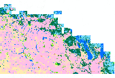
This data set represents wetland areas in Utah as delineated by the National Wetlands Inventory (NWI) conducted by the U. S. Fish and Wildlife Service (USFWS).

Level 3 of the Global Lakes and Wetlands Database (GLWD) comprises lakes, reservoirs, rivers, and different wetland types in the form of a global raster map at 30-sec resolution.
This dataset contains generalized landcover data for the Prairie Farm Rehabilitation Administration (PFRA) determined agricultural extent of Manitoba and Saskatchewan. This dataset was subset into two shapefiles. The other half of this dataset covers PFRA agricultural areas of Alberta and British Columbia. The Landcover Generalization process was undertaken to solve rendering problems of the original vectorized landcover data due to its unwieldy/overwhelming size. LANDSAT 7 imagery used in the process was collected during the WGTPP. This landcover imagery has a 30 meter resolution and is stored in over 1,100 vectorized 1:50,000 map sheet tiles. The data requires over seven gigabytes of disc space. If the user wishes...
This metadata record describes the materials contained in stake folder 2411. Stake 2411 is located at latitude 36.426, longitude -112.639. This location was photographed in the following years: 1872, 1968 and 1995. The materials associated with this item include original best quality images from each repeat date (preserved as digitized film images or in some cases digitized print photographs, depending on availability), scanned film envelopes with camera metadata, records of repeat photography sheets, and all field notes and/or camera notes associated with this stake. All attachments follow the following naming convention: stake_date_material_type_Kanab. Some stakes will have multiple materials from one repeat date...
Types: Citation;
Tags: Albion camera,
Colorado River,
Dallmeyer lenses,
Kanab Creek,
Southwestern United States,
Implementation of the U.S. Department of Agriculture (USDA) Conservation Reserve Program (CRP) and Wetlands Reserve Program (WRP) has resulted in the restoration of >2 million ha of wetland and grassland habitats in the Prairie Pothole Region (PPR). Restoration of habitats through these programs provides diverse ecosystem services to society, but few investigators have evaluated the environmental benefits achieved by these programs. We describe changes in wetland processes, functions, and ecosystem services that occur when wetlands and adjacent uplands on agricultural lands are restored through Farm Bill conservation programs. At the scale of wetland catchments, projects have had positive impacts on water storage,...
Categories: Publication;
Types: Citation;
Tags: carbon,
conservation,
ecosystem services,
grasslands,
prairie potholes,
Beavers (Castor canadensis Kuhl) can influence the competitive dynamics of plant species through selective foraging, collection of materials for dam creation, and alteration of hydrologic conditions. In the Grand Canyon National Park, the native Salix gooddingii C.R.Ball (Goodding?s willow) and Salix exigua Nutt. (coyote willow) are a staple food of beavers. Because Salix competes with the invasive Tamarix ramosissima Ledeb., land mangers are concerned that beavers may cause an increase in Tamarix through selective foraging of Salix. A spatial analysis was conducted to assess whether the presence of beavers correlates with the relative abundance of Salix and Tamarix. These methods were designed to detect a system-wide...
Categories: Publication;
Types: Citation,
Journal Citation;
Tags: Castor canadensis,
Colorado River,
Salix,
Springer Netherlands,
Wetlands,

This data set represents the extent, approximate location and type of wetlands and deepwater habitats in the conterminous United States. These data delineate the areal extent of wetlands and surface waters as defined by Cowardin et al. (1979). Certain wetland habitats are excluded from the National mapping program because of the limitations of aerial imagery as the primary data source used to detect wetlands. These habitats include seagrasses or submerged aquatic vegetation that are found in the intertidal and subtidal zones of estuaries and near shore coastal waters. Some deepwater reef communities (coral or tuberficid worm reefs) have also been excluded from the inventory. These habitats, because of their depth,...

This dataset is part of an extensive analysis of sea-level rise impacts on coastal habitats along the Chesapeake Bay, Delaware Bay, and the ocean beaches of southern New Jersey, Delaware, Maryland, and Virginia. The National Wildlife Federation commissioned Jonathan S. Clough of Warren Pinnacle Consulting, Inc., to apply the Sea Level Affecting Marshes Model (SLAMM, Version 5.0) to the Chesapeake Bay region. The SLAMM model is widely regarded as the premier research tool for simulating the dominant processes involved in wetland conversions and shoreline modifications during long-term sea-level rise. Our analysis looked at a range of sea-level rise scenarios from the 2001 Intergovernmental Panel on Climate Change...

This assessment presents GIS data containing results of all freshwater assessment analyses conducted by The Nature Conservancy for Washington State. This data set includes values for biodiversity metrics (e.g. suitability, threat, number of species) across all HUC6 watersheds in Washington State, as well as identifies rivers, watersheds, and wetlands that provide the best opportunities for conservation of Washington's native freshwater species and ecological systems. Fore more information, visit waconservation.org .

Level 2 of the Global Lakes and Wetlands Database (GLWD) comprises the shoreline polygons of permanent open water bodies (lakes, reservoirs, and rivers) with a surface area >= 0.1 square km, excluding the water bodies contained in GLWD-1.
The data set consists of data collected in 1995, 1996, and 1997 in wetlands in the Prairie Pothole Region of North Dakota and South Dakota. The data were summarized and used in the analysis for two publications in peer-reviewed journals. The data consists of one data set that includes bird abundance and richness data, wetland class (temporary, seasonal, semipermanent, permanent, alkali), and wetland type (private or federal). In conjunction with surveys of wetland birds, the following wetland variables also were recorded: wetland size, date, local-level habitat variables (percent coverage of open water, emergent vegetation, wet meadow, and shoreline/mudflat), and landscape-level habitat variables (percent cover...
Categories: Data;
Tags: Aquatic Biology,
Aquatic birds,
Arrowwood Wetland Management District,
Audubon Wetland Management District,
Biodiversity,
Winter climate change has the potential to have a large impact on coastal wetlands in the southeastern U.S. Warmer winter temperatures and reductions in the intensity of freeze events would likely lead to mangrove forest range expansion and salt marsh displacement in parts of the U.S. Gulf of Mexico and Atlantic coast. The objective of this research was to better understand some of the ecological implications of mangrove forest migration and salt marsh displacement. The potential ecological effects of mangrove migration are diverse ranging from important biotic impacts (e.g., coastal fisheries, land bird migration; colonial nesting wading birds) to ecosystem stability (e.g., response to sea level rise and drought;...
Winter climate change has the potential to have a large impact on coastal wetlands in the southeastern U.S. Warmer winter temperatures and reductions in the intensity of freeze events would likely lead to mangrove forest range expansion and salt marsh displacement in parts of the U.S. Gulf of Mexico and Atlantic coast. The objective of this research was to better understand some of the ecological implications of mangrove forest migration and salt marsh displacement. The potential ecological effects of mangrove migration are diverse ranging from important biotic impacts (e.g., coastal fisheries, land bird migration; colonial nesting wading birds) to ecosystem stability (e.g., response to sea level rise and drought;...
|

|
