Filters: Tags: {"type":"Publication"} (X) > Categories: Publication (X) > Types: Map Service (X)
20 results (90ms)|
Filters
Date Range
Extensions Types
Contacts
Categories Tag Schemes Tags (with Type=Publication ) |

Categories: Publication;
Types: Citation,
Map Service,
OGC WFS Layer,
OGC WMS Layer,
OGC WMS Service;
Tags: Data Series
Sexual segregation occurs frequently in sexually dimorphic species, and it may be influenced by differential habitat requirements between sexes or by social or evolutionary mechanisms that maintain separation of sexes regardless of habitat selection. Understanding the degree of sex-specific habitat specialization is important for management of wildlife populations and the design of monitoring and research programs. Using mid-summer aerial survey data for Dall’s sheep (Ovis dalli dalli) in southern Alaska during 1983–2011, we assessed differences in summer habitat selection by sex and reproductive status at the landscape scale in Wrangell-St. Elias National Park and Preserve (WRST). Males and females were highly...
Categories: Data,
Publication;
Types: Citation,
Downloadable,
Map Service,
OGC WFS Layer,
OGC WMS Layer,
Shapefile;
Tags: Journal of Mammalogy
The Yukon River Basin, underlain by discontinuous permafrost, has experienced a warming climate over the last century that has altered air temperature, precipitation, and permafrost. We investigated a water chemistry database from 1982 to 2014 for the Yukon River and its major tributary, the Tanana River. Significant increases of Ca, Mg, and Na annual flux were found in both rivers. Additionally, SO4 and P annual flux increased in the Yukon River. No annual trends were observed for dissolved organic carbon (DOC) from 2001 to 2014. In the Yukon River, Mg and SO4 flux increased throughout the year, while some of the most positive trends for Ca, Mg, Na, SO4, and P flux occurred during the fall and winter months. Both...
Categories: Data,
Publication;
Types: Citation,
Downloadable,
Map Service,
OGC WFS Layer,
OGC WMS Layer,
Shapefile;
Tags: Geophysical Research Letters
Estimates of the seasonal and interannual exchanges of carbon dioxide (CO2) and methane (CH4) between land ecosystems north of 45°N and the atmosphere are poorly constrained, in part, because of uncertainty in the temporal variability of water-inundated land area. Here we apply a process-based biogeochemistry model to evaluate how interannual changes in wetland inundation extent might have influenced the overall carbon dynamics of the region during the time period 1993–2004. We find that consideration by our model of these interannual variations between 1993 and 2004, on average, results in regional estimates of net methane sources of 67.8 ± 6.2 Tg CH4 yr−1, which is intermediate to model estimates that use two...
Categories: Data,
Publication;
Types: Citation,
Downloadable,
Map Service,
OGC WFS Layer,
OGC WMS Layer,
Shapefile;
Tags: Environmental Research Letters

Categories: Publication;
Types: Citation,
Map Service,
OGC WFS Layer,
OGC WMS Layer,
OGC WMS Service;
Tags: Scientific Investigations Report
Categories: Publication;
Types: Citation,
Map Service,
OGC WFS Layer,
OGC WMS Layer,
OGC WMS Service;
Tags: Data Series
Categories: Publication;
Types: Citation,
Map Service,
OGC WFS Layer,
OGC WMS Layer,
OGC WMS Service;
Tags: Data Series
Categories: Publication;
Types: Citation,
Map Service,
OGC WFS Layer,
OGC WMS Layer,
OGC WMS Service;
Tags: Scientific Investigations Report
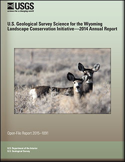
U.S. Geological Survey Science for the Wyoming Landscape Conservation Initiative: 2014 annual report
This is the seventh report produced by the U.S. Geological Survey (USGS) for the Wyoming Landscape Conservation Initiative (WLCI) to detail annual activities conducted by the USGS for addressing specific management needs identified by WLCI partners. In FY2014, there were 26 projects, including a new one that was completed, two others that were also completed, and several that entered new phases or directions. The 26 projects fall into several categories: (1) synthesizing and analyzing existing data to identify current conditions on the landscape and using the data to develop models for projecting past and future landscape conditions; (2) monitoring indicators of ecosystem conditions and the effectiveness of on-the-ground...
Categories: Publication;
Types: Citation,
Map Service,
OGC WFS Layer,
OGC WMS Layer,
OGC WMS Service;
Tags: Open-File Report
Categories: Publication;
Types: Citation,
Map Service,
OGC WFS Layer,
OGC WMS Layer,
OGC WMS Service;
Tags: Open-File Report
Risk to predators hunting dangerous prey is an emerging area of research and could account for possible persistent differences in gray wolf (Canis lupus) pack sizes. We documented significant differences in long-term wolf-pack-size averages and variation in the Superior National Forest (SNF), Denali National Park and Preserve, Yellowstone National Park, and Yukon, Canada (p<0.01). The SNF differences could be related to the wolves’ risk when hunting primary prey, for those packs (N=3) hunting moose (Alces americanus) were significantly larger than those (N=10) hunting white-tailed deer (Odocoileus virginianus) (F1,8=16.50, p=0.004). Our data support the hypothesis that differential pack-size persistence may be perpetuated...
Categories: Data,
Publication;
Types: Citation,
Downloadable,
Map Service,
OGC WFS Layer,
OGC WMS Layer,
Shapefile;
Tags: Behaviour
Identification of landscape features influencing gene flow: How useful are habitat selection models?
Understanding how dispersal patterns are influenced by landscape heterogeneity is critical for modeling species connectivity. Resource selection function (RSF) models are increasingly used in landscape genetics approaches. However, because the ecological factors that drive habitat selection may be different from those influencing dispersal and gene flow, it is important to consider explicit assumptions and spatial scales of measurement. We calculated pairwise genetic distance among 301 Dall's sheep (Ovis dalli dalli) in southcentral Alaska using an intensive noninvasive sampling effort and 15 microsatellite loci. We used multiple regression of distance matrices to assess the correlation of pairwise genetic distance...
Categories: Data,
Publication;
Types: Citation,
Downloadable,
Map Service,
OGC WFS Layer,
OGC WMS Layer,
Shapefile;
Tags: Baseline 5-Baseline data, species of concern: Dall-Thinhorn sheep,
Evolutionary Applications
Categories: Publication;
Types: Citation,
Map Service,
OGC WFS Layer,
OGC WMS Layer,
OGC WMS Service;
Tags: Scientific Investigations Report
Methane (CH4) emissions from the northern high-latitude region represent potentially significant biogeochemical feedbacks to the climate system. We compiled a database of growing-season CH4 emissions from terrestrial ecosystems located across permafrost zones, including 303 sites described in 65 studies. Data on environmental and physical variables, including permafrost conditions, were used to assess controls on CH4 emissions. Water table position, soil temperature, and vegetation composition strongly influenced emissions and had interacting effects. Sites with a dense sedge cover had higher emissions than other sites at comparable water table positions, and this was an effect that was more pronounced at low soil...
Categories: Data,
Publication;
Types: Citation,
Downloadable,
Map Service,
OGC WFS Layer,
OGC WMS Layer,
Shapefile;
Tags: Global Change Biology
Categories: Publication;
Types: Citation,
Map Service,
OGC WFS Layer,
OGC WMS Layer,
OGC WMS Service;
Tags: Fact Sheet
Categories: Publication;
Types: Citation,
Map Service,
OGC WFS Layer,
OGC WMS Layer,
OGC WMS Service;
Tags: Fact Sheet
Categories: Publication;
Types: Citation,
Map Service,
OGC WFS Layer,
OGC WMS Layer,
OGC WMS Service;
Tags: Scientific Investigations Report
The impacts from climate change are increasing the possibility of vulnerable coastal species and habitats crossing critical thresholds that could spur rapid and possibly irreversible changes. For species of high conservation concern, improved knowledge of quantitative thresholds could greatly improve management. To meet this need, we synthesized information pertaining to biological responses as tipping points to sea level rise (SLR) and coastal storms for 45 fish, wildlife, and plant species along the U.S. Atlantic and Gulf Coasts and Caribbean through a literature review and expert elicitation. Although these species were selected based on their ecological, economic, and cultural importance, just over half (56%,...
Categories: Publication;
Types: Citation,
Map Service,
OGC WFS Layer,
OGC WMS Layer,
OGC WMS Service;
Tags: Scientific Investigations Report
The Beringian Coevolution Project (BCP), a field program underway in the high northern latitudes since 1999, has focused on building key scientific infrastructure for integrated specimen-based studies on mammals and their associated parasites. BCP has contributed new insights across temporal and spatial scales into how ancient climate and environmental change have shaped faunas, emphasizing processes of assembly, persistence, and diversification across the vast Beringian region. BCP collections also represent baseline records of biotic diversity from across the northern high latitudes at a time of accelerated environmental change. These specimens and associated data form an unmatched resource for identifying hidden...
Categories: Data,
Publication;
Types: Citation,
Downloadable,
Map Service,
OGC WFS Layer,
OGC WMS Layer,
Shapefile;
Tags: Arctic Science
|

|
