Filters: Date Range: {"choice":"year"} (X) > Tags: imagerybasemapsearthcover (X)
26,368 results (521ms)|
Filters
Date Types (for Date Range)
Types Contacts
Categories Tag Types
|
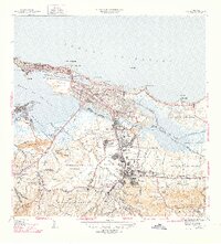
USGS Historical Quadrangle in GeoPDF.
LANDFIRE's (LF) 2022 update (LF 2022) Existing Vegetation Cover (EVC) represents the vertically projected percent cover of the live canopy for a 30-m cell. EVC is produced separately for tree, shrub, and herbaceous lifeforms. Training data depicting percentages of canopy cover are obtained from plot-level ground-based visual assessments and lidar observations. These are combined with Landsat imagery (from multiple seasons), to inform models built independently for each lifeform. Tree, shrub, and herbaceous lifeforms each have a potential range from 10% to 100% (cover values less than 10% are binned into the 10% value). The three independent lifeform datasets are merged into a single product based on the dominant...
LANDFIRE (LF) disturbance products are developed to provide temporal and spatial information related to landscape change. Historical Disturbance (HDist) is developed from the base annual LF disturbance products, and attribute code system, to represent the history of disturbance for a 10-year span. Each year's disturbance scenarios are checked against time relevant LF vegetation products to check for logical inconsistencies. Errant codes are flagged and updated to a discard code with the remaining disturbance types cross-walked/aggregated to Fuel Disturbance (FDist) types. HDist includes the year of disturbance that is recorded for that pixel. In LF 2022, the time since disturbance code is the same for both HDist...
LANDFIRE (LF) 2022 Fuel Vegetation Type (FVT) represents the LF Existing Vegetation Type Ecological Systems (EVT) product, modified to represent pre-disturbance EVT in areas where disturbances have occurred over the past 10 years. Due to shifting EVT codes and labels throughout the years, the FVT codes are based on an early version of EVT codes translated from the current version. FVT is an input for fuel transitions related to disturbance. Fuel products in LF 2022 were created with LF 2016 Remap vegetation in non-disturbed areas. To designate disturbed areas where FVT is modified, the aggregated Annual Disturbance products from 2013 to 2022 in the Fuel Disturbance (FDist) product are used. All existing disturbances...
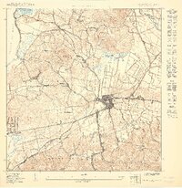
USGS Historical Quadrangle in GeoPDF.
The Monitoring Trends in Burn Severity (MTBS) Program assesses the frequency, extent, and magnitude (size and severity) of all large wildland fires (wildfires and prescribed fires) in the conterminous United States (CONUS), Alaska, Hawaii, and Puerto Rico for the period 1984 and beyond. All fires reported as greater than 1,000 acres in the western U.S. and greater than 500 acres in the eastern U.S. are mapped across all ownerships. MTBS produces a series of geospatial and tabular data for analysis at a range of spatial, temporal, and thematic scales and are intended to meet a variety of information needs that require consistent data about fire effects through space and time. This map layer is a thematic raster image...
The Monitoring Trends in Burn Severity (MTBS) Program assesses the frequency, extent, and magnitude (size and severity) of all large wildland fires (wildfires and prescribed fires) in the conterminous United States (CONUS), Alaska, Hawaii, and Puerto Rico for the period 1984 and beyond. All fires reported as greater than 1,000 acres in the western U.S. and greater than 500 acres in the eastern U.S. are mapped across all ownerships. MTBS produces a series of geospatial and tabular data for analysis at a range of spatial, temporal, and thematic scales and are intended to meet a variety of information needs that require consistent data about fire effects through space and time. This map layer is a thematic raster image...
The Monitoring Trends in Burn Severity (MTBS) Program assesses the frequency, extent, and magnitude (size and severity) of all large wildland fires (wildfires and prescribed fires) in the conterminous United States (CONUS), Alaska, Hawaii, and Puerto Rico for the period 1984 and beyond. All fires reported as greater than 1,000 acres in the western U.S. and greater than 500 acres in the eastern U.S. are mapped across all ownerships. MTBS produces a series of geospatial and tabular data for analysis at a range of spatial, temporal, and thematic scales and are intended to meet a variety of information needs that require consistent data about fire effects through space and time. This map layer is a thematic raster image...
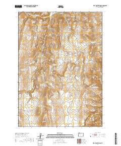
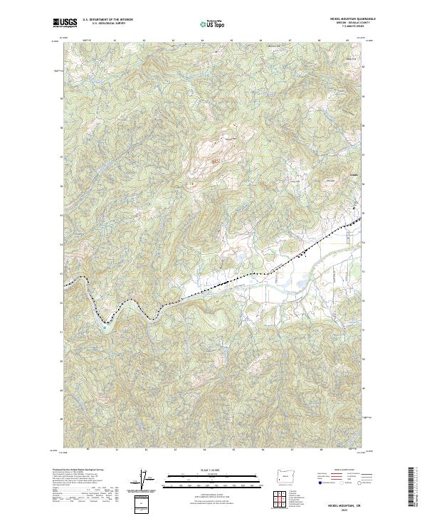
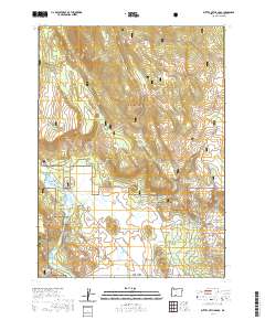
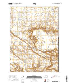
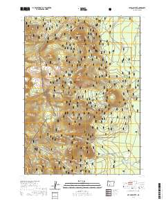
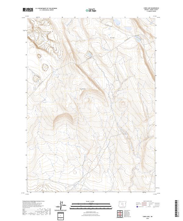
Layered geospatial PDF 7.5 Minute Quadrangle Map. Layers of geospatial data include orthoimagery, roads, grids, geographic names, elevation contours, hydrography, and other selected map features. This map is derived from GIS (geospatial information system) data. It represents a repackaging of GIS data in traditional map form, not creation of new information. The geospatial data in this map are from selected National Map data holdings and other government sources.
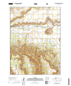
Layered geospatial PDF 7.5 Minute Quadrangle Map. Layers of geospatial data include orthoimagery, roads, grids, geographic names, elevation contours, hydrography, and other selected map features. This map is derived from GIS (geospatial information system) data. It represents a repackaging of GIS data in traditional map form, not creation of new information. The geospatial data in this map are from selected National Map data holdings and other government sources.
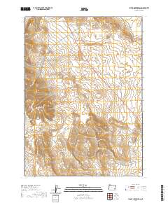
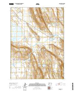
Layered geospatial PDF 7.5 Minute Quadrangle Map. Layers of geospatial data include orthoimagery, roads, grids, geographic names, elevation contours, hydrography, and other selected map features. This map is derived from GIS (geospatial information system) data. It represents a repackaging of GIS data in traditional map form, not creation of new information. The geospatial data in this map are from selected National Map data holdings and other government sources.
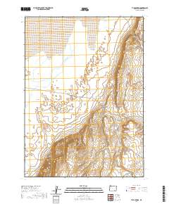
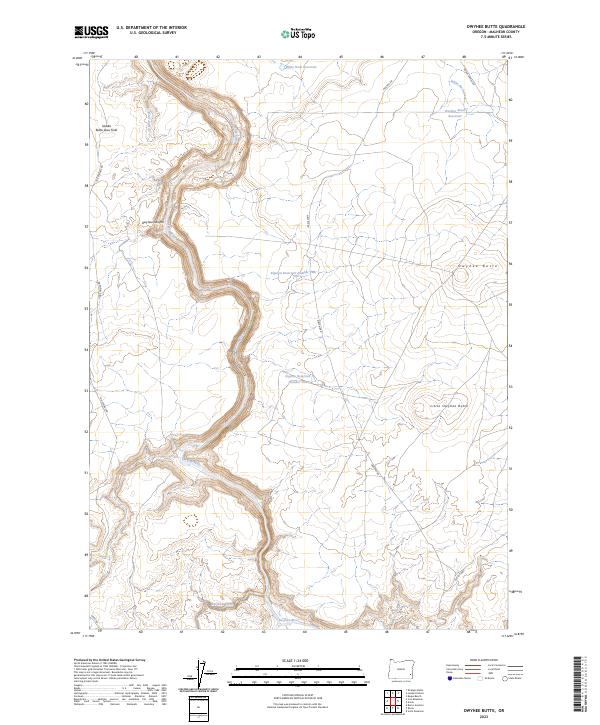
Layered geospatial PDF 7.5 Minute Quadrangle Map. Layers of geospatial data include orthoimagery, roads, grids, geographic names, elevation contours, hydrography, and other selected map features. This map is derived from GIS (geospatial information system) data. It represents a repackaging of GIS data in traditional map form, not creation of new information. The geospatial data in this map are from selected National Map data holdings and other government sources.

USGS Historical Quadrangle in GeoPDF.
Layered geospatial PDF 7.5 Minute Quadrangle Map. Layers of geospatial data include orthoimagery, roads, grids, geographic names, elevation contours, hydrography, and other selected map features. This map is derived from GIS (geospatial information system) data. It represents a repackaging of GIS data in traditional map form, not creation of new information. The geospatial data in this map are from selected National Map data holdings and other government sources.
Layered geospatial PDF 7.5 Minute Quadrangle Map. Layers of geospatial data include orthoimagery, roads, grids, geographic names, elevation contours, hydrography, and other selected map features. This map is derived from GIS (geospatial information system) data. It represents a repackaging of GIS data in traditional map form, not creation of new information. The geospatial data in this map are from selected National Map data holdings and other government sources.
Layered geospatial PDF 7.5 Minute Quadrangle Map. Layers of geospatial data include orthoimagery, roads, grids, geographic names, elevation contours, hydrography, and other selected map features. This map is derived from GIS (geospatial information system) data. It represents a repackaging of GIS data in traditional map form, not creation of new information. The geospatial data in this map are from selected National Map data holdings and other government sources.
Layered geospatial PDF 7.5 Minute Quadrangle Map. Layers of geospatial data include orthoimagery, roads, grids, geographic names, elevation contours, hydrography, and other selected map features. This map is derived from GIS (geospatial information system) data. It represents a repackaging of GIS data in traditional map form, not creation of new information. The geospatial data in this map are from selected National Map data holdings and other government sources.
Layered geospatial PDF 7.5 Minute Quadrangle Map. Layers of geospatial data include orthoimagery, roads, grids, geographic names, elevation contours, hydrography, and other selected map features. This map is derived from GIS (geospatial information system) data. It represents a repackaging of GIS data in traditional map form, not creation of new information. The geospatial data in this map are from selected National Map data holdings and other government sources.
Layered geospatial PDF 7.5 Minute Quadrangle Map. Layers of geospatial data include orthoimagery, roads, grids, geographic names, elevation contours, hydrography, and other selected map features. This map is derived from GIS (geospatial information system) data. It represents a repackaging of GIS data in traditional map form, not creation of new information. The geospatial data in this map are from selected National Map data holdings and other government sources.
Layered geospatial PDF 7.5 Minute Quadrangle Map. Layers of geospatial data include orthoimagery, roads, grids, geographic names, elevation contours, hydrography, and other selected map features. This map is derived from GIS (geospatial information system) data. It represents a repackaging of GIS data in traditional map form, not creation of new information. The geospatial data in this map are from selected National Map data holdings and other government sources.
|

|
