Filters: Date Range: {"choice":"year"} (X) > Tags: orthoimagery (X)
17 results (96ms)|
Filters
Date Types (for Date Range)
Types Contacts
Categories Tag Types Tag Schemes |
In May 2021, the Grand Canyon Monitoring and Research Center (GCMRC) of the U.S. Geological Survey’s (USGS), Southwest Biological Science Center (SBSC) acquired airborne multispectral high resolution data for the Colorado River in Grand Canyon in Arizona, USA. The imagery data consist of four bands (Band 1 – red, Band 2 – green, Band 3 – blue, and Band 4 – near infrared) with a ground resolution of 20 centimeters (cm). These image data are available to the public as 16-bit GeoTIFF files, which can be read and used by most geographic information system (GIS) and image-processing software. The spatial reference of the image data are in the State Plane (SP) map projection using the central Arizona zone (FIPS 0202)...
These data were compiled to perform analyses of hydrologic change, changes in sediment transport, and channel change within Moenkopi Wash, Arizona. Objective(s) of our study were to quantify the magnitude and timing of changes in hydrology, sediment transport, and channel form within Moenkopi Wash and to determine the downstream effects of those changes on sediment delivery downstream to the Little Colorado River, and the Colorado River. These data represent instantaneous discharge records, suspended-sediment sample records, topographic survey data, historical aerial imagery, and channel polygons and centerlines mapped on the historical imagery. Instantaneous discharge records in this study began in 1926 and extend...
The Middle Fork Willamette River basin encompasses 3,548 square kilometers of western Oregon and drains to the mainstem Willamette River. Fall Creek basin encompasses 653 square kilometers and drains to the Middle Fork Willamette River. In cooperation with the U.S. Army Corps of Engineers, the U.S. Geological Survey evaluated geomorphic responses of downstream river corridors to annual drawdowns to streambed at Fall Creek Lake. This study of geomorphic change is focused on the major alluvial channel segments downstream of the U.S. Army Corps of Engineers’ dams on Fall Creek and the Middle Fork Willamette River, as well as the 736 hectare Fall Creek Lake. Reservoir erosion during streambed drawdown results in sediment...
In May 2013, the Grand Canyon Monitoring and Research Center (GCMRC) of the U.S. Geological Survey’s (USGS) Southwest Biological Science Center (SBSC) acquired airborne multispectral high resolution data for the Colorado River in Grand Canyon in Arizona, USA. The imagery data consist of four bands (blue, green, red and near infrared) with a ground resolution of 20 centimeters (cm). These data are available to the public as 16-bit geotiff files. They are projected in the State Plane (SP) map projection using the central Arizona zone (202) and the North American Datum of 1983 (NAD83). The assessed accuracy for these data is based on 91 Ground Control Points (GCPs), and is reported at 95% confidence as 0.64 meters...
These data were compiled to perform analyses of hydrologic change, changes in sediment transport, and channel change within Moenkopi Wash, Arizona. Objective(s) of our study were to quantify the magnitude and timing of changes in hydrology, sediment transport, and channel form within Moenkopi Wash and to determine the downstream effects of those changes on sediment delivery downstream to the Little Colorado River, and the Colorado River. These data represent instantaneous discharge records, suspended-sediment sample records, topographic survey data, historical aerial imagery, and channel polygons and centerlines mapped on the historical imagery. Instantaneous discharge records in this study began in 1926 and extend...
These data were compiled to perform analyses of hydrologic change, changes in sediment transport, and channel change within Moenkopi Wash, Arizona. Objective(s) of our study were to quantify the magnitude and timing of changes in hydrology, sediment transport, and channel form within Moenkopi Wash and to determine the downstream effects of those changes on sediment delivery downstream to the Little Colorado River, and the Colorado River. These data represent instantaneous discharge records, suspended-sediment sample records, topographic survey data, historical aerial imagery, and channel polygons and centerlines mapped on the historical imagery. Instantaneous discharge records in this study began in 1926 and extend...
This data release presents structure-from-motion (SfM) products derived from aerial imagery collected along the North Carolina coast in response to storm events and the recovery process. U.S. Geological Survey (USGS) researchers use the aerial imagery and products to assess future coastal vulnerability, nesting habitats for wildlife, and provide data for hurricane impact models. This research is part of the Remote Sensing Coastal Change Project. Products include digital elevation models and orthorectified imagery (RGB-averaged products) created from aerial imagery surveys with precise Global Navigation Satellite System (GNSS) navigation data flown in a piloted fixed-wing aircraft. The products span the coast over...
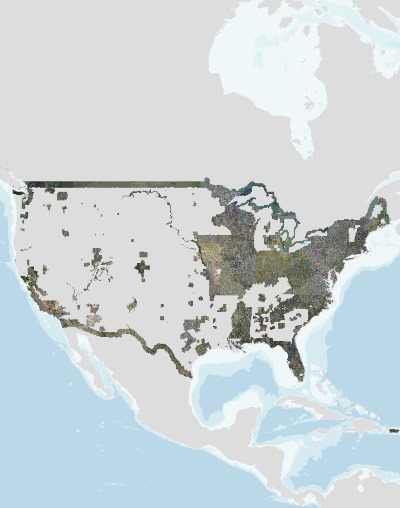
USGS high resolution orthorectified images from The National Map combine the image characteristics of an aerial photograph with the geometric qualities of a map. An orthoimage is a uniform-scale image where corrections have been made for feature displacement such as building tilt and for scale variations caused by terrain relief, sensor geometry, and camera tilt. A mathematical equation based on ground control points, sensor calibration information, and a digital elevation model is applied to each pixel to rectify the image to obtain the geometric qualities of a map. A digital orthoimage may be created from several photographs mosaicked to form the final image. The source imagery may be black-and-white, natural...
This data release presents a time series of aerial imagery and derived structure-from-motion (SfM) products collected along the Delaware Atlantic coast with a piloted fixed-wing aircraft. U.S. Geological Survey (USGS) researchers use the aerial imagery and products to assess topographic and landscape change, evaluate nesting habitats for wildlife, and for understanding coastal vulnerability and response to disturbance events. Products include three-dimensional (3D) point clouds and digital elevation models, and orthomosaic images (RGB-averaged products) created from aerial imagery surveys with precise Global Navigation Satellite System (GNSS) data. The products span the coast over both highly developed towns and...
Types: Map Service,
OGC WFS Layer,
OGC WMS Layer,
OGC WMS Service;
Tags: Coastal,
Delaware,
Digital Elevation Models (DEMs),
East Coast,
Geography,
The Middle Fork Willamette River basin encompasses 3,548 square kilometers of western Oregon and drains to the mainstem Willamette River. Fall Creek basin encompasses 653 square kilometers and drains to the Middle Fork Willamette River. In cooperation with the U.S. Army Corps of Engineers, the U.S. Geological Survey evaluated geomorphic responses of downstream river corridors to annual drawdowns to streambed at Fall Creek Lake. This study of geomorphic change is focused on the major alluvial channel segments downstream of the U.S. Army Corps of Engineers’ dams on Fall Creek and the Middle Fork Willamette River, as well as the 736 hectare Fall Creek Lake. Reservoir erosion during streambed drawdown results in sediment...
Remote-sensing technologies—such as video imagery, aerial photography, satellite imagery, structure-from-motion (SfM) photogrammetry, and lidar (laser-based surveying)— can be used to measure change along U.S. coastlines. Quantifying coastal change is essential for calculating trends in erosion and accretion, evaluating processes that shape coastal landscapes, and predicting how the coast will respond to future natural disasters (e.g. hurricanes, landslides, wildfires) and longer term climate trends such (e.g. sea-level rise, ecosystem change, coral bleaching), all critical for U.S. coastal communities. Rapid developments have occurred in remote-sensing technologies during the 21st century. With collaborators...
In May 2021, the Grand Canyon Monitoring and Research Center (GCMRC) of the U.S. Geological Survey’s (USGS), Southwest Biological Science Center (SBSC) acquired airborne multispectral high resolution data for the Colorado River in Grand Canyon in Arizona, USA. The imagery data consist of four bands (Band 1 – red, Band 2 – green, Band 3 – blue, and Band 4 – near infrared) with a ground resolution of 20 centimeters (cm). These image data are available to the public as 16-bit GeoTIFF files, which can be read and used by most geographic information system (GIS) and image-processing software. The spatial reference of the image data are in the State Plane (SP) map projection using the central Arizona zone (FIPS 0202)...
These data were compiled to perform analyses of hydrologic change, changes in sediment transport, and channel change within Moenkopi Wash, Arizona. Objective(s) of our study were to quantify the magnitude and timing of changes in hydrology, sediment transport, and channel form within Moenkopi Wash and to determine the downstream effects of those changes on sediment delivery downstream to the Little Colorado River, and the Colorado River. These data represent instantaneous discharge records, suspended-sediment sample records, topographic survey data, historical aerial imagery, and channel polygons and centerlines mapped on the historical imagery. Instantaneous discharge records in this study began in 1926 and extend...
The Middle Fork Willamette River basin encompasses 3,548 square kilometers of western Oregon and drains to the mainstem Willamette River. Fall Creek basin encompasses 653 square kilometers and drains to the Middle Fork Willamette River. In cooperation with the U.S. Army Corps of Engineers, the U.S. Geological Survey evaluated geomorphic responses of downstream river corridors to annual drawdowns to streambed at Fall Creek Lake. This study of geomorphic change is focused on the major alluvial channel segments downstream of the U.S. Army Corps of Engineers’ dams on Fall Creek and the Middle Fork Willamette River, as well as the 736 hectare Fall Creek Lake. Reservoir erosion during streambed drawdown results in sediment...
|

|
