Filters: Categories: Publication (X) > partyWithName: U.S. Geological Survey (X)
19 results (71ms)|
Filters
Date Range
Extensions Types Contacts
Categories Tag Types
|
Freshwater fish are among the most vulnerable taxa to climate change globally but are generally understudied in tropical island ecosystems. Climate change is predicted to alter the intensity, frequency, and variability of extreme flow events on the Caribbean island of Puerto Rico. These changes may impact Caribbean native and non-native stream ecosystems and biota complex ways. We compiled an extensive dataset of native and non-native fish assemblages collected at 119 sites across Puerto Rico from 2005 to 2015. We coupled these data with stream flow indices and dam height to understand how flow dynamics drive fish assemblage structure. Sixteen percent of sites contained exclusively non-native species, 34% contained...
Categories: Data,
Publication;
Types: Citation;
Tags: Aquatic Biology,
Caribbean,
Caribbean ecosystems,
Hydrology,
USGS Science Data Catalog (SDC),
Fish occurrence data to support high-resolution distribution models and test various community and macroecological hypotheses have not been available at the national scale. We present IchthyMaps, a database of high-quality historical fish occurrences covering fishes of the conterminous United States. Designed on the principles of metacommunity ecology, IchthyMaps is a compilation of presence records from atlases up to 1990, at the resolution of the 1:100,000 National Hydrography Database Plus (NHDPlus) inter-confluence stream segment, readily aggregated into hierarchically coarser units (e.g. hydrologic unit code 8-digit and 12-digit watersheds). IchthyMaps contains about 606,550 presence records for 1,038 species...
Categories: Data,
Publication;
Types: Citation;
Tags: Alabama,
Arizona,
Arkansas,
Biological Data,
Biological sampling,
Abstract (from http://www.springerplus.com/content/3/1/589): The growing quality and availability of spatial map layers (e.g., climate, geology, and land use) allow stream studies, which historically have occurred over small areas like a single watershed or stream reach, to increasingly explore questions from a landscape perspective. This large-scale perspective for fluvial studies depends on the ability to characterize influences on streams resulting from throughout entire upstream networks or catchments. While acquiring upstream information for a single reach is relatively straight-forward, this process becomes demanding when attempting to obtain summaries for all streams throughout a stream network and across...
Categories: Publication;
Types: Citation;
Tags: Aggregation,
Digitized stream network,
GIS,
Habitat Characterization,
Landscape information,
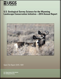
U.S. Geological Survey Science for the Wyoming Landscape Conservation Initiative: 2014 annual report
This is the seventh report produced by the U.S. Geological Survey (USGS) for the Wyoming Landscape Conservation Initiative (WLCI) to detail annual activities conducted by the USGS for addressing specific management needs identified by WLCI partners. In FY2014, there were 26 projects, including a new one that was completed, two others that were also completed, and several that entered new phases or directions. The 26 projects fall into several categories: (1) synthesizing and analyzing existing data to identify current conditions on the landscape and using the data to develop models for projecting past and future landscape conditions; (2) monitoring indicators of ecosystem conditions and the effectiveness of on-the-ground...
Categories: Publication;
Types: Citation,
Map Service,
OGC WFS Layer,
OGC WMS Layer,
OGC WMS Service;
Tags: Open-File Report
The purpose of this report is to present, analyze, and discuss information about the ecological condition of the Upper Mississippi River System (UMRS). The report includes, but is not limited to data and results from the initial years of the Long Term Resource Monitoring Program (LTRMP), the largest monitoring program in the country. The mission of the LTRMP is to provide decision makers with information they need to maintain the UMRS as a sustainable large river ecosystem given its multiple-use character.
This dataset contains information from 674 publications (academic and grey literature) that assessed the effects of climate variability and climate change on the 15 ungulate species that are native to the United States, Canada, Mexico, and Greenland. The publication contains literature published between 1947 and September 2020. Information documented includes study location, climate variables assessed, and ungulate outcomes measured (e.g., life history characteristics, population demographics, migratory behavior).
Categories: Data,
Publication;
Types: Citation;
Tags: Canada,
Greenland,
Mexico,
North America,
USGS Science Data Catalog (SDC),
Geologic Map of MTM -45252 and-45257 Quadrangles, Reull Vallis Region of Mars, credited to Mest, Scott C.; Crown, David A., published in 2003.
Categories: Map,
Publication
Landforms along the Pacific, Gulf of Mexico, and Atlantic coastlines for the conterminous United States are attributed with the relative vulnerability of horizontal erosion due to sea-level rise to characterize coastal zone stability. The position and extent of landforms are geospatially indexed as line-events where these coastal zone features are intersected by the linear-referenced 2013 - 2014 U.S. Geological Survey National Hydrography Dataset Coastline, which corresponds to the National Oceanic and Atmospheric Administration (NOAA) 2013 - 2014 mean high water level datum delineated in intertidal zones open to oceans, behind barrier coasts in bays, lagoons, and estuaries, and sometimes where tidal currents reach...
Categories: Data,
Data Release - In Progress,
Publication;
Types: ArcGIS REST Map Service,
ArcGIS Service Definition,
Citation,
Downloadable,
Map Service,
OGC WFS Layer,
OGC WMS Layer,
Shapefile;
Tags: Geomorphology,
Gulf,
Gulf of Mexico,
HEM,
Hydro linked data,
Geologic map of the Uruk Sulcus Quadrangle of Ganymede, credited to Guest, J. E.; Bianchi, Remo; Greeley, Ronald, published in 1994.
Categories: Map,
Publication
The American Fisheries Society and the Human Dimensions Research Unit of Cornell University have been engaged by NCCWSC to lead 5-year reviews of the CSCs. The purpose of the CSC review and evaluation is to: 1. Evaluate the effectiveness of each CSC in meeting project goals. 2. Assess the level of scientific contribution and achievement at each CSC with respect to climate modeling, climate change impacts assessments, vulnerability and adaptation of fish, wildlife and their habitats, and collaborative development of adaptation strategies for regional stakeholders, and education and training of graduate and post‐doctoral fellows 3. Evaluate the competencies and efficiencies of each host university in managing...
Categories: Publication;
Types: Citation;
Tags: National CASC,
Science Tools for Managers,
Social Science
Landforms along the Pacific, Gulf of Mexico, and Atlantic coastlines for the conterminous United States are attributed with the relative vulnerability of horizontal erosion due to sea-level rise to characterize coastal zone stability. The position and extent of landforms are geospatially indexed as line-events where these coastal zone features are intersected by the linear-referenced 2013 - 2014 U.S. Geological Survey National Hydrography Dataset Coastline, which corresponds to the National Oceanic and Atmospheric Administration (NOAA) 2013 - 2014 mean high water level datum delineated in intertidal zones open to oceans, behind barrier coasts in bays, lagoons, and estuaries, and sometimes where tidal currents reach...
Categories: Data,
Data Release - In Progress,
Publication;
Types: ArcGIS REST Map Service,
ArcGIS Service Definition,
Citation,
Downloadable,
Map Service,
OGC WFS Layer,
OGC WMS Layer,
Shapefile;
Tags: Atlantic,
Connecticut,
Delaware,
Florida,
Geomorphology,
CloseTest is a Windows program for testing capture-recapture data for closure, where closure means no individuals were added to or lost from the population of interest over the sampling period. Test statistics are computed using the closure test presented in Stanley, T.R., and K.P. Burnham. 1999. A closure test for time-specific capture-recapture data. Environmental and Ecological Statistics 6: 197-209. For additional information on how to use the program and its results, please see Stanley, T.R., and J.D. Richards. 2005. Software review: a program for testing capture-recapture data for closure. Wildlife Society Bulletin 33(2): 782-785. System Requirements Windows 2000 and XP, 4MB disk space
Categories: Publication;
Types: Citation
In 2021 and 2022, the U.S. Geological Survey (USGS), in cooperation with the Idaho Department of Water Resources (IDWR), drilled and constructed well SEP 16 (431900112593601) approximately 6 miles south-southeast of Big Southern Butte in Butte County, Idaho. The purpose of the well installation was to collect geologic, geophysical, and hydrologic data. On July 13, 2022, the USGS Idaho National Laboratory Project Office (INLPO) collected select geophysical logs within the cased well including natural gamma, neutron, neutron porosity, and gamma-gamma dual density logs. Gyroscopic deviation data were also collected during geophysical surveying to account for the horizontal and vertical displacement of the well. On...
Categories: Data,
Publication;
Types: Citation,
Map Service,
OGC WFS Layer,
OGC WMS Layer,
OGC WMS Service;
Tags: 431900112593601,
Butte County,
Drilling/completion report,
East Idaho,
Geophysics,
Geologic map of the Ruwa Patera Quadrangle of Io (Ji2), credited to Schaber, G. G.; Scott, D. H.; Greeley, Ronald, published in 1994.
Categories: Map,
Publication
This file provides a table of all the of Species of Greatest Conservation Need listed in the North Central states' (MT, WY, CO, ND, SD, NE, and KS) State Wildlife Action Plans as of summer 2020. Species are organized by the number of states which listed them as Species of Greatest Conservation Need, and then by scientific name. Federal status is also provided for each species. This table is adapted from an unpublished species list compiled by the North Central Climate Adaptation Science Center.
Categories: Data,
Publication;
Types: Citation,
Map Service,
OGC WFS Layer,
OGC WMS Layer,
OGC WMS Service;
Tags: Colorado,
Grasslands,
Kansas,
Montana,
Nebraska,
Over the past 50 years there has been an explosion in scientific interest, research effort and information gathered on the geologic sedimentary character of the United States continental margin. Data and information from thousands of publications have greatly increased our scientific understanding of the geologic origins of the shelf surface but rarely have those data been combined and integrated. This publication is the first release of the Gulf of Mexico and Caribbean (Puerto Rico and U.S. Virgin Islands) coastal and offshore data from the usSEABED database. The report contains a compilation of published and previously unpublished sediment texture and other geologic data about the sea floor from diverse sources....
Categories: Data,
Publication
The American Fisheries Society and the Human Dimensions Research Unit of Cornell University have been engaged by NCCWSC to lead 5-year reviews of the CSCs. The purpose of the CSC review and evaluation is to: 1. Evaluate the effectiveness of each CSC in meeting project goals. 2. Assess the level of scientific contribution and achievement at each CSC with respect to climate modeling, climate change impacts assessments, vulnerability and adaptation of fish, wildlife and their habitats, and collaborative development of adaptation strategies for regional stakeholders, and education and training of graduate and post‐doctoral fellows 3. Evaluate the competencies and efficiencies of each host university in managing...
Categories: Publication;
Types: Citation;
Tags: National CASC,
Science Tools for Managers,
Social Science
Global change, including large scale changes in climate, land use, hydrology, and biogeochemistry, creates unprecedented pressure on inland recreational fisheries. Local fishery managers have little influence on these large-scale changes, but they can manipulate factors such as harvest, food web structure, and some features of habitat. The Safe Operating Space (SOS) concept establishes a framework for analyzing a fishery in the context of both large-scale and local factors. Adaptation is the manipulation of local factors (such as harvest, food web structure, or habitat) to maintain the SOS of a fishery as the climate changes. At the scale of many lakes on a landscape, the SOS can be used to identify lakes that are...
Categories: Publication;
Types: Citation
|

|
