Filters: Date Range: {"choice":"year"} (X) > Tags: {"scheme":"U.S. Department of Commerce, 1995, Countries, dependencies, areas of special sovereignty, and their principal administrative divisions, Federal Information Processing Standard 10-4,): Washington, D.C., National Institute of Standards and Technology"} (X)
6 results (90ms)|
Filters
Date Types (for Date Range)
Tag Types Tags (with Scheme=U.S. Department of Commerce, 1995, Countries, dependencies, areas of special sovereignty, and their principal administrative divisions, Federal Information Processing Standard 10-4,): Washington, D.C., National Institute of Standards and Technology) |
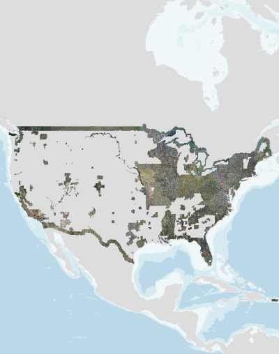
This update to the Alaska National Land Cover Database (NLCD) 2016 replaces the files dated 20200213. In this update the landcover footprint was extended along the northern coast to include the islands that were missed in previous versions, and several duplicate roads (offset by 1 or 2 pixels) were removed on the Aleutian Islands. The Alaska National Land Cover Database 2016 was created using change detection between the nominal dates of 2011 and 2016 utilizing Google Earth engine composites of Landsat imagery. Traditionally, previous classifications of Alaska used path row data and spectral comparisons between path rows along with ancillary data to derive areas of change. Alaska has many challenges for land cover...
In recent years, rising sea levels have threatened critical infrastructure and cultural assets at Puʻuhonua o Hōnaunau National Historical Park thus motivating the park to make adaptive decisions in managing these key resources. To support the development of decision support tools for sea level rise preparedness, the U.S. Geological Survey (USGS) Coastal National Elevation Database (CoNED) Applications Project has created an integrated 1-meter topobathymetric digital elevation model (TBDEM) for Puʻuhonua o Hōnaunau National Historical Park. This dataset was developed in collaboration with the University of Hawaii- Mānoa Sea Level Center, Department of Interior Pacific Island Climate Adaptation Science Center, and...
USGS high resolution orthorectified images from The National Map combine the image characteristics of an aerial photograph with the geometric qualities of a map. An orthoimage is a uniform-scale image where corrections have been made for feature displacement such as building tilt and for scale variations caused by terrain relief, sensor geometry, and camera tilt. A mathematical equation based on ground control points, sensor calibration information, and a digital elevation model is applied to each pixel to rectify the image to obtain the geometric qualities of a map. A digital orthoimage may be created from several photographs mosaicked to form the final image. The source imagery may be black-and-white, natural...
The U.S. Geological Survey (USGS) 3D Elevation Program (3DEP) has initiated the development of a second pilot 3D National Topography Model (3DNTM) to generate 3-dimensional surface elevation models that integrate topographic bare-earth elevation surfaces with river channel bed and coastal bathymetry and topobathymetry. Detailed knowledge of integrated river system topography, bathymetry, and topobathymetry is essential for fisheries habitat restoration, hydrologic modeling, and other key science applications such as flood mapping and identification of fluvial geomorphic features. An integrated 1-meter topobathymetric digital elevation model (TBDEM) for Hardin, Orange, and Jefferson counties in Southeast Texas has...
This update to the Alaska National Land Cover Database (NLCD) 2016 replaces the files dated 20200213. In this update the landcover footprint was extended along the northern coast to include the islands that were missed in previous versions, and several duplicate roads (offset by 1 or 2 pixels) were removed on the Aleutian Islands. The Alaska National Land Cover Database 2016 was created using change detection between the nominal dates of 2011 and 2016 utilizing Google Earth engine composites of Landsat imagery. Traditionally, previous classifications of Alaska used path row data and spectral comparisons between path rows along with ancillary data to derive areas of change. Alaska has many challenges for land cover...
This update to the Alaska National Land Cover Database (NLCD) 2016 replaces the files dated 20200213. In this update the landcover footprint was extended along the northern coast to include the islands that were missed in previous versions, and several duplicate roads (offset by 1 or 2 pixels) were removed on the Aleutian Islands. The Alaska National Land Cover Database 2016 was created using change detection between the nominal dates of 2011 and 2016 utilizing Google Earth engine composites of Landsat imagery. Traditionally, previous classifications of Alaska used path row data and spectral comparisons between path rows along with ancillary data to derive areas of change. Alaska has many challenges for land cover...
|

|
