Filters: System Type: Data Release (X) > Categories: NOT Data Release - In Progress (X) > Tags: {"scheme":"Geographic Names Information System"} (X)
2,112 results (84ms)|
Filters
Date Range
Extensions Types
Contacts
Categories Tag Types Tags (with Scheme=Geographic Names Information System) |
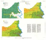
These data were released prior to the October 1, 2016 effective date for the USGS’s policy dictating the review, approval, and release of scientific data as referenced in USGS Survey Manual Chapter 502.8 Fundamental Science Practices: Review and Approval of Scientific Data for Release. This coverage contains information about the probability of obtaining a water supply within the Standing Rock Indian Reservation, Sioux County, North Dakota, and Corson County, South Dakota. The digital data were produced by the U.S. Geological Survey (USGS) in cooperation with the U.S. Environmental Protection Agency. The possibility of obtaining adequate supplies of good quality water from surficial deposits generally is limited...

These data were released prior to the October 1, 2016 effective date for the USGS’s policy dictating the review, approval, and release of scientific data as referenced in USGS Survey Manual Chapter 502.8 Fundamental Science Practices: Review and Approval of Scientific Data for Release. This digital geospatial data set consists of locations of coal, oil, gas and water wells shown as data points in the report, "Structure, Outcrop, and Subcrop of the Bedrock Aquifers Along the Western Margin of the Denver Basin, Colorado" (Robson and others, 1998).

These data were released prior to the October 1, 2016 effective date for the USGS’s policy dictating the review, approval, and release of scientific data as referenced in USGS Survey Manual Chapter 502.8 Fundamental Science Practices: Review and Approval of Scientific Data for Release. The U.S. Geological Survey performed a bathymetric survey of Totten Reservoir using a man-operated boat-mounted multibeam echo sounder integrated with a global positioning system (GPS) and a terrestrial real-time kinematic (RTK) GPS in June 2011. The multi-beam echo sounder collected data at lake depths of approximately 3 feet and greater, whereas the terrestrial topographic survey was performed with the RTK GPS in shallow areas...

These data were released prior to the October 1, 2016 effective date for the USGS’s policy dictating the review, approval, and release of scientific data as referenced in USGS Survey Manual Chapter 502.8 Fundamental Science Practices: Review and Approval of Scientific Data for Release. Digital surfaces and thicknesses of selected hydrogeologic units of the Floridan aquifer system were developed to define an updated hydrogeologic framework as part of the U.S. Geological Survey Groundwater Resources Program. This map layer shows areal and linear water features of Florida, Georgia, South Carolina, and Alabama. The original file was produced by joining the individual State hydrography layers from the 1:2,000,000- scale...

These data were released prior to the October 1, 2016 effective date for the USGS’s policy dictating the review, approval, and release of scientific data as referenced in USGS Survey Manual Chapter 502.8 Fundamental Science Practices: Review and Approval of Scientific Data for Release. This data set describes areas where the Deadwood Formation is directly overlain by surficial deposits, as well as those areas where the Deadwood Formation is absent in the Black Hills area, South Dakota.
These data were released prior to the October 1, 2016 effective date for the USGS’s policy dictating the review, approval, and release of scientific data as referenced in USGS Survey Manual Chapter 502.8 Fundamental Science Practices: Review and Approval of Scientific Data for Release. The U.S. Geological Survey developed this dataset as part of the Colorado Front Range Infrastructure Resources Project (FRIRP). One goal of the FRIRP was to provide information on the availability of those hydrogeologic resources that are either critical to maintaining infrastructure along the northern Front Range or that may become less available because of urban expansion in the northern Front Range. This dataset extends from the...

These data were released prior to the October 1, 2016 effective date for the USGS’s policy dictating the review, approval, and release of scientific data as referenced in USGS Survey Manual Chapter 502.8 Fundamental Science Practices: Review and Approval of Scientific Data for Release. Digital surfaces and thicknesses of selected hydrogeologic units of the Floridan aquifer system were developed to define an updated hydrogeologic framework as part of the U.S. Geological Survey Groundwater Resources Program. This feature class contains points depicting the thickness of the OCAPLPZ.

These data were released prior to the October 1, 2016 effective date for the USGS’s policy dictating the review, approval, and release of scientific data as referenced in USGS Survey Manual Chapter 502.8 Fundamental Science Practices: Review and Approval of Scientific Data for Release. This coverage contains estimates of herbicide use for the eighty-first through the ninety-sixth most-used herbicides in the conterminous United States as reported in Gianessi and Puffer (1991). Herbicide-use estimates in this coverage are reported for each county polygon as acres treated, pounds of active ingredient used, and pounds used per square mile. The herbicide-use estimates provided by Gianessi and Puffer (1991) list acres...

These data were released prior to the October 1, 2016 effective date for the USGS’s policy dictating the review, approval, and release of scientific data as referenced in USGS Survey Manual Chapter 502.8 Fundamental Science Practices: Review and Approval of Scientific Data for Release. This data set represents potentiometric surface contours for the Minnekahta aquifer, Black Hills, South Dakota.

These data were released prior to the October 1, 2016 effective date for the USGS’s policy dictating the review, approval, and release of scientific data as referenced in USGS Survey Manual Chapter 502.8 Fundamental Science Practices: Review and Approval of Scientific Data for Release. Real-time kinematic global navigation satellite systems equipment was used to map features of wetlands at six locations of interest to the Lower Brule Sioux Tribe. Items mapped include general cross-sections (primarily to show elevation differences); man-made features such as access roads, outlet control structures, and water-supply pipes; vegetation features such as edge of cattails or food plots, trees or tree clusters; and hydrologic...

These data were released prior to the October 1, 2016 effective date for the USGS’s policy dictating the review, approval, and release of scientific data as referenced in USGS Survey Manual Chapter 502.8 Fundamental Science Practices: Review and Approval of Scientific Data for Release. This data set represents geologic structure contours for the top of the Minnekahta Limestone, Black Hills, South Dakota.

These data were released prior to the October 1, 2016 effective date for the USGS’s policy dictating the review, approval, and release of scientific data as referenced in USGS Survey Manual Chapter 502.8 Fundamental Science Practices: Review and Approval of Scientific Data for Release. This data set represents geologic structure contours for the top of the Inyan Kara Group, Black Hills, South Dakota.

These data were released prior to the October 1, 2016 effective date for the USGS’s policy dictating the review, approval, and release of scientific data as referenced in USGS Survey Manual Chapter 502.8 Fundamental Science Practices: Review and Approval of Scientific Data for Release. Real-time kinematic global navigation satellite systems equipment was used to map features of wetlands at six locations of interest to the Lower Brule Sioux Tribe. Items mapped include general cross-sections (primarily to show elevation differences); man-made features such as access roads, outlet control structures, and water-supply pipes; vegetation features such as edge of cattails or food plots, trees or tree clusters; and hydrologic...

These data were released prior to the October 1, 2016 effective date for the USGS’s policy dictating the review, approval, and release of scientific data as referenced in USGS Survey Manual Chapter 502.8 Fundamental Science Practices: Review and Approval of Scientific Data for Release. This data set represents the estimated percentage of the 1-km grid cell that is covered by or subject to the agricultural conservation practice (CP330), Contour Farming (CF) on agricultural land by county. Contour Farming is described as "tillage, planting, and other farming operations performed on or near the contour of the field slope." (U.S. Department of Agriculture, 1995) This data set was created with geographic information...

These data were released prior to the October 1, 2016 effective date for the USGS’s policy dictating the review, approval, and release of scientific data as referenced in USGS Survey Manual Chapter 502.8 Fundamental Science Practices: Review and Approval of Scientific Data for Release. Water levels in 93 wells completed in the Wood River Valley aquifer system were measured during October 22–24, 2012; these wells are part of a network established by the U.S. Geological Survey in 2006. Maps of the October 2012 water-table altitude in the unconfined aquifer and the potentiometric- surface altitude of the confined aquifer have similar topology to those on maps of October 2006 conditions. Between October 2006 and October...
These data were released prior to the October 1, 2016 effective date for the USGS’s policy dictating the review, approval, and release of scientific data as referenced in USGS Survey Manual Chapter 502.8 Fundamental Science Practices: Review and Approval of Scientific Data for Release. The entire population of the Wood River Valley depends on ground water for domestic supply, either from domestic or municipal-supply wells, rapid population growth since the 1970s has raised concerns about the continued availability of ground and surface water to support existing uses and streamflow. To help address these concerns, ground- and surface-water conditions in the area before and during the population growth that started...

These data were released prior to the October 1, 2016 effective date for the USGS’s policy dictating the review, approval, and release of scientific data as referenced in USGS Survey Manual Chapter 502.8 Fundamental Science Practices: Review and Approval of Scientific Data for Release. Digital hydrogeologic surface of the Midway Confining Unit in Alabama, Arkansas, Illinois, Kentucky, Missouri, Mississippi. The hydrogeologic unit dataset contains 414 rows and 394 columns representing 1-mile grid spacing. In general, limitations of data interpolation included areas of sparse geophysical log control points, log datums not clearly defined for some logs, unknown exact extent of each hydrogeologic unit in subcrop, interpolation...

These data were released prior to the October 1, 2016 effective date for the USGS’s policy dictating the review, approval, and release of scientific data as referenced in USGS Survey Manual Chapter 502.8 Fundamental Science Practices: Review and Approval of Scientific Data for Release. Digital hydrogeologic surface of the Lower Claiborne Confining Unit in Alabama, Arkansas, Louisiana, Mississippi. The hydrogeologic unit dataset contains 414 rows and 394 columns representing 1-mile grid spacing. In general, limitations of data interpolation included areas of sparse geophysical log control points, log datums not clearly defined for some logs, unknown exact extent of each hydrogeologic unit in subcrop, interpolation...

A three-dimensional numerical groundwater flow model (MODFLOW-USG) was developed for the Wood River Valley (WRV) aquifer system, south-central Idaho, to evaluate groundwater and surface-water availability at the regional scale. The U.S. Geological Survey (USGS), in cooperation Idaho Department of Water Resources, used the transient groundwater flow model to simulate historical hydraulic head conditions from 1995 to 2010. This USGS data release contains all of the input and output files for the simulation described in the associated model documentation report (https://doi.org/10.3133/sir20165080).
These data were released prior to the October 1, 2016 effective date for the USGS’s policy dictating the review, approval, and release of scientific data as referenced in USGS Survey Manual Chapter 502.8 Fundamental Science Practices: Review and Approval of Scientific Data for Release. A point coverage was created from the 1980 Master Area Reference File (MARF) of the U.S. Census Bureay. Each point represents the center of a census tract, though some tracts were split. A 1980 population is associated with each point. Populations for 1970, 1982, 1984, and 1985 were inferred from county population data.
|

|
