Filters
Date Range
Types
Contacts
Tag Types
Tags (with Scheme=National Elevation Dataset (NED))
|

Lidar (Light detection and ranging) discrete-return point cloud data are available in the American Society for Photogrammetry and Remote Sensing (ASPRS) LAS format. The LAS format is a standardized binary format for storing 3-dimensional point cloud data and point attributes along with header information and variable length records specific to the data. Millions of data points are stored as a 3-dimensional data cloud as a series of x (longitude), y (latitude) and z (elevation) points. A few older projects in this collection are in ASCII format. Please refer to http://www.asprs.org/Committee-General/LASer-LAS-File-Format-Exchange-Activities.html for additional information. This data set is a LAZ (compressed LAS)...
Tags: 3DEP,
Cartography,
DEM,
Digital Elevation Model,
Digital Mapping, All tags...
Digital Terrain Model,
Downloadable Data,
Elevation,
Elevation,
Elevation,
GIS,
Geodata,
High Resolution,
LAZ,
LIDAR,
LIght Detection And Ranging,
Lidar Point Cloud (LPC),
Mapping,
NED,
National Elevation Dataset,
OK_Panhandle_B2_2018,
Terrain Elevation,
Topographic Surface,
Topography,
U.S. Geological Survey,
US,
US,
USGS,
United States,
Varies,
elevation, Fewer tags

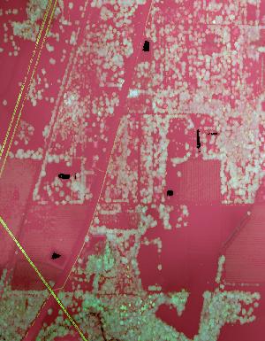
Lidar (Light detection and ranging) discrete-return point cloud data are available in the American Society for Photogrammetry and Remote Sensing (ASPRS) LAS format. The LAS format is a standardized binary format for storing 3-dimensional point cloud data and point attributes along with header information and variable length records specific to the data. Millions of data points are stored as a 3-dimensional data cloud as a series of x (longitude), y (latitude) and z (elevation) points. A few older projects in this collection are in ASCII format. Please refer to http://www.asprs.org/Committee-General/LASer-LAS-File-Format-Exchange-Activities.html for additional information. This data set is a LAZ (compressed LAS)...
Tags: 3DEP,
Cartography,
DEM,
Digital Elevation Model,
Digital Mapping, All tags...
Digital Terrain Model,
Downloadable Data,
Elevation,
Elevation,
Elevation,
FL_Peninsular_FDEM_Desoto_2018,
GIS,
Geodata,
High Resolution,
LAZ,
LIDAR,
LIght Detection And Ranging,
Lidar Point Cloud (LPC),
Mapping,
NED,
National Elevation Dataset,
Terrain Elevation,
Topographic Surface,
Topography,
U.S. Geological Survey,
US,
US,
USGS,
United States,
Varies,
elevation, Fewer tags

Lidar (Light detection and ranging) discrete-return point cloud data are available in the American Society for Photogrammetry and Remote Sensing (ASPRS) LAS format. The LAS format is a standardized binary format for storing 3-dimensional point cloud data and point attributes along with header information and variable length records specific to the data. Millions of data points are stored as a 3-dimensional data cloud as a series of x (longitude), y (latitude) and z (elevation) points. A few older projects in this collection are in ASCII format. Please refer to http://www.asprs.org/Committee-General/LASer-LAS-File-Format-Exchange-Activities.html for additional information. This data set is a LAZ (compressed LAS)...
Tags: 3DEP,
AZ_OrganPipeCactusNM_1_2020,
Cartography,
DEM,
Digital Elevation Model, All tags...
Digital Mapping,
Digital Terrain Model,
Downloadable Data,
Elevation,
Elevation,
Elevation,
GIS,
Geodata,
High Resolution,
LAZ,
LIDAR,
LIght Detection And Ranging,
Lidar Point Cloud (LPC),
Mapping,
NED,
National Elevation Dataset,
Terrain Elevation,
Topographic Surface,
Topography,
U.S. Geological Survey,
US,
US,
USGS,
United States,
Varies,
elevation, Fewer tags
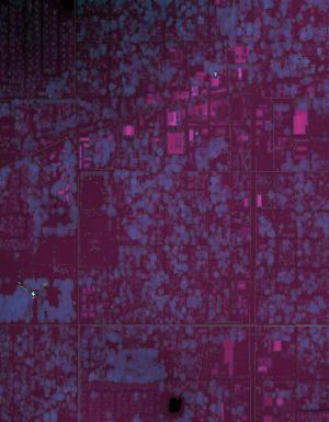
Lidar (Light detection and ranging) discrete-return point cloud data are available in the American Society for Photogrammetry and Remote Sensing (ASPRS) LAS format. The LAS format is a standardized binary format for storing 3-dimensional point cloud data and point attributes along with header information and variable length records specific to the data. Millions of data points are stored as a 3-dimensional data cloud as a series of x (longitude), y (latitude) and z (elevation) points. A few older projects in this collection are in ASCII format. Please refer to http://www.asprs.org/Committee-General/LASer-LAS-File-Format-Exchange-Activities.html for additional information. This data set is a LAZ (compressed LAS)...
Tags: 3DEP,
Cartography,
DEM,
Digital Elevation Model,
Digital Mapping, All tags...
Digital Terrain Model,
Downloadable Data,
Elevation,
Elevation,
Elevation,
FL_Peninsular_FDEM_Orange_2018,
GIS,
Geodata,
High Resolution,
LAZ,
LIDAR,
LIght Detection And Ranging,
Lidar Point Cloud (LPC),
Mapping,
NED,
National Elevation Dataset,
Terrain Elevation,
Topographic Surface,
Topography,
U.S. Geological Survey,
US,
US,
USGS,
United States,
Varies,
elevation, Fewer tags
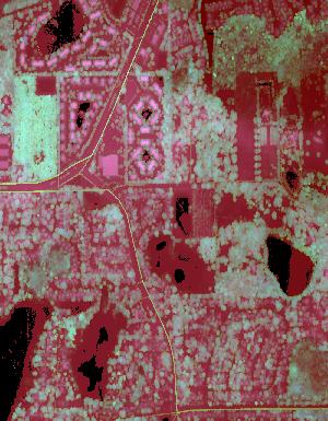
Lidar (Light detection and ranging) discrete-return point cloud data are available in the American Society for Photogrammetry and Remote Sensing (ASPRS) LAS format. The LAS format is a standardized binary format for storing 3-dimensional point cloud data and point attributes along with header information and variable length records specific to the data. Millions of data points are stored as a 3-dimensional data cloud as a series of x (longitude), y (latitude) and z (elevation) points. A few older projects in this collection are in ASCII format. Please refer to http://www.asprs.org/Committee-General/LASer-LAS-File-Format-Exchange-Activities.html for additional information. This data set is a LAZ (compressed LAS)...
Tags: 3DEP,
Cartography,
DEM,
Digital Elevation Model,
Digital Mapping, All tags...
Digital Terrain Model,
Downloadable Data,
Elevation,
Elevation,
Elevation,
FL_Peninsular_FDEM_Orange_2018,
GIS,
Geodata,
High Resolution,
LAZ,
LIDAR,
LIght Detection And Ranging,
Lidar Point Cloud (LPC),
Mapping,
NED,
National Elevation Dataset,
Terrain Elevation,
Topographic Surface,
Topography,
U.S. Geological Survey,
US,
US,
USGS,
United States,
Varies,
elevation, Fewer tags
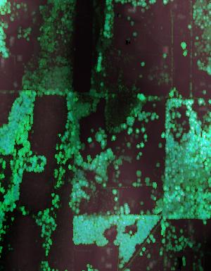
Lidar (Light detection and ranging) discrete-return point cloud data are available in the American Society for Photogrammetry and Remote Sensing (ASPRS) LAS format. The LAS format is a standardized binary format for storing 3-dimensional point cloud data and point attributes along with header information and variable length records specific to the data. Millions of data points are stored as a 3-dimensional data cloud as a series of x (longitude), y (latitude) and z (elevation) points. A few older projects in this collection are in ASCII format. Please refer to http://www.asprs.org/Committee-General/LASer-LAS-File-Format-Exchange-Activities.html for additional information. This data set is a LAZ (compressed LAS)...
Tags: 3DEP,
Cartography,
DEM,
Digital Elevation Model,
Digital Mapping, All tags...
Digital Terrain Model,
Downloadable Data,
Elevation,
Elevation,
Elevation,
GIS,
Geodata,
High Resolution,
LAZ,
LIDAR,
LIght Detection And Ranging,
Lidar Point Cloud (LPC),
Mapping,
NED,
National Elevation Dataset,
Terrain Elevation,
Topographic Surface,
Topography,
U.S. Geological Survey,
US,
US,
USGS,
United States,
Varies,
WA_PierceCounty_1_2020,
elevation, Fewer tags

Lidar (Light detection and ranging) discrete-return point cloud data are available in the American Society for Photogrammetry and Remote Sensing (ASPRS) LAS format. The LAS format is a standardized binary format for storing 3-dimensional point cloud data and point attributes along with header information and variable length records specific to the data. Millions of data points are stored as a 3-dimensional data cloud as a series of x (longitude), y (latitude) and z (elevation) points. A few older projects in this collection are in ASCII format. Please refer to http://www.asprs.org/Committee-General/LASer-LAS-File-Format-Exchange-Activities.html for additional information. This data set is a LAZ (compressed LAS)...
Tags: 3DEP,
Cartography,
DEM,
Digital Elevation Model,
Digital Mapping, All tags...
Digital Terrain Model,
Downloadable Data,
Elevation,
Elevation,
Elevation,
GIS,
Geodata,
High Resolution,
LAZ,
LIDAR,
LIght Detection And Ranging,
Lidar Point Cloud (LPC),
Mapping,
NED,
National Elevation Dataset,
Terrain Elevation,
Topographic Surface,
Topography,
U.S. Geological Survey,
US,
US,
USGS,
United States,
Varies,
WY_Southwest_1_2020,
elevation, Fewer tags

Lidar (Light detection and ranging) discrete-return point cloud data are available in the American Society for Photogrammetry and Remote Sensing (ASPRS) LAS format. The LAS format is a standardized binary format for storing 3-dimensional point cloud data and point attributes along with header information and variable length records specific to the data. Millions of data points are stored as a 3-dimensional data cloud as a series of x (longitude), y (latitude) and z (elevation) points. A few older projects in this collection are in ASCII format. Please refer to http://www.asprs.org/Committee-General/LASer-LAS-File-Format-Exchange-Activities.html for additional information. This data set is a LAZ (compressed LAS)...
Tags: 3DEP,
Cartography,
DEM,
Digital Elevation Model,
Digital Mapping, All tags...
Digital Terrain Model,
Downloadable Data,
Elevation,
Elevation,
Elevation,
GIS,
Geodata,
High Resolution,
LAZ,
LIDAR,
LIght Detection And Ranging,
Lidar Point Cloud (LPC),
Mapping,
NED,
National Elevation Dataset,
Terrain Elevation,
Topographic Surface,
Topography,
U.S. Geological Survey,
US,
US,
USGS,
United States,
Varies,
WA_ColumbiaValley_1_2018,
elevation, Fewer tags

Lidar (Light detection and ranging) discrete-return point cloud data are available in the American Society for Photogrammetry and Remote Sensing (ASPRS) LAS format. The LAS format is a standardized binary format for storing 3-dimensional point cloud data and point attributes along with header information and variable length records specific to the data. Millions of data points are stored as a 3-dimensional data cloud as a series of x (longitude), y (latitude) and z (elevation) points. A few older projects in this collection are in ASCII format. Please refer to http://www.asprs.org/Committee-General/LASer-LAS-File-Format-Exchange-Activities.html for additional information. This data set is a LAZ (compressed LAS)...
Tags: 3DEP,
Cartography,
DEM,
Digital Elevation Model,
Digital Mapping, All tags...
Digital Terrain Model,
Downloadable Data,
Elevation,
Elevation,
Elevation,
GIS,
Geodata,
High Resolution,
LAZ,
LIDAR,
LIght Detection And Ranging,
Lidar Point Cloud (LPC),
Mapping,
NC_HurricaneFlorence_2_2020,
NED,
National Elevation Dataset,
Terrain Elevation,
Topographic Surface,
Topography,
U.S. Geological Survey,
US,
US,
USGS,
United States,
Varies,
elevation, Fewer tags

Lidar (Light detection and ranging) discrete-return point cloud data are available in the American Society for Photogrammetry and Remote Sensing (ASPRS) LAS format. The LAS format is a standardized binary format for storing 3-dimensional point cloud data and point attributes along with header information and variable length records specific to the data. Millions of data points are stored as a 3-dimensional data cloud as a series of x (longitude), y (latitude) and z (elevation) points. A few older projects in this collection are in ASCII format. Please refer to http://www.asprs.org/Committee-General/LASer-LAS-File-Format-Exchange-Activities.html for additional information. This data set is a LAZ (compressed LAS)...
Tags: 3DEP,
Cartography,
DEM,
Digital Elevation Model,
Digital Mapping, All tags...
Digital Terrain Model,
Downloadable Data,
Elevation,
Elevation,
Elevation,
GIS,
Geodata,
High Resolution,
LAZ,
LIDAR,
LIght Detection And Ranging,
Lidar Point Cloud (LPC),
Mapping,
NED,
National Elevation Dataset,
Terrain Elevation,
Topographic Surface,
Topography,
U.S. Geological Survey,
US,
US,
USGS,
United States,
Varies,
WA_ColumbiaValley_3_2018,
elevation, Fewer tags
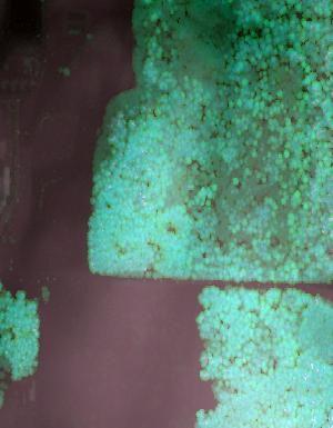
Lidar (Light detection and ranging) discrete-return point cloud data are available in the American Society for Photogrammetry and Remote Sensing (ASPRS) LAS format. The LAS format is a standardized binary format for storing 3-dimensional point cloud data and point attributes along with header information and variable length records specific to the data. Millions of data points are stored as a 3-dimensional data cloud as a series of x (longitude), y (latitude) and z (elevation) points. A few older projects in this collection are in ASCII format. Please refer to http://www.asprs.org/Committee-General/LASer-LAS-File-Format-Exchange-Activities.html for additional information. This data set is a LAZ (compressed LAS)...
Tags: 3DEP,
Cartography,
DEM,
Digital Elevation Model,
Digital Mapping, All tags...
Digital Terrain Model,
Downloadable Data,
Elevation,
Elevation,
Elevation,
GIS,
Geodata,
High Resolution,
LAZ,
LIDAR,
LIght Detection And Ranging,
Lidar Point Cloud (LPC),
Mapping,
NED,
National Elevation Dataset,
Terrain Elevation,
Topographic Surface,
Topography,
U.S. Geological Survey,
US,
US,
USGS,
United States,
Varies,
WA_PierceCounty_1_2020,
elevation, Fewer tags
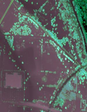
Lidar (Light detection and ranging) discrete-return point cloud data are available in the American Society for Photogrammetry and Remote Sensing (ASPRS) LAS format. The LAS format is a standardized binary format for storing 3-dimensional point cloud data and point attributes along with header information and variable length records specific to the data. Millions of data points are stored as a 3-dimensional data cloud as a series of x (longitude), y (latitude) and z (elevation) points. A few older projects in this collection are in ASCII format. Please refer to http://www.asprs.org/Committee-General/LASer-LAS-File-Format-Exchange-Activities.html for additional information. This data set is a LAZ (compressed LAS)...
Tags: 3DEP,
Cartography,
DEM,
Digital Elevation Model,
Digital Mapping, All tags...
Digital Terrain Model,
Downloadable Data,
Elevation,
Elevation,
Elevation,
GIS,
Geodata,
High Resolution,
LAZ,
LIDAR,
LIght Detection And Ranging,
Lidar Point Cloud (LPC),
Mapping,
NED,
National Elevation Dataset,
Terrain Elevation,
Topographic Surface,
Topography,
U.S. Geological Survey,
US,
US,
USGS,
United States,
Varies,
WA_PierceCounty_1_2020,
elevation, Fewer tags

Lidar (Light detection and ranging) discrete-return point cloud data are available in the American Society for Photogrammetry and Remote Sensing (ASPRS) LAS format. The LAS format is a standardized binary format for storing 3-dimensional point cloud data and point attributes along with header information and variable length records specific to the data. Millions of data points are stored as a 3-dimensional data cloud as a series of x (longitude), y (latitude) and z (elevation) points. A few older projects in this collection are in ASCII format. Please refer to http://www.asprs.org/Committee-General/LASer-LAS-File-Format-Exchange-Activities.html for additional information. This data set is a LAZ (compressed LAS)...
Tags: 3DEP,
Cartography,
DEM,
Digital Elevation Model,
Digital Mapping, All tags...
Digital Terrain Model,
Downloadable Data,
Elevation,
Elevation,
Elevation,
GIS,
Geodata,
High Resolution,
LAZ,
LIDAR,
LIght Detection And Ranging,
Lidar Point Cloud (LPC),
Mapping,
NED,
National Elevation Dataset,
Terrain Elevation,
Topographic Surface,
Topography,
U.S. Geological Survey,
US,
US,
USGS,
United States,
Varies,
WV_FEMAR3_Southcentral_B3_2018,
elevation, Fewer tags
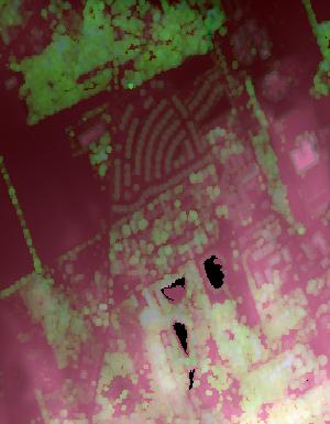
Lidar (Light detection and ranging) discrete-return point cloud data are available in the American Society for Photogrammetry and Remote Sensing (ASPRS) LAS format. The LAS format is a standardized binary format for storing 3-dimensional point cloud data and point attributes along with header information and variable length records specific to the data. Millions of data points are stored as a 3-dimensional data cloud as a series of x (longitude), y (latitude) and z (elevation) points. A few older projects in this collection are in ASCII format. Please refer to http://www.asprs.org/Committee-General/LASer-LAS-File-Format-Exchange-Activities.html for additional information. This data set is a LAZ (compressed LAS)...
Tags: 3DEP,
Cartography,
DEM,
Digital Elevation Model,
Digital Mapping, All tags...
Digital Terrain Model,
Downloadable Data,
Elevation,
Elevation,
Elevation,
GIS,
Geodata,
High Resolution,
LAZ,
LIDAR,
LIght Detection And Ranging,
Lidar Point Cloud (LPC),
Mapping,
NED,
National Elevation Dataset,
PA_WesternPA_4_2019,
Terrain Elevation,
Topographic Surface,
Topography,
U.S. Geological Survey,
US,
US,
USGS,
United States,
Varies,
elevation, Fewer tags

Lidar (Light detection and ranging) discrete-return point cloud data are available in the American Society for Photogrammetry and Remote Sensing (ASPRS) LAS format. The LAS format is a standardized binary format for storing 3-dimensional point cloud data and point attributes along with header information and variable length records specific to the data. Millions of data points are stored as a 3-dimensional data cloud as a series of x (longitude), y (latitude) and z (elevation) points. A few older projects in this collection are in ASCII format. Please refer to http://www.asprs.org/Committee-General/LASer-LAS-File-Format-Exchange-Activities.html for additional information. This data set is a LAZ (compressed LAS)...
Tags: 3DEP,
Cartography,
DEM,
Digital Elevation Model,
Digital Mapping, All tags...
Digital Terrain Model,
Downloadable Data,
Elevation,
Elevation,
Elevation,
GIS,
Geodata,
High Resolution,
LAZ,
LIDAR,
LIght Detection And Ranging,
Lidar Point Cloud (LPC),
Mapping,
NED,
National Elevation Dataset,
Terrain Elevation,
Topographic Surface,
Topography,
U.S. Geological Survey,
US,
US,
USGS,
United States,
Varies,
WY_Sheridan_2_2020,
elevation, Fewer tags

Lidar (Light detection and ranging) discrete-return point cloud data are available in the American Society for Photogrammetry and Remote Sensing (ASPRS) LAS format. The LAS format is a standardized binary format for storing 3-dimensional point cloud data and point attributes along with header information and variable length records specific to the data. Millions of data points are stored as a 3-dimensional data cloud as a series of x (longitude), y (latitude) and z (elevation) points. A few older projects in this collection are in ASCII format. Please refer to http://www.asprs.org/Committee-General/LASer-LAS-File-Format-Exchange-Activities.html for additional information. This data set is a LAZ (compressed LAS)...
Tags: 3DEP,
Cartography,
DEM,
Digital Elevation Model,
Digital Mapping, All tags...
Digital Terrain Model,
Downloadable Data,
Elevation,
Elevation,
Elevation,
GIS,
Geodata,
High Resolution,
LAZ,
LIDAR,
LIght Detection And Ranging,
Lidar Point Cloud (LPC),
Mapping,
NED,
National Elevation Dataset,
Terrain Elevation,
Topographic Surface,
Topography,
U.S. Geological Survey,
US,
US,
USGS,
United States,
Varies,
WY_Sheridan_2_2020,
elevation, Fewer tags

Lidar (Light detection and ranging) discrete-return point cloud data are available in the American Society for Photogrammetry and Remote Sensing (ASPRS) LAS format. The LAS format is a standardized binary format for storing 3-dimensional point cloud data and point attributes along with header information and variable length records specific to the data. Millions of data points are stored as a 3-dimensional data cloud as a series of x (longitude), y (latitude) and z (elevation) points. A few older projects in this collection are in ASCII format. Please refer to http://www.asprs.org/Committee-General/LASer-LAS-File-Format-Exchange-Activities.html for additional information. This data set is a LAZ (compressed LAS)...
Tags: 3DEP,
Cartography,
DEM,
Digital Elevation Model,
Digital Mapping, All tags...
Digital Terrain Model,
Downloadable Data,
Elevation,
Elevation,
Elevation,
GIS,
Geodata,
High Resolution,
LAZ,
LIDAR,
LIght Detection And Ranging,
Lidar Point Cloud (LPC),
Mapping,
NED,
National Elevation Dataset,
Terrain Elevation,
Topographic Surface,
Topography,
U.S. Geological Survey,
US,
US,
USGS,
United States,
Varies,
WY_Sheridan_2_2020,
elevation, Fewer tags

Lidar (Light detection and ranging) discrete-return point cloud data are available in the American Society for Photogrammetry and Remote Sensing (ASPRS) LAS format. The LAS format is a standardized binary format for storing 3-dimensional point cloud data and point attributes along with header information and variable length records specific to the data. Millions of data points are stored as a 3-dimensional data cloud as a series of x (longitude), y (latitude) and z (elevation) points. A few older projects in this collection are in ASCII format. Please refer to http://www.asprs.org/Committee-General/LASer-LAS-File-Format-Exchange-Activities.html for additional information. This data set is a LAZ (compressed LAS)...
Tags: 3DEP,
Cartography,
DEM,
Digital Elevation Model,
Digital Mapping, All tags...
Digital Terrain Model,
Downloadable Data,
Elevation,
Elevation,
Elevation,
GIS,
Geodata,
High Resolution,
LAZ,
LIDAR,
LIght Detection And Ranging,
Lidar Point Cloud (LPC),
Mapping,
NED,
National Elevation Dataset,
Terrain Elevation,
Topographic Surface,
Topography,
U.S. Geological Survey,
US,
US,
USGS,
United States,
Varies,
WY_Sheridan_2_2020,
elevation, Fewer tags

Lidar (Light detection and ranging) discrete-return point cloud data are available in the American Society for Photogrammetry and Remote Sensing (ASPRS) LAS format. The LAS format is a standardized binary format for storing 3-dimensional point cloud data and point attributes along with header information and variable length records specific to the data. Millions of data points are stored as a 3-dimensional data cloud as a series of x (longitude), y (latitude) and z (elevation) points. A few older projects in this collection are in ASCII format. Please refer to http://www.asprs.org/Committee-General/LASer-LAS-File-Format-Exchange-Activities.html for additional information. This data set is a LAZ (compressed LAS)...
Tags: 3DEP,
Cartography,
DEM,
Digital Elevation Model,
Digital Mapping, All tags...
Digital Terrain Model,
Downloadable Data,
Elevation,
Elevation,
Elevation,
GIS,
Geodata,
High Resolution,
LAZ,
LIDAR,
LIght Detection And Ranging,
Lidar Point Cloud (LPC),
Mapping,
NED,
National Elevation Dataset,
Terrain Elevation,
Topographic Surface,
Topography,
U.S. Geological Survey,
US,
US,
USGS,
United States,
Varies,
WY_Sheridan_2_2020,
elevation, Fewer tags
|
|