Filters
Date Range
Types
Contacts
Categories
Tag Types
Tags (with Scheme=None)
|

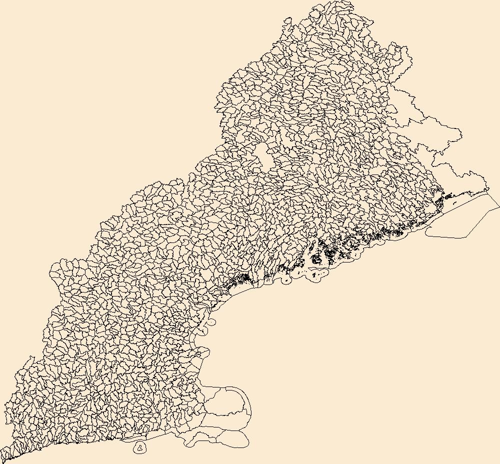
The Watershed Boundary Dataset (WBD) is a comprehensive aggregated collection of hydrologic unit data consistent with the national criteria for delineation and resolution. It defines the areal extent of surface water drainage to a point except in coastal or lake front areas where there could be multiple outlets as stated by the "Federal Standards and Procedures for the National Watershed Boundary Dataset (WBD)" "Standard" (https://pubs.usgs.gov/tm/11/a3/). Watershed boundaries are determined solely upon science-based hydrologic principles, not favoring any administrative boundaries or special projects, nor particular program or agency. This dataset represents the hydrologic unit boundaries to the 12-digit (6th level)...
Tags: 10-digit,
12-digit,
14-digit,
16-digit,
2-digit, All tags...
4-digit,
6-digit,
8-digit,
AL,
Abbeville,
Aiken,
Alabama,
Alachua,
Alamance,
Alexander,
Alleghany,
Allendale,
Anderson,
Anson,
Appling,
Appomattox,
Ashe,
Atkinson,
Attala,
Autauga,
Avery,
Bacon,
Baker,
Baldwin,
Bamberg,
Banks,
Barbour,
Barnwell,
Barrow,
Bartow,
Basin,
Bay,
Beaufort,
Bedford,
Ben Hill,
Berkeley,
Berrien,
Bertie,
Bibb,
Bladen,
Bleckley,
Blount,
Botetourt,
Bradford,
Bradley,
Brantley,
Brevard,
Brooks,
Broward,
Brunswick,
Bryan,
Bulloch,
Bullock,
Buncombe,
Burke,
Butler,
Butts,
Cabarrus,
Caldwell,
Calhoun,
Camden,
Campbell,
Candler,
Carroll,
Carteret,
Caswell,
Catawba,
Chambers,
Charleston,
Charlotte,
Charlton,
Chatham,
Chattahoochee,
Chattooga,
Cherokee,
Chesapeake,
Chester,
Chesterfield,
Chickasaw,
Chilton,
Choctaw,
Chowan,
Citrus,
Clarendon,
Clarke,
Clay,
Clayton,
Cleburne,
Cleveland,
Clinch,
Cobb,
Coffee,
Colleton,
Collier,
Colquitt,
Columbia,
Columbus,
Conecuh,
Cook,
Coosa,
Copiah,
Covington,
Coweta,
Craig,
Craven,
Crawford,
Crenshaw,
Crisp,
Cullman,
Cumberland,
Currituck,
Dade,
Dale,
Dallas,
Danville,
Dare,
Darlington,
Davidson,
Davie,
Dawson,
DeKalb,
DeSoto,
Decatur,
Dillon,
Dinwiddie,
Dixie,
Dodge,
Dooly,
Dorchester,
Dougherty,
Douglas,
Downloadable Data,
Duplin,
Durham,
Duval,
Early,
Echols,
Edgecombe,
Edgefield,
Effingham,
Elbert,
Elmore,
Emanuel,
Emporia,
Escambia,
Esri File GeoDatabase 10,
Etowah,
Evans,
FL,
Fairfield,
Fannin,
Fayette,
FileGDB,
Flagler,
Florence,
Florida,
Floyd,
Forrest,
Forsyth,
Franklin,
Fulton,
GA,
Gadsden,
Gaston,
Gates,
Geneva,
George,
Georgetown,
Georgia,
Gilchrist,
Gilmer,
Glades,
Glascock,
Glynn,
Gordon,
Grady,
Granville,
Grayson,
Greene,
Greensville,
Greenville,
Greenwood,
Guilford,
Gulf,
Gwinnett,
HU-2,
HU-2 Region,
HU2_03,
HUC,
Habersham,
Hale,
Halifax,
Hall,
Hamilton,
Hampton,
Hancock,
Haralson,
Hardee,
Harnett,
Harris,
Harrison,
Hart,
Heard,
Henderson,
Hendry,
Henry,
Hernando,
Hertford,
Highlands,
Hillsborough,
Hinds,
Hoke,
Holmes,
Horry,
Houston,
Hyde,
Hydrography,
Hydrologic Unit Code,
Hydrologic Units,
Indian River,
Iredell,
Irwin,
Isle of Wight,
Itawamba,
Jackson,
Jasper,
Jeff Davis,
Jefferson,
Jefferson Davis,
Jenkins,
Johnson,
Johnston,
Jones,
Kemper,
Kershaw,
LA,
Lafayette,
Lake,
Lamar,
Lancaster,
Lanier,
Lauderdale,
Laurens,
Lawrence,
Leake,
Lee,
Lenoir,
Leon,
Levy,
Lexington,
Liberty,
Lincoln,
Long,
Louisiana,
Lowndes,
Lumpkin,
Lunenburg,
MS,
Macon,
Madison,
Manatee,
Marengo,
Marion,
Marlboro,
Marshall,
Martin,
Martinsville,
McCormick,
McDowell,
McDuffie,
McIntosh,
Mecklenburg,
Meriwether,
Miami-Dade,
Miller,
Mississippi,
Mitchell,
Mobile,
Monroe,
Montgomery,
Moore,
Morgan,
Murray,
Muscogee,
NC,
Nash,
Nassau,
National Watershed Boundary Dataset (WBD),
National Watershed Boundary Dataset (WBD),
Neshoba,
New Hanover,
Newberry,
Newton,
North Carolina,
Northampton,
Nottoway,
Noxubee,
Oconee,
Oglethorpe,
Okaloosa,
Okeechobee,
Oktibbeha,
Onslow,
Orange,
Orangeburg,
Osceola,
Palm Beach,
Pamlico,
Pasco,
Pasquotank,
Patrick,
Paulding,
Peach,
Pearl River,
Pender,
Perquimans,
Perry,
Person,
Petersburg,
Pickens,
Pierce,
Pike,
Pinellas,
Pitt,
Pittsylvania,
Polk,
Pontotoc,
Prentiss,
Prince Edward,
Prince George,
Pulaski,
Putnam,
Quitman,
Rabun,
Randolph,
Rankin,
Region,
Richland,
Richmond,
Roanoke,
Robeson,
Rockdale,
Rockingham,
Rowan,
Russell,
Rutherford,
SC,
Salem,
Saluda,
Sampson,
Santa Rosa,
Sarasota,
Schley,
Scotland,
Scott,
Screven,
Seminole,
Shelby,
Simpson,
Smith,
South Carolina,
Southampton,
Spalding,
Spartanburg,
St. Bernard,
St. Clair,
St. Johns,
St. Lucie,
St. Tammany,
Stanly,
Stephens,
Stewart,
Stokes,
Stone,
Sub-basin,
Sub-region,
Subwatershed,
Suffolk,
Sumter,
Surry,
Sussex,
Suwannee,
TN,
Talbot,
Taliaferro,
Talladega,
Tallapoosa,
Tangipahoa,
Tattnall,
Taylor,
Telfair,
Tennessee,
Terrell,
Thomas,
Tift,
Tippah,
Tishomingo,
Toombs,
Towns,
Transylvania,
Treutlen,
Troup,
Turner,
Tuscaloosa,
Twiggs,
Tyrrell,
US,
Union,
United States,
Upson,
VA,
Vance,
Virginia,
Virginia Beach,
Volusia,
WBD,
Wake,
Wakulla,
Walker,
Walthall,
Walton,
Ware,
Warren,
Washington,
Watauga,
Watershed,
Watershed Boundary Dataset,
Wayne,
Webster,
Wheeler,
White,
Whitfield,
Wilcox,
Wilkes,
Wilkinson,
Williamsburg,
Wilson,
Winston,
Worth,
Yadkin,
Yancey,
York,
inlandWaters, Fewer tags

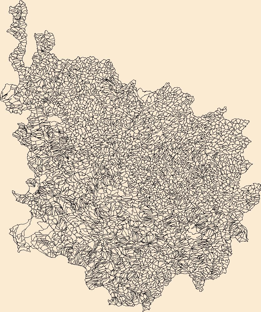
The Watershed Boundary Dataset (WBD) is a comprehensive aggregated collection of hydrologic unit data consistent with the national criteria for delineation and resolution. It defines the areal extent of surface water drainage to a point except in coastal or lake front areas where there could be multiple outlets as stated by the "Federal Standards and Procedures for the National Watershed Boundary Dataset (WBD)" "Standard" (https://pubs.usgs.gov/tm/11/a3/). Watershed boundaries are determined solely upon science-based hydrologic principles, not favoring any administrative boundaries or special projects, nor particular program or agency. This dataset represents the hydrologic unit boundaries to the 12-digit (6th level)...
Tags: 10-digit,
12-digit,
14-digit,
16-digit,
2-digit, All tags...
4-digit,
6-digit,
8-digit,
Adair,
Adams,
Albany,
Allen,
Anderson,
Andrew,
Antelope,
Appanoose,
Arapahoe,
Arthur,
Atchison,
Audrain,
Audubon,
Aurora,
Banner,
Barnes,
Barton,
Basin,
Bates,
Beadle,
Beaverhead,
Bennett,
Benton,
Big Horn,
Billings,
Blaine,
Bon Homme,
Boone,
Boulder,
Bourbon,
Bowman,
Box Butte,
Boyd,
Broadwater,
Brookings,
Broomfield,
Brown,
Brule,
Buchanan,
Buena Vista,
Buffalo,
Burke,
Burleigh,
Burt,
Butler,
Butte,
CO,
Caldwell,
Callaway,
Camden,
Campbell,
Carbon,
Carroll,
Carter,
Cascade,
Cass,
Cedar,
Chaffee,
Chariton,
Charles Mix,
Chase,
Cherokee,
Cherry,
Cheyenne,
Chouteau,
Christian,
Clark,
Clarke,
Clay,
Clear Creek,
Clinton,
Cloud,
Codington,
Coffey,
Cole,
Colfax,
Colorado,
Converse,
Cooper,
Corson,
Crawford,
Crook,
Cuming,
Custer,
Dade,
Dakota,
Dallas,
Daniels,
Daviess,
Davis,
Davison,
Dawes,
Dawson,
Day,
DeKalb,
Decatur,
Deer Lodge,
Dent,
Denver,
Deuel,
Dewey,
Dickey,
Dickinson,
Divide,
Dixon,
Dodge,
Doniphan,
Douglas,
Downloadable Data,
Dundy,
Dunn,
Eddy,
Edmunds,
El Paso,
Elbert,
Ellis,
Ellsworth,
Emmet,
Emmons,
Fall River,
Fallon,
Faulk,
Fergus,
Fillmore,
Flathead,
Foster,
Franklin,
Fremont,
Frontier,
Furnas,
Gage,
Gallatin,
Garden,
Garfield,
Gasconade,
Geary,
Gentry,
GeoPackage,
Gilpin,
Glacier,
Golden Valley,
Goshen,
Gosper,
Gove,
Graham,
Grand,
Granite,
Grant,
Greeley,
Greene,
Gregory,
Grundy,
Guthrie,
HU-2,
HU-2 Region,
HU2_10,
HUC,
Haakon,
Hall,
Hamilton,
Hamlin,
Hand,
Hanson,
Harding,
Harlan,
Harrison,
Hayes,
Henry,
Hettinger,
Hickory,
Hill,
Hitchcock,
Holt,
Hooker,
Hot Springs,
Howard,
Howell,
Hughes,
Hutchinson,
Hyde,
Hydrography,
Hydrologic Unit Code,
Hydrologic Units,
IA,
ID,
Ida,
Idaho,
Iowa,
Jackson,
Jefferson,
Jerauld,
Jewell,
Johnson,
Jones,
Judith Basin,
KS,
Kansas,
Kearney,
Keith,
Keya Paha,
Kidder,
Kimball,
Kingsbury,
Kit Carson,
Knox,
LaMoure,
Laclede,
Lafayette,
Lake,
Lancaster,
Lane,
Laramie,
Larimer,
Lawrence,
Leavenworth,
Lemhi,
Lewis and Clark,
Liberty,
Lincoln,
Linn,
Livingston,
Logan,
Loup,
Lucas,
Lyman,
Lyon,
MN,
MO,
MT,
Macon,
Madison,
Maries,
Marion,
Marshall,
McCone,
McCook,
McHenry,
McIntosh,
McKenzie,
McLean,
McPherson,
Meade,
Meagher,
Mellette,
Mercer,
Merrick,
Miami,
Miller,
Mills,
Miner,
Minnehaha,
Minnesota,
Missouri,
Mitchell,
Moniteau,
Monona,
Monroe,
Montana,
Montgomery,
Moody,
Morgan,
Morrill,
Morris,
Morton,
Mountrail,
Murray,
Musselshell,
ND,
NE,
Nance,
National Watershed Boundary Dataset (WBD),
National Watershed Boundary Dataset (WBD),
Natrona,
Nebraska,
Nemaha,
Ness,
Niobrara,
Nobles,
Nodaway,
North Dakota,
Norton,
Nuckolls,
O'Brien,
Oglala Lakota,
Oliver,
Open Geospatial Consortium GeoPackage 1.2,
Osage,
Osborne,
Osceola,
Otoe,
Ottawa,
Page,
Palo Alto,
Park,
Pawnee,
Pennington,
Perkins,
Petroleum,
Pettis,
Phelps,
Phillips,
Pierce,
Pipestone,
Platte,
Plymouth,
Polk,
Pondera,
Pottawatomie,
Pottawattamie,
Potter,
Powder River,
Powell,
Prairie,
Pulaski,
Putnam,
Randolph,
Ransom,
Ravalli,
Rawlins,
Ray,
Red Willow,
Region,
Republic,
Rice,
Richardson,
Richland,
Riley,
Ringgold,
Roberts,
Rock,
Rooks,
Roosevelt,
Rosebud,
Routt,
Rush,
Russell,
SD,
Sac,
Saline,
Sanborn,
Sargent,
Sarpy,
Saunders,
Schuyler,
Scott,
Scotts Bluff,
Sedgwick,
Seward,
Shawnee,
Shelby,
Sheridan,
Sherman,
Silver Bow,
Sioux,
Slope,
Smith,
South Dakota,
Spink,
St. Charles,
St. Clair,
St. Louis,
Stanley,
Stanton,
Stark,
Stillwater,
Stutsman,
Sub-basin,
Sub-region,
Sublette,
Subwatershed,
Sullivan,
Sully,
Summit,
Sweet Grass,
Sweetwater,
Taylor,
Teller,
Teton,
Texas,
Thayer,
Thomas,
Thurston,
Todd,
Toole,
Treasure,
Trego,
Tripp,
Turner,
US,
Union,
United States,
Valley,
Vernon,
WBD,
WY,
Wabaunsee,
Wallace,
Walworth,
Ward,
Warren,
Washakie,
Washington,
Watershed,
Watershed Boundary Dataset,
Wayne,
Webster,
Weld,
Wells,
Weston,
Wheatland,
Wheeler,
Wibaux,
Wichita,
Williams,
Woodbury,
Worth,
Wright,
Wyandotte,
Wyoming,
Yankton,
Yellowstone,
York,
Yuma,
Ziebach,
inlandWaters, Fewer tags

The Watershed Boundary Dataset (WBD) is a comprehensive aggregated collection of hydrologic unit data consistent with the national criteria for delineation and resolution. It defines the areal extent of surface water drainage to a point except in coastal or lake front areas where there could be multiple outlets as stated by the "Federal Standards and Procedures for the National Watershed Boundary Dataset (WBD)" "Standard" (https://pubs.usgs.gov/tm/11/a3/). Watershed boundaries are determined solely upon science-based hydrologic principles, not favoring any administrative boundaries or special projects, nor particular program or agency. This dataset represents the hydrologic unit boundaries to the 12-digit (6th level)...
Tags: 10-digit,
12-digit,
14-digit,
16-digit,
2-digit, All tags...
4-digit,
6-digit,
8-digit,
AK,
Alaska,
Aleutians East,
Aleutians West,
Anchorage,
Basin,
Bethel,
Bristol Bay,
Chugach,
Copper River,
Denali,
Dillingham,
Downloadable Data,
Esri Shapefile nan,
Fairbanks North Star,
HU-2,
HU-2 Region,
HU2_19,
HUC,
Haines,
Hoonah-Angoon,
Hydrography,
Hydrologic Unit Code,
Hydrologic Units,
Juneau,
Kenai Peninsula,
Ketchikan Gateway,
Kodiak Island,
Kusilvak,
Lake and Peninsula,
Matanuska-Susitna,
National Watershed Boundary Dataset (WBD),
National Watershed Boundary Dataset (WBD),
Nome,
North Slope,
Northwest Arctic,
Petersburg,
Prince of Wales-Hyder,
Region,
Shapefile,
Sitka,
Skagway,
Southeast Fairbanks,
Sub-basin,
Sub-region,
Subwatershed,
US,
United States,
WBD,
Watershed,
Watershed Boundary Dataset,
Wrangell,
Yakutat,
Yukon-Koyukuk,
inlandWaters, Fewer tags
The Watershed Boundary Dataset (WBD) is a comprehensive aggregated collection of hydrologic unit data consistent with the national criteria for delineation and resolution. It defines the areal extent of surface water drainage to a point except in coastal or lake front areas where there could be multiple outlets as stated by the "Federal Standards and Procedures for the National Watershed Boundary Dataset (WBD)" "Standard" (https://pubs.usgs.gov/tm/11/a3/). Watershed boundaries are determined solely upon science-based hydrologic principles, not favoring any administrative boundaries or special projects, nor particular program or agency. This dataset represents the hydrologic unit boundaries to the 12-digit (6th level)...
Tags: 10-digit,
12-digit,
14-digit,
16-digit,
2-digit, All tags...
4-digit,
6-digit,
8-digit,
Addison,
Androscoggin,
Aroostook,
Barnstable,
Basin,
Belknap,
Bennington,
Berkshire,
Bristol,
CT,
Caledonia,
Capitol,
Carroll,
Cheshire,
Columbia,
Connecticut,
Coos,
Cumberland,
Downloadable Data,
Dukes,
Dutchess,
Essex,
Franklin,
GeoPackage,
Grafton,
Greater Bridgeport,
HU-2,
HU-2 Region,
HU2_01,
HUC,
Hampden,
Hampshire,
Hancock,
Hillsborough,
Hydrography,
Hydrologic Unit Code,
Hydrologic Units,
Kennebec,
Kent,
Knox,
Lincoln,
Lower Connecticut River Valley,
MA,
ME,
Maine,
Massachusetts,
Merrimack,
Middlesex,
NH,
NY,
Nantucket,
National Watershed Boundary Dataset (WBD),
National Watershed Boundary Dataset (WBD),
Naugatuck Valley,
New Hampshire,
New York,
Newport,
Norfolk,
Northeastern Connecticut,
Northwest Hills,
Open Geospatial Consortium GeoPackage 1.2,
Orange,
Orleans,
Oxford,
Penobscot,
Piscataquis,
Plymouth,
Providence,
Putnam,
RI,
Region,
Rhode Island,
Rockingham,
Rutland,
Sagadahoc,
Somerset,
South Central Connecticut,
Southeastern Connecticut,
Strafford,
Sub-basin,
Sub-region,
Subwatershed,
Suffolk,
Sullivan,
US,
United States,
VT,
Vermont,
WBD,
Waldo,
Washington,
Watershed,
Watershed Boundary Dataset,
Westchester,
Western Connecticut,
Windham,
Windsor,
Worcester,
York,
inlandWaters, Fewer tags
The Watershed Boundary Dataset (WBD) is a comprehensive aggregated collection of hydrologic unit data consistent with the national criteria for delineation and resolution. It defines the areal extent of surface water drainage to a point except in coastal or lake front areas where there could be multiple outlets as stated by the "Federal Standards and Procedures for the National Watershed Boundary Dataset (WBD)" "Standard" (https://pubs.usgs.gov/tm/11/a3/). Watershed boundaries are determined solely upon science-based hydrologic principles, not favoring any administrative boundaries or special projects, nor particular program or agency. This dataset represents the hydrologic unit boundaries to the 12-digit (6th level)...
Tags: 10-digit,
12-digit,
14-digit,
16-digit,
2-digit, All tags...
4-digit,
6-digit,
8-digit,
AZ,
Apache,
Arizona,
Basin,
CA,
California,
Catron,
Cibola,
Clark,
Cochise,
Coconino,
Downloadable Data,
GeoPackage,
Gila,
Graham,
Grant,
Greenlee,
HU-2,
HU-2 Region,
HU2_15,
HUC,
Hidalgo,
Hydrography,
Hydrologic Unit Code,
Hydrologic Units,
Imperial,
Iron,
Kane,
La Paz,
Lincoln,
Luna,
Maricopa,
McKinley,
Mohave,
NM,
NV,
National Watershed Boundary Dataset (WBD),
National Watershed Boundary Dataset (WBD),
Navajo,
Nevada,
New Mexico,
Nye,
Open Geospatial Consortium GeoPackage 1.2,
Pima,
Pinal,
Region,
Riverside,
San Bernardino,
San Juan,
Santa Cruz,
Sierra,
Sub-basin,
Sub-region,
Subwatershed,
US,
UT,
United States,
Utah,
WBD,
Washington,
Watershed,
Watershed Boundary Dataset,
White Pine,
Yavapai,
Yuma,
inlandWaters, Fewer tags

Public access spatial analysis and statistic summaries of the Protected Areas Database of the United States (PAD-US) provide land managers and decision makers with a general assessment of public access across the nation, as represented by the Public Access Category (see Public Access Cat Definition sheet in Microsoft Excel downloads). Area statistics include total acreage, acres by managing agency, and percent access. These summaries are available for various units: National, State, Department of the Interior Region, Congressional District, County, Hydrologic Unit Code 12, EcoRegions I-IV, Urban Areas. Overlapping designation boundaries are intersected into fee simple lands in the Vector Analysis File ( https://www.sciencebase.gov/catalog/item/6064e0edd34eff1443414d6f...
Categories: Data;
Tags: Agricultural Research Service,
Alabama (AL),
Alaska (AK),
American Samoa (AS),
Arizona (AZ), All tags...
Arkansas (AR),
Army Corps of Engineers,
Biodiversity,
Bureau of Land Management,
Bureau of Reclamation,
Cadastre Theme,
California (CA),
Colorado (CO),
Connecticut (CT),
Conservation,
Delaware (DE),
Department of Defense,
Department of Energy,
Federal Lands,
Federated States of Micronesia (FM),
Florida (FL),
Forest Service,
GAP Status Code,
Gap Analysis,
Geography,
Georgia (GA),
Governmental Units,
Guam (GU),
Hawaii (HI),
IUCN Category,
Idaho (ID),
Illinois (IL),
Indiana (IN),
Iowa (IA),
Kansas (KS),
Kentucky (KY),
Land Manager,
Land Ownership,
Land Stewardship,
Land-Use Change,
Local Government Lands,
Louisiana (LA),
Maine (ME),
Mariana Islands (MP),
Marshall Islands (MH),
Maryland (MD),
Massachusetts (MA),
Michigan (MI),
Minnesota (MN),
Mississippi (MS),
Missouri (MO),
Montana (MT),
NGDA,
NGDA Portfolio Themes,
National Geospatial Data Asset,
National Oceanic and Atmospheric Administration,
National Park Service,
Natural Resources Conservation Service,
Nebraska (NE),
Nevada (NV),
New Hampshire (NH),
New Jersey (NJ),
New Mexico (NM),
New York (NY),
North Carolina (NC),
North Dakota (ND),
Ohio (OH),
Oklahoma (OK),
Oregon (OR),
Outdoor Recreation,
Palau (PW),
Parks,
Pennsylvania (PA),
Private Lands,
Protected Area,
Protection Status,
Public Health,
Public Lands,
Public Open Space,
Puerto Rico (PR),
Rhode Island (RI),
South Carolina (SC),
South Dakota (SD),
State Lands,
Tennessee (TN),
Tennessee Valley Authority,
Texas (TX),
U.S. Fish and Wildlife Service,
U.S. Minor Outlying Islands (UM),
United States,
United States,
United States Virgin Islands (VI),
Utah (UT),
Vermont (VT),
Virginia (VA),
Washington (WA),
West Virginia (WV),
Wisconsin (WI),
Wyoming (WY), Fewer tags
The Watershed Boundary Dataset (WBD) is a comprehensive aggregated collection of hydrologic unit data consistent with the national criteria for delineation and resolution. It defines the areal extent of surface water drainage to a point except in coastal or lake front areas where there could be multiple outlets as stated by the "Federal Standards and Procedures for the National Watershed Boundary Dataset (WBD)" "Standard" (https://pubs.usgs.gov/tm/11/a3/). Watershed boundaries are determined solely upon science-based hydrologic principles, not favoring any administrative boundaries or special projects, nor particular program or agency. This dataset represents the hydrologic unit boundaries to the 12-digit (6th level)...
Tags: 10-digit,
12-digit,
14-digit,
16-digit,
2-digit, All tags...
4-digit,
6-digit,
8-digit,
Adams,
Addison,
Aitkin,
Alcona,
Alger,
Allegan,
Allegany,
Allen,
Alpena,
Antrim,
Arenac,
Ashland,
Ashtabula,
Auglaize,
Baraga,
Barry,
Basin,
Bay,
Bayfield,
Bennington,
Benzie,
Berrien,
Branch,
Brown,
Caledonia,
Calhoun,
Calumet,
Carlton,
Cass,
Cattaraugus,
Cayuga,
Charlevoix,
Chautauqua,
Cheboygan,
Chemung,
Chippewa,
Chittenden,
Clare,
Clinton,
Columbia,
Cook,
Coos,
Cortland,
Crawford,
Cuyahoga,
DeKalb,
Defiance,
Delta,
Dickinson,
Dodge,
Door,
Douglas,
Downloadable Data,
Eaton,
Elkhart,
Emmet,
Erie,
Essex,
Florence,
Fond du Lac,
Forest,
Franklin,
Fulton,
Geauga,
Genesee,
GeoPackage,
Gladwin,
Gogebic,
Grand Isle,
Grand Traverse,
Gratiot,
Green Lake,
HU-2,
HU-2 Region,
HU2_04,
HUC,
Hamilton,
Hancock,
Hardin,
Henry,
Herkimer,
Hillsdale,
Houghton,
Huron,
Hydrography,
Hydrologic Unit Code,
Hydrologic Units,
IL,
IN,
Illinois,
Indiana,
Ingham,
Ionia,
Iosco,
Iron,
Isabella,
Itasca,
Jackson,
Jefferson,
Kalamazoo,
Kalkaska,
Kenosha,
Kent,
Kewaunee,
Keweenaw,
Kosciusko,
LaGrange,
LaPorte,
Lake,
Lamoille,
Langlade,
Lapeer,
Leelanau,
Lenawee,
Lewis,
Livingston,
Lorain,
Lucas,
Luce,
ME,
MI,
MN,
Mackinac,
Macomb,
Madison,
Maine,
Manistee,
Manitowoc,
Marathon,
Marinette,
Marion,
Marquette,
Mason,
Mecosta,
Medina,
Menominee,
Mercer,
Michigan,
Midland,
Milwaukee,
Minnesota,
Missaukee,
Monroe,
Montcalm,
Montmorency,
Muskegon,
NH,
NY,
National Watershed Boundary Dataset (WBD),
National Watershed Boundary Dataset (WBD),
New Hampshire,
New York,
Newaygo,
Niagara,
Noble,
OH,
Oakland,
Oceana,
Oconto,
Ogemaw,
Ohio,
Oneida,
Onondaga,
Ontario,
Ontonagon,
Open Geospatial Consortium GeoPackage 1.2,
Orange,
Orleans,
Osceola,
Oscoda,
Oswego,
Otsego,
Ottawa,
Outagamie,
Oxford,
Ozaukee,
PA,
Paulding,
Pennsylvania,
Pine,
Portage,
Porter,
Potter,
Presque Isle,
Putnam,
Racine,
Region,
Richland,
Roscommon,
Rutland,
Saginaw,
Sandusky,
Sanilac,
Schoolcraft,
Schuyler,
Seneca,
Shawano,
Sheboygan,
Shelby,
Shiawassee,
Somerset,
St. Clair,
St. Joseph,
St. Lawrence,
St. Louis,
Stark,
Steuben,
Sub-basin,
Sub-region,
Subwatershed,
Summit,
Tioga,
Tompkins,
Trumbull,
Tuscola,
US,
United States,
VT,
Van Buren,
Van Wert,
Vermont,
Vilas,
WBD,
WI,
Warren,
Washington,
Washtenaw,
Watershed,
Watershed Boundary Dataset,
Waukesha,
Waupaca,
Waushara,
Wayne,
Wells,
Wexford,
Whitley,
Williams,
Windsor,
Winnebago,
Wisconsin,
Wood,
Wyandot,
Wyoming,
Yates,
inlandWaters, Fewer tags
The Watershed Boundary Dataset (WBD) is a comprehensive aggregated collection of hydrologic unit data consistent with the national criteria for delineation and resolution. It defines the areal extent of surface water drainage to a point except in coastal or lake front areas where there could be multiple outlets as stated by the "Federal Standards and Procedures for the National Watershed Boundary Dataset (WBD)" "Standard" (https://pubs.usgs.gov/tm/11/a3/). Watershed boundaries are determined solely upon science-based hydrologic principles, not favoring any administrative boundaries or special projects, nor particular program or agency. This dataset represents the hydrologic unit boundaries to the 12-digit (6th level)...
Tags: 10-digit,
12-digit,
14-digit,
16-digit,
2-digit, All tags...
4-digit,
6-digit,
8-digit,
Adair,
Adams,
Aitkin,
Alexander,
Allamakee,
Anoka,
Appanoose,
Ashland,
Audrain,
Audubon,
Ballard,
Barron,
Basin,
Bayfield,
Becker,
Beltrami,
Benton,
Berrien,
Big Stone,
Black Hawk,
Blue Earth,
Bollinger,
Bond,
Boone,
Bremer,
Brookings,
Brown,
Buchanan,
Buena Vista,
Buffalo,
Bureau,
Burnett,
Butler,
Calhoun,
Callaway,
Cape Girardeau,
Carlton,
Carroll,
Carver,
Cass,
Cedar,
Cerro Gordo,
Champaign,
Chickasaw,
Chippewa,
Chisago,
Christian,
Clark,
Clarke,
Clay,
Clayton,
Clearwater,
Clinton,
Codington,
Coles,
Columbia,
Cook,
Cottonwood,
Crawford,
Crow Wing,
Dakota,
Dallas,
Dane,
Davis,
Day,
De Witt,
DeKalb,
Delaware,
Dent,
Des Moines,
Deuel,
Dickinson,
Dodge,
Douglas,
Downloadable Data,
DuPage,
Dubuque,
Dunn,
Eau Claire,
Effingham,
Elkhart,
Emmet,
Faribault,
Fayette,
Fillmore,
Floyd,
Fond du Lac,
Ford,
Forest,
Franklin,
Freeborn,
Fulton,
Gasconade,
GeoPackage,
Gogebic,
Goodhue,
Grant,
Green,
Green Lake,
Greene,
Grundy,
Guthrie,
HU-2,
HU-2 Region,
HU2_07,
HUC,
Hamilton,
Hancock,
Hardin,
Henderson,
Hennepin,
Henry,
Houston,
Howard,
Hubbard,
Humboldt,
Hydrography,
Hydrologic Unit Code,
Hydrologic Units,
IA,
IL,
IN,
Illinois,
Indiana,
Iowa,
Iowa,
Iron,
Iroquois,
Isanti,
Itasca,
Jackson,
Jasper,
Jefferson,
Jersey,
Jo Daviess,
Johnson,
Jones,
Juneau,
KY,
Kanabec,
Kandiyohi,
Kane,
Kankakee,
Kendall,
Kenosha,
Kentucky,
Keokuk,
Knox,
Kosciusko,
Kossuth,
La Crosse,
LaPorte,
LaSalle,
Lac qui Parle,
Lafayette,
Lake,
Langlade,
Le Sueur,
Lee,
Lewis,
Lincoln,
Linn,
Livingston,
Logan,
Louisa,
Lucas,
Lyon,
MI,
MN,
MO,
Macon,
Macoupin,
Madison,
Mahaska,
Marathon,
Maries,
Marion,
Marquette,
Marshall,
Martin,
Mason,
McDonough,
McHenry,
McLean,
McLeod,
Meeker,
Menard,
Mercer,
Michigan,
Mille Lacs,
Milwaukee,
Minnesota,
Mississippi,
Missouri,
Mitchell,
Monroe,
Montgomery,
Morgan,
Morrison,
Moultrie,
Mower,
Murray,
Muscatine,
ND,
National Watershed Boundary Dataset (WBD),
National Watershed Boundary Dataset (WBD),
Newton,
Nicollet,
Nobles,
North Dakota,
Ogle,
Olmsted,
Oneida,
Open Geospatial Consortium GeoPackage 1.2,
Osage,
Otter Tail,
Palo Alto,
Peoria,
Pepin,
Perry,
Phelps,
Piatt,
Pierce,
Pike,
Pine,
Pipestone,
Pocahontas,
Polk,
Pope,
Portage,
Porter,
Poweshiek,
Price,
Pulaski,
Putnam,
Racine,
Ralls,
Ramsey,
Randolph,
Redwood,
Region,
Renville,
Reynolds,
Rice,
Richland,
Roberts,
Rock,
Rock Island,
Rusk,
SD,
Sac,
Sangamon,
Sauk,
Sawyer,
Schuyler,
Scotland,
Scott,
Shawano,
Shelby,
Sherburne,
Sibley,
South Dakota,
St. Charles,
St. Clair,
St. Croix,
St. Francois,
St. Joseph,
St. Louis,
Stark,
Starke,
Ste. Genevieve,
Stearns,
Steele,
Stephenson,
Stevens,
Story,
Sub-basin,
Sub-region,
Subwatershed,
Swift,
Tama,
Taylor,
Tazewell,
Texas,
Todd,
Traverse,
Trempealeau,
US,
Union,
United States,
Van Buren,
Vermilion,
Vernon,
Vilas,
WBD,
WI,
Wabasha,
Wadena,
Walworth,
Wapello,
Warren,
Waseca,
Washburn,
Washington,
Watershed,
Watershed Boundary Dataset,
Watonwan,
Waukesha,
Waushara,
Wayne,
Webster,
White,
Whiteside,
Will,
Williamson,
Winnebago,
Winneshiek,
Winona,
Wisconsin,
Wood,
Woodford,
Worth,
Wright,
Yellow Medicine,
inlandWaters, Fewer tags

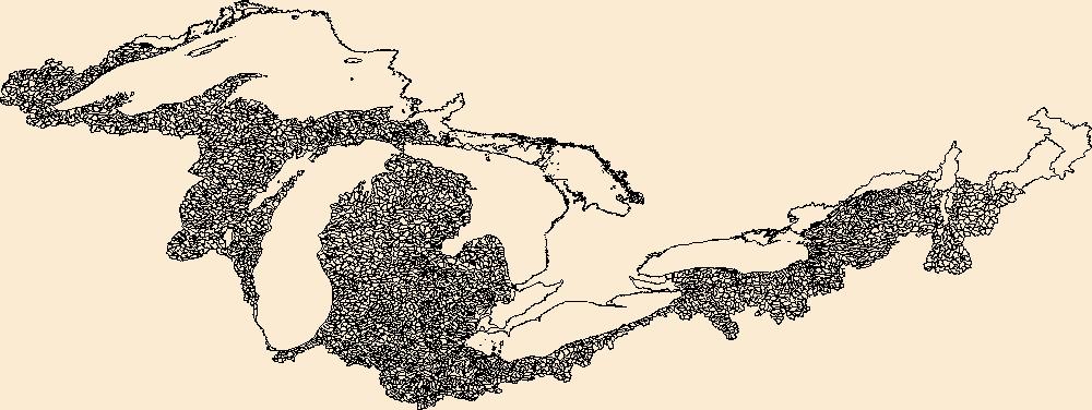
The Watershed Boundary Dataset (WBD) is a comprehensive aggregated collection of hydrologic unit data consistent with the national criteria for delineation and resolution. It defines the areal extent of surface water drainage to a point except in coastal or lake front areas where there could be multiple outlets as stated by the "Federal Standards and Procedures for the National Watershed Boundary Dataset (WBD)" "Standard" (https://pubs.usgs.gov/tm/11/a3/). Watershed boundaries are determined solely upon science-based hydrologic principles, not favoring any administrative boundaries or special projects, nor particular program or agency. This dataset represents the hydrologic unit boundaries to the 12-digit (6th level)...
Tags: 10-digit,
12-digit,
14-digit,
16-digit,
2-digit, All tags...
4-digit,
6-digit,
8-digit,
Adams,
Addison,
Aitkin,
Alcona,
Alger,
Allegan,
Allegany,
Allen,
Alpena,
Antrim,
Arenac,
Ashland,
Ashtabula,
Auglaize,
Baraga,
Barry,
Basin,
Bay,
Bayfield,
Bennington,
Benzie,
Berrien,
Branch,
Brown,
Caledonia,
Calhoun,
Calumet,
Carlton,
Cass,
Cattaraugus,
Cayuga,
Charlevoix,
Chautauqua,
Cheboygan,
Chemung,
Chippewa,
Chittenden,
Clare,
Clinton,
Columbia,
Cook,
Coos,
Cortland,
Crawford,
Cuyahoga,
DeKalb,
Defiance,
Delta,
Dickinson,
Dodge,
Door,
Douglas,
Downloadable Data,
Eaton,
Elkhart,
Emmet,
Erie,
Esri Shapefile nan,
Essex,
Florence,
Fond du Lac,
Forest,
Franklin,
Fulton,
Geauga,
Genesee,
Gladwin,
Gogebic,
Grand Isle,
Grand Traverse,
Gratiot,
Green Lake,
HU-2,
HU-2 Region,
HU2_04,
HUC,
Hamilton,
Hancock,
Hardin,
Henry,
Herkimer,
Hillsdale,
Houghton,
Huron,
Hydrography,
Hydrologic Unit Code,
Hydrologic Units,
IL,
IN,
Illinois,
Indiana,
Ingham,
Ionia,
Iosco,
Iron,
Isabella,
Itasca,
Jackson,
Jefferson,
Kalamazoo,
Kalkaska,
Kenosha,
Kent,
Kewaunee,
Keweenaw,
Kosciusko,
LaGrange,
LaPorte,
Lake,
Lamoille,
Langlade,
Lapeer,
Leelanau,
Lenawee,
Lewis,
Livingston,
Lorain,
Lucas,
Luce,
ME,
MI,
MN,
Mackinac,
Macomb,
Madison,
Maine,
Manistee,
Manitowoc,
Marathon,
Marinette,
Marion,
Marquette,
Mason,
Mecosta,
Medina,
Menominee,
Mercer,
Michigan,
Midland,
Milwaukee,
Minnesota,
Missaukee,
Monroe,
Montcalm,
Montmorency,
Muskegon,
NH,
NY,
National Watershed Boundary Dataset (WBD),
National Watershed Boundary Dataset (WBD),
New Hampshire,
New York,
Newaygo,
Niagara,
Noble,
OH,
Oakland,
Oceana,
Oconto,
Ogemaw,
Ohio,
Oneida,
Onondaga,
Ontario,
Ontonagon,
Orange,
Orleans,
Osceola,
Oscoda,
Oswego,
Otsego,
Ottawa,
Outagamie,
Oxford,
Ozaukee,
PA,
Paulding,
Pennsylvania,
Pine,
Portage,
Porter,
Potter,
Presque Isle,
Putnam,
Racine,
Region,
Richland,
Roscommon,
Rutland,
Saginaw,
Sandusky,
Sanilac,
Schoolcraft,
Schuyler,
Seneca,
Shapefile,
Shawano,
Sheboygan,
Shelby,
Shiawassee,
Somerset,
St. Clair,
St. Joseph,
St. Lawrence,
St. Louis,
Stark,
Steuben,
Sub-basin,
Sub-region,
Subwatershed,
Summit,
Tioga,
Tompkins,
Trumbull,
Tuscola,
US,
United States,
VT,
Van Buren,
Van Wert,
Vermont,
Vilas,
WBD,
WI,
Warren,
Washington,
Washtenaw,
Watershed,
Watershed Boundary Dataset,
Waukesha,
Waupaca,
Waushara,
Wayne,
Wells,
Wexford,
Whitley,
Williams,
Windsor,
Winnebago,
Wisconsin,
Wood,
Wyandot,
Wyoming,
Yates,
inlandWaters, Fewer tags

The Watershed Boundary Dataset (WBD) is a comprehensive aggregated collection of hydrologic unit data consistent with the national criteria for delineation and resolution. It defines the areal extent of surface water drainage to a point except in coastal or lake front areas where there could be multiple outlets as stated by the "Federal Standards and Procedures for the National Watershed Boundary Dataset (WBD)" "Standard" (https://pubs.usgs.gov/tm/11/a3/). Watershed boundaries are determined solely upon science-based hydrologic principles, not favoring any administrative boundaries or special projects, nor particular program or agency. This dataset represents the hydrologic unit boundaries to the 12-digit (6th level)...
Tags: 10-digit,
12-digit,
14-digit,
16-digit,
2-digit, All tags...
4-digit,
6-digit,
8-digit,
AL,
Alabama,
Alcorn,
Anderson,
Ashe,
Avery,
Basin,
Bedford,
Bell,
Benton,
Bland,
Bledsoe,
Blount,
Bradley,
Bristol,
Buchanan,
Buncombe,
Caldwell,
Calloway,
Campbell,
Cannon,
Carroll,
Carter,
Catoosa,
Cherokee,
Chester,
Claiborne,
Clay,
Cocke,
Coffee,
Colbert,
Cullman,
Cumberland,
Dade,
DeKalb,
Decatur,
Dickenson,
Dickson,
Downloadable Data,
Etowah,
Fannin,
Fentress,
Franklin,
GA,
GeoPackage,
Georgia,
Giles,
Gilmer,
Graham,
Grainger,
Graves,
Grayson,
Greene,
Greenville,
Grundy,
HU-2,
HU-2 Region,
HU2_06,
HUC,
Habersham,
Hamblen,
Hamilton,
Hancock,
Hardin,
Harlan,
Hawkins,
Haywood,
Henderson,
Henry,
Hickman,
Houston,
Humphreys,
Hydrography,
Hydrologic Unit Code,
Hydrologic Units,
Itawamba,
Jackson,
Jefferson,
Johnson,
KY,
Kentucky,
Knox,
Lauderdale,
Lawrence,
Lee,
Letcher,
Lewis,
Limestone,
Lincoln,
Livingston,
Loudon,
Lumpkin,
Lyon,
MS,
Macon,
Madison,
Marion,
Marshall,
Maury,
McCracken,
McDowell,
McMinn,
McNairy,
Meigs,
Mississippi,
Mitchell,
Monroe,
Moore,
Morgan,
NC,
National Watershed Boundary Dataset (WBD),
National Watershed Boundary Dataset (WBD),
North Carolina,
Norton,
Open Geospatial Consortium GeoPackage 1.2,
Perry,
Pickens,
Polk,
Prentiss,
Putnam,
Rabun,
Region,
Rhea,
Roane,
Russell,
Rutherford,
SC,
Scott,
Sequatchie,
Sevier,
Smyth,
South Carolina,
Stewart,
Sub-basin,
Sub-region,
Subwatershed,
Sullivan,
Swain,
TN,
Tazewell,
Tennessee,
Tishomingo,
Towns,
Transylvania,
Trigg,
US,
Unicoi,
Union,
United States,
VA,
Van Buren,
Virginia,
WBD,
WV,
Walker,
Washington,
Watauga,
Watershed,
Watershed Boundary Dataset,
Wayne,
West Virginia,
White,
Whitfield,
Williamson,
Winston,
Wise,
Wythe,
Yancey,
inlandWaters, Fewer tags

The Watershed Boundary Dataset (WBD) is a comprehensive aggregated collection of hydrologic unit data consistent with the national criteria for delineation and resolution. It defines the areal extent of surface water drainage to a point except in coastal or lake front areas where there could be multiple outlets as stated by the "Federal Standards and Procedures for the National Watershed Boundary Dataset (WBD)" "Standard" (https://pubs.usgs.gov/tm/11/a3/). Watershed boundaries are determined solely upon science-based hydrologic principles, not favoring any administrative boundaries or special projects, nor particular program or agency. This dataset represents the hydrologic unit boundaries to the 12-digit (6th level)...
Tags: 10-digit,
12-digit,
14-digit,
16-digit,
2-digit, All tags...
4-digit,
6-digit,
8-digit,
AL,
Alabama,
Alcorn,
Anderson,
Ashe,
Avery,
Basin,
Bedford,
Bell,
Benton,
Bland,
Bledsoe,
Blount,
Bradley,
Bristol,
Buchanan,
Buncombe,
Caldwell,
Calloway,
Campbell,
Cannon,
Carroll,
Carter,
Catoosa,
Cherokee,
Chester,
Claiborne,
Clay,
Cocke,
Coffee,
Colbert,
Cullman,
Cumberland,
Dade,
DeKalb,
Decatur,
Dickenson,
Dickson,
Downloadable Data,
Esri Shapefile nan,
Etowah,
Fannin,
Fentress,
Franklin,
GA,
Georgia,
Giles,
Gilmer,
Graham,
Grainger,
Graves,
Grayson,
Greene,
Greenville,
Grundy,
HU-2,
HU-2 Region,
HU2_06,
HUC,
Habersham,
Hamblen,
Hamilton,
Hancock,
Hardin,
Harlan,
Hawkins,
Haywood,
Henderson,
Henry,
Hickman,
Houston,
Humphreys,
Hydrography,
Hydrologic Unit Code,
Hydrologic Units,
Itawamba,
Jackson,
Jefferson,
Johnson,
KY,
Kentucky,
Knox,
Lauderdale,
Lawrence,
Lee,
Letcher,
Lewis,
Limestone,
Lincoln,
Livingston,
Loudon,
Lumpkin,
Lyon,
MS,
Macon,
Madison,
Marion,
Marshall,
Maury,
McCracken,
McDowell,
McMinn,
McNairy,
Meigs,
Mississippi,
Mitchell,
Monroe,
Moore,
Morgan,
NC,
National Watershed Boundary Dataset (WBD),
National Watershed Boundary Dataset (WBD),
North Carolina,
Norton,
Perry,
Pickens,
Polk,
Prentiss,
Putnam,
Rabun,
Region,
Rhea,
Roane,
Russell,
Rutherford,
SC,
Scott,
Sequatchie,
Sevier,
Shapefile,
Smyth,
South Carolina,
Stewart,
Sub-basin,
Sub-region,
Subwatershed,
Sullivan,
Swain,
TN,
Tazewell,
Tennessee,
Tishomingo,
Towns,
Transylvania,
Trigg,
US,
Unicoi,
Union,
United States,
VA,
Van Buren,
Virginia,
WBD,
WV,
Walker,
Washington,
Watauga,
Watershed,
Watershed Boundary Dataset,
Wayne,
West Virginia,
White,
Whitfield,
Williamson,
Winston,
Wise,
Wythe,
Yancey,
inlandWaters, Fewer tags
The Watershed Boundary Dataset (WBD) is a comprehensive aggregated collection of hydrologic unit data consistent with the national criteria for delineation and resolution. It defines the areal extent of surface water drainage to a point except in coastal or lake front areas where there could be multiple outlets as stated by the "Federal Standards and Procedures for the National Watershed Boundary Dataset (WBD)" "Standard" (https://pubs.usgs.gov/tm/11/a3/). Watershed boundaries are determined solely upon science-based hydrologic principles, not favoring any administrative boundaries or special projects, nor particular program or agency. This dataset represents the hydrologic unit boundaries to the 12-digit (6th level)...
Tags: 10-digit,
12-digit,
14-digit,
16-digit,
2-digit, All tags...
4-digit,
6-digit,
8-digit,
AL,
Alabama,
Alcorn,
Anderson,
Ashe,
Avery,
Basin,
Bedford,
Bell,
Benton,
Bland,
Bledsoe,
Blount,
Bradley,
Bristol,
Buchanan,
Buncombe,
Caldwell,
Calloway,
Campbell,
Cannon,
Carroll,
Carter,
Catoosa,
Cherokee,
Chester,
Claiborne,
Clay,
Cocke,
Coffee,
Colbert,
Cullman,
Cumberland,
Dade,
DeKalb,
Decatur,
Dickenson,
Dickson,
Downloadable Data,
Esri File GeoDatabase 10,
Etowah,
Fannin,
Fentress,
FileGDB,
Franklin,
GA,
Georgia,
Giles,
Gilmer,
Graham,
Grainger,
Graves,
Grayson,
Greene,
Greenville,
Grundy,
HU-2,
HU-2 Region,
HU2_06,
HUC,
Habersham,
Hamblen,
Hamilton,
Hancock,
Hardin,
Harlan,
Hawkins,
Haywood,
Henderson,
Henry,
Hickman,
Houston,
Humphreys,
Hydrography,
Hydrologic Unit Code,
Hydrologic Units,
Itawamba,
Jackson,
Jefferson,
Johnson,
KY,
Kentucky,
Knox,
Lauderdale,
Lawrence,
Lee,
Letcher,
Lewis,
Limestone,
Lincoln,
Livingston,
Loudon,
Lumpkin,
Lyon,
MS,
Macon,
Madison,
Marion,
Marshall,
Maury,
McCracken,
McDowell,
McMinn,
McNairy,
Meigs,
Mississippi,
Mitchell,
Monroe,
Moore,
Morgan,
NC,
National Watershed Boundary Dataset (WBD),
National Watershed Boundary Dataset (WBD),
North Carolina,
Norton,
Perry,
Pickens,
Polk,
Prentiss,
Putnam,
Rabun,
Region,
Rhea,
Roane,
Russell,
Rutherford,
SC,
Scott,
Sequatchie,
Sevier,
Smyth,
South Carolina,
Stewart,
Sub-basin,
Sub-region,
Subwatershed,
Sullivan,
Swain,
TN,
Tazewell,
Tennessee,
Tishomingo,
Towns,
Transylvania,
Trigg,
US,
Unicoi,
Union,
United States,
VA,
Van Buren,
Virginia,
WBD,
WV,
Walker,
Washington,
Watauga,
Watershed,
Watershed Boundary Dataset,
Wayne,
West Virginia,
White,
Whitfield,
Williamson,
Winston,
Wise,
Wythe,
Yancey,
inlandWaters, Fewer tags
The Watershed Boundary Dataset (WBD) is a comprehensive aggregated collection of hydrologic unit data consistent with the national criteria for delineation and resolution. It defines the areal extent of surface water drainage to a point except in coastal or lake front areas where there could be multiple outlets as stated by the "Federal Standards and Procedures for the National Watershed Boundary Dataset (WBD)" "Standard" (https://pubs.usgs.gov/tm/11/a3/). Watershed boundaries are determined solely upon science-based hydrologic principles, not favoring any administrative boundaries or special projects, nor particular program or agency. This dataset represents the hydrologic unit boundaries to the 12-digit (6th level)...
Tags: 10-digit,
12-digit,
14-digit,
16-digit,
2-digit, All tags...
4-digit,
6-digit,
8-digit,
Alpine,
Bannock,
Basin,
Bear Lake,
Beaver,
Box Elder,
CA,
Cache,
California,
Carbon,
Caribou,
Carson City,
Cassia,
Churchill,
Clark,
Davis,
Douglas,
Downloadable Data,
Duchesne,
El Dorado,
Elko,
Esmeralda,
Esri Shapefile nan,
Eureka,
Franklin,
Garfield,
HU-2,
HU-2 Region,
HU2_16,
HUC,
Harney,
Humboldt,
Hydrography,
Hydrologic Unit Code,
Hydrologic Units,
ID,
Idaho,
Inyo,
Iron,
Juab,
Kane,
Lander,
Lassen,
Lincoln,
Lyon,
Malheur,
Millard,
Mineral,
Mono,
Morgan,
NV,
National Watershed Boundary Dataset (WBD),
National Watershed Boundary Dataset (WBD),
Nevada,
Nevada,
Nye,
OR,
Oneida,
Oregon,
Pershing,
Piute,
Placer,
Power,
Region,
Rich,
Salt Lake,
San Bernardino,
Sanpete,
Sevier,
Shapefile,
Sierra,
Storey,
Sub-basin,
Sub-region,
Subwatershed,
Summit,
Tooele,
Tuolumne,
US,
UT,
Uinta,
United States,
Utah,
Utah,
WBD,
WY,
Wasatch,
Washington,
Washoe,
Watershed,
Watershed Boundary Dataset,
Wayne,
Weber,
White Pine,
Wyoming,
inlandWaters, Fewer tags
The Watershed Boundary Dataset (WBD) is a comprehensive aggregated collection of hydrologic unit data consistent with the national criteria for delineation and resolution. It defines the areal extent of surface water drainage to a point except in coastal or lake front areas where there could be multiple outlets as stated by the "Federal Standards and Procedures for the National Watershed Boundary Dataset (WBD)" "Standard" (https://pubs.usgs.gov/tm/11/a3/). Watershed boundaries are determined solely upon science-based hydrologic principles, not favoring any administrative boundaries or special projects, nor particular program or agency. This dataset represents the hydrologic unit boundaries to the 12-digit (6th level)...
Tags: 10-digit,
12-digit,
14-digit,
16-digit,
2-digit, All tags...
4-digit,
6-digit,
8-digit,
Alameda,
Alpine,
Amador,
Basin,
Butte,
CA,
Calaveras,
California,
Colusa,
Contra Costa,
Curry,
Del Norte,
Douglas,
Downloadable Data,
El Dorado,
Esmeralda,
Fresno,
GeoPackage,
Glenn,
HU-2,
HU-2 Region,
HU2_18,
HUC,
Humboldt,
Hydrography,
Hydrologic Unit Code,
Hydrologic Units,
Imperial,
Inyo,
Jackson,
Josephine,
Kern,
Kings,
Klamath,
Lake,
Lassen,
Los Angeles,
Madera,
Marin,
Mariposa,
Mendocino,
Merced,
Mineral,
Modoc,
Mono,
Monterey,
NV,
Napa,
National Watershed Boundary Dataset (WBD),
National Watershed Boundary Dataset (WBD),
Nevada,
Nevada,
Nye,
OR,
Open Geospatial Consortium GeoPackage 1.2,
Orange,
Oregon,
Placer,
Plumas,
Region,
Riverside,
Sacramento,
San Benito,
San Bernardino,
San Diego,
San Francisco,
San Joaquin,
San Luis Obispo,
San Mateo,
Santa Barbara,
Santa Clara,
Santa Cruz,
Shasta,
Sierra,
Siskiyou,
Solano,
Sonoma,
Stanislaus,
Sub-basin,
Sub-region,
Subwatershed,
Sutter,
Tehama,
Trinity,
Tulare,
Tuolumne,
US,
United States,
Ventura,
WBD,
Washoe,
Watershed,
Watershed Boundary Dataset,
Yolo,
Yuba,
inlandWaters, Fewer tags
The Watershed Boundary Dataset (WBD) is a comprehensive aggregated collection of hydrologic unit data consistent with the national criteria for delineation and resolution. It defines the areal extent of surface water drainage to a point except in coastal or lake front areas where there could be multiple outlets as stated by the "Federal Standards and Procedures for the National Watershed Boundary Dataset (WBD)" "Standard" (https://pubs.usgs.gov/tm/11/a3/). Watershed boundaries are determined solely upon science-based hydrologic principles, not favoring any administrative boundaries or special projects, nor particular program or agency. This dataset represents the hydrologic unit boundaries to the 12-digit (6th level)...
Tags: 10-digit,
12-digit,
14-digit,
16-digit,
2-digit, All tags...
4-digit,
6-digit,
8-digit,
AR,
Acadia,
Adams,
Alcorn,
Alexander,
Allen,
Amite,
Arkansas,
Arkansas,
Ascension,
Ashley,
Assumption,
Attala,
Avoyelles,
Ballard,
Basin,
Beauregard,
Benton,
Bienville,
Bolivar,
Bollinger,
Bradley,
Butler,
Calcasieu,
Caldwell,
Calhoun,
Calloway,
Cameron,
Cape Girardeau,
Carlisle,
Carroll,
Catahoula,
Chester,
Chickasaw,
Chicot,
Choctaw,
Claiborne,
Clark,
Clay,
Cleveland,
Coahoma,
Columbia,
Concordia,
Copiah,
Craighead,
Crittenden,
Crockett,
Cross,
Dallas,
DeSoto,
Desha,
Downloadable Data,
Drew,
Dunklin,
Dyer,
East Baton Rouge,
East Carroll,
East Feliciana,
Esri Shapefile nan,
Evangeline,
Faulkner,
Fayette,
Franklin,
Fulton,
Garland,
Gibson,
Grant,
Graves,
Greene,
Grenada,
HU-2,
HU-2 Region,
HU2_08,
HUC,
Hardeman,
Harrison,
Haywood,
Hempstead,
Henderson,
Henry,
Hickman,
Hinds,
Holmes,
Hot Spring,
Howard,
Humphreys,
Hydrography,
Hydrologic Unit Code,
Hydrologic Units,
IL,
Iberia,
Iberville,
Illinois,
Iron,
Issaquena,
Jackson,
Jefferson,
Jefferson Davis,
KY,
Kentucky,
LA,
LaSalle,
Lafayette,
Lafourche,
Lake,
Lauderdale,
Lawrence,
Leake,
Lee,
Leflore,
Lincoln,
Livingston,
Lonoke,
Louisiana,
MO,
MS,
Madison,
Marshall,
McCracken,
McNairy,
Mississippi,
Mississippi,
Missouri,
Monroe,
Montgomery,
Morehouse,
Natchitoches,
National Watershed Boundary Dataset (WBD),
National Watershed Boundary Dataset (WBD),
Nevada,
New Madrid,
Obion,
Oktibbeha,
Orleans,
Ouachita,
Panola,
Pemiscot,
Perry,
Phillips,
Pike,
Plaquemines,
Poinsett,
Pointe Coupee,
Polk,
Pontotoc,
Prairie,
Prentiss,
Pulaski,
Quitman,
Randolph,
Rapides,
Region,
Reynolds,
Richland,
Saline,
Scott,
Shapefile,
Sharkey,
Shelby,
St. Bernard,
St. Charles,
St. Francis,
St. Francois,
St. Helena,
St. James,
St. John the Baptist,
St. Landry,
St. Martin,
St. Mary,
St. Tammany,
Ste. Genevieve,
Stoddard,
Sub-basin,
Sub-region,
Subwatershed,
Sunflower,
TN,
Tallahatchie,
Tangipahoa,
Tate,
Tennessee,
Tensas,
Terrebonne,
Tippah,
Tipton,
Tunica,
US,
Union,
United States,
Vermilion,
Vernon,
WBD,
Warren,
Washington,
Watershed,
Watershed Boundary Dataset,
Wayne,
Weakley,
Webster,
West Baton Rouge,
West Carroll,
West Feliciana,
White,
Wilkinson,
Winn,
Woodruff,
Yalobusha,
Yazoo,
Yell,
inlandWaters, Fewer tags

The Watershed Boundary Dataset (WBD) is a comprehensive aggregated collection of hydrologic unit data consistent with the national criteria for delineation and resolution. It defines the areal extent of surface water drainage to a point except in coastal or lake front areas where there could be multiple outlets as stated by the "Federal Standards and Procedures for the National Watershed Boundary Dataset (WBD)" "Standard" (https://pubs.usgs.gov/tm/11/a3/). Watershed boundaries are determined solely upon science-based hydrologic principles, not favoring any administrative boundaries or special projects, nor particular program or agency. This dataset represents the hydrologic unit boundaries to the 12-digit (6th level)...
Tags: 10-digit,
12-digit,
14-digit,
16-digit,
2-digit, All tags...
4-digit,
6-digit,
8-digit,
AL,
Abbeville,
Aiken,
Alabama,
Alachua,
Alamance,
Alexander,
Alleghany,
Allendale,
Anderson,
Anson,
Appling,
Appomattox,
Ashe,
Atkinson,
Attala,
Autauga,
Avery,
Bacon,
Baker,
Baldwin,
Bamberg,
Banks,
Barbour,
Barnwell,
Barrow,
Bartow,
Basin,
Bay,
Beaufort,
Bedford,
Ben Hill,
Berkeley,
Berrien,
Bertie,
Bibb,
Bladen,
Bleckley,
Blount,
Botetourt,
Bradford,
Bradley,
Brantley,
Brevard,
Brooks,
Broward,
Brunswick,
Bryan,
Bulloch,
Bullock,
Buncombe,
Burke,
Butler,
Butts,
Cabarrus,
Caldwell,
Calhoun,
Camden,
Campbell,
Candler,
Carroll,
Carteret,
Caswell,
Catawba,
Chambers,
Charleston,
Charlotte,
Charlton,
Chatham,
Chattahoochee,
Chattooga,
Cherokee,
Chesapeake,
Chester,
Chesterfield,
Chickasaw,
Chilton,
Choctaw,
Chowan,
Citrus,
Clarendon,
Clarke,
Clay,
Clayton,
Cleburne,
Cleveland,
Clinch,
Cobb,
Coffee,
Colleton,
Collier,
Colquitt,
Columbia,
Columbus,
Conecuh,
Cook,
Coosa,
Copiah,
Covington,
Coweta,
Craig,
Craven,
Crawford,
Crenshaw,
Crisp,
Cullman,
Cumberland,
Currituck,
Dade,
Dale,
Dallas,
Danville,
Dare,
Darlington,
Davidson,
Davie,
Dawson,
DeKalb,
DeSoto,
Decatur,
Dillon,
Dinwiddie,
Dixie,
Dodge,
Dooly,
Dorchester,
Dougherty,
Douglas,
Downloadable Data,
Duplin,
Durham,
Duval,
Early,
Echols,
Edgecombe,
Edgefield,
Effingham,
Elbert,
Elmore,
Emanuel,
Emporia,
Escambia,
Etowah,
Evans,
FL,
Fairfield,
Fannin,
Fayette,
Flagler,
Florence,
Florida,
Floyd,
Forrest,
Forsyth,
Franklin,
Fulton,
GA,
Gadsden,
Gaston,
Gates,
Geneva,
GeoPackage,
George,
Georgetown,
Georgia,
Gilchrist,
Gilmer,
Glades,
Glascock,
Glynn,
Gordon,
Grady,
Granville,
Grayson,
Greene,
Greensville,
Greenville,
Greenwood,
Guilford,
Gulf,
Gwinnett,
HU-2,
HU-2 Region,
HU2_03,
HUC,
Habersham,
Hale,
Halifax,
Hall,
Hamilton,
Hampton,
Hancock,
Haralson,
Hardee,
Harnett,
Harris,
Harrison,
Hart,
Heard,
Henderson,
Hendry,
Henry,
Hernando,
Hertford,
Highlands,
Hillsborough,
Hinds,
Hoke,
Holmes,
Horry,
Houston,
Hyde,
Hydrography,
Hydrologic Unit Code,
Hydrologic Units,
Indian River,
Iredell,
Irwin,
Isle of Wight,
Itawamba,
Jackson,
Jasper,
Jeff Davis,
Jefferson,
Jefferson Davis,
Jenkins,
Johnson,
Johnston,
Jones,
Kemper,
Kershaw,
LA,
Lafayette,
Lake,
Lamar,
Lancaster,
Lanier,
Lauderdale,
Laurens,
Lawrence,
Leake,
Lee,
Lenoir,
Leon,
Levy,
Lexington,
Liberty,
Lincoln,
Long,
Louisiana,
Lowndes,
Lumpkin,
Lunenburg,
MS,
Macon,
Madison,
Manatee,
Marengo,
Marion,
Marlboro,
Marshall,
Martin,
Martinsville,
McCormick,
McDowell,
McDuffie,
McIntosh,
Mecklenburg,
Meriwether,
Miami-Dade,
Miller,
Mississippi,
Mitchell,
Mobile,
Monroe,
Montgomery,
Moore,
Morgan,
Murray,
Muscogee,
NC,
Nash,
Nassau,
National Watershed Boundary Dataset (WBD),
National Watershed Boundary Dataset (WBD),
Neshoba,
New Hanover,
Newberry,
Newton,
North Carolina,
Northampton,
Nottoway,
Noxubee,
Oconee,
Oglethorpe,
Okaloosa,
Okeechobee,
Oktibbeha,
Onslow,
Open Geospatial Consortium GeoPackage 1.2,
Orange,
Orangeburg,
Osceola,
Palm Beach,
Pamlico,
Pasco,
Pasquotank,
Patrick,
Paulding,
Peach,
Pearl River,
Pender,
Perquimans,
Perry,
Person,
Petersburg,
Pickens,
Pierce,
Pike,
Pinellas,
Pitt,
Pittsylvania,
Polk,
Pontotoc,
Prentiss,
Prince Edward,
Prince George,
Pulaski,
Putnam,
Quitman,
Rabun,
Randolph,
Rankin,
Region,
Richland,
Richmond,
Roanoke,
Robeson,
Rockdale,
Rockingham,
Rowan,
Russell,
Rutherford,
SC,
Salem,
Saluda,
Sampson,
Santa Rosa,
Sarasota,
Schley,
Scotland,
Scott,
Screven,
Seminole,
Shelby,
Simpson,
Smith,
South Carolina,
Southampton,
Spalding,
Spartanburg,
St. Bernard,
St. Clair,
St. Johns,
St. Lucie,
St. Tammany,
Stanly,
Stephens,
Stewart,
Stokes,
Stone,
Sub-basin,
Sub-region,
Subwatershed,
Suffolk,
Sumter,
Surry,
Sussex,
Suwannee,
TN,
Talbot,
Taliaferro,
Talladega,
Tallapoosa,
Tangipahoa,
Tattnall,
Taylor,
Telfair,
Tennessee,
Terrell,
Thomas,
Tift,
Tippah,
Tishomingo,
Toombs,
Towns,
Transylvania,
Treutlen,
Troup,
Turner,
Tuscaloosa,
Twiggs,
Tyrrell,
US,
Union,
United States,
Upson,
VA,
Vance,
Virginia,
Virginia Beach,
Volusia,
WBD,
Wake,
Wakulla,
Walker,
Walthall,
Walton,
Ware,
Warren,
Washington,
Watauga,
Watershed,
Watershed Boundary Dataset,
Wayne,
Webster,
Wheeler,
White,
Whitfield,
Wilcox,
Wilkes,
Wilkinson,
Williamsburg,
Wilson,
Winston,
Worth,
Yadkin,
Yancey,
York,
inlandWaters, Fewer tags

The 2020 North American Land Cover 30-meter dataset was produced as part of the North American Land Change Monitoring System (NALCMS), a trilateral effort between Natural Resources Canada, the United States Geological Survey, and three Mexican organizations including the National Institute of Statistics and Geography (Instituto Nacional de Estadística y Geografía), National Commission for the Knowledge and Use of the Biodiversity (Comisión Nacional Para el Conocimiento y Uso de la Biodiversidad), and the National Forestry Commission of Mexico (Comisión Nacional Forestal). The collaboration is facilitated by the Commission for Environmental Cooperation, an international organization created by the Canada, Mexico,...
Tags: Canada,
Land Surface > Land Use/Land Cover > Land Cover,
Land Surface > Surface Radiative Properties > Reflectance,
Land cover,
Landsat, All tags...
Mexico,
Mid-latitude,
NAFTA,
NGDA,
NGDA Land Use Land Cover Theme,
NGDAID120,
National Geospatial Data Asset,
North America,
North America Free Trade Agreement,
Northern Hemisphere,
Reflectance,
Remote sensing,
USGS Science Data Catalog (SDC),
USGS:EROSabcd1234efgh5678,
United States,
Western Hemisphere,
imageryBaseMapsEarthCover, Fewer tags

Spatial analysis and statistical summaries of the Protected Areas Database of the United States (PAD-US) provide land managers and decision makers with a general assessment of management intent for biodiversity protection, natural resource management, and recreation access across the nation. The PAD-US 2.1 Combined Fee, Designation, Easement feature class (with Military Lands and Tribal Areas from the Proclamation and Other Planning Boundaries feature class) was modified to remove overlaps, avoiding overestimation in protected area statistics and to support user needs. A Python scripted process ("CreateVectorAnalysisFileScript.zip" associated item of PAD-US 2.1 Spatial Analysis and Statistics, 2021; https://doi.org/10.5066/P9KJLB3Q)...
Categories: Data;
Tags: Agricultural Research Service,
Alabama (AL),
Alaska (AK),
American Samoa (AS),
Arizona (AZ), All tags...
Arkansas (AR),
Army Corps of Engineers,
Biodiversity,
Bureau of Land Management,
Bureau of Reclamation,
Cadastre Theme,
California (CA),
Colorado (CO),
Connecticut (CT),
Conservation,
Delaware (DE),
Department of Defense,
Department of Energy,
Federal Lands,
Federated States of Micronesia (FM),
Florida (FL),
Forest Service,
GAP Status Code,
Gap Analysis,
Geography,
Georgia (GA),
Governmental Units,
Guam (GU),
Hawaii (HI),
IUCN Category,
Idaho (ID),
Illinois (IL),
Indiana (IN),
Iowa (IA),
Kansas (KS),
Kentucky (KY),
Land Manager,
Land Ownership,
Land Stewardship,
Land-Use Change,
Local Government Lands,
Louisiana (LA),
Maine (ME),
Mariana Islands (MP),
Marshall Islands (MH),
Maryland (MD),
Massachusetts (MA),
Michigan (MI),
Minnesota (MN),
Mississippi (MS),
Missouri (MO),
Montana (MT),
NGDA,
NGDA Portfolio Themes,
National Geospatial Data Asset,
National Oceanic and Atmospheric Administration,
National Park Service,
Natural Resources Conservation Service,
Nebraska (NE),
Nevada (NV),
New Hampshire (NH),
New Jersey (NJ),
New Mexico (NM),
New York (NY),
North Carolina (NC),
North Dakota (ND),
Ohio (OH),
Oklahoma (OK),
Oregon (OR),
Outdoor Recreation,
Palau (PW),
Parks,
Pennsylvania (PA),
Private Lands,
Protected Area,
Protection Status,
Public Health,
Public Lands,
Public Open Space,
Puerto Rico (PR),
Rhode Island (RI),
South Carolina (SC),
South Dakota (SD),
State Lands,
Tennessee (TN),
Tennessee Valley Authority,
Texas (TX),
U.S. Fish and Wildlife Service,
U.S. Minor Outlying Islands (UM),
United States,
United States,
United States Virgin Islands (VI),
Utah (UT),
Vermont (VT),
Virginia (VA),
Washington (WA),
West Virginia (WV),
Wisconsin (WI),
Wyoming (WY), Fewer tags

Protection Status spatial analysis and statistical summaries of the Protected Areas Database of the United States (PAD-US) provide land managers and decision makers with a general assessment of management intent to protect biodiversity across the nation and identify areas managed for multiple uses, including natural resource extraction, as represented by the GAP Status Code (see GAP Status Code Definition sheet in all associated Summary Statistics by GAP Status Code Microsoft Excel Workbook download). Area statistics include total acreage, acres by managing agency, and percent protection. These summaries are available for various units of interest to stakeholders: National, State, Department of the Interior Region,...
Categories: Data;
Tags: Agricultural Research Service,
Alabama (AL),
Alaska (AK),
American Samoa (AS),
Arizona (AZ), All tags...
Arkansas (AR),
Army Corps of Engineers,
Biodiversity,
Bureau of Land Management,
Bureau of Reclamation,
Cadastre Theme,
California (CA),
Colorado (CO),
Connecticut (CT),
Conservation,
Delaware (DE),
Department of Defense,
Department of Energy,
Federal Lands,
Federated States of Micronesia (FM),
Florida (FL),
Forest Service,
GAP Status Code,
Gap Analysis,
Geography,
Georgia (GA),
Governmental Units,
Guam (GU),
Hawaii (HI),
IUCN Category,
Idaho (ID),
Illinois (IL),
Indiana (IN),
Iowa (IA),
Kansas (KS),
Kentucky (KY),
Land Manager,
Land Ownership,
Land Stewardship,
Land-Use Change,
Local Government Lands,
Louisiana (LA),
Maine (ME),
Mariana Islands (MP),
Marshall Islands (MH),
Maryland (MD),
Massachusetts (MA),
Michigan (MI),
Minnesota (MN),
Mississippi (MS),
Missouri (MO),
Montana (MT),
NGDA,
NGDA Portfolio Themes,
National Geospatial Data Asset,
National Oceanic and Atmospheric Administration,
National Park Service,
Natural Resources Conservation Service,
Nebraska (NE),
Nevada (NV),
New Hampshire (NH),
New Jersey (NJ),
New Mexico (NM),
New York (NY),
North Carolina (NC),
North Dakota (ND),
Ohio (OH),
Oklahoma (OK),
Oregon (OR),
Outdoor Recreation,
Palau (PW),
Parks,
Pennsylvania (PA),
Private Lands,
Protected Area,
Protection Status,
Public Health,
Public Lands,
Public Open Space,
Puerto Rico (PR),
Rhode Island (RI),
South Carolina (SC),
South Dakota (SD),
State Lands,
Tennessee (TN),
Tennessee Valley Authority,
Texas (TX),
U.S. Fish and Wildlife Service,
U.S. Minor Outlying Islands (UM),
United States,
United States,
United States Virgin Islands (VI),
Utah (UT),
Vermont (VT),
Virginia (VA),
Washington (WA),
West Virginia (WV),
Wisconsin (WI),
Wyoming (WY),
land use and land cover, Fewer tags
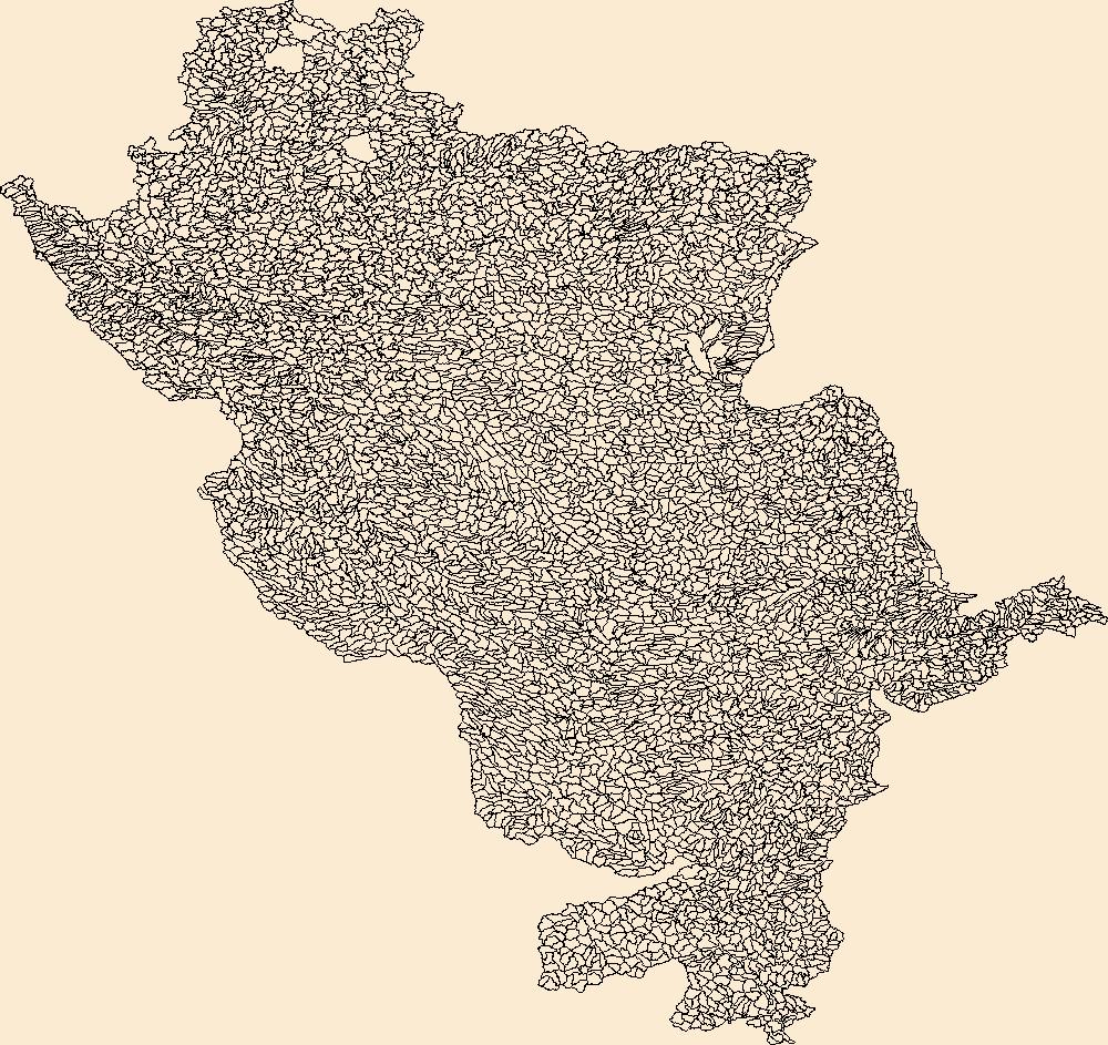
The Watershed Boundary Dataset (WBD) is a comprehensive aggregated collection of hydrologic unit data consistent with the national criteria for delineation and resolution. It defines the areal extent of surface water drainage to a point except in coastal or lake front areas where there could be multiple outlets as stated by the "Federal Standards and Procedures for the National Watershed Boundary Dataset (WBD)" "Standard" (https://pubs.usgs.gov/tm/11/a3/). Watershed boundaries are determined solely upon science-based hydrologic principles, not favoring any administrative boundaries or special projects, nor particular program or agency. This dataset represents the hydrologic unit boundaries to the 12-digit (6th level)...
Tags: 10-digit,
12-digit,
14-digit,
16-digit,
2-digit, All tags...
4-digit,
6-digit,
8-digit,
Adair,
Adams,
Alexander,
Allegany,
Alleghany,
Allegheny,
Allen,
Anderson,
Armstrong,
Ashe,
Ashland,
Ashtabula,
Athens,
Auglaize,
Ballard,
Barbour,
Barren,
Bartholomew,
Basin,
Bath,
Beaver,
Bedford,
Bell,
Belmont,
Benton,
Blackford,
Blair,
Bland,
Bledsoe,
Boone,
Bourbon,
Boyd,
Boyle,
Bracken,
Braxton,
Breathitt,
Breckinridge,
Brooke,
Brown,
Buchanan,
Bullitt,
Butler,
Cabell,
Caldwell,
Calhoun,
Cambria,
Cameron,
Campbell,
Cannon,
Carroll,
Carter,
Casey,
Cass,
Cattaraugus,
Champaign,
Chautauqua,
Cheatham,
Christian,
Claiborne,
Clarion,
Clark,
Clay,
Clearfield,
Clermont,
Clinton,
Coffee,
Coles,
Columbiana,
Coshocton,
Craig,
Crawford,
Crittenden,
Cumberland,
Darke,
Davidson,
Daviess,
DeKalb,
Dearborn,
Decatur,
Delaware,
Dickenson,
Dickson,
Doddridge,
Douglas,
Downloadable Data,
Dubois,
Edgar,
Edmonson,
Edwards,
Effingham,
Elk,
Elliott,
Erie,
Estill,
Fairfield,
Fayette,
Fentress,
Fleming,
Floyd,
Ford,
Forest,
Fountain,
Franklin,
Fulton,
Galax,
Gallatin,
Gallia,
Garrard,
Garrett,
Geauga,
GeoPackage,
Gibson,
Giles,
Gilmer,
Grant,
Grayson,
Green,
Greenbrier,
Greene,
Greenup,
Grundy,
Guernsey,
HU-2,
HU-2 Region,
HU2_05,
HUC,
Hamilton,
Hancock,
Hardin,
Harlan,
Harrison,
Hart,
Henderson,
Hendricks,
Henry,
Hickman,
Highland,
Hocking,
Holmes,
Hopkins,
Houston,
Howard,
Humphreys,
Huntington,
Hydrography,
Hydrologic Unit Code,
Hydrologic Units,
IL,
IN,
Illinois,
Indiana,
Indiana,
Iroquois,
Jackson,
Jasper,
Jay,
Jefferson,
Jennings,
Jessamine,
Johnson,
KY,
Kanawha,
Kenton,
Kentucky,
Knott,
Knox,
Kosciusko,
Larue,
Laurel,
Lawrence,
Lee,
Leslie,
Letcher,
Lewis,
Licking,
Lincoln,
Livingston,
Logan,
Lyon,
MD,
Macon,
Madison,
Magoffin,
Mahoning,
Marion,
Marshall,
Martin,
Maryland,
Mason,
Massac,
McCracken,
McCreary,
McDowell,
McKean,
McLean,
Meade,
Medina,
Meigs,
Menifee,
Mercer,
Metcalfe,
Miami,
Mingo,
Monongalia,
Monroe,
Montgomery,
Morgan,
Morrow,
Moultrie,
Muhlenberg,
Muskingum,
NC,
NY,
National Watershed Boundary Dataset (WBD),
National Watershed Boundary Dataset (WBD),
Nelson,
New York,
Nicholas,
Noble,
North Carolina,
OH,
Ohio,
Ohio,
Oldham,
Open Geospatial Consortium GeoPackage 1.2,
Orange,
Overton,
Owen,
Owsley,
PA,
Parke,
Patrick,
Pendleton,
Pennsylvania,
Perry,
Pickaway,
Pickett,
Pike,
Pleasants,
Pocahontas,
Pope,
Portage,
Posey,
Potter,
Powell,
Preble,
Preston,
Pulaski,
Putnam,
Radford,
Raleigh,
Randolph,
Region,
Richland,
Ripley,
Ritchie,
Roane,
Robertson,
Rockcastle,
Ross,
Rowan,
Rush,
Russell,
Rutherford,
Saline,
Scioto,
Scott,
Sequatchie,
Shelby,
Simpson,
Smith,
Smyth,
Somerset,
Spencer,
Stark,
Starke,
Stewart,
Sub-basin,
Sub-region,
Subwatershed,
Sullivan,
Summers,
Summit,
Sumner,
Surry,
Switzerland,
TN,
Taylor,
Tazewell,
Tennessee,
Tippecanoe,
Tipton,
Todd,
Trigg,
Trimble,
Trousdale,
Trumbull,
Tucker,
Tuscarawas,
Tyler,
US,
Union,
United States,
Upshur,
VA,
Van Buren,
Vanderburgh,
Venango,
Vermilion,
Vermillion,
Vigo,
Vinton,
Virginia,
WBD,
WV,
Wabash,
Warren,
Warrick,
Washington,
Watauga,
Watershed,
Watershed Boundary Dataset,
Wayne,
Webster,
Wells,
West Virginia,
Westmoreland,
Wetzel,
White,
Whitley,
Wilkes,
Williamson,
Wilson,
Wirt,
Wise,
Wolfe,
Wood,
Woodford,
Wyandot,
Wyoming,
Wythe,
inlandWaters, Fewer tags
|
|

