Filters: Tags: {"scheme":"The National Map Type Thesaurus","name":"elevation"} (X)
1 result (103ms)|
Filters
Date Range
Contacts Tag Types Tags (with Scheme=The National Map Type Thesaurus) |
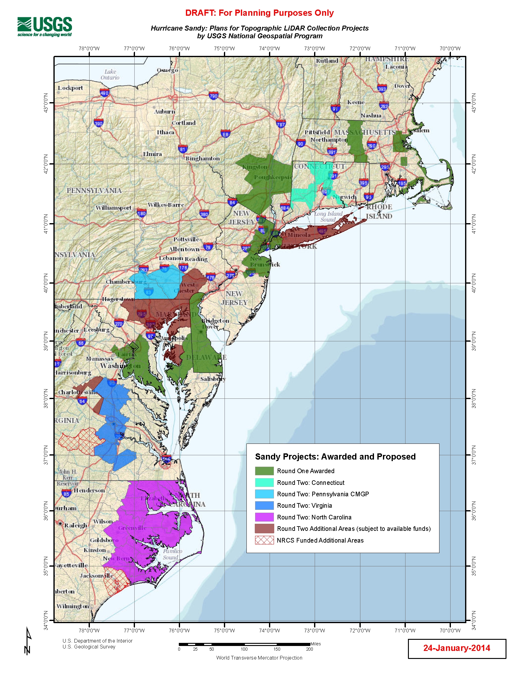
U.S. Geological Survey, Department of the Interior - The Hurricane Sandy Supplemental Funding lidar and DEM acquisition plan is part of the 3DEP initiative to systematically collect enhanced elevation data (Quality Level 2) in the form of high-quality light detection and ranging (lidar) data over the conterminous United States, Hawaii, and the territories on an 8-year schedule. The FY14 Hurricane Sandy acquisition plan currently anticipates collecting 20,000 - 30,000 sq. mi. within the impacted area. Exact area collected will depend on partnerships and other contributions to the plan. Interested parties who wish to become a funding partner with the USGS FY14 or in future years should contact a USGS Geospatial Liaison...
|

|
