Filters
Contacts
(Less)
-
U.S. Geological Survey
-
Abell, John M.
-
American Association of Zoo Veterinarians
-
Anderson, Eric D.
-
Baker, Michael S.
-
Blakely, Richard J.
-
Box, Stephen E.
-
Ciembronowicz, Kate T.
-
Cross, VeeAnn A.
-
DeWitt, Ed H.
-
Franson, J. Christian
-
Galbreath, Elizabeth J.
-
Halley, Robert B.
-
Hammar-Klose, Erika S.
-
Hine, Al C.
-
Holm-Denoma, Christopher S.
-
Jarrett, Bret D.
-
Locker, Stan D.
-
Lund, Karen
-
Naar, Dave F.
-
Saltus, Richard W.
-
San Juan, Carma A.
-
Soto-Viruet, Yadira
-
Textoris, Steven D.
-
Twichell, David C.
-
Wacaster, Susan
-
Wiemeyer, Stanley N.
-
Hart, Rheannon M.
-
Kresse, Timothy M.
-
Westerman, Drew A.
-
Gretchen H. Roffler
-
Wiley
-
Anthony McGuire
-
David Olefeldt
-
Gordon Luikart
-
Layne G. Adams
-
Michael K. Schwartz
-
Qianlai Zhuang
-
Sandra Talbot
-
Yujie He
-
David D Susong
-
Gretchen P Oelsner
-
Tanya J Gallegos
-
A. David McGuire
-
AGU
-
Albina Tsvetkova
-
Anderson, Zachary W.
-
Andrew G. Hope
-
Anson V. Koehler
-
Anthony Arendt
-
More...
|
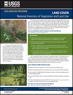
The Gap Analysis Program (GAP) produces data and tools that help meet critical national challenges such as biodiversity conservation, renewable energy development, climate change adaptation, and infrastructure investment. The GAP national land cover includes data on the vegetation and land-use patterns of the United States, including Alaska, Hawaii, and Puerto Rico. This national dataset combines land cover data generated by regional GAP projects with Landscape Fire and Resource Management Planning Tools (LANDFIRE) data. LANDFIRE is an interagency vegetation, fire, and fuel characteristics mapping program, sponsored by the U.S. Department of the Interior and the U.S. Department of Agriculture Forest Service.
|
|