Filters: Tags: {"type":"place"} (X) > Date Range: {"choice":"year"} (X)
29,130 results (65ms)|
Filters
Date Types (for Date Range)
Types
Contacts
Categories Tag Schemes
|
The Coupled Ocean-Atmosphere-Wave-Sediment Transport (COAWST Warner and others, 2019; Warner and others, 2010) model was used to simulate three-dimensional hydrodynamics and waves to study salinity intrusion in the Delaware Bay estuary for 2016, 2018, 2021. Salinity intrusion in coastal systems is due in part to extreme events like drought or low-pressure storms and longer-term sea level rise, threatening economic infrastructure and ecological health. Along the eastern seaboard of the United States, approximately 13 million people rely on the water resources of the Delaware River basin, which is actively managed to suppress the salt front (or ~0.52 daily averaged psu line) through river discharge targets. However,...
Categories: Data;
Types: Map Service,
NetCDF OPeNDAP Service,
OGC WMS Layer;
Tags: Earth Science > Oceans > Ocean Circulation > Ocean Currents,
Earth Science > Oceans > Ocean Temperature > Potential Temperature,
Earth Science > Oceans > Salinity/Density > Salinity,
Earth Science > Oceans > Sea Surface Topography > Sea Surface Height,
Earth Science Services > Models > Weather Research/Forecast Models,
GIS layers depicting South Atlantic Priority Amphibian and Reptile Conservation Areas (PARCAs)
GIS layers showing current and future connectivity for pine snake, eastern diamondback rattlesnake, eastern couger, red wolf, and black bear
Categories: Data;
Tags: Climate change,
Completed,
Data,
Data.gov South Atlantic Landscape Conservation Cooperative,
Datasets/Database,
Album caption: Outcrop of Van Horn conglomeratic sandstone on the south-facing escarpment of Sierra Diablo. 4 Miles West of bounds(Circle) Ranch, Sierra Blanca Quadrangle. Hudspeth County, Texas, July, 1931.
Emerging applications of ecosystem resilience and resistance concepts in sagebrush ecosystems allow managers to better predict and mitigate impacts of wildfire and invasive annual grasses. Soil temperature and moisture strongly influence the kind and amount of vegetation, and consequently, are closely tied to sagebrush ecosystem resilience and resistance (Chambers et al. 2014, 2016). Soil taxonomic temperature and moisture regimes can be used as indicators of resilience and resistance at landscape scales to depict environmental gradients in sagebrush ecosystems that range from cold/cool-moist sites to warm-dry sites. We aggregated soil survey spatial and tabular data to facilitate broad-scale analyses of resilience...
Categories: Data;
Types: Citation;
Tags: Data,
EARTH SCIENCE > LAND SURFACE > LANDSCAPE,
LCC Network Science Catalog,
Resistance and Resilience,
Resistance and Resilience,
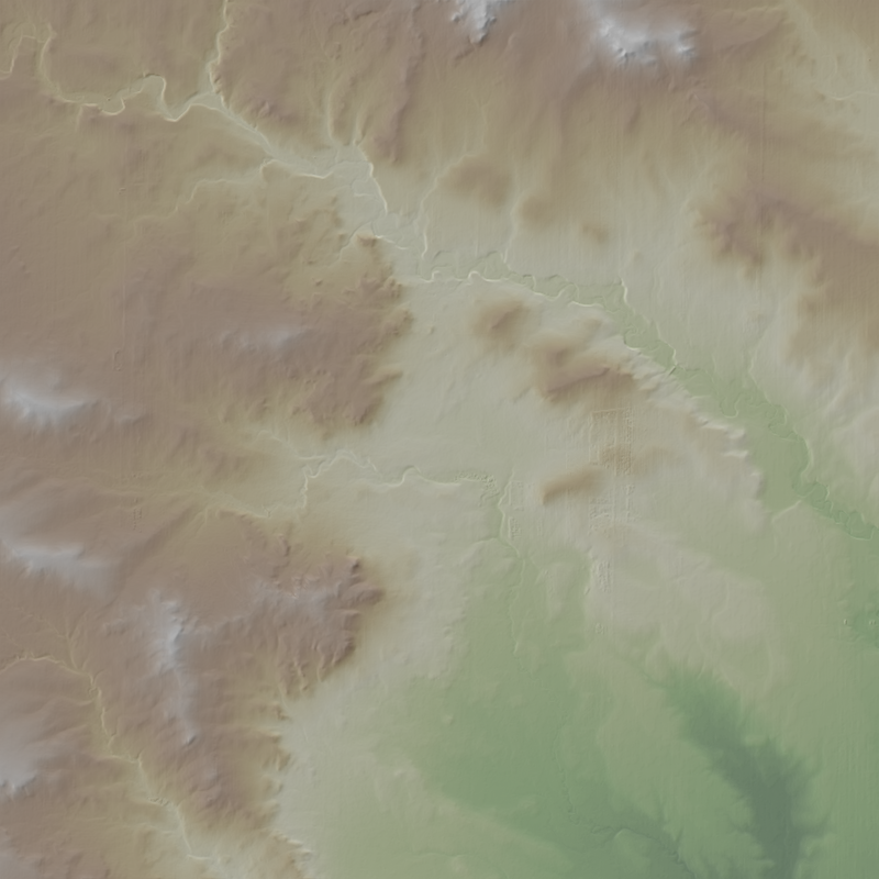
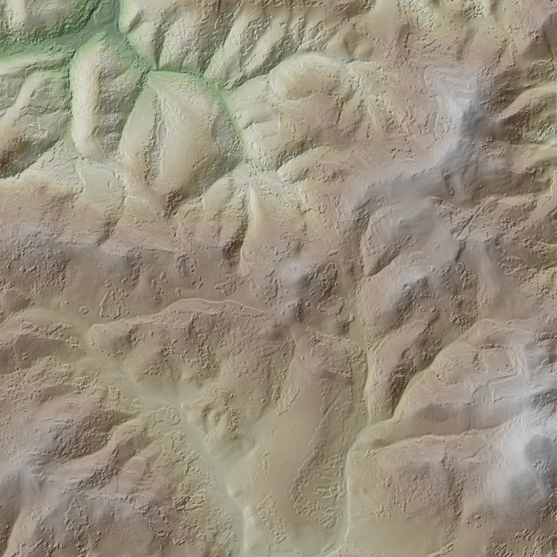
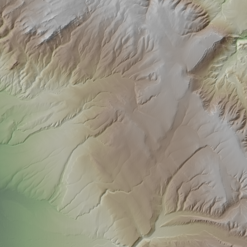
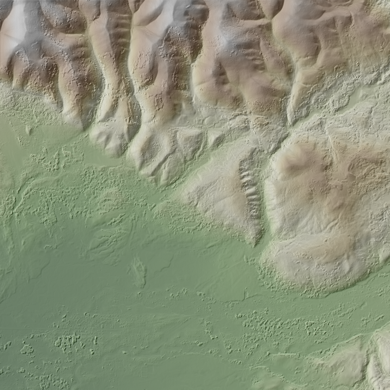
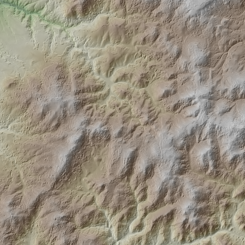
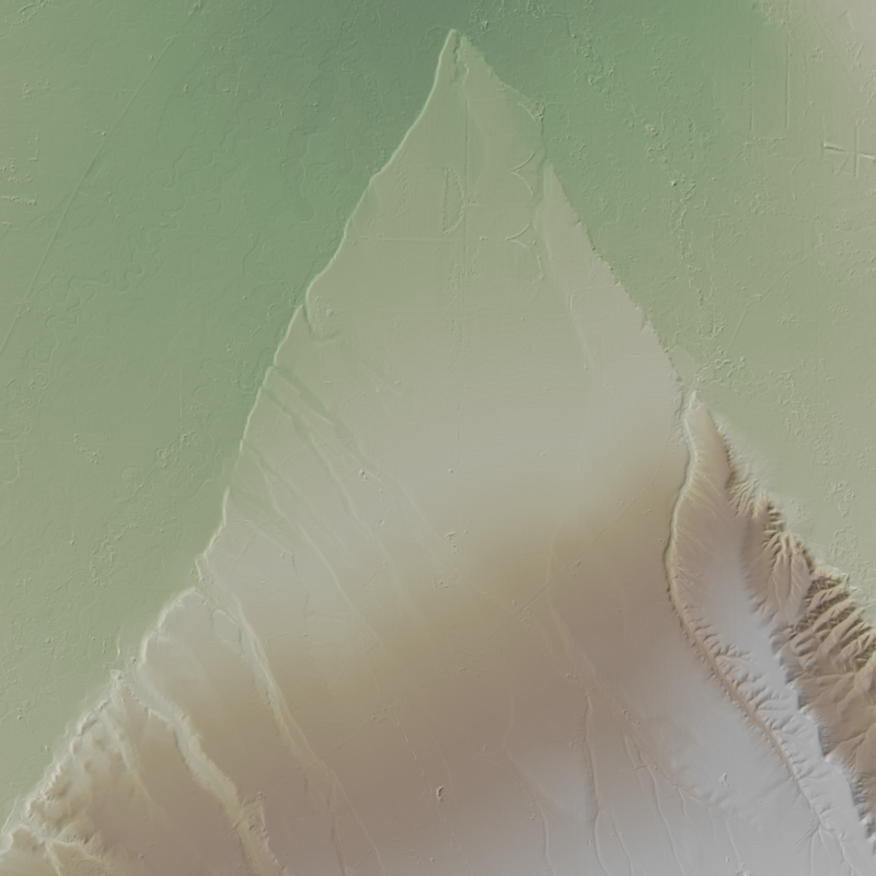
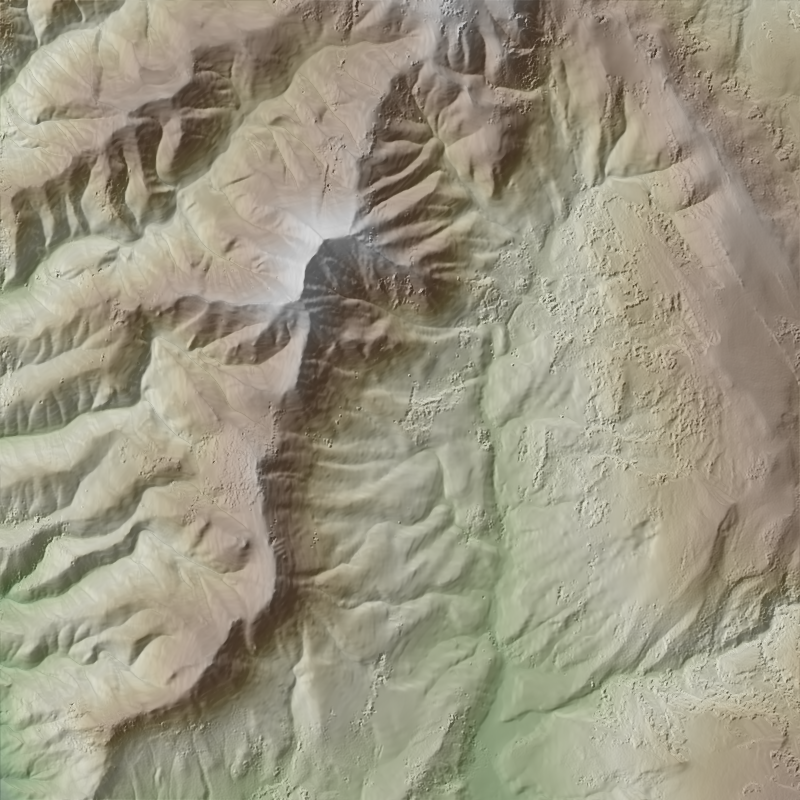
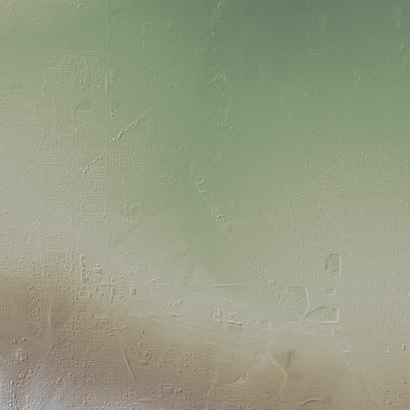
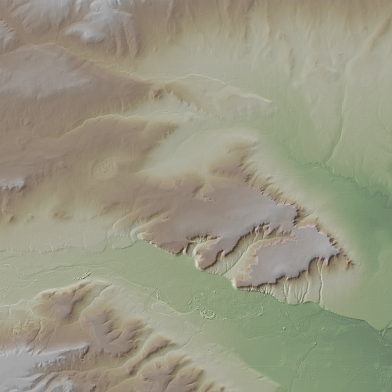
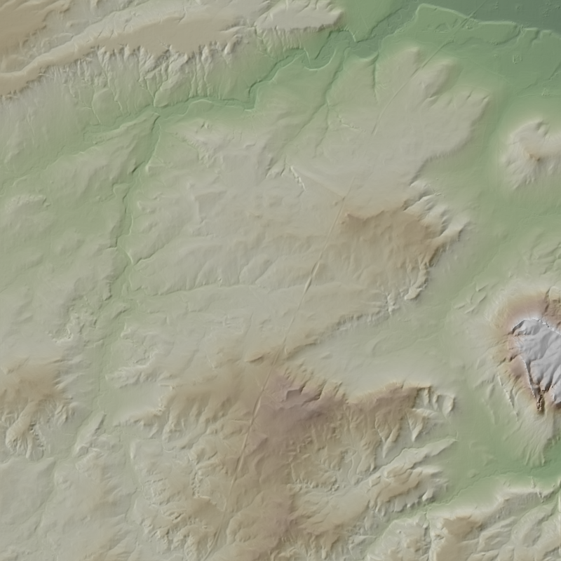
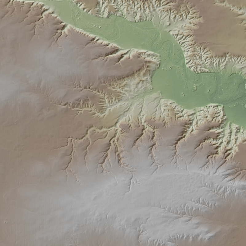
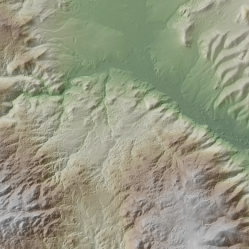
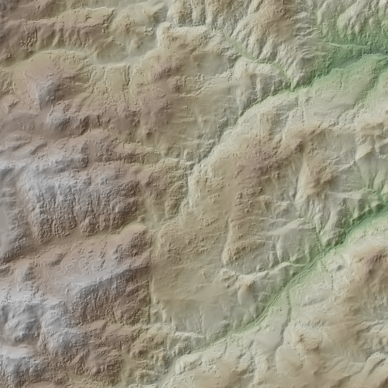
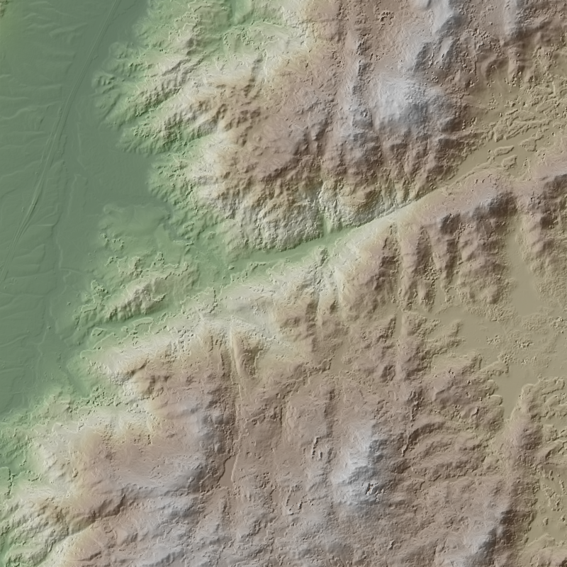
This is a 1-meter resolution digital surface model (DSM) derived from commercial electro-optical satellite imagery. Contributing imaging sensors include WorldView-1, WorldView-2, WorldView-3, and GeoEye-1. A digital surface model (DSM) is a 3D representation of the Earth’s surface height, including any natural or built features located on it, such as the tops of buildings, trees and vegetation. This “top of surface” elevation dataset was produced by the National Geospatial-Intelligence Agency (NGA) with the support of the GeoData Cooperative. The GeoData Cooperative is a Department of Defense mission-driven collaboration between industry, academia, and the U.S. Government to enable access to current, accurate, and...
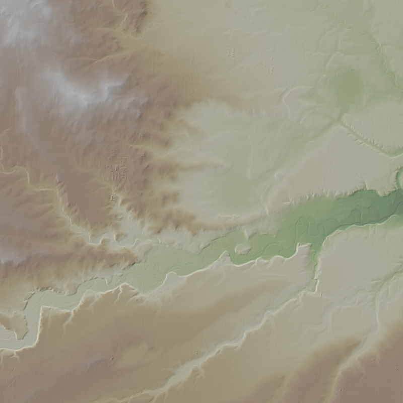
This is a 1-meter resolution digital surface model (DSM) derived from commercial electro-optical satellite imagery. Contributing imaging sensors include WorldView-1, WorldView-2, WorldView-3, and GeoEye-1. A digital surface model (DSM) is a 3D representation of the Earth’s surface height, including any natural or built features located on it, such as the tops of buildings, trees and vegetation. This “top of surface” elevation dataset was produced by the National Geospatial-Intelligence Agency (NGA) with the support of the GeoData Cooperative. The GeoData Cooperative is a Department of Defense mission-driven collaboration between industry, academia, and the U.S. Government to enable access to current, accurate, and...
This is a 1-meter resolution digital surface model (DSM) derived from commercial electro-optical satellite imagery. Contributing imaging sensors include WorldView-1, WorldView-2, WorldView-3, and GeoEye-1. A digital surface model (DSM) is a 3D representation of the Earth’s surface height, including any natural or built features located on it, such as the tops of buildings, trees and vegetation. This “top of surface” elevation dataset was produced by the National Geospatial-Intelligence Agency (NGA) with the support of the GeoData Cooperative. The GeoData Cooperative is a Department of Defense mission-driven collaboration between industry, academia, and the U.S. Government to enable access to current, accurate, and...
This is a 1-meter resolution digital surface model (DSM) derived from commercial electro-optical satellite imagery. Contributing imaging sensors include WorldView-1, WorldView-2, WorldView-3, and GeoEye-1. A digital surface model (DSM) is a 3D representation of the Earth’s surface height, including any natural or built features located on it, such as the tops of buildings, trees and vegetation. This “top of surface” elevation dataset was produced by the National Geospatial-Intelligence Agency (NGA) with the support of the GeoData Cooperative. The GeoData Cooperative is a Department of Defense mission-driven collaboration between industry, academia, and the U.S. Government to enable access to current, accurate, and...
This is a 1-meter resolution digital surface model (DSM) derived from commercial electro-optical satellite imagery. Contributing imaging sensors include WorldView-1, WorldView-2, WorldView-3, and GeoEye-1. A digital surface model (DSM) is a 3D representation of the Earth’s surface height, including any natural or built features located on it, such as the tops of buildings, trees and vegetation. This “top of surface” elevation dataset was produced by the National Geospatial-Intelligence Agency (NGA) with the support of the GeoData Cooperative. The GeoData Cooperative is a Department of Defense mission-driven collaboration between industry, academia, and the U.S. Government to enable access to current, accurate, and...
This is a 1-meter resolution digital surface model (DSM) derived from commercial electro-optical satellite imagery. Contributing imaging sensors include WorldView-1, WorldView-2, WorldView-3, and GeoEye-1. A digital surface model (DSM) is a 3D representation of the Earth’s surface height, including any natural or built features located on it, such as the tops of buildings, trees and vegetation. This “top of surface” elevation dataset was produced by the National Geospatial-Intelligence Agency (NGA) with the support of the GeoData Cooperative. The GeoData Cooperative is a Department of Defense mission-driven collaboration between industry, academia, and the U.S. Government to enable access to current, accurate, and...
This is a 1-meter resolution digital surface model (DSM) derived from commercial electro-optical satellite imagery. Contributing imaging sensors include WorldView-1, WorldView-2, WorldView-3, and GeoEye-1. A digital surface model (DSM) is a 3D representation of the Earth’s surface height, including any natural or built features located on it, such as the tops of buildings, trees and vegetation. This “top of surface” elevation dataset was produced by the National Geospatial-Intelligence Agency (NGA) with the support of the GeoData Cooperative. The GeoData Cooperative is a Department of Defense mission-driven collaboration between industry, academia, and the U.S. Government to enable access to current, accurate, and...
This is a 1-meter resolution digital surface model (DSM) derived from commercial electro-optical satellite imagery. Contributing imaging sensors include WorldView-1, WorldView-2, WorldView-3, and GeoEye-1. A digital surface model (DSM) is a 3D representation of the Earth’s surface height, including any natural or built features located on it, such as the tops of buildings, trees and vegetation. This “top of surface” elevation dataset was produced by the National Geospatial-Intelligence Agency (NGA) with the support of the GeoData Cooperative. The GeoData Cooperative is a Department of Defense mission-driven collaboration between industry, academia, and the U.S. Government to enable access to current, accurate, and...
This is a 1-meter resolution digital surface model (DSM) derived from commercial electro-optical satellite imagery. Contributing imaging sensors include WorldView-1, WorldView-2, WorldView-3, and GeoEye-1. A digital surface model (DSM) is a 3D representation of the Earth’s surface height, including any natural or built features located on it, such as the tops of buildings, trees and vegetation. This “top of surface” elevation dataset was produced by the National Geospatial-Intelligence Agency (NGA) with the support of the GeoData Cooperative. The GeoData Cooperative is a Department of Defense mission-driven collaboration between industry, academia, and the U.S. Government to enable access to current, accurate, and...
This is a 1-meter resolution digital surface model (DSM) derived from commercial electro-optical satellite imagery. Contributing imaging sensors include WorldView-1, WorldView-2, WorldView-3, and GeoEye-1. A digital surface model (DSM) is a 3D representation of the Earth’s surface height, including any natural or built features located on it, such as the tops of buildings, trees and vegetation. This “top of surface” elevation dataset was produced by the National Geospatial-Intelligence Agency (NGA) with the support of the GeoData Cooperative. The GeoData Cooperative is a Department of Defense mission-driven collaboration between industry, academia, and the U.S. Government to enable access to current, accurate, and...
This is a 1-meter resolution digital surface model (DSM) derived from commercial electro-optical satellite imagery. Contributing imaging sensors include WorldView-1, WorldView-2, WorldView-3, and GeoEye-1. A digital surface model (DSM) is a 3D representation of the Earth’s surface height, including any natural or built features located on it, such as the tops of buildings, trees and vegetation. This “top of surface” elevation dataset was produced by the National Geospatial-Intelligence Agency (NGA) with the support of the GeoData Cooperative. The GeoData Cooperative is a Department of Defense mission-driven collaboration between industry, academia, and the U.S. Government to enable access to current, accurate, and...
This is a 1-meter resolution digital surface model (DSM) derived from commercial electro-optical satellite imagery. Contributing imaging sensors include WorldView-1, WorldView-2, WorldView-3, and GeoEye-1. A digital surface model (DSM) is a 3D representation of the Earth’s surface height, including any natural or built features located on it, such as the tops of buildings, trees and vegetation. This “top of surface” elevation dataset was produced by the National Geospatial-Intelligence Agency (NGA) with the support of the GeoData Cooperative. The GeoData Cooperative is a Department of Defense mission-driven collaboration between industry, academia, and the U.S. Government to enable access to current, accurate, and...
This is a 1-meter resolution digital surface model (DSM) derived from commercial electro-optical satellite imagery. Contributing imaging sensors include WorldView-1, WorldView-2, WorldView-3, and GeoEye-1. A digital surface model (DSM) is a 3D representation of the Earth’s surface height, including any natural or built features located on it, such as the tops of buildings, trees and vegetation. This “top of surface” elevation dataset was produced by the National Geospatial-Intelligence Agency (NGA) with the support of the GeoData Cooperative. The GeoData Cooperative is a Department of Defense mission-driven collaboration between industry, academia, and the U.S. Government to enable access to current, accurate, and...
This is a 1-meter resolution digital surface model (DSM) derived from commercial electro-optical satellite imagery. Contributing imaging sensors include WorldView-1, WorldView-2, WorldView-3, and GeoEye-1. A digital surface model (DSM) is a 3D representation of the Earth’s surface height, including any natural or built features located on it, such as the tops of buildings, trees and vegetation. This “top of surface” elevation dataset was produced by the National Geospatial-Intelligence Agency (NGA) with the support of the GeoData Cooperative. The GeoData Cooperative is a Department of Defense mission-driven collaboration between industry, academia, and the U.S. Government to enable access to current, accurate, and...
This is a 1-meter resolution digital surface model (DSM) derived from commercial electro-optical satellite imagery. Contributing imaging sensors include WorldView-1, WorldView-2, WorldView-3, and GeoEye-1. A digital surface model (DSM) is a 3D representation of the Earth’s surface height, including any natural or built features located on it, such as the tops of buildings, trees and vegetation. This “top of surface” elevation dataset was produced by the National Geospatial-Intelligence Agency (NGA) with the support of the GeoData Cooperative. The GeoData Cooperative is a Department of Defense mission-driven collaboration between industry, academia, and the U.S. Government to enable access to current, accurate, and...
|

|
