Filters: Tags: 7.5 minute (X)
3 results (10ms)|
Filters
Date Range
Extensions Types Contacts
Categories Tag Types Tag Schemes |
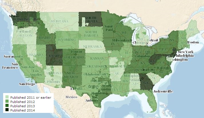
The USGS US Topo Availability service from The National Map (TNM) consists of footprints where US Topo is available in GeoPDF format. Various green tints are used to reflect the year in which latest US Topo map products are published. Information about the latest available US Topo maps can be discovered as well as product downloads from this service through an 'Identify' query. Service content is updated daily to ensure the most current map product is represented. If a user wants to download all current and historical USGS Topo Maps over a given area, these products are available at The National Map viewer (http://viewer.nationalmap.gov/viewer) or the USGS Store (http://store.usgs.gov). For additional information...
The USGS Map Indices service from The National Map (TNM) consists of 1x1 Degree, 30x60 Minute (100K), 15 Minute (63K), 7.5 Minute (24K), and 3.75 Minute grid polygons used in The National Map viewer for reference and to download data. At 1:24,000-scale (24K), the standard map size is 7.5 minutes of latitude by 7.5 minutes of longitude. At 1:100,000-scale (100K), the standard map size is 30 minutes of latitude by 60 minutes of longitude. The National Map viewer allows free download of public domain USGS map indices data in Esri File Geodatabase format.
The USGS Map Indices service from The National Map (TNM) consists of 1x1 Degree, 30x60 Minute (100K), 15 Minute (63K), 7.5 Minute (24K), and 3.75 Minute grid polygons used in The National Map viewer for reference and to download data. At 1:24,000-scale (24K), the standard map size is 7.5 minutes of latitude by 7.5 minutes of longitude. At 1:100,000-scale (100K), the standard map size is 30 minutes of latitude by 60 minutes of longitude. The National Map viewer allows free download of public domain USGS map indices data in Esri File Geodatabase format.
Categories: Data;
Types: ArcGIS REST Map Service,
Map Service;
Tags: 100K,
15 minute,
1:100,000,
1:24,000,
1:62,500,
|

|
