Filters: Tags: ALKALI CREEK (X)
14 results (18ms)|
Filters
Date Range
Extensions Types Contacts
Categories Tag Types Tag Schemes |
This data set contains imagery from the National Agriculture Imagery Program (NAIP). The NAIP program is administered by USDA FSA and has been established to support two main FSA strategic goals centered on agricultural production. These are, increase stewardship of America's natural resources while enhancing the environment, and to ensure commodities are procured and distributed effectively and efficiently to increase food security. The NAIP program supports these goals by acquiring and providing ortho imagery that has been collected during the agricultural growing season in the U.S. The NAIP ortho imagery is tailored to meet FSA requirements and is a fundamental tool used to support FSA farm and conservation programs....

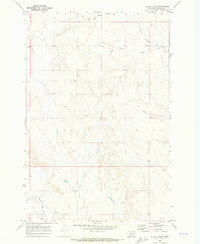
USGS Historical Quadrangle in GeoPDF.
This data set contains imagery from the National Agriculture Imagery Program (NAIP). The NAIP program is administered by USDA FSA and has been established to support two main FSA strategic goals centered on agricultural production. These are, increase stewardship of America's natural resources while enhancing the environment, and to ensure commodities are procured and distributed effectively and efficiently to increase food security. The NAIP program supports these goals by acquiring and providing ortho imagery that has been collected during the agricultural growing season in the U.S. The NAIP ortho imagery is tailored to meet FSA requirements and is a fundamental tool used to support FSA farm and conservation programs....
This data set contains imagery from the National Agriculture Imagery Program (NAIP). The NAIP program is administered by USDA FSA and has been established to support two main FSA strategic goals centered on agricultural production. These are, increase stewardship of America's natural resources while enhancing the environment, and to ensure commodities are procured and distributed effectively and efficiently to increase food security. The NAIP program supports these goals by acquiring and providing ortho imagery that has been collected during the agricultural growing season in the U.S. The NAIP ortho imagery is tailored to meet FSA requirements and is a fundamental tool used to support FSA farm and conservation programs....
This data set contains imagery from the National Agriculture Imagery Program (NAIP). The NAIP program is administered by USDA FSA and has been established to support two main FSA strategic goals centered on agricultural production. These are, increase stewardship of America's natural resources while enhancing the environment, and to ensure commodities are procured and distributed effectively and efficiently to increase food security. The NAIP program supports these goals by acquiring and providing ortho imagery that has been collected during the agricultural growing season in the U.S. The NAIP ortho imagery is tailored to meet FSA requirements and is a fundamental tool used to support FSA farm and conservation programs....
This data set contains imagery from the National Agriculture Imagery Program (NAIP). The NAIP program is administered by USDA FSA and has been established to support two main FSA strategic goals centered on agricultural production. These are, increase stewardship of America's natural resources while enhancing the environment, and to ensure commodities are procured and distributed effectively and efficiently to increase food security. The NAIP program supports these goals by acquiring and providing ortho imagery that has been collected during the agricultural growing season in the U.S. The NAIP ortho imagery is tailored to meet FSA requirements and is a fundamental tool used to support FSA farm and conservation programs....
This data release provides digital flight line data for a high-resolution radiometric survey over the South Pass-Granite Mountains region in central Wyoming. The airborne survey was funded by the state of Wyoming, designed by the Wyoming State Geological Survey (WSGS), and contracted by the USGS. The survey is aligned with the Earth Mapping Resources Initiative and was designed to meet complementary needs related to geologic mapping and characterization of mineral resource potential. A total of 47,973.8 line km of radiometric data were acquired over an area of 8639 km2. Data were collected from a helicopter flown at a nominal terrain clearance of 100 meters (m) above topography along N-S flight lines spaced at 200...
Categories: Data;
Types: Downloadable,
GeoTIFF,
Map Service,
Raster;
Tags: AASG,
Aeroradiometric survey,
Airborne geophysical survey,
Alkali Creek,
Association of State Geologists,
USGS Historical Quadrangle in GeoPDF.
This data set contains imagery from the National Agriculture Imagery Program (NAIP). The NAIP program is administered by USDA FSA and has been established to support two main FSA strategic goals centered on agricultural production. These are, increase stewardship of America's natural resources while enhancing the environment, and to ensure commodities are procured and distributed effectively and efficiently to increase food security. The NAIP program supports these goals by acquiring and providing ortho imagery that has been collected during the agricultural growing season in the U.S. The NAIP ortho imagery is tailored to meet FSA requirements and is a fundamental tool used to support FSA farm and conservation programs....
This data release provides digital flight line data for a high-resolution airborne magnetic and radiometric survey over the South Pass-Granite Mountains region in central Wyoming. The airborne survey was funded by the state of Wyoming, designed by the Wyoming State Geological Survey (WSGS), and contracted by the USGS. The survey is aligned with the Earth Mapping Resources Initiative and was designed to meet complementary needs related to geologic mapping and characterization of mineral resource potential. A total of 47,973.8 line km of magnetic and radiometric data were acquired over an area of 8639 km. Data were collected from a helicopter flown at a nominal terrain clearance of 100 meters (m) above topography...
Categories: Data;
Types: Downloadable,
Map Service,
OGC WFS Layer,
OGC WMS Layer,
Shapefile;
Tags: AASG,
Aeromagnetic survey,
Aeroradiometric survey,
Airborne geophysical survey,
Alkali Creek,
This data release provides digital flight line data for a high-resolution airborne magnetic survey over the South Pass-Granite Mountains region in central Wyoming. The airborne survey was funded by the state of Wyoming, designed by the Wyoming State Geological Survey (WSGS), and contracted by the USGS. The survey is aligned with the Earth Mapping Resources Initiative and was designed to meet complementary needs related to geologic mapping and characterization of mineral resource potential. A total of 47,973.8 line km of magnetic and radiometric data were acquired over an area of 8639 km2. Data were collected from a helicopter flown at a nominal terrain clearance of 100 meters (m) above topography along N-S flight...
Categories: Data;
Types: Downloadable,
GeoTIFF,
Map Service,
Raster;
Tags: AASG,
Aeromagnetic survey,
Airborne geophysical survey,
Alkali Creek,
Association of State Geologists,
This data set contains imagery from the National Agriculture Imagery Program (NAIP). The NAIP program is administered by USDA FSA and has been established to support two main FSA strategic goals centered on agricultural production. These are, increase stewardship of America's natural resources while enhancing the environment, and to ensure commodities are procured and distributed effectively and efficiently to increase food security. The NAIP program supports these goals by acquiring and providing ortho imagery that has been collected during the agricultural growing season in the U.S. The NAIP ortho imagery is tailored to meet FSA requirements and is a fundamental tool used to support FSA farm and conservation programs....
This data set contains imagery from the National Agriculture Imagery Program (NAIP). The NAIP program is administered by USDA FSA and has been established to support two main FSA strategic goals centered on agricultural production. These are, increase stewardship of America's natural resources while enhancing the environment, and to ensure commodities are procured and distributed effectively and efficiently to increase food security. The NAIP program supports these goals by acquiring and providing ortho imagery that has been collected during the agricultural growing season in the U.S. The NAIP ortho imagery is tailored to meet FSA requirements and is a fundamental tool used to support FSA farm and conservation programs....
Small fault or land slip on Alkali Creek east of Freighters Spring on west face of escarpment, Sec. 21, T. 24 N., R. 101 W. South Pass quadrangle, Wyoming. No date.
|

|
