Filters: Tags: ANZA (X)
13 results (44ms)|
Filters
Date Range
Extensions Types
Contacts
Categories Tag Types Tag Schemes |
This data set contains imagery from the National Agriculture Imagery Program (NAIP). The NAIP program is administered by USDA FSA and has been established to support two main FSA strategic goals centered on agricultural production. These are, increase stewardship of America's natural resources while enhancing the environment, and to ensure commodities are procured and distributed effectively and efficiently to increase food security. The NAIP program supports these goals by acquiring and providing ortho imagery that has been collected during the agricultural growing season in the U.S. The NAIP ortho imagery is tailored to meet FSA requirements and is a fundamental tool used to support FSA farm and conservation programs....
This data set contains imagery from the National Agriculture Imagery Program (NAIP). The NAIP program is administered by USDA FSA and has been established to support two main FSA strategic goals centered on agricultural production. These are, increase stewardship of America's natural resources while enhancing the environment, and to ensure commodities are procured and distributed effectively and efficiently to increase food security. The NAIP program supports these goals by acquiring and providing ortho imagery that has been collected during the agricultural growing season in the U.S. The NAIP ortho imagery is tailored to meet FSA requirements and is a fundamental tool used to support FSA farm and conservation programs....
This data set contains imagery from the National Agriculture Imagery Program (NAIP). The NAIP program is administered by USDA FSA and has been established to support two main FSA strategic goals centered on agricultural production. These are, increase stewardship of America's natural resources while enhancing the environment, and to ensure commodities are procured and distributed effectively and efficiently to increase food security. The NAIP program supports these goals by acquiring and providing ortho imagery that has been collected during the agricultural growing season in the U.S. The NAIP ortho imagery is tailored to meet FSA requirements and is a fundamental tool used to support FSA farm and conservation programs....
This data set contains imagery from the National Agriculture Imagery Program (NAIP). The NAIP program is administered by USDA FSA and has been established to support two main FSA strategic goals centered on agricultural production. These are, increase stewardship of America's natural resources while enhancing the environment, and to ensure commodities are procured and distributed effectively and efficiently to increase food security. The NAIP program supports these goals by acquiring and providing ortho imagery that has been collected during the agricultural growing season in the U.S. The NAIP ortho imagery is tailored to meet FSA requirements and is a fundamental tool used to support FSA farm and conservation programs....
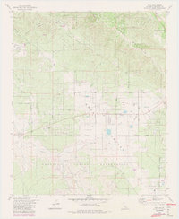
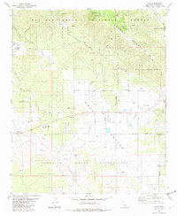
USGS Historical Quadrangle in GeoPDF.
USGS Historical Quadrangle in GeoPDF.
The Cahuilla Valley and Terwilliger Valley groundwater basins, 9-006 and 7-026 respectively (California Department of Water Resources 2016) located approximately 25 miles southwest of Palm Springs, are the sole-source for groundwater supply for the rural disadvantaged community and two Native American Tribes, the Ramona Band of Cahuilla and the Cahuilla. The characteristics and sustainable yield of the Cahuilla Valley and Terwilliger Valley groundwater basins are not well understood and are threatened by increasing water use and potential changes in water sustainability related to climate change. Previous USGS studies of the Cahuilla-Terwilliger Valley groundwater basins defined the thicknesses and characteristics...
Categories: Data;
Tags: Anza,
California,
California Water Science Center,
Electrical Resistivity Tomography,
Riverside,
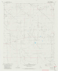
USGS Historical Quadrangle in GeoPDF.
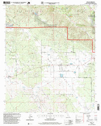
USGS Historical Quadrangle in GeoPDF.
The Cahuilla Valley and Terwilliger Valley groundwater basins, 9-006 and 7-026 respectively (California Department of Water Resources 2016) located approximately 25 miles southwest of Palm Springs, are the sole-source for groundwater supply for the rural disadvantaged community and two Native American Tribes, the Ramona Band of Cahuilla and the Cahuilla. The characteristics and sustainable yield of the Cahuilla Valley and Terwilliger Valley groundwater basins are not well understood and are threatened by increasing water use and potential changes in water sustainability related to climate change. Previous USGS studies of the Cahuilla-Terwilliger Valley groundwater basins defined the thicknesses and characteristics...
This dataset provides monthly and average annual long-term estimates (water years 1981-2010) of gridded recharge and runoff from water years 1896-2018 for the Anza-Cahuilla Groundwater Basin in southern California. Gridded data are available in flat ASCII files (*.asc) in the NAD83 California Teale Albers projection. This dataset also includes streamflow calibration basins and stations as shape files (*.shp), and a Basin Characterization Model (BCMv8) model archive.
The Cahuilla Valley and Terwilliger Valley groundwater basins, 9-006 and 7-026 respectively (California Department of Water Resources 2016) located approximately 25 miles southwest of Palm Springs, are the sole-source for groundwater supply for the rural disadvantaged community and two Native American Tribes, the Ramona Band of Cahuilla and the Cahuilla. The characteristics and sustainable yield of the Cahuilla Valley and Terwilliger Valley groundwater basins are not well understood and are threatened by increasing water use and potential changes in water sustainability related to climate change. Previous USGS studies of the Cahuilla-Terwilliger Valley groundwater basins defined the thicknesses and characteristics...
Categories: Data;
Tags: Anza,
California,
California Water Science Center,
Electrical Resistivity Tomography,
Riverside,
The Cahuilla Valley and Terwilliger Valley groundwater basins, 9-006 and 7-026 respectively (California Department of Water Resources 2016) located approximately 25 miles southwest of Palm Springs, are the sole-source for groundwater supply for the rural disadvantaged community and two Native American Tribes, the Ramona Band of Cahuilla and the Cahuilla. The characteristics and sustainable yield of the Cahuilla Valley and Terwilliger Valley groundwater basins are not well understood and are threatened by increasing water use and potential changes in water sustainability related to climate change. Previous USGS studies of the Cahuilla-Terwilliger Valley groundwater basins defined the thicknesses and characteristics...
Categories: Data;
Types: Downloadable,
Map Service,
OGC WFS Layer,
OGC WMS Layer,
Shapefile;
Tags: Anza,
California,
California Water Science Center,
Electrical Resistivity Tomography,
Riverside,
|

|
