Filters: Tags: ARBUCKLE (X)
17 results (89ms)|
Filters
Date Range
Types Contacts
Categories Tag Types Tag Schemes |
Core Research Center, core D263, from well operated by UNIVERSAL RESOURCESRaw Properties from download, web scrape, MapServer, and Macrostrat API{"Lib Num": "D263", "API Num": "1516322611", "Operator": "UNIVERSAL RESOURCES", "Well Name": "1-33 RISLEY", "Field": "COCINERA", "State": "KS", "County": "ROOKS", "Type": "SLABBED", "Photos": "F", "Thin Sec": "F", "Analysis": "F", "Latitude": "39.407705", "Longitude": "-99.55509", "coordinates_geohash": "9z10ntfnw28k", "Source": "FROM STATE RECORDS", "Security Flag": "NO SPECIAL RESTRICTIONS", "crc_collection_name": "core", "sb_parent_id": "4f4e49dae4b07f02db5e0486", "intervals": [{"Formation": "LANSING-KANSAS CITY", "Age": "PENN", "Min Depth": "3290", "Max Depth": "3301"},...
Categories: Physical Item;
Tags: ARBUCKLE,
CAMB,
LANSING-KANSAS CITY,
Late Cretaceous,
Niobrara Chalk,
Core Research Center, cutting HH01823, from well operated by LARIO OIL AND GASRaw Properties from download, web scrape, MapServer, and Macrostrat API{"Lib Num": "HH01823", "API Num": "0512111068", "Operator": "LARIO OIL AND GAS", "Well Name": "WAKANDA 3-42", "Field": "WILDCAT", "State": "CO", "County": "WASHINGTON", "Thin Sec": "F", "Analysis": "T", "Latitude": "39.73818", "Longitude": "-102.956", "coordinates_geohash": "9xnf14jexmdj", "Source": "FROM STATE RECORDS", "Min": "3500", "Max": "7300", "Security Flag": "NO SPECIAL RESTRICTIONS", "crc_collection_name": "cutting", "sb_parent_id": "4f4e49d8e4b07f02db5df2d2", "intervals": [{"Formation": "UNKNOWN", "Age": null, "Min Depth": "7214", "Max Depth": "7300"}, {"Formation":...
Core Research Center, cutting HH01822, from well operated by LARIO OIL AND GASRaw Properties from download, web scrape, MapServer, and Macrostrat API{"Lib Num": "HH01822", "API Num": "0512111064", "Operator": "LARIO OIL AND GAS", "Well Name": "FRIEND TRUST 18-22", "Field": "WILDCAT", "State": "CO", "County": "WASHINGTON", "Thin Sec": "F", "Analysis": "T", "Latitude": "39.70946", "Longitude": "-103.02187", "coordinates_geohash": "9xn9zsvu27vg", "Source": "FROM STATE RECORDS", "Min": "5107", "Max": "7375", "Security Flag": "NO SPECIAL RESTRICTIONS", "crc_collection_name": "cutting", "sb_parent_id": "4f4e49d8e4b07f02db5df2d2", "intervals": [{"Formation": "UNKNOWN", "Age": "MISSISSIPPIAN", "Min Depth": "7342", "Max...
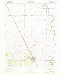
USGS Historical Quadrangle in GeoPDF.
Core Research Center, core S063, from well operated by DAKOTA RESOURCESRaw Properties from download, web scrape, MapServer, and Macrostrat API{"Lib Num": "S063", "API Num": "1505320801", "Operator": "DAKOTA RESOURCES", "Well Name": "2 MILLER", "Field": "EAST BLOOMER", "State": "KS", "County": "ELLSWORTH", "Type": "FULL", "Photos": "T", "Thin Sec": "F", "Analysis": "F", "Latitude": "38.531797", "Longitude": "-98.423438", "coordinates_geohash": "9yf50q6pzxt6", "Source": "FROM STATE RECORDS", "Security Flag": "NO SPECIAL RESTRICTIONS", "crc_collection_name": "core", "sb_parent_id": "4f4e49dae4b07f02db5e0486", "intervals": [{"Formation": "ARBUCKLE", "Age": "CAMB", "Min Depth": "3280", "Max Depth": "3337"}], "crcwc_url":...
Core Research Center, core R118, from well operated by GENERAL AM OIL TEXASRaw Properties from download, web scrape, MapServer, and Macrostrat API{"Lib Num": "R118", "API Num": "0510106003", "Operator": "GENERAL AM OIL TEXAS", "Well Name": "1-19 STATE", "Field": "WILDCAT", "State": "CO", "County": "PUEBLO", "Type": "FULL", "Photos": "F", "Thin Sec": "F", "Analysis": "T", "Latitude": "38.119749", "Longitude": "-104.163715", "coordinates_geohash": "9wvbveqr9s28", "Source": "FROM STATE RECORDS", "Security Flag": "NO SPECIAL RESTRICTIONS", "crc_collection_name": "core", "sb_parent_id": "4f4e49dae4b07f02db5e0486", "intervals": [{"Formation": "MISSISSIPPIAN", "Age": "MISS", "Min Depth": "6961", "Max Depth": "6989"}, {"Formation":...
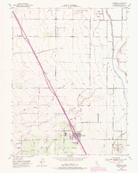
USGS Historical Quadrangle in GeoPDF.
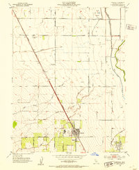
USGS Historical Quadrangle in GeoPDF.
This data set contains imagery from the National Agriculture Imagery Program (NAIP). The NAIP program is administered by USDA FSA and has been established to support two main FSA strategic goals centered on agricultural production. These are, increase stewardship of America's natural resources while enhancing the environment, and to ensure commodities are procured and distributed effectively and efficiently to increase food security. The NAIP program supports these goals by acquiring and providing ortho imagery that has been collected during the agricultural growing season in the U.S. The NAIP ortho imagery is tailored to meet FSA requirements and is a fundamental tool used to support FSA farm and conservation programs....
This data set contains imagery from the National Agriculture Imagery Program (NAIP). The NAIP program is administered by USDA FSA and has been established to support two main FSA strategic goals centered on agricultural production. These are, increase stewardship of America's natural resources while enhancing the environment, and to ensure commodities are procured and distributed effectively and efficiently to increase food security. The NAIP program supports these goals by acquiring and providing ortho imagery that has been collected during the agricultural growing season in the U.S. The NAIP ortho imagery is tailored to meet FSA requirements and is a fundamental tool used to support FSA farm and conservation programs....
Core Research Center, core S921, from well operated by AMERICAN HUNTER EXPLRaw Properties from download, web scrape, MapServer, and Macrostrat API{"Lib Num": "S921", "API Num": "1505122493", "Operator": "AMERICAN HUNTER EXPL", "Well Name": "1 WASINGER", "Field": "NEDDAM ", "State": "KS", "County": "ELLIS", "Type": "SLABBED", "Photos": "F", "Thin Sec": "F", "Analysis": "F", "Latitude": "39.098563", "Longitude": "-99.324976", "coordinates_geohash": "9ycq7v9v8k3v", "Source": "FROM STATE RECORDS", "Security Flag": "NO SPECIAL RESTRICTIONS", "crc_collection_name": "core", "sb_parent_id": "4f4e49dae4b07f02db5e0486", "intervals": [{"Formation": "ARBUCKLE", "Age": "CAMB", "Min Depth": "3451", "Max Depth": "3480"}], "crcwc_url":...
Core Research Center, core A596, from well operated by NORSK-HYDRO PETRaw Properties from download, web scrape, MapServer, and Macrostrat API{"Lib Num": "A596", "API Num": "0503906208", "Operator": "NORSK-HYDRO PET", "Well Name": "1 PACKARD STATE", "Field": "WILDCAT", "State": "CO", "County": "ELBERT", "Type": "SLABBED", "Photos": "T", "Thin Sec": "T", "Analysis": "T", "Latitude": "39.354022", "Longitude": "-103.854525", "coordinates_geohash": "9wypuspmy1mm", "Source": "FROM STATE RECORDS", "Security Flag": "NO SPECIAL RESTRICTIONS", "crc_collection_name": "core", "sb_parent_id": "4f4e49dae4b07f02db5e0486", "intervals": [{"Formation": "DAKOTA J", "Age": "CRET", "Min Depth": "5767", "Max Depth": "5783"}, {"Formation":...
This data set contains imagery from the National Agriculture Imagery Program (NAIP). The NAIP program is administered by USDA FSA and has been established to support two main FSA strategic goals centered on agricultural production. These are, increase stewardship of America's natural resources while enhancing the environment, and to ensure commodities are procured and distributed effectively and efficiently to increase food security. The NAIP program supports these goals by acquiring and providing ortho imagery that has been collected during the agricultural growing season in the U.S. The NAIP ortho imagery is tailored to meet FSA requirements and is a fundamental tool used to support FSA farm and conservation programs....
This data set contains imagery from the National Agriculture Imagery Program (NAIP). The NAIP program is administered by USDA FSA and has been established to support two main FSA strategic goals centered on agricultural production. These are, increase stewardship of America's natural resources while enhancing the environment, and to ensure commodities are procured and distributed effectively and efficiently to increase food security. The NAIP program supports these goals by acquiring and providing ortho imagery that has been collected during the agricultural growing season in the U.S. The NAIP ortho imagery is tailored to meet FSA requirements and is a fundamental tool used to support FSA farm and conservation programs....
Core Research Center, core S593, from well operated by OHARE ENERGYRaw Properties from download, web scrape, MapServer, and Macrostrat API{"Lib Num": "S593", "API Num": "1516321973", "Operator": "OHARE ENERGY", "Well Name": "4 KRILEY E", "Field": "RIFFE", "State": "KS", "County": "ROOKS", "Type": "FULL", "Photos": "F", "Thin Sec": "F", "Analysis": "F", "Latitude": "39.428446", "Longitude": "-99.243563", "coordinates_geohash": "9z12m9tp375c", "Source": "FROM STATE RECORDS", "Security Flag": "NO SPECIAL RESTRICTIONS", "crc_collection_name": "core", "sb_parent_id": "4f4e49dae4b07f02db5e0486", "intervals": [{"Formation": "LANSING", "Age": "PENN", "Min Depth": "3238", "Max Depth": "3250"}, {"Formation": "ARBUCKLE", "Age":...
Core Research Center, core R247, from well operated by ANADARKO PRODUCTIONRaw Properties from download, web scrape, MapServer, and Macrostrat API{"Lib Num": "R247", "API Num": "1505520453", "Operator": "ANADARKO PRODUCTION", "Well Name": "A-1 ARDERY", "Field": "HUGOTON GAS AREA ", "State": "KS", "County": "FINNEY", "Type": "SLABBED", "Photos": "F", "Thin Sec": "F", "Analysis": "F", "Latitude": "37.783982", "Longitude": "-100.701462", "coordinates_geohash": "9y8quqr7tuex", "Source": "FROM STATE RECORDS", "Security Flag": "NO SPECIAL RESTRICTIONS", "crc_collection_name": "core", "sb_parent_id": "4f4e49dae4b07f02db5e0486", "intervals": [{"Formation": "ARBUCKLE", "Age": "CAMB", "Min Depth": "5966", "Max Depth": "6008"}],...
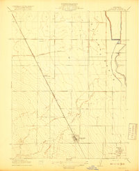
USGS Historical Quadrangle in GeoPDF.
|

|
