Filters: Tags: ARTILLERY PEAK (X)
38 results (118ms)|
Filters
Date Range
Types Contacts
Categories Tag Types Tag Schemes |
This data set contains imagery from the National Agriculture Imagery Program (NAIP). The NAIP program is administered by USDA FSA and has been established to support two main FSA strategic goals centered on agricultural production. These are, increase stewardship of America's natural resources while enhancing the environment, and to ensure commodities are procured and distributed effectively and efficiently to increase food security. The NAIP program supports these goals by acquiring and providing ortho imagery that has been collected during the agricultural growing season in the U.S. The NAIP ortho imagery is tailored to meet FSA requirements and is a fundamental tool used to support FSA farm and conservation programs....
ADMMR map collection: Artillery Peak Manganese Deposits Geologic Cross Sections; 1 in. to 100 feet; 36 x 24 in.
Categories: Data;
Tags: 1940s,
Arizona,
Artillery Mtn.,
Artillery Mts. physiographic area,
Artillery Peak,
ADMMR map collection: Artillery Peak Manganese Deposits Vertical Cross Sections; 1 in. to 100 feet; 40 x 28 in.
Categories: Data;
Tags: 1940s,
Arizona,
Artillery Mtn.,
Artillery Mts. physiographic area,
Artillery Peak,
ADMMR map collection: Artillery Peak Explanation Sections; 36 x 24 in.
Categories: Data;
Tags: Arizona,
Artillery Mtn.,
Artillery Mts. physiographic area,
Artillery Peak,
Artillery Peak - 15 Min,
ADMMR map collection: Artillery Peak Explanation with Assay Data; 1 in. to 50 feet; 23 x 37 in.
Categories: Data;
Tags: Arizona,
Artillery Mtn.,
Artillery Mts. physiographic area,
Artillery Peak,
Artillery Peak - 15 Min,
ADMMR map collection: Artillery Peak Manganese Deposits Vertical Cross Sections; 1 in. to 100 feet; 37 x 25 in.
Categories: Data;
Tags: 1940s,
Arizona,
Artillery Mtn.,
Artillery Mts. physiographic area,
Artillery Peak,
ADMMR map collection: Artillery Peak Manganese Analysis of Special Composite Samples; 1 in. to 100 feet; 15 x 11 in.
Categories: Data;
Tags: Arizona,
Artillery Mtn.,
Artillery Mts. physiographic area,
Artillery Peak,
Artillery Peak - 15 Min,
ADMMR map collection: Artillery Peak Manganese Deposits Vertical Cross Sections; 1 in. to 100 feet; 37 x 24 in.
Categories: Data;
Tags: 1940s,
Arizona,
Artillery Mtn.,
Artillery Mts. physiographic area,
Artillery Peak,
ADMMR map collection: Artillery Peak Manganese Proposed Mining Method; 1 in. to 20 feet; 38 x 26 in.
Categories: Data;
Tags: 1940s,
Arizona,
Artillery Mtn.,
Artillery Mts. physiographic area,
Artillery Peak,
ADMMR map collection: Artillery Peak Manganese Deposits Vertical Cross Sections; 1 in. to 100 feet; 37 x 25 in.
Categories: Data;
Tags: 1940s,
Arizona,
Artillery Mtn.,
Artillery Mts. physiographic area,
Artillery Peak,
ADMMR map collection: Topographic Map of Area Between Artillery Peak and Alamo; 1 in. to 6240 feet; 24 x 20 in.
Categories: Data;
Tags: 1940s,
Arizona,
Artillery Mtn.,
Artillery Mts. physiographic area,
Artillery Peak,
ADMMR map collection: Artillery Peak Manganese Deposits Ore Reserve Blocks; 1 in. to 200 feet; 39 x 25 in.
Categories: Data;
Tags: 1940s,
Arizona,
Artillery Mtn.,
Artillery Mts. physiographic area,
Artillery Peak,
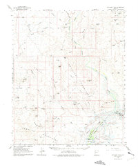
USGS Historical Quadrangle in GeoPDF.
ADMMR map collection: Artillery Peak Manganese Deposits Vertical Cross Sections; 1 in. to 100 feet; 37 x 24 in.
Categories: Data;
Tags: 1940s,
Arizona,
Artillery Mtn.,
Artillery Mts. physiographic area,
Artillery Peak,
ADMMR map collection: Artillery Peak Manganese Deposits Topographic Map; 1 in. to 600 feet; 36 x 24 in.
Categories: Data;
Tags: 1940s,
Arizona,
Artillery Mtn.,
Artillery Mts. physiographic area,
Artillery Peak,
This data set contains imagery from the National Agriculture Imagery Program (NAIP). The NAIP program is administered by USDA FSA and has been established to support two main FSA strategic goals centered on agricultural production. These are, increase stewardship of America's natural resources while enhancing the environment, and to ensure commodities are procured and distributed effectively and efficiently to increase food security. The NAIP program supports these goals by acquiring and providing ortho imagery that has been collected during the agricultural growing season in the U.S. The NAIP ortho imagery is tailored to meet FSA requirements and is a fundamental tool used to support FSA farm and conservation programs....
ADMMR map collection: Artillery Peak Manganese Deposits Ore Blocks Indicated by Drilling; 1 in. to 200 feet; 35 x 29 in.
Categories: Data;
Tags: 1940s,
Arizona,
Artillery Mtn.,
Artillery Mts. physiographic area,
Artillery Peak,
ADMMR map collection: Artillery Peak Manganese Project 303A Map; 1 in. to 100 feet; 15 x 11 in.
Categories: Data;
Tags: 1950s,
Arizona,
Artillery Mtn.,
Artillery Mts. physiographic area,
Artillery Peak,
ADMMR map collection: Artillery Peak Manganese Deposits Geologic Cross Sections; 1 in. to 100 feet; 36 x 24 in.
Categories: Data;
Tags: 1940s,
Arizona,
Artillery Mtn.,
Artillery Mts. physiographic area,
Artillery Peak,
ADMMR map collection: Artillery Peak Explanation with Assay Data and Geology; 1 in. to 50 feet; 36 x 52 in.
Categories: Data;
Tags: Arizona,
Artillery Mtn.,
Artillery Mts. physiographic area,
Artillery Peak,
Artillery Peak - 15 Min,
|

|
