Filters: Tags: Alaska (X) > Date Range: {"choice":"year"} (X)
6,673 results (26ms)|
Filters
Date Types (for Date Range)
Types
Contacts
Categories Tag Types
|

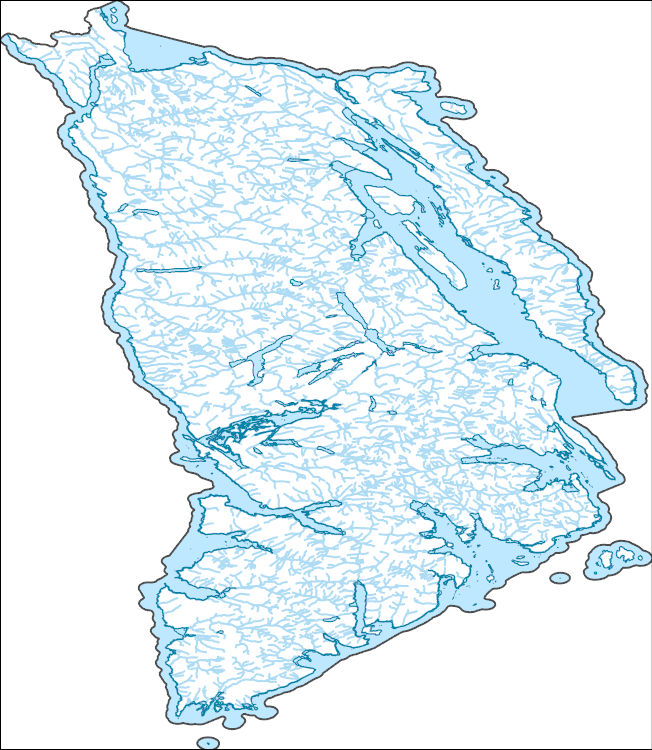
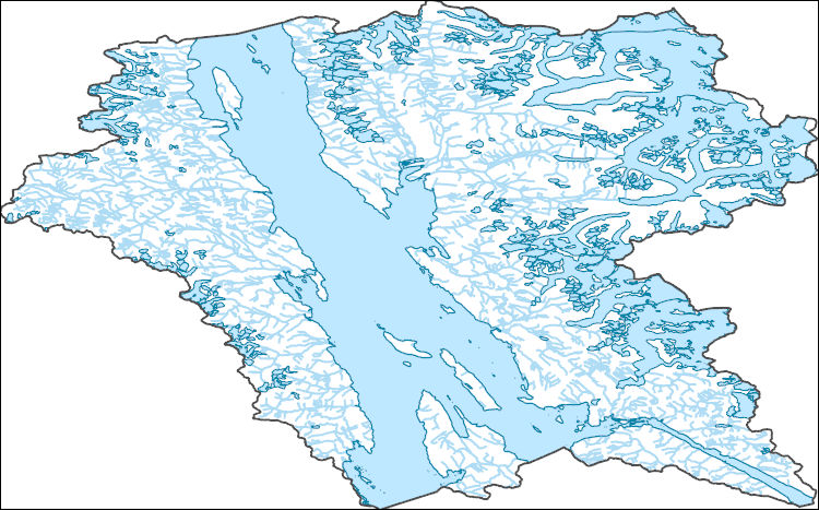
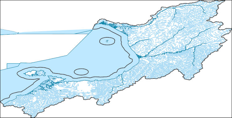
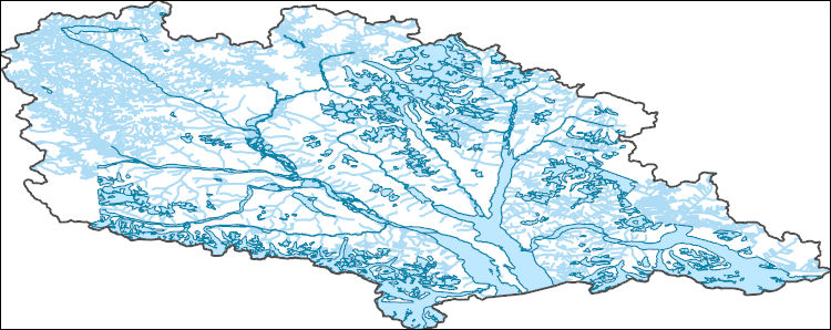
The National Hydrography Dataset (NHD) is a feature-based database that interconnects and uniquely identifies the stream segments or reaches that make up the nation's surface water drainage system. NHD data was originally developed at 1:100,000-scale and exists at that scale for the whole country. This high-resolution NHD, generally developed at 1:24,000/1:12,000 scale, adds detail to the original 1:100,000-scale NHD. (Data for Alaska, Puerto Rico and the Virgin Islands was developed at high-resolution, not 1:100,000 scale.) Local resolution NHD is being developed where partners and data exist. The NHD contains reach codes for networked features, flow direction, names, and centerline representations for areal water...

The National Hydrography Dataset (NHD) is a feature-based database that interconnects and uniquely identifies the stream segments or reaches that make up the nation's surface water drainage system. NHD data was originally developed at 1:100,000-scale and exists at that scale for the whole country. This high-resolution NHD, generally developed at 1:24,000/1:12,000 scale, adds detail to the original 1:100,000-scale NHD. (Data for Alaska, Puerto Rico and the Virgin Islands was developed at high-resolution, not 1:100,000 scale.) Local resolution NHD is being developed where partners and data exist. The NHD contains reach codes for networked features, flow direction, names, and centerline representations for areal water...

The National Hydrography Dataset (NHD) is a feature-based database that interconnects and uniquely identifies the stream segments or reaches that make up the nation's surface water drainage system. NHD data was originally developed at 1:100,000-scale and exists at that scale for the whole country. This high-resolution NHD, generally developed at 1:24,000/1:12,000 scale, adds detail to the original 1:100,000-scale NHD. (Data for Alaska, Puerto Rico and the Virgin Islands was developed at high-resolution, not 1:100,000 scale.) Local resolution NHD is being developed where partners and data exist. The NHD contains reach codes for networked features, flow direction, names, and centerline representations for areal water...
The National Hydrography Dataset (NHD) is a feature-based database that interconnects and uniquely identifies the stream segments or reaches that make up the nation's surface water drainage system. NHD data was originally developed at 1:100,000-scale and exists at that scale for the whole country. This high-resolution NHD, generally developed at 1:24,000/1:12,000 scale, adds detail to the original 1:100,000-scale NHD. (Data for Alaska, Puerto Rico and the Virgin Islands was developed at high-resolution, not 1:100,000 scale.) Local resolution NHD is being developed where partners and data exist. The NHD contains reach codes for networked features, flow direction, names, and centerline representations for areal water...
The National Hydrography Dataset (NHD) is a feature-based database that interconnects and uniquely identifies the stream segments or reaches that make up the nation's surface water drainage system. NHD data was originally developed at 1:100,000-scale and exists at that scale for the whole country. This high-resolution NHD, generally developed at 1:24,000/1:12,000 scale, adds detail to the original 1:100,000-scale NHD. (Data for Alaska, Puerto Rico and the Virgin Islands was developed at high-resolution, not 1:100,000 scale.) Local resolution NHD is being developed where partners and data exist. The NHD contains reach codes for networked features, flow direction, names, and centerline representations for areal water...
The National Hydrography Dataset (NHD) is a feature-based database that interconnects and uniquely identifies the stream segments or reaches that make up the nation's surface water drainage system. NHD data was originally developed at 1:100,000-scale and exists at that scale for the whole country. This high-resolution NHD, generally developed at 1:24,000/1:12,000 scale, adds detail to the original 1:100,000-scale NHD. (Data for Alaska, Puerto Rico and the Virgin Islands was developed at high-resolution, not 1:100,000 scale.) Local resolution NHD is being developed where partners and data exist. The NHD contains reach codes for networked features, flow direction, names, and centerline representations for areal water...
The National Hydrography Dataset (NHD) is a feature-based database that interconnects and uniquely identifies the stream segments or reaches that make up the nation's surface water drainage system. NHD data was originally developed at 1:100,000-scale and exists at that scale for the whole country. This high-resolution NHD, generally developed at 1:24,000/1:12,000 scale, adds detail to the original 1:100,000-scale NHD. (Data for Alaska, Puerto Rico and the Virgin Islands was developed at high-resolution, not 1:100,000 scale.) Local resolution NHD is being developed where partners and data exist. The NHD contains reach codes for networked features, flow direction, names, and centerline representations for areal water...
This project will provide a comprehensive synthesis of beaver recolonization science and techniques for successful reintroduction or population expansion through a thorough, in-depth, coordinated review of all North American beaver-related information, including identification of research gaps and data needs, and recommendations for project implementation. This information will be disseminated through a series of one-day workshops.
Categories: Data,
Project;
Types: Map Service,
OGC WFS Layer,
OGC WMS Layer,
OGC WMS Service;
Tags: 2013,
AK-1,
Alaska,
Alaska,
Alaska,
This project will create a targeted and easily understandable guide to tools that support landscape-level planning in the face of climate change for NPLCC partners. The guide will build on previous NPLCC research on decision support needs with an emphasis on tools currently in use in the region. A survey of NPLCC partners will discover who is currently using or planning to use tools in the region, tools they are using, how well these tools are meeting their needs, and regional and outside experts engaged in tool use. Additional tools research will provide information on tools not currently in use in the region that could also provide needed functionality.
Categories: Data;
Types: Map Service,
OGC WFS Layer,
OGC WMS Layer,
OGC WMS Service;
Tags: Academics & scientific researchers,
Ak-1,
Alaska,
British Columbia,
CA-2,
The Tongass National Forest has identified resources that are important to stakeholders and vulnerable to climate-related stressors. Cooperators will review an action plan and convene a workshop to be held in Southeast Alaska in 2016. The workshop will foster collaboration between scientists, managers, and stakeholders. Workshop goals include: sharing information about climate-related stressors and effects on NPLCC Priority Resources in the Tongass National Forest; developing strategic priorities for improving understanding, reducing risks, and increasing adaptive capacity and resilience; coordinating support for increasing knowledge and informing resource managers
Categories: Data,
Project;
Types: Map Service,
OGC WFS Layer,
OGC WMS Layer,
OGC WMS Service;
Tags: AK-0,
Alaska,
Anadromous fish,
Applications and Tools,
Change in air temperature and precipitation,
This is a collection of Alaska photographs taken by James F. Seitz in 1950 using a 9X12 centimeter camera.. Displayed is photograph number 7 in Tarr Inlet, Margerie Glacier on left, Grand Pacific Glacier taken in 1950.
This is a collection of James Frederick Seitz's Alaska photographs taken during his field work in 1949 using 620 camera. Displayed is photograph number 64 of Hugh Miller Glacier taken in 1949.
LANDFIRE's (LF) 2022 update (LF 2022) Existing Vegetation Cover (EVC) represents the vertically projected percent cover of the live canopy for a 30-m cell. EVC is produced separately for tree, shrub, and herbaceous lifeforms. Training data depicting percentages of canopy cover are obtained from plot-level ground-based visual assessments and lidar observations. These are combined with Landsat imagery (from multiple seasons), to inform models built independently for each lifeform. Tree, shrub, and herbaceous lifeforms each have a potential range from 10% to 100% (cover values less than 10% are binned into the 10% value). The three independent lifeform datasets are merged into a single product based on the dominant...
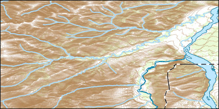
Layers of geospatial data include contours, boundaries, land cover, hydrography, roads, transportation, geographic names, structures, and other selected map features.
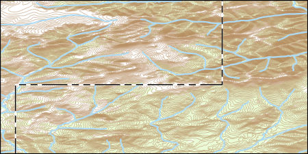
Layers of geospatial data include contours, boundaries, land cover, hydrography, roads, transportation, geographic names, structures, and other selected map features.
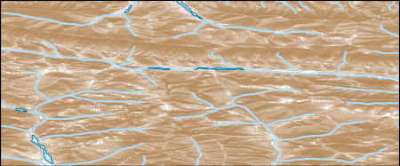
Layers of geospatial data include contours, boundaries, land cover, hydrography, roads, transportation, geographic names, structures, and other selected map features.
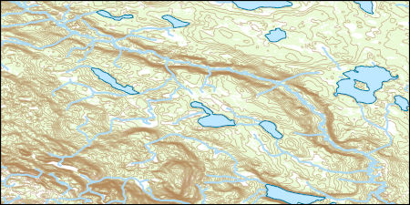
Layers of geospatial data include contours, boundaries, land cover, hydrography, roads, transportation, geographic names, structures, and other selected map features.
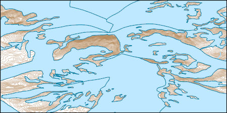
Layers of geospatial data include contours, boundaries, land cover, hydrography, roads, transportation, geographic names, structures, and other selected map features.
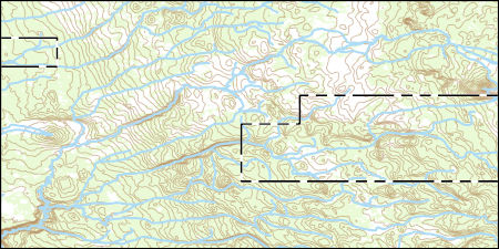
Layers of geospatial data include contours, boundaries, land cover, hydrography, roads, transportation, geographic names, structures, and other selected map features.
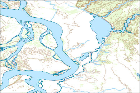
Layers of geospatial data include contours, boundaries, land cover, hydrography, roads, transportation, geographic names, structures, and other selected map features.
|

|
