Filters
Date Range
Types
Contacts
Tag Types
Tag Schemes
|
This data set contains imagery from the National Agriculture Imagery Program (NAIP). The NAIP program is administered by USDA FSA and has been established to support two main FSA strategic goals centered on agricultural production. These are, increase stewardship of America's natural resources while enhancing the environment, and to ensure commodities are procured and distributed effectively and efficiently to increase food security. The NAIP program supports these goals by acquiring and providing ortho imagery that has been collected during the agricultural growing season in the U.S. The NAIP ortho imagery is tailored to meet FSA requirements and is a fundamental tool used to support FSA farm and conservation programs....
Types: Citation;
Tags: 19005,
3.75 x 3.75 minute,
4309137,
ALLAMAKEE CO IA FSA,
Aerial Compliance, All tags...
Allamakee,
Compliance,
Digital Ortho rectified Image,
Downloadable Data,
IA,
IA005,
JPEG2000,
NAIP,
Ortho Rectification,
Orthoimagery,
Quarter Quadrangle,
USDA National Agriculture Imagery Program (NAIP),
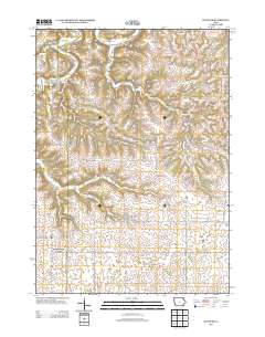
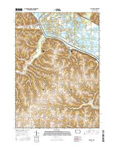
WAUKON NW,
WAUKON NW, NW,
farming, Fewer tags
This data set contains imagery from the National Agriculture Imagery Program (NAIP). The NAIP program is administered by USDA FSA and has been established to support two main FSA strategic goals centered on agricultural production. These are, increase stewardship of America's natural resources while enhancing the environment, and to ensure commodities are procured and distributed effectively and efficiently to increase food security. The NAIP program supports these goals by acquiring and providing ortho imagery that has been collected during the agricultural growing season in the U.S. The NAIP ortho imagery is tailored to meet FSA requirements and is a fundamental tool used to support FSA farm and conservation programs....
Types: Citation;
Tags: 19005,
3.75 x 3.75 minute,
4309146,
ALLAMAKEE CO IA FSA,
Aerial Compliance, All tags...
Allamakee,
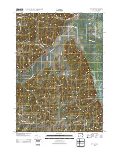
CHURCH,
CHURCH, NE,
Compliance,
Digital Ortho rectified Image,
Downloadable Data,
IA,
IA005,
JPEG2000,
NAIP,
Ortho Rectification,
Orthoimagery,
Quarter Quadrangle,
USDA National Agriculture Imagery Program (NAIP),
farming, Fewer tags
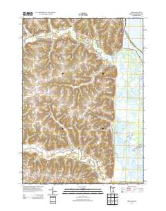
Layered GeoPDF 7.5 Minute Quadrangle Map. Layers of geospatial data include orthoimagery, roads, grids, geographic names, elevation contours, hydrography, and other selected map features.
Tags: 7.5 x 7.5 minute,
Allamakee,
Downloadable Data,
EarthCover,
GeoPDF, All tags...
Houston,
Imagery and Base Maps,
Iowa,
Map,
Minnesota,
Public Land Survey System,
Reno, MN-WI-IA,
U.S. National Grid,
US,
US Topo,
US Topo Historical,
United States,
Vernon,
Wisconsin,
boundary,
contour,
geographic names,
hydrography,
imageryBaseMapsEarthCover,
orthoimage,
structures,
topographic,
transportation,
woodland, Fewer tags
Layered GeoPDF 7.5 Minute Quadrangle Map. Layers of geospatial data include orthoimagery, roads, grids, geographic names, elevation contours, hydrography, and other selected map features.
Tags: 7.5 x 7.5 minute,
Allamakee,
Downloadable Data,
EarthCover,
GeoPDF, All tags...
Imagery and Base Maps,
Iowa,
Map,
U.S. National Grid,
US,
US Topo,
US Topo Historical,
United States,
Waukon, IA,
contour,
geographic names,
hydrography,
orthoimage,
topographic,
transportation, Fewer tags
Layered GeoPDF 7.5 Minute Quadrangle Map. Layers of geospatial data include orthoimagery, roads, grids, geographic names, elevation contours, hydrography, and other selected map features.
Tags: 7.5 x 7.5 minute,
Allamakee,
Downloadable Data,
EarthCover,
GeoPDF, All tags...
Imagery and Base Maps,
Iowa,
Map,
U.S. National Grid,
US,
US Topo,
US Topo Historical,
United States,
Waukon NW, IA,
contour,
geographic names,
hydrography,
orthoimage,
topographic,
transportation, Fewer tags
Layered GeoPDF 7.5 Minute Quadrangle Map. Layers of geospatial data include orthoimagery, roads, grids, geographic names, elevation contours, hydrography, and other selected map features.
Tags: 7.5 x 7.5 minute,
Allamakee,
Downloadable Data,
EarthCover,
GeoPDF, All tags...
Imagery and Base Maps,
Iowa,
Map,
Rossville, IA,
U.S. National Grid,
US,
US Topo,
US Topo Historical,
United States,
contour,
geographic names,
hydrography,
orthoimage,
topographic,
transportation, Fewer tags
Layered GeoPDF 7.5 Minute Quadrangle Map. Layers of geospatial data include orthoimagery, roads, grids, geographic names, elevation contours, hydrography, and other selected map features.
Tags: 7.5 x 7.5 minute,
Allamakee,
Downloadable Data,
EarthCover,
GeoPDF, All tags...
Hanover, IA,
Imagery and Base Maps,
Iowa,
Map,
Public Land Survey System,
U.S. National Grid,
US,
US Topo,
US Topo Historical,
United States,
Winneshiek,
boundary,
contour,
geographic names,
hydrography,
imageryBaseMapsEarthCover,
orthoimage,
structures,
topographic,
transportation,
woodland, Fewer tags
Layered GeoPDF 7.5 Minute Quadrangle Map. Layers of geospatial data include orthoimagery, roads, grids, geographic names, elevation contours, hydrography, and other selected map features.
Tags: 7.5 x 7.5 minute,
Allamakee,
Downloadable Data,
EarthCover,
GeoPDF, All tags...
Imagery and Base Maps,
Iowa,
Map,
New Albin, IA,
Public Land Survey System,
U.S. National Grid,
US,
US Topo,
US Topo Historical,
United States,
boundary,
contour,
geographic names,
hydrography,
imageryBaseMapsEarthCover,
orthoimage,
structures,
topographic,
transportation,
woodland, Fewer tags
This data set contains imagery from the National Agriculture Imagery Program (NAIP). The NAIP program is administered by USDA FSA and has been established to support two main FSA strategic goals centered on agricultural production. These are, increase stewardship of America's natural resources while enhancing the environment, and to ensure commodities are procured and distributed effectively and efficiently to increase food security. The NAIP program supports these goals by acquiring and providing ortho imagery that has been collected during the agricultural growing season in the U.S. The NAIP ortho imagery is tailored to meet FSA requirements and is a fundamental tool used to support FSA farm and conservation programs....
Types: Citation;
Tags: 19005,
3.75 x 3.75 minute,
4309138,
ALLAMAKEE CO IA FSA,
Aerial Compliance, All tags...
Allamakee,
Compliance,
Digital Ortho rectified Image,
Downloadable Data,
IA,
IA005,
JPEG2000,
NAIP,
NEW ALBIN,
NEW ALBIN, SW,
Ortho Rectification,
Orthoimagery,
Quarter Quadrangle,
USDA National Agriculture Imagery Program (NAIP),
farming, Fewer tags
This data set contains imagery from the National Agriculture Imagery Program (NAIP). The NAIP program is administered by USDA FSA and has been established to support two main FSA strategic goals centered on agricultural production. These are, increase stewardship of America's natural resources while enhancing the environment, and to ensure commodities are procured and distributed effectively and efficiently to increase food security. The NAIP program supports these goals by acquiring and providing ortho imagery that has been collected during the agricultural growing season in the U.S. The NAIP ortho imagery is tailored to meet FSA requirements and is a fundamental tool used to support FSA farm and conservation programs....
Types: Citation;
Tags: 19005,
3.75 x 3.75 minute,
4309148,
ALLAMAKEE CO IA FSA,
Aerial Compliance, All tags...
Allamakee,
Compliance,
Digital Ortho rectified Image,
Downloadable Data,
FERRYVILLE,
FERRYVILLE, SE,
IA,
IA005,
JPEG2000,
NAIP,
Ortho Rectification,
Orthoimagery,
Quarter Quadrangle,
USDA National Agriculture Imagery Program (NAIP),
farming, Fewer tags
This data set contains imagery from the National Agriculture Imagery Program (NAIP). The NAIP program is administered by USDA FSA and has been established to support two main FSA strategic goals centered on agricultural production. These are, increase stewardship of America's natural resources while enhancing the environment, and to ensure commodities are procured and distributed effectively and efficiently to increase food security. The NAIP program supports these goals by acquiring and providing ortho imagery that has been collected during the agricultural growing season in the U.S. The NAIP ortho imagery is tailored to meet FSA requirements and is a fundamental tool used to support FSA farm and conservation programs....
Types: Citation;
Tags: 19005,
3.75 x 3.75 minute,
4309152,
ALLAMAKEE CO IA FSA,
Aerial Compliance, All tags...
Allamakee,
Compliance,
Digital Ortho rectified Image,
Downloadable Data,
FRANKVILLE,
FRANKVILLE, SE,
IA,
IA005,
JPEG2000,
NAIP,
Ortho Rectification,
Orthoimagery,
Quarter Quadrangle,
USDA National Agriculture Imagery Program (NAIP),
farming, Fewer tags
This data set contains imagery from the National Agriculture Imagery Program (NAIP). The NAIP program is administered by USDA FSA and has been established to support two main FSA strategic goals centered on agricultural production. These are, increase stewardship of America's natural resources while enhancing the environment, and to ensure commodities are procured and distributed effectively and efficiently to increase food security. The NAIP program supports these goals by acquiring and providing ortho imagery that has been collected during the agricultural growing season in the U.S. The NAIP ortho imagery is tailored to meet FSA requirements and is a fundamental tool used to support FSA farm and conservation programs....
Types: Citation;
Tags: 19005,
3.75 x 3.75 minute,
4309153,
ALLAMAKEE CO IA FSA,
Aerial Compliance, All tags...
Allamakee,
Compliance,
Digital Ortho rectified Image,
Downloadable Data,
IA,
IA005,
JPEG2000,
NAIP,
Ortho Rectification,
Orthoimagery,
Quarter Quadrangle,
ROSSVILLE,
ROSSVILLE, NE,
USDA National Agriculture Imagery Program (NAIP),
farming, Fewer tags
Layered GeoPDF 7.5 Minute Quadrangle Map. Layers of geospatial data include orthoimagery, roads, grids, geographic names, elevation contours, hydrography, and other selected map features.
Tags: 7.5 x 7.5 minute,
Allamakee,
Downloadable Data,
EarthCover,
GeoPDF, All tags...
Imagery and Base Maps,
Iowa,
Map,
Public Land Survey System,
Rossville, IA,
U.S. National Grid,
US,
US Topo,
US Topo Historical,
United States,
boundary,
contour,
geographic names,
hydrography,
imageryBaseMapsEarthCover,
orthoimage,
structures,
topographic,
transportation,
woodland, Fewer tags
Layered GeoPDF 7.5 Minute Quadrangle Map. Layers of geospatial data include orthoimagery, roads, grids, geographic names, elevation contours, hydrography, and other selected map features.
Tags: 7.5 x 7.5 minute,
Allamakee,
Downloadable Data,
EarthCover,
GeoPDF, All tags...
Houston,
Imagery and Base Maps,
Iowa,
Map,
Minnesota,
Public Land Survey System,
U.S. National Grid,
US,
US Topo,
US Topo Historical,
United States,
Wilmington, MN-IA,
Winneshiek,
boundary,
contour,
geographic names,
hydrography,
imageryBaseMapsEarthCover,
orthoimage,
structures,
topographic,
transportation,
woodland, Fewer tags
Layered GeoPDF 7.5 Minute Quadrangle Map. Layers of geospatial data include orthoimagery, roads, grids, geographic names, elevation contours, hydrography, and other selected map features.
Tags: 7.5 x 7.5 minute,
Allamakee,
Dorchester, IA,
Downloadable Data,
EarthCover, All tags...
GeoPDF,
Imagery and Base Maps,
Iowa,
Map,
Public Land Survey System,
U.S. National Grid,
US,
US Topo,
US Topo Historical,
United States,
Winneshiek,
boundary,
contour,
geographic names,
hydrography,
imageryBaseMapsEarthCover,
orthoimage,
structures,
topographic,
transportation,
woodland, Fewer tags
Layered GeoPDF 7.5 Minute Quadrangle Map. Layers of geospatial data include orthoimagery, roads, grids, geographic names, elevation contours, hydrography, and other selected map features.
Tags: 7.5 x 7.5 minute,
Allamakee,
Downloadable Data,
EarthCover,
GeoPDF, All tags...
Imagery and Base Maps,
Iowa,
Map,
Public Land Survey System,
Rossville, IA,
U.S. National Grid,
US,
US Topo,
US Topo Historical,
United States,
boundary,
contour,
geographic names,
hydrography,
imageryBaseMapsEarthCover,
orthoimage,
structures,
topographic,
transportation,
woodland, Fewer tags
Layered GeoPDF 7.5 Minute Quadrangle Map. Layers of geospatial data include orthoimagery, roads, grids, geographic names, elevation contours, hydrography, and other selected map features.
Tags: 7.5 x 7.5 minute,
Allamakee,
Downloadable Data,
EarthCover,
Frankville, IA, All tags...
GeoPDF,
Imagery and Base Maps,
Iowa,
Map,
U.S. National Grid,
US,
US Topo,
US Topo Historical,
United States,
Winneshiek,
contour,
geographic names,
hydrography,
orthoimage,
topographic,
transportation, Fewer tags
Layered GeoPDF 7.5 Minute Quadrangle Map. Layers of geospatial data include orthoimagery, roads, grids, geographic names, elevation contours, hydrography, and other selected map features.
Tags: 7.5 x 7.5 minute,
Allamakee,
Clayton,
Downloadable Data,
EarthCover, All tags...
GeoPDF,
Giard, IA,
Imagery and Base Maps,
Iowa,
Map,
U.S. National Grid,
US,
US Topo,
US Topo Historical,
United States,
contour,
geographic names,
hydrography,
orthoimage,
topographic,
transportation, Fewer tags
Layered GeoPDF 7.5 Minute Quadrangle Map. Layers of geospatial data include orthoimagery, roads, grids, geographic names, elevation contours, hydrography, and other selected map features.
Tags: 7.5 x 7.5 minute,
Allamakee,
Crawford,
Downloadable Data,
EarthCover, All tags...
GeoPDF,
Imagery and Base Maps,
Iowa,
Lansing, IA-WI,
Map,
Public Land Survey System,
U.S. National Grid,
US,
US Topo,
US Topo Historical,
United States,
Wisconsin,
boundary,
contour,
geographic names,
hydrography,
imageryBaseMapsEarthCover,
orthoimage,
structures,
topographic,
transportation,
woodland, Fewer tags
The Watershed Boundary Dataset (WBD) is a comprehensive aggregated collection of hydrologic unit data consistent with the national criteria for delineation and resolution. It defines the areal extent of surface water drainage to a point except in coastal or lake front areas where there could be multiple outlets as stated by the "Federal Standards and Procedures for the National Watershed Boundary Dataset (WBD)" "Standard" (https://pubs.usgs.gov/tm/11/a3/). Watershed boundaries are determined solely upon science-based hydrologic principles, not favoring any administrative boundaries or special projects, nor particular program or agency. This dataset represents the hydrologic unit boundaries to the 12-digit (6th level)...
Tags: 10-digit,
12-digit,
14-digit,
16-digit,
2-digit, All tags...
4-digit,
6-digit,
8-digit,
Adair,
Adams,
Aitkin,
Alexander,
Allamakee,
Anoka,
Appanoose,
Ashland,
Audrain,
Audubon,
Ballard,
Barron,
Basin,
Bayfield,
Becker,
Beltrami,
Benton,
Berrien,
Big Stone,
Black Hawk,
Blue Earth,
Bollinger,
Bond,
Boone,
Bremer,
Brookings,
Brown,
Buchanan,
Buena Vista,
Buffalo,
Bureau,
Burnett,
Butler,
Calhoun,
Callaway,
Cape Girardeau,
Carlton,
Carroll,
Carver,
Cass,
Cedar,
Cerro Gordo,
Champaign,
Chickasaw,
Chippewa,
Chisago,
Christian,
Clark,
Clarke,
Clay,
Clayton,
Clearwater,
Clinton,
Codington,
Coles,
Columbia,
Cook,
Cottonwood,
Crawford,
Crow Wing,
Dakota,
Dallas,
Dane,
Davis,
Day,
De Witt,
DeKalb,
Delaware,
Dent,
Des Moines,
Deuel,
Dickinson,
Dodge,
Douglas,
Downloadable Data,
DuPage,
Dubuque,
Dunn,
Eau Claire,
Effingham,
Elkhart,
Emmet,
Faribault,
Fayette,
Fillmore,
Floyd,
Fond du Lac,
Ford,
Forest,
Franklin,
Freeborn,
Fulton,
Gasconade,
GeoPackage,
Gogebic,
Goodhue,
Grant,
Green,
Green Lake,
Greene,
Grundy,
Guthrie,
HU-2,
HU-2 Region,
HU2_07,
HUC,
Hamilton,
Hancock,
Hardin,
Henderson,
Hennepin,
Henry,
Houston,
Howard,
Hubbard,
Humboldt,
Hydrography,
Hydrologic Unit Code,
Hydrologic Units,
IA,
IL,
IN,
Illinois,
Indiana,
Iowa,
Iowa,
Iron,
Iroquois,
Isanti,
Itasca,
Jackson,
Jasper,
Jefferson,
Jersey,
Jo Daviess,
Johnson,
Jones,
Juneau,
KY,
Kanabec,
Kandiyohi,
Kane,
Kankakee,
Kendall,
Kenosha,
Kentucky,
Keokuk,
Knox,
Kosciusko,
Kossuth,
La Crosse,
LaPorte,
LaSalle,
Lac qui Parle,
Lafayette,
Lake,
Langlade,
Le Sueur,
Lee,
Lewis,
Lincoln,
Linn,
Livingston,
Logan,
Louisa,
Lucas,
Lyon,
MI,
MN,
MO,
Macon,
Macoupin,
Madison,
Mahaska,
Marathon,
Maries,
Marion,
Marquette,
Marshall,
Martin,
Mason,
McDonough,
McHenry,
McLean,
McLeod,
Meeker,
Menard,
Mercer,
Michigan,
Mille Lacs,
Milwaukee,
Minnesota,
Mississippi,
Missouri,
Mitchell,
Monroe,
Montgomery,
Morgan,
Morrison,
Moultrie,
Mower,
Murray,
Muscatine,
ND,
National Watershed Boundary Dataset (WBD),
National Watershed Boundary Dataset (WBD),
Newton,
Nicollet,
Nobles,
North Dakota,
Ogle,
Olmsted,
Oneida,
Open Geospatial Consortium GeoPackage 1.2,
Osage,
Otter Tail,
Palo Alto,
Peoria,
Pepin,
Perry,
Phelps,
Piatt,
Pierce,
Pike,
Pine,
Pipestone,
Pocahontas,
Polk,
Pope,
Portage,
Porter,
Poweshiek,
Price,
Pulaski,
Putnam,
Racine,
Ralls,
Ramsey,
Randolph,
Redwood,
Region,
Renville,
Reynolds,
Rice,
Richland,
Roberts,
Rock,
Rock Island,
Rusk,
SD,
Sac,
Sangamon,
Sauk,
Sawyer,
Schuyler,
Scotland,
Scott,
Shawano,
Shelby,
Sherburne,
Sibley,
South Dakota,
St. Charles,
St. Clair,
St. Croix,
St. Francois,
St. Joseph,
St. Louis,
Stark,
Starke,
Ste. Genevieve,
Stearns,
Steele,
Stephenson,
Stevens,
Story,
Sub-basin,
Sub-region,
Subwatershed,
Swift,
Tama,
Taylor,
Tazewell,
Texas,
Todd,
Traverse,
Trempealeau,
US,
Union,
United States,
Van Buren,
Vermilion,
Vernon,
Vilas,
WBD,
WI,
Wabasha,
Wadena,
Walworth,
Wapello,
Warren,
Waseca,
Washburn,
Washington,
Watershed,
Watershed Boundary Dataset,
Watonwan,
Waukesha,
Waushara,
Wayne,
Webster,
White,
Whiteside,
Will,
Williamson,
Winnebago,
Winneshiek,
Winona,
Wisconsin,
Wood,
Woodford,
Worth,
Wright,
Yellow Medicine,
inlandWaters, Fewer tags
|
|

