Filters: Tags: Alliance (X)
49 results (22ms)|
Filters
Date Range
Types Contacts
Tag Types Tag Schemes |
This data set contains imagery from the National Agriculture Imagery Program (NAIP). The NAIP program is administered by USDA FSA and has been established to support two main FSA strategic goals centered on agricultural production. These are, increase stewardship of America's natural resources while enhancing the environment, and to ensure commodities are procured and distributed effectively and efficiently to increase food security. The NAIP program supports these goals by acquiring and providing ortho imagery that has been collected during the agricultural growing season in the U.S. The NAIP ortho imagery is tailored to meet FSA requirements and is a fundamental tool used to support FSA farm and conservation programs....
The vegetation units on this map were determined through a series of image processing steps including unsupervised classification, ecological modeling and stereoscopic interpretation of aerial photographs supported by field sampling and ecological analysis. The vegetation boundaries were identified on the photographs by means of the photographic signature and collateral information on slope, hydrology, geography, and vegetation in accordance with the Standardized National Vegetation Classification System (October 1995). The mapped vegetation reflects conditions that existed during the specific year and season that the aerial photographs were taken. There is a margin of error inherent in the use of aerial photographs....
This polygon feature class represents vegetation communities mapped at Canyonlands National Park. The polygons were generated using guidelines set by the Standardized National Vegetation Classification System (October 1995). A combination of methods were used to map Canyonlands. The USGS used e-Cognition software to create segments. The segments created were then looked at and extensively edited by the vegetation mappers. Some mapping was done on screen, using the 2002 imagery. Hard copy 9X9 photography was used for photo interpretation. Traditional image interpretation cues were used to develop the polygons, such as shape, size, pattern, tone, texture, color, and shadow. Additional data layers were used in aiding...
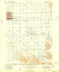
USGS Historical Quadrangle in GeoPDF.
USGS Historical Quadrangle in GeoPDF.
USGS Historical Quadrangle in GeoPDF.
The National Park Service (NPS), in conjunction with the Biological Resources Division (BRD) of the U.S. Geological Survey (USGS), has implemented a program to "develop a uniform hierarchical vegetation methodology" at a national level. The program will also create a geographic information system (GIS) database for the parks under its management. The purpose of the data is to document the state of vegetation within the NPS service area during the 1990's, thereby providing a baseline study for further analysis at the Regional or Service-wide level. The vegetation at Devils Tower National Monument was mapped using 1:16,000 scale U.S. Forest Service Color Aerial Photography acquired July 29, 1993. The mapping classification...
The vegetation units on this map were determined through the stereoscopic interpretation of aerial photographs supported by field sampling and ecological analysis. The vegetation boundaries were identified on the photographs by means of the photographic signature and collateral information on slope, hydrology, geography, and vegetation in accordance with the Standardized National Vegetation Classification System (October 1995). The mapped vegetation reflects conditions that existed during the specific year and season that the aerial photographs were taken. There is a margin of error inherent in the use of aerial photographs. Therefore, a detailed ground and historical analysis of a single site may result in a revision...
This geospatial database covers vegetation land cover and land use for Wind Cave National Park and surrounding areas and is authorized as part of the USGS/NPS Vegetation Mapping Program http://www.usgs.gov/core_science_systems/csas/vip/index.html. The program is administered by the Biological Resources Division (BRD) of the United States Geological Survey (USGS). This mapping effort was performed by the US Bureau of Reclamation's (USBR) Remote Sensing and GIS Group, Technical Service Center, Denver, CO. The vegetation mapping program is part of a larger Inventory and Monitoring (I&M) program started by the National Park Service (NPS) http://science.nature.nps.gov/im/. I&M goals are, among others, to map the vegetation...
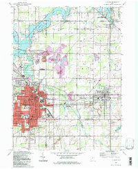
USGS Historical Quadrangle in GeoPDF.
This polygon feature class represents vegetation communities mapped at Capitol Reef National Park to an alliance or association level, depending on the photo signature. The polygons were generated using guidelines set by the Standardized National Vegetation Classification System (October 1995). Original lines were drawn on-screen using the DOQs collected in June of 2002 as a base map. Hard copy 9X9 photography was used for photo interpretation. Traditional image interpretation cues were used to develop the polygons, such as shape, size, pattern, tone, texture, color, and shadow. Additional data layers were used in aiding the interpretation, such as slope, hydrology, geography, and ground-collected vegetation information....
This polygon feature class represents vegetation communities mapped at Arches National Park to an alliance or association level, depending on the photo signature. The polygons were generated using guidelines set by the Standardized National Vegetation Classification System (October 1995). Original lines were drawn on mylar overlays using the DOQs collected in June of 2002. Hard copy 9x9 photography was used for photo interpretation. Traditional image interpretation cues were used to develop the polygons, such as shape, size, pattern, tone, texture, color, and shadow. Additional data layers were used in aiding the interpretation, such as slope, hydrology, soils, geography, and ground-collected vegetation information....
This polygon feature class represents vegetation communities mapped at Dinosaur National Monument. The polygons were delineated following guidelines set by the National Vegetation Classification System (October 1995). Original lines were drawn on a mylar overlay on top of printed 1:12,000 digital scale orthophoto quadrangles (DOQ), collected in the summer of 2002. Hard copy 9X9 stereo aerial photography was used for photo interpretation. Intuitive ecological modeling and visual interpretation cues, such as shape, size, pattern, tone, texture, color, and shadow, were used to develop the polygons. Additional data layers used to aid the interpretation include slope, hydrology, geography, and ground-collected vegetation...
USGS Historical Quadrangle in GeoPDF.

USGS Historical Quadrangle in GeoPDF.
USGS Historical Quadrangle in GeoPDF.
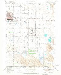
USGS Historical Quadrangle in GeoPDF.
This polygon feature class represents vegetation communities mapped at Fossil Butte National Monument. The polygons were generated using guidelines set by the Standardized National Vegetation Classification System (October 1995). Polygons were generated using machine learning, as well as on screen digitizing of vegetation map types using 2004 imagery flown for the vegetation mapping project. Additional data layers were used in aiding the interpretation, such as slope, hydrology, geography, and ground-collected vegetation information. The attributed vegetation classes were subjected to an accuracy assessment, following which final adjustments were made to the vegetation classes. As with any digital layer, this layer...
Fort Bowie National Historic Site Vegetation Inventory and Mapping Project - Spatial Vegetation Data
This polygon feature class represents vegetation communities mapped at Fort Bowie National Historic Site to an alliance or association level. Field crews used landscape features as a guide to develop the polygons, such as shape, size, pattern, tone, texture, color, and shadow. Additional data layers were used in aiding the interpretation, such as slope, hydrology, geography, and ground-collected vegetation information. The draft polygons were printed out and taken into the field; Field crews modified boundaires and merged or split delineated polygons based on field observations. All edits were made on paper maqps and transferred into GIS later. The minimum mapping unit was 1/2 hectare. The attributed vegetation...
This data set contains imagery from the National Agriculture Imagery Program (NAIP). The NAIP program is administered by USDA FSA and has been established to support two main FSA strategic goals centered on agricultural production. These are, increase stewardship of America's natural resources while enhancing the environment, and to ensure commodities are procured and distributed effectively and efficiently to increase food security. The NAIP program supports these goals by acquiring and providing ortho imagery that has been collected during the agricultural growing season in the U.S. The NAIP ortho imagery is tailored to meet FSA requirements and is a fundamental tool used to support FSA farm and conservation programs....
|

|
