Filters: Tags: Anderson Creek (X)
18 results (15ms)|
Filters
Date Range
Types Contacts
Categories Tag Types Tag Schemes |
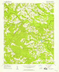
USGS Historical Quadrangle in GeoPDF.
This data set contains imagery from the National Agriculture Imagery Program (NAIP). The NAIP program is administered by USDA FSA and has been established to support two main FSA strategic goals centered on agricultural production. These are, increase stewardship of America's natural resources while enhancing the environment, and to ensure commodities are procured and distributed effectively and efficiently to increase food security. The NAIP program supports these goals by acquiring and providing ortho imagery that has been collected during the agricultural growing season in the U.S. The NAIP ortho imagery is tailored to meet FSA requirements and is a fundamental tool used to support FSA farm and conservation programs....
The following tabs contain sediment transport rates modeled using the Wilcock and Crowe (2003) sediment transport model. The transport rate for each cross section and each scenario are labeled under each tab, which contains all the cross sections from an individual reach. The following tabs contain sediment transport rates modeled using the Wilcock and Crowe (2003) sediment transport model.
This data set contains imagery from the National Agriculture Imagery Program (NAIP). The NAIP program is administered by USDA FSA and has been established to support two main FSA strategic goals centered on agricultural production. These are increase stewardship of America's natural resources while enhancing the environment, and to ensure commodities are procured and distributed effectively and efficiently to increase food security. The NAIP program supports these goals by acquiring and providing ortho imagery that has been collected during the agricultural growing season in the U.S. The NAIP ortho imagery is tailored to meet FSA requirements and is a fundamental tool used to support FSA farm and conservation programs....
This archive contains two files. For Measure Discharges, each tab contains the data and pacific daylight standard time the discharge measurement was taken. The discharge (Q), is calculated using the rating curve developed from measured discharges and water heights recorded from the staff gage. For Modeled Discharges, the following spreadsheets contain discharges modeled from RHYSSES and corrected using measured discharges. The spreadsheets labeled 'discharge' contain the corrected modeled discharge for each flow scenario, from Boulder and Anderson Creek. The spreadsheets labeled 'conversion' contain the calibration relationship used to correct the modeled discharges.
Categories: Data;
Types: Downloadable;
Tags: Anderson Creek,
Boulder Creek,
Canyon Creek,
Jack Creek,
Northwest CASC,
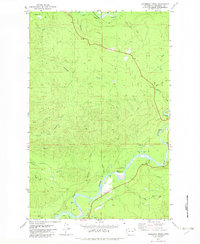
USGS Historical Quadrangle in GeoPDF.
This data set contains imagery from the National Agriculture Imagery Program (NAIP). The NAIP program is administered by USDA FSA and has been established to support two main FSA strategic goals centered on agricultural production. These are increase stewardship of America's natural resources while enhancing the environment, and to ensure commodities are procured and distributed effectively and efficiently to increase food security. The NAIP program supports these goals by acquiring and providing ortho imagery that has been collected during the agricultural growing season in the U.S. The NAIP ortho imagery is tailored to meet FSA requirements and is a fundamental tool used to support FSA farm and conservation programs....
This data set contains imagery from the National Agriculture Imagery Program (NAIP). The NAIP program is administered by USDA FSA and has been established to support two main FSA strategic goals centered on agricultural production. These are increase stewardship of America's natural resources while enhancing the environment, and to ensure commodities are procured and distributed effectively and efficiently to increase food security. The NAIP program supports these goals by acquiring and providing ortho imagery that has been collected during the agricultural growing season in the U.S. The NAIP ortho imagery is tailored to meet FSA requirements and is a fundamental tool used to support FSA farm and conservation programs....
The following spreadsheets contain discharge measurements that were used to develop rating curves for each stream gage. The numbers on each tab refer to the date the measurement was collected. Each spreadsheet contains distance, depth, and velocity measurements used to calculate discharge in centimeters and highlighted in yellow.
The following spreadsheets contain pressure and temperature recorded by the barologgers (atmospheric measure) and leveloggers (stream measure) at each stream gauge. Temperature and pressure from stream gauges are needed to calculate discharge, which was in turn needed to calibrate the hydrologic model used in this project.
This data set contains imagery from the National Agriculture Imagery Program (NAIP). The NAIP program is administered by USDA FSA and has been established to support two main FSA strategic goals centered on agricultural production. These are, increase stewardship of America's natural resources while enhancing the environment, and to ensure commodities are procured and distributed effectively and efficiently to increase food security. The NAIP program supports these goals by acquiring and providing ortho imagery that has been collected during the agricultural growing season in the U.S. The NAIP ortho imagery is tailored to meet FSA requirements and is a fundamental tool used to support FSA farm and conservation programs....
The following spreadsheets contain pebble counts presented as %finer. Each site name, reach, and cross section are denoted in the rows at the top. Statistical measures including geometric mean and standard deviation for each cross section are enumerated at the bottom
Categories: Data;
Types: Downloadable;
Tags: Anderson Creek,
Boulder Creek,
Canyon Creek,
Jack Creek,
Northwest CASC,
This data set contains imagery from the National Agriculture Imagery Program (NAIP). The NAIP program is administered by USDA FSA and has been established to support two main FSA strategic goals centered on agricultural production. These are, increase stewardship of America's natural resources while enhancing the environment, and to ensure commodities are procured and distributed effectively and efficiently to increase food security. The NAIP program supports these goals by acquiring and providing ortho imagery that has been collected during the agricultural growing season in the U.S. The NAIP ortho imagery is tailored to meet FSA requirements and is a fundamental tool used to support FSA farm and conservation programs....
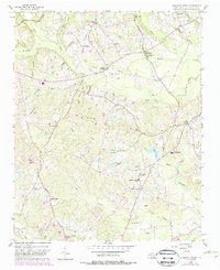
USGS Historical Quadrangle in GeoPDF.
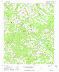
USGS Historical Quadrangle in GeoPDF.
This data set contains imagery from the National Agriculture Imagery Program (NAIP). The NAIP program is administered by USDA FSA and has been established to support two main FSA strategic goals centered on agricultural production. These are, increase stewardship of America's natural resources while enhancing the environment, and to ensure commodities are procured and distributed effectively and efficiently to increase food security. The NAIP program supports these goals by acquiring and providing ortho imagery that has been collected during the agricultural growing season in the U.S. The NAIP ortho imagery is tailored to meet FSA requirements and is a fundamental tool used to support FSA farm and conservation programs....
This data set contains imagery from the National Agriculture Imagery Program (NAIP). The NAIP program is administered by USDA FSA and has been established to support two main FSA strategic goals centered on agricultural production. These are increase stewardship of America's natural resources while enhancing the environment, and to ensure commodities are procured and distributed effectively and efficiently to increase food security. The NAIP program supports these goals by acquiring and providing ortho imagery that has been collected during the agricultural growing season in the U.S. The NAIP ortho imagery is tailored to meet FSA requirements and is a fundamental tool used to support FSA farm and conservation programs....
Daily observed (historical) and RHESSys simulated streamflow under three climate change scenarios for eight Oregon watersheds. RHESSys and SnowModel simulated daily snow water equivalent (SWE) values. Eight Oregon watersheds; 4 within the upper McKenzie River Basin (Anderson, Boulder, McKenzie at Clear Lake, and Lookout), 3 within the Metolius River Basin (Canyon, Jefferson and Jack) and Shitike Creek. See site map and GIS watershed outline layer available. The definition of the files are as follows: Ac_Q.csv = observed and Rhessys simulated daily streamflow; Bc_Q.csv = observed and Rhessys simulated daily streamflow; ccnnnf1234_Q.csv = observed and Rhessys simulated daily streamflow; jcncs_Q.csv = observed and...
Categories: Data;
Types: Downloadable;
Tags: Anderson Creek,
Boulder Creek,
Canyon Creek,
Jack Creek,
Northwest CASC,
|

|
