Filters: Tags: Antelope Valley (X)
50 results (54ms)|
Filters
Date Range
Extensions (Less) Types (Less)
Contacts (Less)
Categories (Less) Tag Types Tag Schemes
|
This dataset consists of points representing selected well site locations and water-level measurements used by Lopes and Allander (2009) to develop autumn 2006 groundwater-level altitude contours for Smith and Mason Valleys, and the lower Walker River basin, Nevada. Since the publication of Lopes and Allander (2009), the positional coordinates and land-surface altitudes at selected well sites used to develop autumn 2006 groundwater-level contours in that report were updated as part of a 2022 U.S. Geological Survey study (Davies and Naranjo, 2022).
Categories: Data;
Types: Downloadable,
Map Service,
OGC WFS Layer,
OGC WMS Layer,
Shapefile;
Tags: Antelope Valley,
Basin 106,
Basin 107,
Basin 108,
Basin 109,
This data set consists of polylines representing groundwater-level altitude contours, 1982, for middle Humboldt River basin, north-central Nevada as published on plate 2, figure 3 in the U.S. Geological Survey Water-Resources Investigations Report 98-4209 titled "Hydrogeologic framework and ground-water levels, 1982 and 1996, middle Humboldt River basin, north-central Nevada," 1999. A subset of the contours were published as part of a larger data set representing water-table contours for Nevada (Buto and others, 2006). The remaining contours have been added to complete this data set. References Cited Buto, S.G., Evetts, D.M., Smith-Sager, S., 2006, Water-table contours of Nevada, accessed May 16, 2018 at URL https://water.usgs.gov/lookup/getspatial?sir2006-5100_wanv_l.
Categories: Data;
Types: Downloadable,
Map Service,
OGC WFS Layer,
OGC WMS Layer,
Shapefile;
Tags: Antelope Valley,
Boulder Flat,
Carico Lake Valley,
Crescent Valley,
Elko County,
This data set contains imagery from the National Agriculture Imagery Program (NAIP). The NAIP program is administered by USDA FSA and has been established to support two main FSA strategic goals centered on agricultural production. These are, increase stewardship of America's natural resources while enhancing the environment, and to ensure commodities are procured and distributed effectively and efficiently to increase food security. The NAIP program supports these goals by acquiring and providing ortho imagery that has been collected during the agricultural growing season in the U.S. The NAIP ortho imagery is tailored to meet FSA requirements and is a fundamental tool used to support FSA farm and conservation programs....
This dataset includes the magnetotelluric (MT) sounding data collected in 2003 along a north-south profile west of Wendover, Nevada. It is important to know whether major mining districts in the Northern Nevada Gold Province are underlain by rocks of the Archean Wyoming craton, which are known to contain orogenic gold deposits, or by accreted rocks of the Paleoproterozoic Mojave province. It is also important to know the location and orientation of the Archean/Proterozoic suture zone between these provinces as well as major basement structures within these terranes because they may influence subsequent patterns of sedimentation, deformation, magmatism, and hydrothermal activity. This study was funded by the U.S....
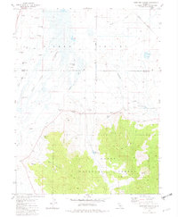
USGS Historical Quadrangle in GeoPDF.
This dataset consists of digitized 1:24,000-scale polylines and polygons representing hydrographic areas for the Walker River basin, California and Nevada.
Categories: Data;
Types: Downloadable,
Map Service,
OGC WFS Layer,
OGC WMS Layer,
Shapefile;
Tags: Antelope Valley,
Basin 106,
Basin 107,
Basin 108,
Basin 109,

This dataset represents "phreatophyte areas" mapped as part of a groundwater reconnaissance effort in four valleys in central Nevada and published in 1964. The data were digitized for comparison with mapping of groundwater discharge areas done in 2011 as part of a groundwater study in these valleys published in 2016.
This data set consists of polylines representing groundwater-level altitude contours, 1996, for middle Humboldt River basin, north-central Nevada as published on plate 2, figure 4 in the U.S. Geological Survey Water-Resources Investigations Report 98-4209 titled "Hydrogeologic framework and ground-water levels, 1982 and 1996, middle Humboldt River basin, north-central Nevada," 1999. A subset of the contours were published as part of a larger data set representing water-table contours for Nevada (Buto and others, 2006). References Cited Buto, S.G., Evetts, D.M., Smith-Sager, S., 2006, Water-table contours of Nevada, accessed May 16, 2018 at URL https://water.usgs.gov/lookup/getspatial?sir2006-5100_wanv_l.
Categories: Data;
Types: Downloadable,
Map Service,
OGC WFS Layer,
OGC WMS Layer,
Shapefile;
Tags: Antelope Valley,
Boulder Flat,
Carico Lake Valley,
Crescent Valley,
Elko County,
Edwards Air Force Base (EAFB) is located in Kern County, CA, approximately 35 kilometers (km) northeast of Lancaster and 9 km south of California City. The Air Force Research Laboratory (AFRL) is situated on EAFB, approximately 7 km southwest of Boron, CA. Release of contaminants from the AFRL facilities have contaminated local groundwater, which is mostly restricted to fractured granitic bedrock, but studies indicate that the groundwater and contaminant plumes have moved into alluvial deposits to the north and northwest (AECOM, 2014). The U.S. Geological Survey (USGS) and the Air Force Civil Engineer Center (AFCEC) entered into a cooperative agreement in 2017 to develop a hydrogeologic framework model to help determine...
Categories: Data;
Tags: Antelope Valley,
Edwards Air Force Base,
Hydrology,
Mojave Desert,
Stratigraphy,
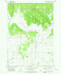
USGS Historical Quadrangle in GeoPDF.
This dataset includes the magnetotelluric (MT) sounding data collected in 2003 along a north-south profile west of Wendover, Nevada. It is important to know whether major mining districts in the Northern Nevada Gold Province are underlain by rocks of the Archean Wyoming craton, which are known to contain orogenic gold deposits, or by accreted rocks of the Paleoproterozoic Mojave province. It is also important to know the location and orientation of the Archean/Proterozoic suture zone between these provinces as well as major basement structures within these terranes because they may influence subsequent patterns of sedimentation, deformation, magmatism, and hydrothermal activity. This study was funded by the U.S....
This data set contains imagery from the National Agriculture Imagery Program (NAIP). The NAIP program is administered by USDA FSA and has been established to support two main FSA strategic goals centered on agricultural production. These are, increase stewardship of America's natural resources while enhancing the environment, and to ensure commodities are procured and distributed effectively and efficiently to increase food security. The NAIP program supports these goals by acquiring and providing ortho imagery that has been collected during the agricultural growing season in the U.S. The NAIP ortho imagery is tailored to meet FSA requirements and is a fundamental tool used to support FSA farm and conservation programs....
This dataset includes the magnetotelluric (MT) sounding data collected in 2003 along a north-south profile west of Wendover, Nevada. It is important to know whether major mining districts in the Northern Nevada Gold Province are underlain by rocks of the Archean Wyoming craton, which are known to contain orogenic gold deposits, or by accreted rocks of the Paleoproterozoic Mojave province. It is also important to know the location and orientation of the Archean/Proterozoic suture zone between these provinces as well as major basement structures within these terranes because they may influence subsequent patterns of sedimentation, deformation, magmatism, and hydrothermal activity. This study was funded by the U.S....
This data set contains imagery from the National Agriculture Imagery Program (NAIP). The NAIP program is administered by USDA FSA and has been established to support two main FSA strategic goals centered on agricultural production. These are increase stewardship of America's natural resources while enhancing the environment, and to ensure commodities are procured and distributed effectively and efficiently to increase food security. The NAIP program supports these goals by acquiring and providing ortho imagery that has been collected during the agricultural growing season in the U.S. The NAIP ortho imagery is tailored to meet FSA requirements and is a fundamental tool used to support FSA farm and conservation programs....
This data set contains imagery from the National Agriculture Imagery Program (NAIP). The NAIP program is administered by USDA FSA and has been established to support two main FSA strategic goals centered on agricultural production. These are increase stewardship of America's natural resources while enhancing the environment, and to ensure commodities are procured and distributed effectively and efficiently to increase food security. The NAIP program supports these goals by acquiring and providing ortho imagery that has been collected during the agricultural growing season in the U.S. The NAIP ortho imagery is tailored to meet FSA requirements and is a fundamental tool used to support FSA farm and conservation programs....
This data set contains imagery from the National Agriculture Imagery Program (NAIP). The NAIP program is administered by USDA FSA and has been established to support two main FSA strategic goals centered on agricultural production. These are, increase stewardship of America's natural resources while enhancing the environment, and to ensure commodities are procured and distributed effectively and efficiently to increase food security. The NAIP program supports these goals by acquiring and providing ortho imagery that has been collected during the agricultural growing season in the U.S. The NAIP ortho imagery is tailored to meet FSA requirements and is a fundamental tool used to support FSA farm and conservation programs....
This data set contains imagery from the National Agriculture Imagery Program (NAIP). The NAIP program is administered by USDA FSA and has been established to support two main FSA strategic goals centered on agricultural production. These are increase stewardship of America's natural resources while enhancing the environment, and to ensure commodities are procured and distributed effectively and efficiently to increase food security. The NAIP program supports these goals by acquiring and providing ortho imagery that has been collected during the agricultural growing season in the U.S. The NAIP ortho imagery is tailored to meet FSA requirements and is a fundamental tool used to support FSA farm and conservation programs....
This data set contains imagery from the National Agriculture Imagery Program (NAIP). The NAIP program is administered by USDA FSA and has been established to support two main FSA strategic goals centered on agricultural production. These are increase stewardship of America's natural resources while enhancing the environment, and to ensure commodities are procured and distributed effectively and efficiently to increase food security. The NAIP program supports these goals by acquiring and providing ortho imagery that has been collected during the agricultural growing season in the U.S. The NAIP ortho imagery is tailored to meet FSA requirements and is a fundamental tool used to support FSA farm and conservation programs....
This data set contains imagery from the National Agriculture Imagery Program (NAIP). The NAIP program is administered by USDA FSA and has been established to support two main FSA strategic goals centered on agricultural production. These are, increase stewardship of America's natural resources while enhancing the environment, and to ensure commodities are procured and distributed effectively and efficiently to increase food security. The NAIP program supports these goals by acquiring and providing ortho imagery that has been collected during the agricultural growing season in the U.S. The NAIP ortho imagery is tailored to meet FSA requirements and is a fundamental tool used to support FSA farm and conservation programs....
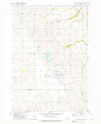
USGS Historical Quadrangle in GeoPDF.
|

|
