Filters: Tags: Antimony (X)
107 results (3.8s)|
Filters
Date Range
Extensions Types Contacts
Categories Tag Types
|
The U.S. Geological Survey (USGS) has undertaken a mineral resources assessment for tungsten for a portion of the Great Basin in parts of western Nevada and east-central California. This data release provides the Great Basin Tungsten Database: the geospatial and geologic data, and results of chemical analyses for 46,955 samples collected in the assessment area, extracted from the USGS National Geochemical Database. These rock records were collected as part of various programs and projects at the USGS and analyzed from 1963 to 2015. The database represents rock records, each comprising one best value chemical determination for each analyzed chemical species, that include skarns, carbonate lithologies (for example,...
Categories: Data;
Types: Downloadable,
Map Service,
OGC WFS Layer,
OGC WMS Layer,
Shapefile;
Tags: California,
GGGSC,
Geology, Geophysics, and Geochemistry Science Center,
Great Basin,
MRP,
This location is part of the Arizona Mineral Industry Location System (AzMILS), an inventory of mineral occurences, prospects and mine locations in Arizona. Pima184 is located in T17S R16E Sec 27 C in the Empire Mountains - 15 Min quad. This collection consists of various reports, maps, records and related materials acquired by the Arizona Department of Mines and Mineral Resources regarding mining properties in Arizona. Information was obtained by various means, including the property owners, exploration companies, consultants, verbal interviews, field visits, newspapers and publications. Some sections may be redacted for copyright. Please see the access statement.
ADMMR map collection: El Oro Claim Map Showing Workings and Veins; 1 in. to 200 feet; 37 x 21 in.
The U.S. Geological Survey (USGS) has compiled a geodatabase containing mineral-related geospatial data for 10 countries of interest in Southwest Asia (area of study): Afghanistan, Cambodia, Laos, India, Indonesia, Iran, Nepal, North Korea, Pakistan, and Thailand. The data can be used in analyses of the extractive fuel and nonfuel mineral industries and related economic and physical infrastructure integral for the successful operation of the mineral industries within the area of study as well as the movement of mineral products across domestic and global markets. This geodatabase reflects the USGS ongoing commitment to its mission of understanding the nature and distribution of global mineral commodity supply chains...
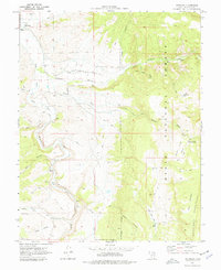
USGS Historical Quadrangle in GeoPDF.
This report summarizes work done while profiling fifty-two (52) antimony and barite companies, mines, and /or deposits in twenty (20) market economy countries, exclusive of the United States. The profiles include current geological, engineering and economic data on deposits that represent eighty -five (85) percent of the production potential for these two commodities. In addition to summarizing the information collected, the report describes the methods used to gather and evaluate the data. Several suggestions are made for improving the data collection efforts on future work of this type.
This data set contains imagery from the National Agriculture Imagery Program (NAIP). The NAIP program is administered by USDA FSA and has been established to support two main FSA strategic goals centered on agricultural production. These are, increase stewardship of America's natural resources while enhancing the environment, and to ensure commodities are procured and distributed effectively and efficiently to increase food security. The NAIP program supports these goals by acquiring and providing ortho imagery that has been collected during the agricultural growing season in the U.S. The NAIP ortho imagery is tailored to meet FSA requirements and is a fundamental tool used to support FSA farm and conservation programs....
This data set contains imagery from the National Agriculture Imagery Program (NAIP). The NAIP program is administered by USDA FSA and has been established to support two main FSA strategic goals centered on agricultural production. These are, increase stewardship of America's natural resources while enhancing the environment, and to ensure commodities are procured and distributed effectively and efficiently to increase food security. The NAIP program supports these goals by acquiring and providing ortho imagery that has been collected during the agricultural growing season in the U.S. The NAIP ortho imagery is tailored to meet FSA requirements and is a fundamental tool used to support FSA farm and conservation programs....
ADMMR map collection: Orphan Lode 245 Level Ventilation Plan Map; 1 in. to 20 feet; 32 x 32 in.
Categories: Data;
Tags: Antimony,
Arizona,
Barium, Witherite,
Bright Angel - 15 Min,
Calcium, Calcite,
Heinrichs Geoexploration Co. Maps: Pauline Project, Section B-B'; 1 in. to 200 feet; 33 x 14 in.
Heinrichs Geoexploration Co. Maps: Pauline Project, Section B-B'; 1 in. to 200 feet; 32 x 18 in.
Compilation of Geospatial Data (GIS) for the Mineral Industries and Related Infrastructure of Africa
This geodatabase reflects the U.S. Geological Survey’s (USGS) ongoing commitment to its mission of understanding the nature and distribution of global mineral commodity supply chains by updating and publishing the georeferenced locations of mineral commodity production and processing facilities, mineral exploration and development sites, and mineral commodity exporting ports in Africa. The geodatabase and geospatial data layers serve to create a new geographic information product in the form of a geospatial portable document format (PDF) map. The geodatabase contains data layers from USGS, foreign governmental, and open-source sources as follows: (1) mineral production and processing facilities, (2) mineral exploration...
Sediment hosted gold deposits in Nevada were first mined in the 1960s from open pit mines with large tonnage and low grade resources. Since that time, continuing exploration and discovery have identified extraordinary resources, and together these deposits now form the second-largest gold endowment on Earth, surpassed only by the Witwatersrand Gold Fields of South Africa. The data herein are part of a larger U.S. Geological Survey (USGS) project to develop an updated geospatial database of mines, mineral deposits and mineral regions in the United States. The point and polygon layers within this database represent locations of mines, mineral occurrences (which includes deposits and prospects), and mining...
Categories: Data;
Types: ArcGIS REST Map Service,
ArcGIS Service Definition,
Downloadable,
Map Service;
Tags: Ag,
Au,
BLM,
Bureau of Land Management,
Carlin,
This data release provides electron microprobe geochemical data that was collected as part of a scoping study to evaluate whether unconventional critical element resources may be associated with sediment-hosted copper systems in the Midcontinent Rift. We report abundances of trace elements in native copper and sulfide minerals in 12 thin sections from samples of the Mesoproterozoic lower Nonesuch Formation that were collected from underground exposures in the White Pine deposit. Approximately 350 spots were analyzed for Cu, Pb, Zn, Fe, Ni, Co, As, Sb, Ag, Hg, and S. The electron microprobe data were collected by personnel of the Central Region Minerals Program in Denver, Colorado, for the U.S. Geological Survey...
Categories: Data;
Types: Map Service,
OGC WFS Layer,
OGC WMS Layer,
OGC WMS Service;
Tags: Ag,
Antimony,
Arsenic,
As,
Central Region Minerals Program,
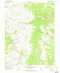
USGS Historical Quadrangle in GeoPDF.
This location is part of the Arizona Mineral Industry Location System (AzMILS), an inventory of mineral occurences, prospects and mine locations in Arizona. Gila386 is located in T8N R9E Sec 28 N2 in the Mazatzal Peak - 7.5 Min quad. This collection consists of various reports, maps, records and related materials acquired by the Arizona Department of Mines and Mineral Resources regarding mining properties in Arizona. Information was obtained by various means, including the property owners, exploration companies, consultants, verbal interviews, field visits, newspapers and publications. Some sections may be redacted for copyright. Please see the access statement.
This data set consists of records for over 900 mineral facilities in Latin America and Canada. The mineral facilities include mines, plants, smelters, or refineries of aluminum, cement, coal, copper, diamond, gold, iron and steel, nickel, platinum-group metals, salt, and silver, among others. Records include attributes such as commodity, country, location, company name, facility type and capacity if applicable, and generalized coordinates. The data were compiled from multiple sources, including the 2003 and 2004 USGS Minerals Yearbooks (Latin America and Candada volume), data to be published in the 2005 Minerals Yearbook Latin America and Canada Volume, minerals statistics and information from the USGS minerals...
This location is part of the Arizona Mineral Industry Location System (AzMILS), an inventory of mineral occurences, prospects and mine locations in Arizona. Yavapai1265 is located in T11N R1W Sec 21 SW in the Battle Flat - 7.5 Min quad. This collection consists of various reports, maps, records and related materials acquired by the Arizona Department of Mines and Mineral Resources regarding mining properties in Arizona. Information was obtained by various means, including the property owners, exploration companies, consultants, verbal interviews, field visits, newspapers and publications. Some sections may be redacted for copyright. Please see the access statement.
ADMMR map collection: El Oro Map of Underground Workings and Surface Improvement; 1 in. to 100 feet; 44 x 32 in.
The 'Vulture Mining District, Mammoth Copper Project' file is part of the Grover Heinrichs mining collection. Grover was the Vice President of Heinrichs GEOEXploration, located in Tucson, Arizona. The collection contains over 1,400 folders including economic geology reports, maps, photos, correspondence, drill logs and other related materials. The focus of much of the information is on the western United States, particularly Arizona, but the collection also includes files on mining activity throughout the United States, foreign countries, and 82 mineral commodities.
|

|
