Filters: Tags: Appalachia (X)
19 results (93ms)|
Filters
Contacts
(Less)
|
Research and surveillance reports have documented a significant increase in coal workers' pneumoconiosis, including the most severe forms of progressive massive fibrosis and rapidly progressive pneumoconiosis in U.S. coal miners, particularly those in Appalachian coalfields. Several possible explanations for these observations include excessive exposures to total respirable dust, increased exposure to freshly fractured silica and silicates, or greater exposure to smaller particles that may be the result of changing mining practices. This dataset contains the chemical and morphological characteristics of particulate matter retrieved from lung tissue slices of historical and contemporary miners.
Categories: Data;
Types: Map Service,
OGC WFS Layer,
OGC WMS Layer,
OGC WMS Service;
Tags: Appalachia,
Environmental Health,
GGGSC,
Geochemistry,
Geology, Geophysics, and Geochemistry Science Center,
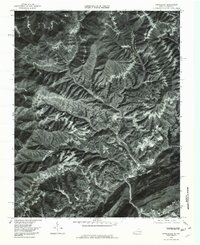
This data set contains imagery from the National Agriculture Imagery Program (NAIP). The NAIP program is administered by USDA FSA and has been established to support two main FSA strategic goals centered on agricultural production. These are, increase stewardship of America's natural resources while enhancing the environment, and to ensure commodities are procured and distributed effectively and efficiently to increase food security. The NAIP program supports these goals by acquiring and providing ortho imagery that has been collected during the agricultural growing season in the U.S. The NAIP ortho imagery is tailored to meet FSA requirements and is a fundamental tool used to support FSA farm and conservation programs....
This data set contains imagery from the National Agriculture Imagery Program (NAIP). The NAIP program is administered by USDA FSA and has been established to support two main FSA strategic goals centered on agricultural production. These are, increase stewardship of America's natural resources while enhancing the environment, and to ensure commodities are procured and distributed effectively and efficiently to increase food security. The NAIP program supports these goals by acquiring and providing ortho imagery that has been collected during the agricultural growing season in the U.S. The NAIP ortho imagery is tailored to meet FSA requirements and is a fundamental tool used to support FSA farm and conservation programs....
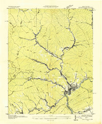
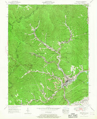
USGS Historical Quadrangle in GeoPDF.
USGS Historical Quadrangle in GeoPDF.
USGS Historical Quadrangle in GeoPDF.
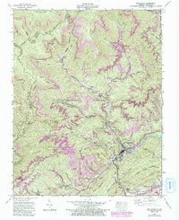
USGS Historical Quadrangle in GeoPDF.
This data set contains imagery from the National Agriculture Imagery Program (NAIP). The NAIP program is administered by USDA FSA and has been established to support two main FSA strategic goals centered on agricultural production. These are, increase stewardship of America's natural resources while enhancing the environment, and to ensure commodities are procured and distributed effectively and efficiently to increase food security. The NAIP program supports these goals by acquiring and providing ortho imagery that has been collected during the agricultural growing season in the U.S. The NAIP ortho imagery is tailored to meet FSA requirements and is a fundamental tool used to support FSA farm and conservation programs....
This data set contains imagery from the National Agriculture Imagery Program (NAIP). The NAIP program is administered by USDA FSA and has been established to support two main FSA strategic goals centered on agricultural production. These are, increase stewardship of America's natural resources while enhancing the environment, and to ensure commodities are procured and distributed effectively and efficiently to increase food security. The NAIP program supports these goals by acquiring and providing ortho imagery that has been collected during the agricultural growing season in the U.S. The NAIP ortho imagery is tailored to meet FSA requirements and is a fundamental tool used to support FSA farm and conservation programs....
This data set contains imagery from the National Agriculture Imagery Program (NAIP). The NAIP program is administered by USDA FSA and has been established to support two main FSA strategic goals centered on agricultural production. These are, increase stewardship of America's natural resources while enhancing the environment, and to ensure commodities are procured and distributed effectively and efficiently to increase food security. The NAIP program supports these goals by acquiring and providing ortho imagery that has been collected during the agricultural growing season in the U.S. The NAIP ortho imagery is tailored to meet FSA requirements and is a fundamental tool used to support FSA farm and conservation programs....
Robinson Forest, in eastern Kentucky, is a research forest owned and operated by the University of Kentucky (UK) since the 1920s. The UK Department of Forestry and Natural Resources began collecting streamflow and water-chemistry data in the forest starting with weirs at Falling Rock and Little Millseat in 1971, and supplemented by weirs at Coles Fork and Clemons Fork in 1973. This digital dataset includes information about how and where these data were collected, and how these data were processed. These data include streamflow, water temperature, and water chemistry (turbidity, chloride, nitrates, sulfates, ammonium, pH, alkalinity, calcium, magnesium, potassium, sodium, conductivity, total organic carbon, and...
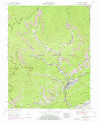
USGS Historical Quadrangle in GeoPDF.
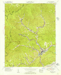
USGS Historical Quadrangle in GeoPDF.
USGS Historical Quadrangle in GeoPDF.
Robinson Forest, in eastern Kentucky, is a research forest owned and operated by the University of Kentucky (UK) since the 1920s. The UK Department of Forestry and Natural Resources began collecting air temperature data at the Robinson Forest Camp in 1971. This digital dataset includes information about the weather station where these data were collected, and how these data were processed. These data include air temperature records from 1971-2018.
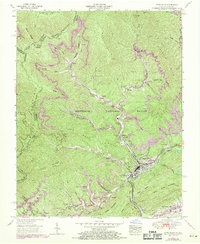
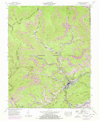
USGS Historical Quadrangle in GeoPDF.
Precipitation and Precipitation Chemistry in Robinson Forest, Breathitt County, Kentucky (1971-2018)
Robinson Forest, in eastern Kentucky, is a research forest owned and operated by the University of Kentucky (UK) since the 1920s. The UK Department of Forestry and Natural Resources began collecting precipitation and precipitation chemistry data in the forest starting with one weather station at the Robinson Forest Camp in 1971, and followed by several additional stations in the mid-1990s. This digital dataset includes information about the weather stations where these data were collected, and how these data were processed. These data include precipitation and precipitation chemistry (chloride, nitrates, sulfates, ammonium, pH, alkalinity, calcium, magnesium, potassium, sodium, conductivity, total organic carbon,...
Robinson Forest, in eastern Kentucky, is a research forest owned and operated by the University of Kentucky (UK) since the 1920s. The Forest is situated in a portion of eastern Kentucky that has undergone extensive resource extraction, including silvaculture and both underground and surface mining of coal. This site has been used to evaluate hydrologic process, stream permanence, and the potential effect of different methods of mineland reclamation on hydrology. Hydrology was simulated using the Water Availability Tool for Environmental Resources.
Categories: Data;
Types: Map Service,
OGC WFS Layer,
OGC WMS Layer,
OGC WMS Service;
Tags: Appalachia,
Breathitt County,
Cumberland,
Kentucky,
Knott County,
This data set contains imagery from the National Agriculture Imagery Program (NAIP). The NAIP program is administered by USDA FSA and has been established to support two main FSA strategic goals centered on agricultural production. These are, increase stewardship of America's natural resources while enhancing the environment, and to ensure commodities are procured and distributed effectively and efficiently to increase food security. The NAIP program supports these goals by acquiring and providing ortho imagery that has been collected during the agricultural growing season in the U.S. The NAIP ortho imagery is tailored to meet FSA requirements and is a fundamental tool used to support FSA farm and conservation programs....
|

|
